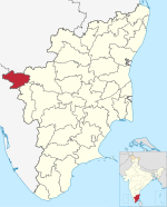
Ooty, abbreviated as Udagai) is a town and municipality in the Nilgiris district of the Indian state of Tamil Nadu. It is located 86 km (53 mi) northwest of Coimbatore, and is the headquarters of Nilgiris district. Situated in the Nilgiri hills, it is known by the epithet "Queen of Hill Stations", and is a popular tourist destination.

The Nilgiris district is one of the 38 districts in the southern Indian state of Tamil Nadu. Nilgiri is the name given to a range of mountains spread across the borders among the states of Tamil Nadu, Karnataka and Kerala. The Nilgiri Hills are part of a larger mountain chain known as the Western Ghats. Their highest point is the mountain of Doddabetta, height 2,637 m. The district is contained mainly within the Nilgiri Mountains range. The administrative headquarters is located at Ooty. The district is bounded by Coimbatore to the south, Erode to the east, and Chamarajnagar district of Karnataka and Wayanad district of Kerala to the north. As it is located at the junction of three states, namely, Tamil Nadu, Kerala, and Karnataka, significant Malayali and Kannadiga populations reside in the district. Nilgiris district is known for natural mines of Gold, which is also seen in the other parts of Nilgiri Biosphere Reserve extended in the neighbouring states of Karnataka and Kerala too.
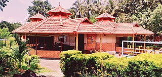
Nilambur is a major town, a municipality and a Taluk in the Malappuram district of the Indian state of Kerala. It is located close to the Nilgiris range of the Western Ghats on the banks of the Chaliyar River. This place is also known as 'Teak Town' because of the abundance of Nilambur teaks, which is a variety of a large, deciduous tree that occurs in mixed hardwood forests. Unlike many Municipalities of India; Nilambur is covered with large amounts of vegetation, making it very scenic.

The Nilgiri Mountain Railway (NMR) is a 1,000 mmmetre gauge railway in Nilgiris district, Tamil Nadu, India, built by the British in 1908. The railway is operated by the Southern Railway and is the only rack railway in India.
Panvel is a city and taluka in Raigad district of Maharashtra, India. It is highly populated due to its closeness to Mumbai. Panvel is also governed for development purpose by the body of Mumbai Metropolitan Region. Panvel Municipal Corporation is the first Municipal Corporation in Raigad and the 27th Municipal corporation of Maharashtra State.
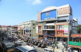
Sultan Bathery is a town and municipality in the Wayanad district of Kerala, India, near its borders with Tamil Nadu and Karnataka. Once known as a strategic location in the Malabar region, Sultan Bathery is the headquarters of the Sultan Bathery taluk.

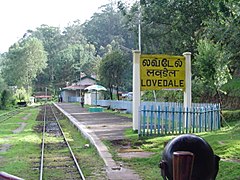
The Lawrence School, Lovedale, is a co-educational private boarding school located at Lovedale, a hill station on the Nilgiri Mountains in the southern Indian state of Tamil Nadu.
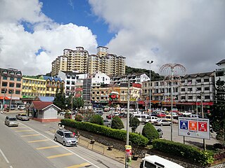
Brinchang is a town and hill resort located at an altitude of 1,540 metres (5,050 ft) in Cameron Highlands in the state of Pahang, Malaysia.

Wellington is a town in the Nilgiris District of the Indian state of Tamil Nadu, located at three kilometres to the north of Coonoor on the NH-181. The town includes a Wellington Bazaar, and the Wellington Cantonment. The Wellington Cantonment is home to The Madras Regimental Centre (MRC) and The Defence Services Staff College (DSSC). The Nilgiri passenger train passes through Wellington, which also has a railway station.

Badagaon Dhasan is a town and a Nagar Parishad in Tikamgarh district in the state of Madhya Pradesh, India.

Bhowali is a town and a municipal board in Nainital District in the state of Uttarakhand, India. It is situated at a distance of 11 km (6.8 mi) from the city of Nainital, the district headquarters; at an average elevation of 1,654 m (5,427 ft) from sea level. It is the seat of Bhowali tehsil, one of the eight subdivisions of Nainital district.

Papanasam is a panchayat town in Thanjavur district in the Indian state of Tamil Nadu. It is located 25 kilometres (16 mi) from Thanjavur and 15 kilometres (9.3 mi) from Kumbakonam. The name literally translates to "Destruction of Sins" in the Tamil language. It is the suburban region of Kumbakonam.

Ketti also called Ketti Valley is a small town nestled in a large valley of the same name. It is located in The Nilgiris District of Tamil Nadu State, South India and is a Revenue Village of Coonoor Taluk. Upper Ketti is another village called Yellanahalli, which is located on the main Coonoor to Ooty road.

Vazhikkadavu is a village in Nilambur taluk of Malappuram district, Kerala, India. As of 2011, it has total population of 47,322.

Mukurthi Peak is one of the highest peaks in the Western Ghats, situated on the border of Udagamandalam taluk, Nilgiris, Tamil Nadu, Nilambur taluk, Malappuram, and Kerala in India. It reaches an altitude of 2,554 m (8,379ft), and is the fifth-highest peak in South India.

The Pykara is a river 19 kilometres (12 mi) from Ooty in the Indian State of Tamil Nadu with a village by the same name nearby. The Pykara River is considered very sacred by the Todas. It rises at Mukurthi peak, flows northwards, and then turns to the west after reaching the edge of the plateau. The river flows through Mukurthi, Pykara and Glenmorgan dams, and forms part of an important hydro-electric power project.
Chembakolli is a village in the south of India, in the Nilgiris district, Tamil Nadu. It is located in the Nilgiri Hills. Chembakolli's closest town is Gudalur and its closest city is Mysore and Coimbatore to south of Nilgiris district.
St. Joseph's Higher Secondary School is a boys' school located in the scenic hill station town Ooty, which is part of The Nilgiris district in Tamil Nadu, India. The school was started by Christian missionaries in 1820.

Masinagudi is a village in the Nilgiris District of the state of Tamil Nadu in India. It is located 30 km (19 mi) from the district headquarters at Ooty. It is in the buffer zone of the Mudumalai National Park. Masinagudi has several schools and other amenities and a number of resorts.
Mulligoor is a village in the Kundah taluk of Nilgiris District of Tamil Nadu State, India. It is situated 10 kilometers away from sub-district headquarters Kundah and 30 kilometers from district headquarters Ooty. The main cultivation in Mulligoor is tea growing. This area surrounding Mulligoor is also very rich in wildlife.
