The Margaret Mitchell House is a historic house museum located in Atlanta, Georgia. The structure was the home of author Margaret Mitchell in the early 20th century. It is located in Midtown, at 979 Crescent Avenue. Constructed by Cornelius J. Sheehan as a single-family residence in a then-fashionable section of residential Peachtree Street, the building's original address was 806 Peachtree Street. The house was known as the Crescent Apartments when Mitchell and her husband lived in Apt. 1 on the ground floor from 1925 to 1932. While living there, Mitchell wrote the bulk of her Pulitzer Prize-winning 1936 novel, Gone with the Wind.

This is a list of sites in Minnesota which are included in the National Register of Historic Places. There are more than 1,700 properties and historic districts listed on the NRHP; each of Minnesota's 87 counties has at least 2 listings. Twenty-two sites are also National Historic Landmarks.

This is a list of structures, sites, districts, and objects on the National Register of Historic Places in North Carolina:

This list is of the properties and historic districts which are designated on the National Register of Historic Places or that were formerly so designated, in Hennepin County, Minnesota; there are 190 entries as of April 2023. A significant number of these properties are a result of the establishment of Fort Snelling, the development of water power at Saint Anthony Falls, and the thriving city of Minneapolis that developed around the falls. Many historic sites outside the Minneapolis city limits are associated with pioneers who established missions, farms, and schools in areas that are now suburbs in that metropolitan area.

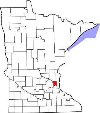
This is a complete list of National Register of Historic Places listings in Ramsey County, Minnesota. It is intended to be a complete list of the properties and districts on the National Register of Historic Places in Ramsey County, Minnesota, United States. The locations of National Register properties and districts for which the latitude and longitude coordinates are included below, may be seen in an online map.

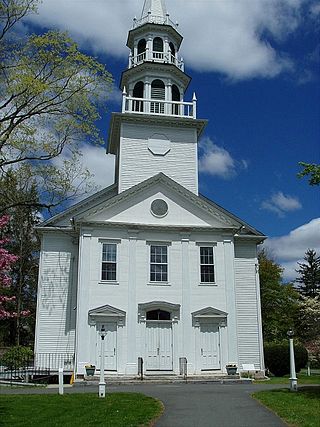
The South Britain Historic District encompasses the core of the unincorporated village of South Britain in Southbury, Connecticut, United States. The village arose in the 18th century as an industrial center serving the surrounding agricultural community, powered by the Pomperaug River, and rivalled the town center of Southbury in importance. The district was listed on the National Register of Historic Places in 1987.

This is a list of the National Register of Historic Places listings in Goodhue County, Minnesota. It is intended to be a complete list of the properties and districts on the National Register of Historic Places in Goodhue County, Minnesota, United States. The locations of National Register properties and districts for which the latitude and longitude coordinates are included below, may be seen in an online map.

This is a list of the National Register of Historic Places listings in Saint Louis County, Minnesota. It is intended to be a complete list of the properties and districts on the National Register of Historic Places in Saint Louis County, Minnesota, United States. The locations of National Register properties and districts for which the latitude and longitude coordinates are included below, may be seen in an online map.

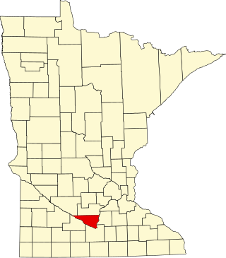
This is a list of the National Register of Historic Places listings in Nicollet County, Minnesota. It is intended to be a complete list of the properties and districts on the National Register of Historic Places in Nicollet County, Minnesota, United States. The locations of National Register properties and districts for which the latitude and longitude coordinates are included below, may be seen in an online map.

This is a list of the National Register of Historic Places listings in Olmsted County, Minnesota. It is intended to be a complete list of the properties and districts on the National Register of Historic Places in Olmsted County, Minnesota, United States. The locations of National Register properties and districts for which the latitude and longitude coordinates are included below, may be seen in an online map.

This is a list of the National Register of Historic Places listings in Washington County, Minnesota. It is intended to be a complete list of the properties and districts on the National Register of Historic Places in Washington County, Minnesota, United States. The locations of National Register properties and districts for which the latitude and longitude coordinates are included below, may be seen in an online map.

This is a list of the National Register of Historic Places listings in Rock County, Minnesota. It is intended to be a complete list of the properties and districts on the National Register of Historic Places in Rock County, Minnesota, United States. The locations of National Register properties and districts for which the latitude and longitude coordinates are included below, may be seen in an online map.

Edward Townsend Mix was an American architect of the Gilded Age who designed many buildings in the Midwestern United States. His career was centered in Milwaukee, Wisconsin, and many of his designs made use of the region's distinctive Cream City brick.

This is a list of the National Register of Historic Places listings in Chippewa County, Minnesota. It is intended to be a complete list of the properties and districts on the National Register of Historic Places in Chippewa County, Minnesota, United States. The locations of National Register properties and districts for which the latitude and longitude coordinates are included below, may be seen in an online map.

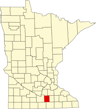
This is a list of the National Register of Historic Places listings in Waseca County, Minnesota. It is intended to be a complete list of the properties and districts on the National Register of Historic Places in Waseca County, Minnesota, United States. The locations of National Register properties and districts for which the latitude and longitude coordinates are included below, may be seen in an online map.

This is a list of the National Register of Historic Places listings in Lac qui Parle County, Minnesota. It is intended to be a complete list of the properties and districts on the National Register of Historic Places in Lac qui Parle County, Minnesota, United States. The locations of National Register properties and districts for which the latitude and longitude coordinates are included below, may be seen in an online map.

The John Mann House is an Italianate-styled farmhouse built in 1856 in Fitchburg, Wisconsin, United States. It was added to the National Register of Historic Places on July 8, 1982. Since 1980, the building has housed Quivey's Grove restaurant.

This is a list of the National Register of Historic Places listings in Mitchell County, Texas.

The Moore Farm and Twitchell Mill Site is a historic property on Page Road in Dublin, New Hampshire. The 6.8-acre (2.8 ha) property includes an early 19th-century farmhouse, as well as the remnants of one of Dublin's earliest industrial sites. It lies just south of a bend in Page Road in southern Dublin, where Stanley Brook runs east-west along the south side of the road. In c. 1768 Samuel Twitchell, Dublin's second settler, built a sawmill that used Stanley Brook as its power source. This mill was the second established in what is now Dublin, after that of Eli Morse. It was used until the mid-19th century, and now only its foundations remain. The farmhouse of Samuel Moore was built in a glen on the south side of the brook c. 1812, and was a vernacular Cape style farmhouse. The farm was purchased in 1935 by William and Katherine Mitchell Jackson, and the house was moved about 100 yards (91 m) to the top of a rise where it has commanding views of Mount Monadnock. The house was restored and enlarged under the guidance of architects Bradley & Church and again renovated in 1951. The farm complex includes a barn that is contemporaneous to the house, and a caretaker's cottage that is a 1952 reconstruction of an earlier one destroyed by fire.


