Magsaysay Boulevard station

Last updated
 Magsaysay Boulevard 
Manila Light Rail Transit System
LocationMagsaysay Boulevard corner V. Mapa Street, Santa Mesa, Manila
Owned by Light Rail Transit Authority
Line(s) Line 4
PlatformsSide platform
Tracks2
Construction
Structure typeUnderground
Disabled accessYes
Services
Preceding station  Manila LRT  Following station
Terminus Line 4
toward  Taytay

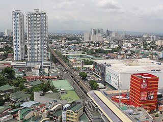
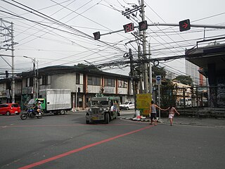
Magsaysay Boulevard station is a proposed station along the planned Manila Light Rail Transit System Line 4 (Line 4) in Manila, Metro Manila, Philippines. It will be located a few meters south of the intersection of Magsaysay Boulevard and V. Mapa Street in Santa Mesa. [1]

The Manila Light Rail Transit System Line 4 is a proposed rapid transit line to be built in Metro Manila and Rizal in the Philippines. When completed, it will be the second rapid transit line serving the province of Rizal after the extension of Line 2 to Antipolo.

Metro Manila Metropolis and Region in Metropolitan Manila Development Authority, Philippines

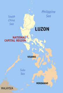
Metropolitan Manila, officially the National Capital Region (NCR), is the seat of government and one of the three defined metropolitan areas of the Philippines. It is composed of 16 cities namely: the City of Manila, Quezon City, Caloocan, Las Piñas, Makati, Malabon, Mandaluyong, Marikina, Muntinlupa, Navotas, Parañaque, Pasay, Pasig, San Juan, Taguig, and Valenzuela, as well as the municipality of Pateros.

Philippines Republic in Southeast Asia

The Philippines, officially the Republic of the Philippines, is an archipelagic country in Southeast Asia. Situated in the western Pacific Ocean, it consists of about 7,641 islands that are categorized broadly under three main geographical divisions from north to south: Luzon, Visayas, and Mindanao. The capital city of the Philippines is Manila and the most populous city is Quezon City, both part of Metro Manila. Bounded by the South China Sea on the west, the Philippine Sea on the east and the Celebes Sea on the southwest, the Philippines shares maritime borders with Taiwan to the north, Vietnam to the west, Palau to the east, and Malaysia and Indonesia to the south.

When completed, the station will serve as the western terminus of the line. It will also be an interchange station with the Manila Line 2 V. Mapa station. The station shall also serve the following destinations: Unciano Colleges and General Hospital, SM City Santa Mesa, and other nearby establishments.

Manila Light Rail Transit System Line 2 The second rapid transit line of Metro Manila.

The Manila Light Rail Transit System Line 2, also known as MRT Line 2, LRT Line 2, MRT-2, LRT-2, or Megatren, is a rapid transit line in Metro Manila in the Philippines, generally running in an east-west direction along the Radial Road 6 and a portion of the Circumferential Road 1. Although operated by the Light Rail Transit Authority, resulting in its being called "LRT-2", it is actually a heavy rail, rapid transit system owing to its use of electric multiple units instead of the light rail vehicles used in earlier lines and is presently the only line utilizing such vehicles in the country. Envisioned in the 1970s as part of the Metropolitan Manila Strategic Mass Rail Transit Development Plan, the eleven-station, 13.8-kilometer (8.6 mi) line was the third rapid transit line to be built in Metro Manila when it started operations in 2003. It is operated by the Light Rail Transit Authority (LRTA), a government-owned and controlled corporation attached to the Department of Transportation (DOTr) under an official development assistance scheme.

V. Mapa station station on the Manila Line 2 (MRT-2)

V. Mapa station is a station on the Manila Light Rail Transit System Line 2. It is one of the many elevated stations that can be found on the line and also one of the four stations in the line with a reserve track nearby together with Santolan, Anonas and Araneta Center-Cubao. The station during its inception was formerly called as "G. Araneta Station" but was renamed into the current name due to the minor realignment of some stations that has caused the change of proximity to the V. Mapa street. The station serves the areas of Santa Mesa, Manila, Quezon City and San Juan. The station is located at Ramon Magsaysay Boulevard and Victorino Mapa Street at Santa Mesa, Manila.

The Unciano Colleges and General Hospital (UCGH) is located in V. Mapa Street corner Guadalcanal Street, Manila, Philippines. Founded in 1976

Related Research Articles

Sampaloc, Manila Place in National Capital Region, Philippines

Sampaloc is a district of Manila, Philippines. It is referred to as the University Belt, for numerous colleges and universities are found within the district such as the University of Santo Tomas, the oldest extant university in Asia; the National University, the first private nonsectarian and coeducational institution in the Philippines; the Far Eastern University, known for its Art Deco campus and cultural heritage site of the Philippines; and the University of the East, once dubbed as the largest university in Asia in terms of enrollment. The district is bordered by the districts of Quiapo and San Miguel in the south, Santa Mesa district in the south and east, Santa Cruz district in the west and north, and Quezon City in the northeast.

Santa Mesa Place in National Capital Region, Philippines

Santa Mesa is a district in Manila, Philippines. It is surrounded by Pasig River on the southwestern side, and by the San Juan River on its southern and eastern side. Land borders include the districts of San Miguel to the west and Sampaloc to the north; and to the northeast is Quezon City.

Santa Mesa railway station a station on the South Main Line (Southrail) of the Philippine National Railways

Santa Mesa station is a station on the South Main Line (Southrail) of the Philippine National Railways. Like all PNR stations, the station is at grade. It is located on an unnamed road near Ramon Magsaysay Boulevard in Santa Mesa, Manila, making it one of two stations to have its own access road. The station is named after the district where it is located.

The public transportation system in Metro Manila, Philippines is inadequate to accommodate the mobility and other basic needs of a densely populated metropolis, the result of many factors and problems that the government has failed to deliver. Metro Manila exists in a state of heavy traffic congestion, with people and goods trapped by the very transportation system that is supposed to move them quickly and efficiently. Because of the insufficient public transportation network, car ownership has risen dramatically, contributing further to the congestion that occurs at all times of day on the road. Filipinos view cars as tools to get them to where they need to go; they also believe that their car is an important symbol of the success they have achieved in life. In recent years, however, the Philippine government has been pushing to improve the system through various infrastructure projects, hoping to solve the interlinked problems of transportation, land use and environment.

Radial Road 6

Radial Road 6 is the sixth radial road in Metro Manila, in the Philippines. It passes through the cities of Manila, Quezon City, San Juan, Pasig, and Marikina, as well as Cainta, and Antipolo in the province of Rizal.

Transportation in Metro Manila

The transportation system in Metro Manila is inadequate to accommodate the mobility and other basic needs of an densely populated metropolis, the result of many factors and problems that the government has failed to provide or address. Metro Manila exists in a state of near-permanent gridlock, with people and goods trapped by the very transportation system that is supposed to move them quickly and efficiently. Because of the insufficient public transportation network, car ownership has risen dramatically, contributing further to the congestion that occurs at all times of day on the road. Filipinos view cars as tools to get them to where they need to go; they also believe that their car is an important symbol of the success they have achieved in life. In recent years, however, the Philippine government has been pushing to improve the system through various infrastructure projects, hoping to solve the interlinked problems of transportation, land use and environment.

Magsaysay Boulevard

President Ramon Magsaysay Boulevard, simply known Magsaysay Boulevard, is the principal artery of Santa Mesa in Manila, Philippines. It is a six-lane divided roadway that travels east-west from Gregorio Araneta Avenue near the city's border with Quezon City and San Juan to Lacson Avenue and the Nagtahan Interchange, close to the district of San Miguel. The entire length of the boulevard serves as the boundary between Sampaloc in the north and Santa Mesa in the south with the Manila Light Rail Transit System Line 2 running along its median. East of Gregorio Araneta, the road continues as Aurora Boulevard while west of Lacson, it extends as Legarda Street via a flyover into San Miguel and Quiapo.

Victorino Mapa Street

Victorino Mapa Street, also known by its short form V. Mapa Street, is the main north-south road in Santa Mesa district in the City of Manila, Philippines. The street, including its eastern extension, runs for 1.6 kilometers from the junction with Magsaysay Boulevard in the north to Pat Antonio Street in the southeast by the San Juan River that serves as the district's border with San Juan and Mandaluyong. It is home to Don Bosco School, Manila, Unciano Colleges and General Hospital, and several new condominiums and a few motels.

Pureza Street is a short street located in Santa Mesa district in Manila, Philippines. It is a notable road in a generally north-south orientation between the junction with Paltok Street and San Jose Street in Santa Mesa and the intersection with Anonas Street also in Santa Mesa. It is served by Pureza Station of the Manila Line 2.

Radial Road 5

Radial Road 5, more commonly referred to as R-5, is a network of roads and bridges that altogether form the fifth radial road of Manila in the Philippines. The road links the City of Manila with Mandaluyong and Pasig in the east, leading out of Metro Manila into the province of Rizal and south towards Laguna. It is the only arterial road traversing the east side of the Laguna de Bay.

Index of Metro Manila-related articles

The following is an alphabetical list of articles related to the Philippine capital region of Metro Manila.

The Manila Metro Rail Transit System Line 8, or MRT-8, also known as PNR East-West Line, is a proposed rapid transit line in the Philippines. It will be a nine-kilometer railway system connecting Sampaloc, Manila and Diliman, Quezon City via, Commonwealth Avenue, Quezon Avenue, and España Boulevard. The unsolicited proposal for the project was submitted to the Philippine government by Malaysia-based construction engineering company AlloyMTD group in 2016, and is awaiting for approval by the National Economic Development Authority (NEDA). According to MTD Philippines, Inc. President Patrick Nicholas David, the project will cost PHP 60 billion.

EDSA station is a proposed station along the planned Manila Light Rail Transit System Line 4 in Quezon City, Metro Manila, Philippines. It will be located at the intersection of EDSA and Shaw Boulevard in Mandaluyong adjacent to the Shangri-La Plaza.

Wack Wack station is a proposed station along the planned Manila Light Rail Transit System Line 4 in Mandaluyong, Metro Manila, Philippines. It will be located at the intersection of Old Wack Wack Road and Shaw Boulevard in Pleasant Hills nearby the Wack Wack Golf and Country Club.

Acacia Lane station is a proposed station along the planned Manila Light Rail Transit System Line 4 in Mandaluyong, Metro Manila, Philippines. It will be located in between the intersection of Shaw Boulevard with Gomezville Street/9 de Pebrero Street and Acacia Lane in Pleasant Hills.

Kalentong station is a proposed station along the planned Manila Light Rail Transit System Line 4 in Mandaluyong, Metro Manila, Philippines. It will be located at the intersection of New Panaderos and General Kalentong streets and Shaw Boulevard in Barangay Daang Bakal.

Dupil station is a proposed station along the planned Manila Light Rail Transit System Line 4 in Manila, Metro Manila, Philippines. It will be located a few meters north of the intersection of Dupil Street and P. Sanchez Street in Santa Mesa, nearby Our Lady of Lourdes Hospital.

References

  1. "Study on Medium Capacity Transit System Project in Metro Manila, the Republic of the Philippines" (PDF). Ministry of Economy, Trade and Industry (Japan) . Retrieved 9 July 2015.