
Antipolo, officially the City of Antipolo,, or simply known as Antipolo City, is a 1st class city and the capital of the province of Rizal, Philippines. According to the 2015 census, it has a population of 776,386 people.

Cainta, officially the Municipality of Cainta,, is a 1st class municipality in the province of Rizal, Philippines. According to the 2015 census, it has a population of 322,128 people.

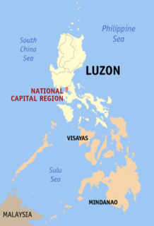
Tanay, officially the Municipality of Tanay,, is a 1st class municipality in the province of Rizal, Philippines. According to the 2015 census, it has a population of 117,830 people.

V. Mapa station is a station on the Manila Light Rail Transit System Line 2. It is one of the many elevated stations that can be found on the line and also one of the four stations in the line with a reserve track nearby together with Santolan, Anonas and Araneta Center-Cubao. The station during its inception was formerly called as "G. Araneta Station" but was renamed into the current name due to the minor realignment of some stations that has caused the change of proximity to the V. Mapa street. The station serves the areas of Santa Mesa, Manila, Quezon City and San Juan. The station is located at Ramon Magsaysay Boulevard and Victorino Mapa Street at Santa Mesa, Manila.

Boni Station, also called as Boni Avenue Station, is a station on the Manila Metro Rail Transit System Line 3. It is the eighth station for trains headed to Taft Avenue and the sixth station for trains headed to North Avenue. It has several restaurants and shops that surround the station, including a public market located across the train station.
The public transportation system in Metro Manila, Philippines is woefully inadequate to accommodate the mobility and other basic needs of an overpopulated metropolis, the result of many factors and problems that the government has failed to provide or address. Metro Manila exists in a state of near-permanent gridlock, with people and goods trapped by the very transportation system that is supposed to move them quickly and efficiently. Because of the insufficient public transportation network, car ownership has risen dramatically, contributing further to the congestion that occurs at all times of day on the road. Filipinos view cars as tools to get them to where they need to go; they also believe that their car is an important symbol of the success they have achieved in life. In recent years, however, the Philippine government has been pushing to improve the system through various infrastructure projects, hoping to solve the interlinked problems of transportation, land use and environment.

Blumentritt station is a station on the South Main Line ("Southrail") of the Philippine National Railways. Like all PNR stations, it is at grade. It is located at the corner of Old Antipolo Street and Rizal Avenue in Santa Cruz, Manila and derives its name from nearby Blumentritt Road, which is named after the Bohemian professor Ferdinand Blumentritt, friend of José Rizal and sympathizer of the Filipino cause.

The transportation system in Metro Manila is woefully inadequate to accommodate the mobility and other basic needs of an overpopulated metropolis, the result of many factors and problems that the government has failed to provide or address. Metro Manila exists in a state of near-permanent gridlock, with people and goods trapped by the very transportation system that is supposed to move them quickly and efficiently. Because of the insufficient public transportation network, car ownership has risen dramatically, contributing further to the congestion that occurs at all times of day on the road. Filipinos view cars as tools to get them to where they need to go; they also believe that their car is an important symbol of the success they have achieved in life. In recent years, however, the Philippine government has been pushing to improve the system through various infrastructure projects, hoping to solve the interlinked problems of transportation, land use and environment.

Ortigas Avenue is a 15.5 km highway traversing through the eastern part of Metro Manila and the western part of Rizal province. It is one of the busiest highways in Metro Manila.

SM Center Angono is a shopping mall owned by SM Prime Holdings, the largest mall developer in the Philippines. It is located along Manila East Road, Angono, Rizal. This mall which opened to the public on November 14, 2014 is the 50th SM Supermall in the Philippines, the second along Manila East Road after SM City Taytay and third in Rizal Province after SM City Taytay and SM City Masinag, and is the third SM Supermall without cinemas after SM Center Pasig and SM Center Las Piñas. It is also the first SM Center to anchor Savemore Market rather than anchoring the Hypermarket. It was succeeded the following year by another SM Supermall also in Rizal, SM City San Mateo.

The Dr. Arcadio Santos Avenue or Dr. A. Santos Avenue,, is the primary east-west thoroughfare in Parañaque, southern Metro Manila, Philippines. The avenue's western end is at Victor Medina Street in the boundary between La Huerta and San Dionisio, as the continuation of Ninoy Aquino Avenue. Physically, Ninoy Aquino Avenue connects northbound to NAIA Road in Pasay which, in turn, continues west to Roxas Boulevard back in Parañaque, and then to Macapagal Boulevard, where it finally ends. Its eastern end is at South Luzon Expressway, at the city's border with Sucat, Muntinlupa, where it becomes Meralco Road to service the rest of the route to Sucat railway station.

San Lazaro Tourism and Business Park is the marketing name given to the 16-hectare (40-acre) multiple use site under development by the Manila Jockey Club Investments Corp. in Manila, Philippines. It takes its name from the old San Lazaro Hippodrome, a horse racetrack that stood on the site from 1912 to 2003. Currently, the site includes the SM City San Lazaro shopping center, the two-tower Vertex office complex, the three-tower Celadon Park and Celadon Residences, and the five-tower Avida Towers San Lazaro condominium complex. It has been declared a tourism economic zone with information technology component in 2009.
Meralco station is a proposed station along the planned Manila Light Rail Transit System Line 4 in Pasig, Metro Manila, Philippines. It will be located near the intersection of Ortigas Avenue and Meralco Avenue in Ugong and will be adjacent to the Manila Electric Company (Meralco) Center building. Under the current proposal, the station will be the second heading east from its interchange with Ortigas MRT station on EDSA towards suburban Taytay along busy Ortigas Avenue.
Bonifacio Avenue station, also Felix Avenue station, is a proposed station along the planned Manila Light Rail Transit System Line 4 in Cainta, Rizal, Philippines. It will be located at the intersection of Ortigas Avenue Extension with Bonifacio Avenue and Felix Avenue in the Cainta barangay of Santo Domingo adjacent to Robinsons Place Cainta shopping mall. Under the current proposal, the station will be the first station of the line outside Metro Manila.
L. Wood station is a proposed station along the planned Manila Light Rail Transit System Line 4 in Taytay, Rizal, Philippines. It will be located at the Tikling Junction which is the intersection of Ortigas Avenue Extension with Leonard Wood Road and Taytay Diversion Road in the Taytay poblacion of Dolores.

Radial Road 5, more commonly referred to as R-5, is a network of roads and bridges that altogether form the fifth radial road of Manila in the Philippines. The road links the City of Manila with Mandaluyong and Pasig in the east, leading out of Metro Manila into the province of Rizal and south towards Laguna. It is the only arterial road traversing the east side of the Laguna de Bay.

Radial Road 4, more commonly referred to as R-4, is a proposed network of roads and bridges that altogether would form the fourth radial road of Manila in the Philippines. The road would link the City of Manila with Makati and Pasig in the south and east, leading out of Metro Manila into the province of Rizal. R-4 parallels Radial Road 5 (R-5) on the south bank of the Pasig River. At present, only certain portions of the road are complete.
The following is an alphabetical list of articles related to the Philippine capital region of Metro Manila.


