Governor Pascual railway station

Last updated
 Governor Pascual 
Philippine National Railways
GPstationsteelplatform.jpg
Governor Pascual station temporary steel platform.
Other namesMalabon, Acacia
Location Governor Pascual Avenue, Brgy. Acacia, Malabon
Owned by Philippine National Railways
Line(s) PNR Northrail (1891-1997, 2018-present)
North Shuttle Line
PlatformsSide platform
Tracks1
Other information
StatusOperational
Station codeGP
History
Opened1970s (original)
December 3, 2018
Rebuilt2018 (partly)
Services
Preceding station  PNR  Following station
Terminus North Shuttle
toward  FTI
Metro North Commuter
toward  Tutuban
PNR Metro Commuter
North–South Commuter Line
BSicon exKBHFa orange.svg
Valenzuela
BSicon dWASSERq.svg
BSicon exSTR orange.svg
BSicon hKRZWae orange.svg
BSicon dWASSERq.svg
BSicon GRZq.svg
BSicon exSTR orange.svg
BSicon KACCa orange.svg
BSicon exSTR orange.svg
Governor Pascual
BSicon GRZq.svg
BSicon STR orange.svg
BSicon HSTACC orange.svg
Caloocan
BSicon ABZg+l orange.svgBSicon KDSTeq orange.svg
Caloocan Depot
BSicon HSTACC orange.svg
10th Avenue
BSicon HSTACC orange.svg
5th Avenue
BSicon GRZq.svg
BSicon STR orange.svg
BSicon dWASSERq.svgBSicon hKRZWae orange.svgBSicon dWASSERq.svg
Maypajo Estuary
BSicon HSTACC orange.svg
Solis
BSicon KDSTa orange.svgBSicon STR orange.svg
Tutuban Railyard &
Tayuman Locomotive Shed
BSicon ABZg+l orange.svg
BSicon ABZgl orange.svg
BSicon ABZg+r orange.svg
BSicon ABZgr orange.svg
BSicon KINTACCe orange.svgBSicon STR orange.svg
Tutuban
  2  
BSicon INTACC orange.svg
Blumentritt
  1  
BSicon HSTACC orange.svg
Laong Laan
BSicon lHSTACC.svg
BSicon eINTACC orange.svg
España
  8  
BSicon dWASSERq.svgBSicon hKRZWae orange.svgBSicon dWASSERq.svg
Valencia Estuary
BSicon INTACC orange.svg
Santa Mesa
  2  
BSicon dWASSERq.svgBSicon hKRZWae orange.svgBSicon dWASSERq.svg
Pandacan Estuary
BSicon HSTACC orange.svg
Pandacan
BSicon dWASSERq.svgBSicon hKRZWae orange.svgBSicon dWASSERq.svg
Pandacan Estuary
BSicon HSTACC orange.svg
Paco
BSicon HSTACC orange.svg
San Andres
BSicon HSTACC orange.svg
Vito Cruz
BSicon GRZq.svg
BSicon STR orange.svg
BSicon eHSTACC orange.svg
Buendia
BSicon HSTACC orange.svg
Dela Rosa
BSicon HSTACC orange.svg
Pasay Road
BSicon dWASSERq.svgBSicon hKRZWae orange.svgBSicon dWASSERq.svg
Tripa de Gallina Estuary
BSicon INTACC orange.svg
EDSA
  3  
BSicon dWASSERq.svgBSicon hKRZWae orange.svgBSicon dWASSERq.svg
Tripa de Gallina Estuary
BSicon INTACC orange.svg
Nichols BSicon FLUG.svg
  9  
BSicon INTACC orange.svg
FTI
  9  
BSicon GRZq.svg
BSicon STR orange.svg
BSicon HSTACC orange.svg
Bicutan
BSicon GRZq.svg
BSicon STR orange.svg
BSicon HSTACC orange.svg
Sucat
BSicon dWASSERq.svgBSicon hKRZWae orange.svgBSicon dWASSERq.svg
Sucat River
BSicon dWASSERq.svgBSicon hKRZWae orange.svgBSicon dWASSERq.svg
BSicon INTACC orange.svg
Alabang BSicon BUS2.svg
BSicon dWASSERq.svgBSicon hKRZWae orange.svgBSicon dWASSERq.svg
Bayanan Creek
BSicon dWASSERq.svgBSicon hKRZWae orange.svgBSicon dWASSERq.svg
Poblacion River
BSicon HSTACC orange.svg
Muntinlupa
BSicon dWASSERq.svgBSicon hKRZWae orange.svgBSicon dWASSERq.svg
Magdaong River
BSicon eHST orange.svg
Tunasan
BSicon GRZq.svg
BSicon STR orange.svg
BSicon dWASSERq.svgBSicon hKRZWae orange.svgBSicon dWASSERq.svg
Tunasan River
BSicon GRZq.svg
BSicon STR orange.svg
BSicon dWASSERq.svgBSicon hKRZWae orange.svgBSicon dWASSERq.svg
San Isidro River
BSicon HSTACC orange.svg
San Pedro
BSicon exKRW+l orange.svg
BSicon STR orange.svg
BSicon exKRWr orange.svg
BSicon GRZq.svg
BSicon exSTR orange.svg
BSicon STR orange.svg
BSicon exKBHFe orange.svgBSicon STR orange.svg
Carmona
BSicon HST orange.svg
Pacita MG
BSicon GRZq.svg
BSicon STR orange.svg
BSicon HST orange.svg
Golden City 1
BSicon HSTACC orange.svg
Biñan
BSicon dWASSERq.svgBSicon hKRZWae orange.svgBSicon dWASSERq.svg
Biñan River
BSicon GRZq.svg
BSicon STR orange.svg
BSicon dWASSERq.svgBSicon hKRZWae orange.svgBSicon dWASSERq.svg
Silang-Santa Rosa River
BSicon HSTACC orange.svg
Santa Rosa
BSicon eHST orange.svg
Golden City 2
BSicon GRZq.svg
BSicon STR orange.svg
BSicon dWASSERq.svgBSicon hKRZWae orange.svgBSicon dWASSERq.svg
Cabuyao River delta
BSicon HSTACC orange.svg
Cabuyao
BSicon eHST orange.svg
Gulod
BSicon dWASSERq.svgBSicon hKRZWae orange.svgBSicon dWASSERq.svg
Cabuyao River delta
BSicon ACC orange.svg
Mamatid
BSicon eHST orange.svg
Banlic
BSicon GRZq.svg
BSicon STR orange.svg
BSicon dWASSERq.svgBSicon hKRZWae orange.svgBSicon dWASSERq.svg
BSicon KACCe orange.svg
Calamba

Governor Pascual railway station (also called as Malabon or Acacia station) is a railway station of the Philippine National Railways (PNR). It is located and situated adjacent to Governor Pascual Avenue, Barangay Acacia in Malabon, Metro Manila.

Philippine National Railways Railway company in the Philippines

The Philippine National Railways (PNR) is a state-owned railway company in the Philippines, operating a single line of track on Luzon. As of 2016, it operates one commuter rail service in Metro Manila and local services between Sipocot, Naga City and Legazpi City in the Bicol Region. PNR began operations on November 24, 1892 as the Ferrocarril de Manila-Dagupan, during the Spanish colonial period, and later becoming the Manila Railroad Company (MRR) during the American colonial period. It became the Philippine National Railways on June 20, 1964 by virtue of Republic Act No. 4156. The PNR is an agency of the Department of Transportation.

Governor Pascual Avenue road in Malabon, the Philippines

Governor Wenceslao Pascual Avenue, commonly known as simply Governor Pascual Avenue, is the principal east-west artery in the city of Malabon in Metro Manila, the Philippines. It is an unsigned route in the Philippine highway network classified by the Department of Public Works and Highways as a national tertiary road. The 4.43-kilometre (2.75 mi) two-lane avenue is the longest of the city's national roads. Portions of it are prone to flooding from the Tullahan River which flows just north of the avenue in east-central Malabon.

Malabon Highly Urbanized City in National Capital Region, Philippines

Malabon, officially the City of Malabon,, or simply known as Malabon City, is a 1st class highly urbanized city in Metro Manila, Philippines. According to the 2015 census, it has a population of 365,525 people.

Contents

History

Historically, the station is named after the adjacent Acacia village, where the old station once stood. Presently, it is named after the road, which is, in turn, named after Governor Wenceslao Pascual, who was the administrator of Malabon, formerly then-municipality of Rizal when it was split from Navotas. [1]

The old station was demolished during clearing operations in 2007 for the ill-fated and renegotiated Northrail. In 2018, after consultations with the Malabon City LGU, DOTr and PNR intended to restore the at-grade railway station here, despite no longer being a designated stop in the elevated Northrail system. It is the most recent expansion of the Caloocan-FTI line beyond Caloocan, and the first time in 2 decades that there has been rail activity. [2]

In September 2018, PNR engineers commenced the exploration of the site of the old Acacia railway station, and drafted plans to rebuild the dismantled rail lines there and set a target to reopen the service and station before the end of 2018. [3] A ceremony was held to officially mark the commencement of the restoration of services. [4] Soon after, railroad tracks were laid down along with ballasts. It required the restoration of Samson Road railroad crossing, which was done on November 23, 2018, [5] which enables the PNR to serve Malabon City once again. Services to Governor Pascual resumed on December 3, 2018, after two decades of hiatus. [6]

The rails that cover the radius of this station was dismantled and replaced with standard gauge tracks, which have also been dismantled for the NLEX Segment 10.1. Construction materials related to the NLEX Segment have been moved to make way for the restoration of the at-grade rails.

The railroad crossing along Governor Pascual Road is pending restoration, as it was dismantled too during the clearing operations and eventual road reblocking.

Nearby landmarks

Governor Pascual is lined with stores and establishments. Further to the west is Robinsons Town Mall Malabon, heading to Navotas, while to the east, Malabon City Zoo is located, leading back to Monumento in Caloocan City.

Robinsons Town Mall Malabon shopping centre in Malabon City, Philippines

Robinsons Town Mall Malabon is a shopping mall located in Malabon, Metro Manila, Philippines. It is the first full service mall in Malabon owned and managed by Robinsons Land Corporation, the second largest mall operator in the Philippines. The mall was opened in 2013. It is the 37th mall opened by Robinsons in the Philippines and the first and only Robinsons mall in Malabon and the whole CAMANAVA area.

Station Layout

L1
Platforms
Side platform, doors will open on the left
Platform PNR Metro Commuter towards FTI and Tutuban (←)
L1Concourse/
Street Level
Ticket Booths, Station Control, Shops, Caltex Acacia gas station

Related Research Articles

Rail transport in the Philippines This is the system of rail transport in the Philippines

Rail transportation in the Philippines presently is used mostly to transport passengers within Metro Manila and the nearby province of Laguna. Freight transport is nonexistent, although there are plans for a revival from Port Area, Manila to Laguna, and a cargo train planned between Subic and Clark. Currently, the country has a railway footprint of only 79 kilometres through Line 1, Line 2, Line 3 and the Philippine National Railways (PNR) Metro Commuter Line. This situation will change in the immediate future as the government has plans to expand its current footprint to more than 244 kilometers.

Monumento station station on the Manila LRT Yellow Line (LRT-1)

Monumento station is a station on the Manila Light Rail Transit System Line 1. Like all other Line 1 stations, Monumento is above-ground. The station serves the southern portion of Caloocan, and is named after the most famous landmark of Caloocan, the Monumento Circle, which houses the Bonifacio Monument, a famous monument to Andrés Bonifacio. The name Monumento itself is derived from the Spanish word for monument. Being a former terminal in Line 1, it is called Monumento Terminal.

San Fernando railway station (Pampanga)

San Fernando City station or simply San Fernando station is a defunct railway station of the PNR Northrail line of Philippine National Railways. It is situated San Fernando, Pampanga. Historically, the old PNR train station was the site of a stopping place for Filipino and American prisoners of war during the Bataan death march in 1942.

Tullahan River river in the Philippines

The Tullahan River is a river of the Philippines. It is located to the north of Manila and has an approximate length of 7.6 miles (12.2 km). It starts at the La Mesa Reservoir in Quezon City and flows through Malabon and Valenzuela and empties into the Manila Bay.In 2019, San Miguel Corporation pledges ₱1 billion for the cleanup of the Tullahan River as part of the Manila Bay rehabilitation effort.

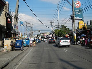
The public transportation system in Metro Manila, Philippines is inadequate to accommodate the mobility and other basic needs of a densely populated metropolis, the result of many factors and problems that the government has failed to deliver. Metro Manila exists in a state of heavy traffic congestion, with people and goods trapped by the very transportation system that is supposed to move them quickly and efficiently. Because of the insufficient public transportation network, car ownership has risen dramatically, contributing further to the congestion that occurs at all times of day on the road. Filipinos view cars as tools to get them to where they need to go; they also believe that their car is an important symbol of the success they have achieved in life. In recent years, however, the Philippine government has been pushing to improve the system through various infrastructure projects, hoping to solve the interlinked problems of transportation, land use and environment.

5th Avenue railway station

5th Avenue station is a railway station of the Philippine National Railways as part of Governor Pascual - FTI Line. Facilities such as ramps and platforms were planned to be constructed near the railway crossing with C-3 Road in Caloocan, Metro Manila. The plans to rehabilitate this part of PNR's network were implemented but no concrete platforms were erected.

EDSA railway station

EDSA station is a station on the South Main Line ("Southrail") of the Philippine National Railways. Like all PNR stations, this station is at grade. The station is located at the intersection of the South Luzon Expressway and Epifanio de los Santos Avenue in Makati, below the Magallanes Interchange.

FTI railway station

FTI station is a station of the South Main Line ("Southrail") of the Philippine National Railways. Like all PNR stations, this station is at grade. It is located on the East Service Road of the South Luzon Expressway in Taguig, on the foot of the Metro Manila Skyway. It is named after its major landmark, the grounds of the formerly state-owned Food Terminal, Inc. which is now renamed as Arca South.

10th Avenue railway station

10th Avenue station is a railway station of the Philippine National Railways (PNR) as part of Governor Pascual - FTI Line. Like all PNR stations, the station is at grade. It is located on 10th Avenue in Caloocan, near the original Caloocan railway station.

Solis railway station

Solis station is a railway station of the Philippine National Railways as part of the Governor Pascual - FTI Line. Like all PNR stations, the station is at grade. It is located and situated along the railroad crossing on Solis St. in Tondo, Manila.

Valenzuela railway station was a railway station that is situated on the Northrail line. This line has been used for passenger and freight transportation by Philippine National Railways and its precursors in the past. If the railway line will be rebuilt, it shall be located within the city of Valenzuela.

Caloocan railway station

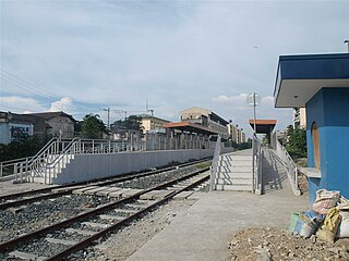
Caloocan railway station is a railway station of the Philippine National Railways (PNR) as part of the Governor Pascual - FTI line. It is rebuilt from its original location, now located and situated adjacent to Apolinario Mabini St., and along the railroad crossing on Samson Road in Caloocan, Metro Manila.

Roman Catholic Diocese of Kalookan diocese of the Catholic Church in the Philippines

The Roman Catholic Diocese of Kalookan is a diocese of the Latin Church of the Catholic Church in Metro Manila, Philippines which comprises Malabon City, Navotas City, and the southern portion of Caloocan City. The diocese was created by Pope John Paul II on June 28, 2003 through his apostolic letter Quoniam Quaelibet. The diocese was canonically erected on August 22, 2003, with the installation of its first bishop, Deogracias S. Iñiguez, D.D. then Bishop of Iba, Zambales. Upon Bishop Iñiguez's resignation on January 25, 2013, Antipolo Auxiliary Bishop Francisco M. De Leon, D.D. was named Apostolic Administrator of the diocese. On October 14, 2015, Pope Francis named Pablo Virgilio S. David, D.D., STh.D, auxiliary bishop of Roman Catholic Archdiocese of San Fernando in Pampanga, as the second bishop of Kalookan.

Circumferential Road 4

Circumferential Road 4 is the 4th Circumferential road in Metro Manila, in the Philippines. It passes through the cities of Navotas, Malabon, Caloocan, Quezon City, Mandaluyong, Makati, and Pasay.

PNR Metro Commuter Line

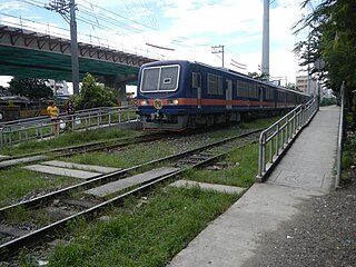
The Philippine National Railways Metro Commuter Line is a commuter rail line operated by the Philippine National Railways, stretching from Tondo, Manila to the southern and northern edge of Metro Manila. Presently, there are 31 railway stations. The current line is colored orange on most maps.

Dela Rosa railway station

Dela Rosa is a station on the South Main Line ("Southrail") of the Philippine National Railways. Like all PNR stations, this station is at grade. The station is located at the corner of Dela Rosa Street and the South Luzon Expressway in Makati.

Meycauayan railway station was a former railroad station in the Philippine National Railways' Dagupan line, and is also a proposed railway station that is situated on the Northrail line. This line has been used for passenger and freight transportation by Philippine National Railways and its precursors in the past.

References

  1. M, Cecile (7 December 2010). "My Malabon: The Wenceslao Pascual House". Mymalabon.blogspot.com. Retrieved 2 February 2019.
  2. "After 20 years, PNR resumes Sangandaan, Caloocan-FTI Taguig route". Gmanetwork.com. Retrieved 2018-09-10.
  3. "Philippine National Railways". Facebook.com. Retrieved 2 February 2019.
  4. "Track Laying Ceremony ng Main Line North Extension to Governor Pascual sa Malabon City". Remate.ph. Retrieved 2 February 2019.
  5. "Department of Transportation - Philippines". Facebook.com. Retrieved 2 February 2019.
  6. "Department of Transportation - Philippines". Facebook.com. Retrieved 2 February 2019.

Coordinates: 14°40′12.1″N120°58′22.2″E / 14.670028°N 120.972833°E / 14.670028; 120.972833

Geographic coordinate system Coordinate system

A geographic coordinate system is a coordinate system that enables every location on Earth to be specified by a set of numbers, letters or symbols. The coordinates are often chosen such that one of the numbers represents a vertical position and two or three of the numbers represent a horizontal position; alternatively, a geographic position may be expressed in a combined three-dimensional Cartesian vector. A common choice of coordinates is latitude, longitude and elevation. To specify a location on a plane requires a map projection.