This article does not cite any sources .(September 2017) (Learn how and when to remove this template message) |
Buendia | |||||||||||
|---|---|---|---|---|---|---|---|---|---|---|---|
| Philippine National Railways | |||||||||||
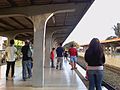
 Platform area of Buendia station | |||||||||||
| Location | South Luzon Expressway cor. Gil Puyat Avenue Pio del Pilar, Makati | ||||||||||
| Coordinates | 14°33′26.47″N121°0′29.17″E / 14.5573528°N 121.0081028°E Coordinates: 14°33′26.47″N121°0′29.17″E / 14.5573528°N 121.0081028°E | ||||||||||
| Owned by | Philippine National Railways | ||||||||||
| Line(s) | █ PNR Southrail | ||||||||||
| Platforms | Side platforms | ||||||||||
| Tracks | 2 | ||||||||||
| Construction | |||||||||||
| Structure type | At grade | ||||||||||
| Disabled access | Yes | ||||||||||
| Other information | |||||||||||
| Station code | DIA | ||||||||||
| History | |||||||||||
| Opened | 1975 | ||||||||||
| Closed | September 8, 2017 | ||||||||||
| Rebuilt | 1990, 2009 | ||||||||||
| Services | |||||||||||
| |||||||||||
PNR Metro Commuter | |||||||||||||||||||||||||||||||||||||||||||||||||||||||||||||||||||||||||||||||||||||||||||||||||||||||||||||||||||||||||||||||||||||||||||||||||||||||||||||||||||||||||||||||||||||||||||||||||||||||||||||||||||||||||||||||||||||||||||||||||||||||||||||||||||||||||||||||||||||||||||||||||||||||||||||||||||||||||||||||||||||||||||||||||||||||||||||||||||||||||||||||||||||||||||||||||||||||||||||||||||||||||||||||||||||||||||||||||||||||||||||||||||||||||||||||||||||||||||||||||||||||||||||||||||||||||||||||||||||||||||||||||||||||||||||||||||||||||||||||||||||||||||||||||||||||||||||||||||||||||||||||||||||||||||||||||||||||||||||||||||||||||||||||||||||||||||||||||
|---|---|---|---|---|---|---|---|---|---|---|---|---|---|---|---|---|---|---|---|---|---|---|---|---|---|---|---|---|---|---|---|---|---|---|---|---|---|---|---|---|---|---|---|---|---|---|---|---|---|---|---|---|---|---|---|---|---|---|---|---|---|---|---|---|---|---|---|---|---|---|---|---|---|---|---|---|---|---|---|---|---|---|---|---|---|---|---|---|---|---|---|---|---|---|---|---|---|---|---|---|---|---|---|---|---|---|---|---|---|---|---|---|---|---|---|---|---|---|---|---|---|---|---|---|---|---|---|---|---|---|---|---|---|---|---|---|---|---|---|---|---|---|---|---|---|---|---|---|---|---|---|---|---|---|---|---|---|---|---|---|---|---|---|---|---|---|---|---|---|---|---|---|---|---|---|---|---|---|---|---|---|---|---|---|---|---|---|---|---|---|---|---|---|---|---|---|---|---|---|---|---|---|---|---|---|---|---|---|---|---|---|---|---|---|---|---|---|---|---|---|---|---|---|---|---|---|---|---|---|---|---|---|---|---|---|---|---|---|---|---|---|---|---|---|---|---|---|---|---|---|---|---|---|---|---|---|---|---|---|---|---|---|---|---|---|---|---|---|---|---|---|---|---|---|---|---|---|---|---|---|---|---|---|---|---|---|---|---|---|---|---|---|---|---|---|---|---|---|---|---|---|---|---|---|---|---|---|---|---|---|---|---|---|---|---|---|---|---|---|---|---|---|---|---|---|---|---|---|---|---|---|---|---|---|---|---|---|---|---|---|---|---|---|---|---|---|---|---|---|---|---|---|---|---|---|---|---|---|---|---|---|---|---|---|---|---|---|---|---|---|---|---|---|---|---|---|---|---|---|---|---|---|---|---|---|---|---|---|---|---|---|---|---|---|---|---|---|---|---|---|---|---|---|---|---|---|---|---|---|---|---|---|---|---|---|---|---|---|---|---|---|---|---|---|---|---|---|---|---|---|---|---|---|---|---|---|---|---|---|---|---|---|---|---|---|---|---|---|---|---|---|---|---|---|---|---|---|---|---|---|---|---|---|---|---|---|---|---|---|---|---|---|---|---|---|---|---|---|---|---|---|---|---|---|---|---|---|---|---|---|---|---|---|---|---|---|---|---|---|---|---|---|---|---|---|---|---|---|---|---|---|---|---|---|---|---|---|---|---|---|---|---|---|---|---|---|---|---|---|---|---|---|---|---|---|---|---|---|---|---|---|---|---|---|---|---|---|---|---|---|---|---|---|---|---|---|---|---|---|---|---|---|---|---|---|---|---|---|---|---|---|---|---|---|---|---|---|---|---|---|---|---|---|---|---|---|---|---|---|---|---|---|---|---|---|---|---|---|---|---|---|---|---|---|---|---|---|---|---|---|---|---|---|---|---|---|---|---|---|---|---|---|---|---|---|---|---|---|---|---|---|---|---|---|---|---|---|---|---|---|---|---|---|---|---|---|---|---|---|---|---|---|---|---|---|---|---|---|---|---|---|---|---|---|---|---|---|---|---|---|---|---|---|
North–South Commuter Line | |||||||||||||||||||||||||||||||||||||||||||||||||||||||||||||||||||||||||||||||||||||||||||||||||||||||||||||||||||||||||||||||||||||||||||||||||||||||||||||||||||||||||||||||||||||||||||||||||||||||||||||||||||||||||||||||||||||||||||||||||||||||||||||||||||||||||||||||||||||||||||||||||||||||||||||||||||||||||||||||||||||||||||||||||||||||||||||||||||||||||||||||||||||||||||||||||||||||||||||||||||||||||||||||||||||||||||||||||||||||||||||||||||||||||||||||||||||||||||||||||||||||||||||||||||||||||||||||||||||||||||||||||||||||||||||||||||||||||||||||||||||||||||||||||||||||||||||||||||||||||||||||||||||||||||||||||||||||||||||||||||||||||||||||||||||||||||||||||
| |||||||||||||||||||||||||||||||||||||||||||||||||||||||||||||||||||||||||||||||||||||||||||||||||||||||||||||||||||||||||||||||||||||||||||||||||||||||||||||||||||||||||||||||||||||||||||||||||||||||||||||||||||||||||||||||||||||||||||||||||||||||||||||||||||||||||||||||||||||||||||||||||||||||||||||||||||||||||||||||||||||||||||||||||||||||||||||||||||||||||||||||||||||||||||||||||||||||||||||||||||||||||||||||||||||||||||||||||||||||||||||||||||||||||||||||||||||||||||||||||||||||||||||||||||||||||||||||||||||||||||||||||||||||||||||||||||||||||||||||||||||||||||||||||||||||||||||||||||||||||||||||||||||||||||||||||||||||||||||||||||||||||||||||||||||||||||||||||
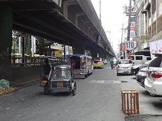
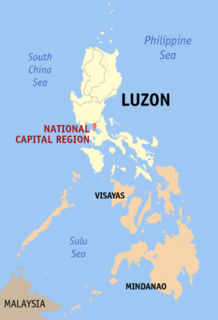
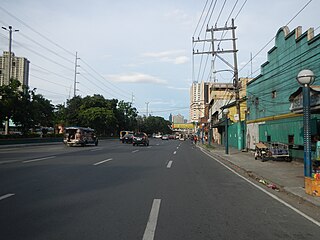
Buendia was a station on the South Main Line ("Southrail") of the Philippine National Railways. Like all PNR stations, this station is at grade. The station was located at the corner of Gil Puyat Avenue (formerly named Buendia Avenue) and the South Luzon Expressway in Makati.

The Philippine National Railways (PNR) is a state-owned railway company in the Philippines, operating a single line of track on Luzon. As of 2016, it operates one commuter rail service in Metro Manila and local services between Sipocot, Naga City and Legazpi City in the Bicol Region. PNR began operations on November 24, 1892 as the Ferrocarril de Manila-Dagupan, during the Spanish colonial period, and later becoming the Manila Railroad Company (MRR) during the American colonial period. It became the Philippine National Railways on June 20, 1964 by virtue of Republic Act No. 4156. The PNR is an agency of the Department of Transportation.
The Gil Puyat Avenue, formerly and still referred to as Buendia Avenue, is a major arterial thoroughfare which travels east–west through the cities of Makati and Pasay in western Metro Manila, Philippines. It is one of the busiest avenues in Metro Manila linking the Makati Central Business District with the rest of the metropolis. Its western end begins at Roxas Boulevard and continues through San Isidro District, Pasay until intersecting with Taft Avenue. Past the intersection with the elevated Gil Puyat LRT Station, the road runs through Tramo Street and Barangay Palanan in Makati. East of Osmeña Highway, Gil Puyat intersects with the busy streets of the Central Business District before finally reaching its terminus at Epifanio de los Santos Avenue (EDSA).
The South Luzon Expressway, formerly known as the South Superhighway (SSH), Manila South Diversion Road (MSDR), and Manila South Expressway (MSEX), is a network of two expressways that connects Metro Manila to the provinces of the Calabarzon region in the Philippines. The first expressway is the Skyway, operated jointly by the Skyway Operation and Management Corporation (SomCo) and Citra Metro Manila Tollways Corporation (CMMTC). The second expressway, the South Luzon Tollway or Alabang–Calamba–Santo Tomas Expressway (ACTEx), is jointly operated by the South Luzon Tollway Corporation, a joint venture of the Philippine National Construction Corporation and the San Miguel Corporation-backed Citra group of Indonesia via the Manila Toll Expressway Systems, Inc. (MATES).
Contents
Buendia was the ninth station from Tutuban and is one of three stations serving Makati, the other two being Pasay Road and EDSA. It was permanently closed in favor of a newly constructed, more spacious Dela Rosa station located at the southern end of the former station.

Tutuban station commonly as Manila railway Station or Divisoria railway Station is the main train station of the Philippine National Railways (PNR) and the main train station of the city of Manila in the Philippines. It was formerly known as the Manila Railroad Company (MRRCo). The name refers to two stations: the original Tutuban station, which today forms part of the Tutuban Centermall, and the PNR Executive Building, which houses PNR offices and serves as the current terminus of all PNR services.

Pasay Road is a station on the South Main Line ("Southrail") of the Philippine National Railways. Like all PNR stations, this station is at grade. The station is located on Estacion Street in Barangay Pio del Pilar in Makati, making it only one of two stations to have its own access road. It is named after Pasay Road, the old name of the Makati section of Arnaiz Avenue.

EDSA station is a station on the South Main Line ("Southrail") of the Philippine National Railways. Like all PNR stations, this station is at grade. The station is located at the intersection of the South Luzon Expressway and Epifanio de los Santos Avenue in Makati, below the Magallanes Interchange.