Related Research Articles

Newspaper Rock State Historic Monument is a Utah state monument featuring a rock panel carved with one of the largest known collections of petroglyphs. It is located in San Juan County, along Utah State Route 211, 28 miles (45 km) northwest of Monticello and 53 miles (85 km) south of Moab.

The Jeffers Petroglyphs site is an outcrop in southwestern Minnesota with pre-contact Native American petroglyphs. The petroglyphs are pecked into rock of the Red Rock Ridge, a 23-mile (37 km)-long Sioux quartzite outcrop that extends from Watonwan County, Minnesota to Brown County, Minnesota. The exposed surface is approximately 150 by 650 feet and surrounded by virgin prairie. "The site lies in an area inhabited in the early historic period by the Dakota Indians, and both the style and form of some of the carvings are identical with motifs that appear on Dakota hide paintings and their quill designs and beadwork. Others are foreign to this Plains Indian tradition and seem to be much earlier in origin." Several old wagon trail ruts traverse the site, one of which is believed to be the old stage coach route from New Ulm, Minnesota to Sioux Falls, South Dakota.

Washington State Park is a public recreation area covering 2,147 acres (869 ha) in Washington County in the central eastern part of the state of Missouri. It is located on Highway 21 about 14 miles (23 km) northeast of Potosi or 7 miles (11 km) southwest of De Soto on the eastern edge of the Ozarks. The state park is noted for its Native American rock carvings and for its finely crafted stonework from the 1930s.

Millstone Bluff is a natural bluff in Pope County, Illinois, United States, located near the community of Glendale. Listed on the National Register of Historic Places because of its archaeological significance, Millstone Bluff is one of three National Register sites in Pope County, along with the Golconda Historic District and part of the Kincaid Mounds State Historic Site.
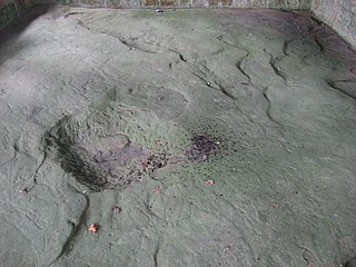
The Leo Petroglyph is a sandstone petroglyph containing 37 images of humans and other animals as well as footprints of each. The petroglyph is located near the small village of Leo, Ohio and is thought to have been created by the Fort Ancient peoples. The area in which the sandstone petroglyph was found is on the edge of an unglaciated Mississippian sandstone cliff 20–65 feet (6.1–19.8 m) high. A 20 by 16 feet slab containing the 37 carvings is protected by a wooden shelter, a Works Progress Administration project. The meanings of the drawings are unknown. On November 10, 1970, it was added to the National Register of Historic Places. The site is maintained by the Ohio History Connection.

Coso Rock Art District is a rock art site containing over 100,000 Petroglyphs by Paleo-Indians and/or Native Americans. The district is located near the towns of China Lake and Ridgecrest, California. Big and Little Petroglyph Canyons were declared a National Historic Landmark in 1964. In 2001, they were incorporated into this larger National Historic Landmark District. There are several other distinct canyons in the Coso Rock Art District besides the Big and Little Petroglyph Canyons. Also known as Little Petroglyph Canyon and Sand Tanks, Renegade Canyon is but one of several major canyons in the Coso Range, each hosting thousands of petroglyphs. The majority of the Coso Range images fall into one of six categories: bighorn sheep, entopic images, anthropomorphic or human-like figures, other animals, weapons & tools, and "medicine bag" images. Scholars have proposed a few potential interpretations of this rock art. The most prevalent of these interpretations is that they could have been used for rituals associated with hunting.

The Barnesville Petroglyph petroglyph site in the eastern part of the U.S. state of Ohio. Located approximately 3 miles (4.8 km) southwest of the village of Barnesville in Belmont County, the petroglyphs have been known both by archaeologists and the general public since the 1850s or earlier. Although the site was significantly damaged during the twentieth century, it is still a significant archaeological site, and has been named a historic site.

Indian God Rock is a large boulder in the northwestern part of the U.S. state of Pennsylvania. Located near the unincorporated community of Brandon, it lies along the Allegheny River in Venango County's Rockland Township. It is significant for the large petroglyph on one of its sides. Because of the petroglyph, the rock has been an explorers' landmark, a tourist attraction, and an object of scholarly investigation.

The Francis Farm Petroglyphs are a group of petroglyphs in the southwestern part of the U.S. state of Pennsylvania. Located on a boulder in Jefferson Township in the northwestern portion of Fayette County, it has been known to archaeologists since at least the middle of the nineteenth century. Despite damage in the 1930s, it remains an important archaeological site, and accordingly, it has been designated a historic site.

The Sugar Grove Petroglyphs are a group of petroglyphs in the southwestern part of the U.S. state of Pennsylvania. Located on an outcrop of sandstone in Monongahela Township near the eastern edge of Greene County, the petroglyphs have been known since at least the 1930s. Due to their value as an archaeological site, the petroglyphs have been named a historic site.

Judaculla Rock is a curvilinear-shaped outcrop of soapstone known for its ancient carvings and petroglyphs. The archaeological site is located on a 0.85-acre rectangular-shaped property, now owned by Jackson County. It is approximately 60 meters east of Caney Fork Creek, a major branch of the northwestward-trending Tuckasegee River in the mountains of Western North Carolina.

The Petroglyph Point is an archaeological site within the Lava Beds National Monument, located southeast of Tulelake, California. Petroglyph Point contains one of the largest panels of Native American rock art in the United States. The petroglyphs are carved along the face of a former island of ancient Tule Lake, in a region historically of the Modoc people territory. The Petroglyph Point Archeological Site was listed on the National Register of Historic Places in 1975, while the Lava Beds National Monument Archeological District was listed in March 1991.

The Picture Rock Pass Petroglyphs Site is in northern Lake County, Oregon, United States. The site is located near the summit of Picture Rock Pass on land administered by the Bureau of Land Management. The designs were scraped into a basalt boulder by ancient Native Americans, probably between 7,500 and 12,000 years ago. No one knows the meaning of the petroglyph designs. Because of its unique archaeological and cultural significance, the Picture Rock Pass Petroglyph Site was listed on the National Register of Historic Places in 1975.

The Bellows Falls Petroglyph Site is an archaeological site containing panels of precontact Native American petroglyphs in Bellows Falls, Vermont. Located near the Vilas Bridge on bedrock west of and above the Connecticut River, adjacent to Great Falls, they depict a rarely-seen assemblage of anthropomorphic figures that is believed to be unique in New England, and uncommon even in surrounding geographic areas. The site was listed on the National Register of Historic Places in 1990.
The Hodgdon Site, designated the Maine Archeological Survey Site 69.4, is a prehistoric rock art site near Embden, Maine. The site is located on a ledge overlooking the Kennebec River, in territory that was under the control of the Norridgewock tribe around the time of European contact, and is several miles downriver from the historic Norridgewock village. The markings are estimated to date to the Late Ceramic Period and include anthropomorphic representations of human figures, as well as an unusual representation of a post-and-beam structure topped by parallel semicircular arcs. This latter figure is thought to represent the house of Father Sébastien Rale, a French Jesuit priest who built a house at Norridgewock in 1722.
The Wyatt Petroglyphs are rock art located in Independence County, Arkansas, in the general vicinity of the city of Desha. The petroglyphs are of a type commonly found in eastern Missouri and southern Illinois, and are believed to date to about 1500 CE. Depictions include a thunderbird, bird tracks, arrows, human figures, and crescents and sun rays, all typical of other known regional petroglyph sites. Their relationship to area Native American archaeological sites is not well understood.
The eastern part of the United States state of Maine is known to have historically significant examples of prehistoric and historic rock art. The easternmost shore, particularly the shores and islands of Machias Bay, contain one of the greatest concentrations of rock art on the east coast of North America, with creation dates estimated to range from c. 1000 BCE to beyond the European contact period. Many of these sites are listed on the United States National Register of Historic Places.

Inscription Rock is a large slab of limestone measuring approximately 32 by 21 feet located on the south shore of Kelleys Island in Lake Erie in Erie County, Ohio. It is situated near the intersections of E Lakeshore Drive and Addison Rd under a large shelter structure with a viewing platform and is open to the public. The rock was listed on the National Register of Historic Places in 1973 and was also located near a series of crescent shaped mounds thought to be created by Pre-Columbian peoples. More mounds were documented to be on the island and another rock with inscriptions was located on the north shore of the island. Unlike Inscription Rock, this boulder was granite - likely a glacial erratic - and engraved with two upside-down figures. However now only Inscription Rock remains since island quarry workers dynamited the petroglyph rock on the north shore.

The Castle Gardens Petroglyph Site is a 6-mile (9.7 km) by 1-mile (1.6 km) region of vertical cliff faces in Fremont County, Wyoming, United States, with extensive petroglyph images incised in the rock faces. The glyphs include images of water turtles and circular shields, as well as human and animal figures. The figures with circular shields are particular to the area, and are known as Castle Gardens Shield style images. A consensus of researchers is that the figures were carved by Athabaskans related to the Navajo and Apache, some time between 1000 AD and 1250 AD. The site is being developed by the Bureau of Land Management, and may be visited.
References
- 1 2 "National Register Information System". National Register of Historic Places . National Park Service. July 9, 2010.
- 1 2 "Native American Petroglyphs and Pictographs of Maine MPS". National Park Service. Retrieved August 2, 2014.
| Topics | |
|---|---|
| Lists by state |
|
| Lists by insular areas | |
| Lists by associated state | |
| Other areas | |
| Related | |