There were several historic mills around the metro Atlanta area, for which many of its current-day roads are still named. Most of the mills date back to the 1820s and 1830s, and were built along the area's many streams. The locations of many of these mills are shown on a map of 1875 showing U. S. military operations around Atlanta in 1864. This map is now located in the U. S. Library of Congress but can be seen on the webpage linked here.

Bridgeton is an unincorporated community in Raccoon Township, Parke County, in the U.S. state of Indiana. It is notable for its covered bridge, which was destroyed on April 28, 2005, by a fire set by an arsonist. A historically accurate reconstruction of the bridge was completed in October, 2006.

Lock and Dam No. 15 is a lock and dam located on the Upper Mississippi River. It spans the river between Rock Island, Illinois and Davenport, Iowa. Lock and Dam 15 is the largest roller dam in the world, its dam is 1,203 feet (366.7 m) long and consists of nine 109 feet (33.2 m) non-submersible, non-overflow roller gates and two 109 feet (33.2 m) non-submersible overflow roller gates. It is unusual among the upper Mississippi River dams in that it has only roller gates, has different sizes and types of roller gates, it is not perpendicular to the flow of the river and is one of the few facilities that has a completed auxiliary lock. The main lock is 110 feet (33.5 m) wide by 600 feet (180 m) long and its auxiliary lock is 110 feet (34 m) wide by 360 feet (110 m) long. In 2004, the facility was listed in the National Register of Historic Places as Lock and Dam No. 15 Historic District, #04000175 covering 3,590 acres (1,450 ha), 2 buildings, 9 structures, and 1 object.

The Graue Mill is a water-powered grist mill that was originally erected in 1852. Now a museum, it is one of two operating water-powered gristmills in Illinois. It is located on Salt Creek in Oak Brook, Illinois, owned and operated by the Forest Preserve District of DuPage County.
Big Sugar Creek is a 47-mile-long (76 km) waterway in the Ozark Mountains of southwest Missouri. The creek starts near the Arkansas state line. Big Sugar starts from three tributaries. One flows north from Garfield, Arkansas, and one, west near Seligman, Missouri, and another, south from Washburn, Missouri. Big Sugar flows west down Sugar Creek Valley, where in the Jacket community it is joined by Otter Creek, from Pea Ridge, Arkansas.

The John H. Addams Homestead, also known as the Jane Addams Birthplace, is located in the Stephenson County village of Cedarville, Illinois, United States. The homestead property, a 5.5-acre (22,000 m2) site, includes an 1840s era Federal style house, a Pennsylvania-style barn, and the remains of John H. Addams' mill complex. The house was built in two portions, in 1846 and 1854 by Addams; he added some minor additions during the 1870s. Other major alterations took place during a 1950s modernization of the home. The homestead has been noted for its significance to industry and politics. On September 6, 1860, future Nobel Peace Prize recipient Jane Addams was born in the house.

The Roslyn Grist Mill is located along Old Northern Boulevard in Roslyn, New York, United States. It was built sometime before the mid-18th century and is one of the few surviving Dutch colonial commercial frame buildings in the U.S. Added to the National Register of Historic Places in 1986, it is currently being restored for use as a museum.
Brandon is an unincorporated community located in Hill County in Central Texas, United States. It is located at the intersection of State Highway 22 and FM 1243, approximately ten miles east of Hillsboro.

Price's Mill, also known as Calliham's (Callaham's) Mill, Stone's Mill, and Park's Mill, is a water-powered gristmill about 2 mi (3 km) east of the town of Parksville on South Carolina Highway 33-138 at Stevens Creek in McCormick County. Its name in the USGS Geographic Names Information System is Prices Mill. It was built in the 1890s and was named to the National Register of Historic Places on November 22, 1972. At this time, it was one of the few remaining water-powered gristmills in South Carolina.

The Newlin Mill Complex, also referred to as The Newlin Grist Mill, is a water-powered gristmill on the west branch of Chester Creek near Concordville, Pennsylvania built in 1704 by Nathaniel and Mary Newlin and operated commercially until 1941. During its three centuries of operation, the mill has been known as the Lower Mill, the Markham Mill, the Seventeen-O-Four Mill and the Concord Flour Mill. In 1958 the mill property was bought by E. Mortimer Newlin, restored and given to the Nicholas Newlin Foundation to use as a historical park. Water power is still used to grind corn meal which is sold on site. The park includes five historical buildings, which were added to the National Register of Historic Places in 1983, and 150 acres (61 ha) of natural woodland.

The New Hope Mills Complex is a historic grist mill complex located on Glen Haven Road near the intersection with Route 41A in the hamlet of New Hope in the town of Niles in Cayuga County, New York. The complex includes the mill building, two vernacular dwellings, a 1910s gambrel roofed storage barn, a 1935 saw mill, two concrete faced dams, and a 1-acre (4,000 m2) mill pond.

The Winthrop Mill is a historic mill building on Mill Street in New London, Connecticut. It is a grist mill located astride Briggs Brook between bridges carrying the eastbound and westbound lanes of Interstate 95. The mill was established in 1650, and the complex retains elements that are believed to be original to its construction. It is now owned by the city and the grounds are open daily; the mill itself is open for tours by special appointment. The property was added to the National Register of Historic Places on November 30, 1982.

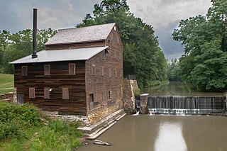
Pine Creek Gristmill is a historic building located in Wildcat Den State Park in Muscatine County, Iowa, United States. The building was listed on the National Register of Historic Places in 1979.

Hagood Mill is an operational water-powered gristmill built in 1845 by James Hagood near Pickens, South Carolina. It was listed in the National Register of Historic Places in 1972.

The McCosh Grist Mill is a historic grist mill near Rock Mills in Randolph County, Alabama. The mill was built in the early 1870s, and is the oldest extant stone grist mill in Alabama. It was built by James Eichelburger McCosh, whose grandfather, Jacob Eichelburger, operated earlier mills that were similar to those in his native Pennsylvania. McCosh also owned 500 acres of farmland nearby, and later added a cotton gin to the site. The mill operated until 1958, and was purchased in 1970 by the United States Army Corps of Engineers as part of the West Point Lake reservoir project.

The Green River Crib Dam is a historic 19th-century dam on the Green River in western Guilford, Vermont. Built about 1811, it is a reminder of the modest industrial enterprises once conducted in the area using the water power it provided, and is one of the state's few surviving crib dams. It was listed on the National Register of Historic Places in 1995.

The Monroe City Mill was a grist mill located in Monroe City, Illinois, an unincorporated community in the historic Bluff Precinct of Monroe County, Illinois, United States. Monroe County was founded in 1816. Prior to that, the area was part of St. Clair County in the Illinois Territory.

The Grist Mill Bridge, Dam and Mill Site consists of three structures located along Upton Road between Island Road and the Maple River, one-half mile west of Elsie, Michigan in Duplain Township. The three structures are:

Hodgson-Aid Mill, also known as Hodgson Water Mill and Aid-Hodgson Mill, is a historic grist mill located on Bryant Creek near Sycamore, Ozark County, Missouri. It was constructed around 1897, and is a 3+1⁄2-story, timber frame mill building covered with red-painted weatherboards. Associated with the mill are the man-made mill pond and the limestone barrel vault constructed at the base of the cliff where Hodgson Spring discharges. The mill has not been in operation since 1976. It is privately owned.


