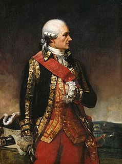
The Washington–Rochambeau Revolutionary Route (W3R) is a 680-mile-long (1,090 km) series of roads used by the Continental Army under the command of George Washington and the Expédition Particulière under the command of Jean-Baptiste de Rochambeau during their 1781 march from Newport, Rhode Island to Yorktown, Virginia. The route is a designated National Historic Trail (2009) with interpretive literature, signs, and exhibits that describe the key role of French diplomatic, military, and economic aid to the United States during the American Revolutionary War.
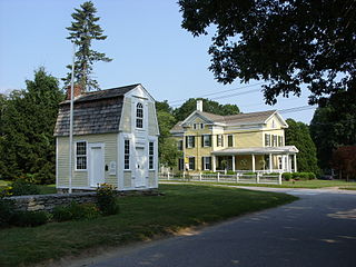
The Sterling Hill Historic District encompasses a well-preserved early 19th-century rural village center on western edge of the town of Sterling, Connecticut. Centered at the junction of Plainfield Pike and Sterling Hill Road, it consists of a cluster of 19th and early 19th-century houses, and a church. Unlike other period villages, it has largely been unaffected by later development. It was listed on the National Register of Historic Places in 1986.

The Newtown Borough Historic District is a 100-acre (40 ha) historic district in the borough of Newtown within the town of Newtown in Fairfield County, Connecticut. There is a local historic district, and an overlapping district that was listed on the National Register of Historic Places in 1996.

The Dorrance Inn, also known as the Samuel Dorrance House, is a historic former inn at 748 Plainfield Pike in Sterling, Connecticut. Built about 1722, it is notable as a place that hosted officers of the French Army in 1781 and 1782, as it was along the march route taken by French commander Rochambeau's troops en route to Yorktown, Virginia. Dorrance's Inn is one of a few places mentioned by name in multiple accounts written by French officers. The building was individually listed on the National Register of Historic Places in 2002. and is a contributing building in the Sterling Hill Historic District.
The Fourth Camp of Rochambeau's Army is a historic military camp site near Plains Road and Lovers Lane on the banks of the Shetucket River in Windham, Connecticut. It was here that the French Army under the command of Rochambeau encamped in the summer of 1781, en route from Providence, Rhode Island to the New York City area. Four divisions passed through, each one night apart, starting with the Bourbonnais on June 21, then the Royal Deux-Ponts, then the Soissonnais, and finally the Saintonge division, on successive nights. One of Rochambeau's aides described Windham at the time as "a charming market town, where, incidentally, there were many pretty women at whose homes we passed the afternoon very agreeably." Of the camp site, he wrote, "A mile away is a beautiful river with a fine wooden bridge. We camped on its banks very comfortably, though hardly militarily."

March Route of Rochambeau's Army: Manship Road-Barstow Road is a historic site in Canterbury, Connecticut that was listed on the National Register of Historic Places in 2003, for its evocation of the march route French commander Rochambeau's troops in 1781 and in 1782.

March Route of Rochambeau's Army: Old Canterbury Road is a historic site in Plainfield, Connecticut along the 1781 and/or 1782 march routes of Rochambeau's army. It includes a stretch of what is now Old Canterbury Road and a stretch of Canterbury Road whose environs evoke the period of the Rochambeau army's march. It is a 2-acre (0.81 ha) site that was listed on the National Register of Historic Places in 2003.
The March Route of Rochambeau's Army: Palmer Road is a linear historic district encompassing a portion of Connecticut Route 14 in eastern Scotland, Connecticut. It was listed on the National Register of Historic Places in 2003 as an evocative surviving element of the march route of the French Army commanded by Rochambeau during the American Revolutionary War in 1781 and 1782.

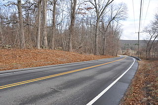
March Route of Rochambeau's Army: Plainfield Pike is a 3.6 mile-long road segment in Plainfield and Sterling, Connecticut which forms a portion of the historic march route of Comte de Rochambeau's army in June 1781 on its way to Yorktown, Virginia, and again of the returning army in November 1782. It was listed on the National Register of Historic Places (NRHP) in 2003.

The War Office, also once known as the Capt. Joseph Trumble Store and Office, is a historic commercial building on the Lebanon Green in Lebanon, Connecticut. Built about 1732 as a commercial building, it is most significant as the place from which Governor Jonathan Trumbull conducted military business during the American Revolutionary War. It is now part of the museum property managed by the Connecticut Society of the Sons of the American Revolution that also includes the Trumbull House and the Wadsworth Stables. The building was listed on the National Register of Historic Places in 1970.

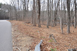
The March Route of Rochambeau's Army: Bailey Road is a section of abandoned, old roadway that is a historic site in Bolton, Connecticut. It was listed on the National Register of Historic Places in 2003. The roadway is one of the most intact sections in Connecticut of the march route taken by French troops under the command of the Count de Rochambeau in 1781.

The Caleb Baldwin Tavern is a historic house at 32 Main Street in the Newtown Borough Historic District, located in Newtown, Connecticut, United States. Built c. 1763, the two-and-a-half-story house was listed on the National Register of Historic Places on August 23, 2002. It is considered historically significant for its role in movement of French forces of Rochambeau, in which the building housed some of the army's officers in June 1781, en route to the Siege of Yorktown. It also an example of traditional 18th-century New England architecture, and retains some details from that time period.

The Daniel Basset House is a historic house a 1024 Monroe Turnpike in Monroe, Connecticut. It is a 2-1/2 story wood frame structure, five bays wide, with two brick chimneys and a side gable roof. Its centered entrance is flanked by sidelight windows and pilasters, and is topped by a transom window. The second floor extends slightly over the first floor on the front (west-facing) facade. Built in 1775, the house is significant for its association with events in the American Revolutionary War. It is along the march route taken by French commander Rochambeau's troops in 1781 en route to Yorktown, Virginia and possibly during their return. A ball was held in the house's second-floor ballroom for the French officers of Lauzun's mounted section of Rochambeau's army on June 30, 1781, which camped nearby.

Camps Nos. 10 and 41 of Rochambeau's Army, also known as Site No. 97-87D, is an archeological site that was listed on the National Register of Historic Places in 2002.

March Route of Rochambeau's Army: Reservoir Road is a historic site in Newtown, Connecticut. It was listed on the National Register of Historic Places in 2003.

The March Route of Rochambeau's Army: Hutchinson Road is a 2-acre (0.81 ha) historic road section in Andover, Connecticut. The section of Hutchinson Road, laid out in the early 18th century and formerly an alignment of United States Route 6, formed part of the 1781-82 march routes of Rochambeau's army which contributed to American victory in the American Revolutionary War. It was listed on the National Register of Historic Places in 2002.

The Fifth Camp of Rochambeau's Infantry, also known as Site 12-25, is a historic site and an archeological site in Bolton, Connecticut, on the march route of Rochambeau's army on its way to the Hudson River and ultimately to Yorktown, Virginia. It was used on four successive nights, the 22nd through the 25th of June, 1781, by the four divisions of Rochambeau's army. In the evenings, the French entertained locals by playing music and dancing with local women, on Bolton Green.

March Route of Rochambeau's Army: Ridgebury Road is a historic site in Ridgefield, Connecticut. It was listed on the National Register of Historic Places in 2003.