Carroll Plantation is a plantation in Penobscot County, Maine, United States. The plantation was named for Daniel Carroll, a signer of the United States Constitution. It is located along Maine State Route 6 near its intersection with State Route 170. The population was 153 at the 2010 census. It is part of the Bangor Metropolitan Statistical Area.

Kingston is a village in Tuscola County in the U.S. state of Michigan. The population was 440 at the 2010 census. The village is located at the southern edge of Kingston Township and is partially within Koylton Township.

Wilder is a city in Jackson County, Minnesota, United States. The population was 60 at the 2010 census.

Saxon is a town in Iron County, Wisconsin, United States. The population was 350 at the 2000 census. The census-designated place of Saxon is located in the town.

Teton Village is a census-designated place (CDP) in Teton County, Wyoming, United States. The population was 330 at the 2010 census. The village surrounds the base of the Jackson Hole Mountain Resort. It is accessed from nearby Jackson, Wyoming and the surrounding area via the Moose-Wilson Road.
Ciriza is a town and municipality located in the province and autonomous community of Navarre, northern Spain.

Zeba is a census-designated place in L'Anse Township of Baraga County in the U.S. state of Michigan. It is located on the southern shore of Keweenaw Bay at 46°48′09″N 88°24′52″W, about halfway between L'Anse and Pequaming. The community was named Zeba because of a small stream that runs southeast of it. The 2010 census recorded a population of 480 inhabitants.
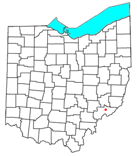
Whipple is an unincorporated community in southern Salem Township, Washington County, Ohio, United States. Although it is unincorporated, it once had a post office, with the ZIP code of 45788. It lies on State Route 821 south of the village of Lower Salem, at the junction of Whipple Run with Duck Creek. The community took its name from nearby Whipple Run.

Malema District is a district of Nampula Province in north-eastern Mozambique. The principal town is Malema.
KCHL is an Urban Gospel radio station based in San Antonio, Texas and broadcast on 1480 AM.
Ulah is an unincorporated community in Randolph County, south of the neighboring county seat of Asheboro, North Carolina.
The Rural Municipality of Shell River was a rural municipality (RM) in the Canadian province of Manitoba. It was incorporated as a rural municipality on December 22, 1883. On January 1, 2015 it was amalgamated as a result a provincial government mandate with the RM of Hillsburg and the Town of Roblin to form the Municipality of Hillsburg – Roblin – Shell River.
Jeziernia is a village in the administrative district of Gmina Tomaszów Lubelski, within Tomaszów Lubelski County, Lublin Voivodeship, in eastern Poland.
The Alder River is a 6.3-mile-long (10.1 km) river in Maine. A tributary of the Androscoggin River, the Alder flows west from Locke Mills to Bethel.
Dixie, Mathews County is an unincorporated community in Mathews County, in the Commonwealth of Virginia.
KRJE is a Christian radio station licensed to Hawkeye, Iowa, broadcasting on 89.9 MHz FM. KRJE is owned by Hawkeye Seventh-Day Adventist Church.
McCoy is an unincorporated community in Decatur County, Indiana, in the United States.

Wawasee Village is an unincorporated community in Turkey Creek Township, Kosciusko County, in the U.S. state of Indiana.
Sweetwater is an unincorporated community in Newton County, in the U.S. state of Missouri.

Hybart is an unincorporated community in Monroe County, in the U.S. state of Alabama. Hybart is located at 31°49′36″N 87°22′56″W. It is located at the intersection of Alabama State Route 41 and Monroe County Road 56, in the northwestern part of Monroe County, just a short distance from its border with Wilcox County, Alabama. Hybart is the host of a locally famous Alabama turkey hunting competition called the Butterball which has appeared in Mobile Bay Magazine. The area is also known for being a good hunting spot for whitetail deer, turkey, quail, dove, and duck. Hybart is on the northwestern edge of the Red Hills region of southwestern Alabama, a hilly, wooded, and still largely undeveloped part of the state, geologically distinct from the Gulf Coastal Plain to its south, and the Black Belt region to its north. Within the Red Hills region, the Forever Wild Land Trust of Alabama owns two large tracts of land a few miles to the southeast of Hybart. Recreational opportunities in these tracts include hunting, woods road hiking/exploration, wildflower viewing, photography, and bird and wildlife watching. The Red Hills tracts are open to visitors year-round.

