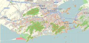
The North Loop is a neighborhood in the Central community of Minneapolis.

Rosebank is a cosmopolitan commercial and residential suburb to the north of central Johannesburg, South Africa. It is located in Region B of the City of Johannesburg Metropolitan Municipality, and is the location of a Gautrain station.

Tijuca is a neighbourhood of the Northern Zone of the city of Rio de Janeiro, Brazil. It comprises the region of Saens Peña and Afonso Pena squares. According to the 2000 Census, the district has close to 150,000 inhabitants. It borders with Praça da Bandeira, Maracanã, Vila Isabel, Andaraí, Grajaú and Alto da Boa Vista neighbourhoods.

Barra da Tijuca is an upper-class neighborhood or bairro in the West Zone of Rio de Janeiro, Brazil, located in the western portion of the city on the Atlantic Ocean. Barra is well known for its beaches, its many lakes and rivers, and its lifestyle. This neighbourhood represents 4.7% of the city population and 13% of the total area of Rio de Janeiro.
The urban-to-ruraltransect is an urban planning model created by the New Urbanist Andrés Duany. The transect defines a series of zones that transition from sparse rural farmhouses to the dense urban core. Each zone is fractal in that it contains a similar transition from the edge to the center of the neighborhood. The transect is an important part of the New Urbanism and smart growth movements. Duany's firm DPZ has embodied the transect philosophy into their SmartCode generic planning code for municipal ordinances.

Mixed use is a type of urban development, urban design, urban planning and/or a zoning classification that blends multiple uses, such as residential, commercial, cultural, institutional, or entertainment, into one space, where those functions are to some degree physically and functionally integrated, and that provides pedestrian connections. Mixed-use development may be applied to a single building, a block or neighborhood, or in zoning policy across an entire city or other administrative unit. These projects may be completed by a private developer, (quasi-)governmental agency, or a combination thereof. A mixed-use development may be a new construction, reuse of an existing building or brownfield site, or a combination.
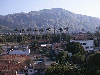
Bangu is a neighborhood in the West Zone of Rio de Janeiro, Brazil. It is a middle-class neighborhood. It is located in the western area of the city being one of the most populated districts, with 244,518 inhabitants [1] distributed in an area of 4570.69 ha. Located in the geographic center of the city, the neighborhood is close to Campo Grande, Senador Camará, Vila Aliança, Padre Miguel and Realengo. On November 22, 2004, the mayor of Rio de Janeiro César Maia created by decree the district Gericinó. The neighborhood was originally part of the neighborhood of Bangu, the region where the penitentiary of Bangu is located, besides Bangu dump. The region is where Gericinó was located containing the sub-district of the Aqueduct. Since 2004, the complex of Bangu and dump of Bangu, no longer belong to the neighborhood of Bangu.

Centar is a neighborhood of the city of Niš, Serbia. It is the part of the Niš municipality of Medijana.

Parkwood is a neighborhood located in the Far Northeast section of Philadelphia, Pennsylvania, United States. The neighborhood's boundaries include the Byberry East Industrial Park to the north and northwest, Poquessing Creek to the east, Knights Road to the southeast and Woodhaven Road to the southwest. The neighborhood was developed by Hyman Korman in the 1960-1962 as a planned residential community. The predominant housing type is the brick row house. The Parkwood Shopping Center is a local shopping destination, while the Philadelphia Mills mall is a regional shopping destination on Knights Road to the east of Parkwood's residential area.

Suba is the 11th locality of Bogotá, capital of Colombia. It is located in the northwest of the city, bordering to the north the municipality of Chía in Cundinamarca, to the west the municipality of Cota, to the east the locality Usaquén and to the south the localities Engativá and Barrios Unidos. This district is inhabited by residents of all social classes.
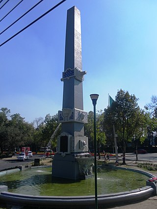
Polanco is a neighborhood in the Miguel Hidalgo borough of Mexico City. Polanco is an affluent colonia, noted for its luxury shopping along Presidente Masaryk Avenue, the most expensive street in Mexico, as well as for the numerous prominent cultural institutions located within the neighborhood.
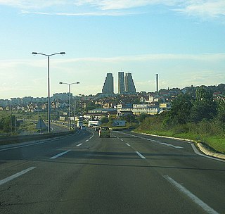
Konjarnik is an urban neighborhood of Belgrade, the capital of Serbia. It is divided between Belgrade's municipalities of Voždovac and Zvezdara. As a large neighborhood, it has several sub-neighborhoods of its own, including Denkova Bašta, Učiteljsko Naselje and Rudo.

Méier is a middle class and upper middle class neighborhood in the North Zone of Rio de Janeiro, Brazil. The neighborhood is the historic center of the "Área dos Engenhos", or "Mill Area", which today is known as Grande Méier and has been a sub-prefecture since 2013. As a result, it has a wide range of shops and a variety of services and transport, although it is not one of the largest neighborhoods of the municipality. In the neighborhood is located one of the first shopping centers in Brazil, Shopping do Méier, opened in 1963. It has two distinct urban appearances, one more bustling, commercial, in the areas close to the train station, and a quieter one, on more residential streets.
Guadalupe is a neighborhood located in the North Zone of Rio de Janeiro, Brazil. It is surrounded by Barros Filho, Honório Gurgel, Marechal Hermes, Deodoro, Ricardo de Albuquerque, Costa Barros and Anchieta. Its designation is a homage to Our Lady of Guadalupe which main church in Rio de Janeiro is located in this neighbourhood. The neighbourhood was built as a project of former Casa Popular Foundation and it was inaugurated by president Getúlio Vargas. Are also notable in the neighbourhood the "Igloos of Guadalupe", a set of houses in hemisphere shape, looking like igloos, and built in the late 1940s on Calama street.

The Central Zone is an administrative zone of the city of São Paulo, Brazil.
Pedra de Guaratiba is a neighborhood in the West Zone of Rio de Janeiro, Brazil.

Jaraguá is a district located in the northwest zone of the Brazilian city of São Paulo, which became a district in 1948, in areas divided from Perus, Pirituba and the former sub-district of "Nossa Senhora do Ó". Jaraguá borders the municipalities of Osasco to the west, and Caieiras to the north. Also with the districts of Perus, Anhanguera, Brasilândia, São Domingos and Pirituba.
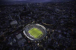
Ciudad de los Deportes is a neighborhood in Benito Juárez, Mexico City.

San Pedro de los Pinos is a neighborhood located in center-west of Mexico City. Before being urbanized during the first half of the 20th century, the colonia was part of a vast farming area belonging to several ranches and haciendas.

Colonia Verónica Anzures is a colonia of Mexico City located in the Miguel Hidalgo borough. The neighborhood is a residential area but it also houses some office buildings, most importantly the Torre Ejecutiva Pemex.

