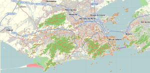
Rio de Janeiro, or simply Rio, is the capital of the state of the same name, Brazil's third most populous state, and the second most populous city in Brazil, after São Paulo. Listed by the GaWC as a beta global city, Rio de Janeiro is the sixth most populous city in the Americas. Part of the city has been designated as a World Heritage Site, named "Rio de Janeiro: Carioca Landscapes between the Mountain and the Sea", on 1 July 2012 as a Cultural Landscape.

Niterói is a municipality of the state of Rio de Janeiro in the southeast region of Brazil. It lies across Guanabara Bay facing the city of Rio de Janeiro and forms part of the Rio de Janeiro Metropolitan Area. It was the state capital, as marked by its golden mural crown, from 1834 to 1894 and again from 1903 to 1975. It has an estimated population of 515,317 inhabitants (2020) and an area of 129.375 km2 (49.952 sq mi), making it the fifth most populous city in the state. It has the highest Human Development Index of the state and the seventh highest among Brazil's municipalities in 2010. Individually, it is the second municipality with the highest average monthly household income per capita in Brazil and appears in 13th place among the municipalities of the country according to social indicators related to education. The city has the nicknames of Nikiti, Nicki City and the Smile City (Cidade Sorriso).

The Catete Palace is an urban mansion in Rio de Janeiro's Flamengo neighborhood. The property stretches from Rua do Catete to Praia do Flamengo. Construction began in 1858 and ended in 1867. From 1897 to 1960, it was Brazil's presidential palace and the site of Getúlio Vargas' suicide. It now houses the Museu da República and a theatre. The Catete underground rail station is adjacent.
Bangu Atlético Clube, commonly known as Bangu, is a Brazilian professional association football club based in Rio de Janeiro, in the western neighbourhood of Bangu. The team plays in Série D, the fourth tier of the Brazilian football league system, as well as in the Campeonato Carioca, the top tier of the Rio de Janeiro state football league.

Governador Island is the largest island in Guanabara Bay, in Rio de Janeiro, Brazil. It has a population of about 211,018 inhabitants, in a small area of 42 km2 (16 sq mi).

Laranjeiras is an upper-middle-class neighborhood located in the South Zone of Rio de Janeiro, Brazil. Primarily residential, It is one of the city's oldest neighborhoods, having been founded in the 17th century, with the construction of country houses in the valley located around the Carioca River, which bordered Corcovado Mountain. Because of this, the neighborhood was previously called Vale do Carioca, or Carioca Valley.

Zózimo Alves Calazaes, best known as Zózimo was a Brazilian footballer whose career as a defender and midfielder lasted from 1948 to 1967.
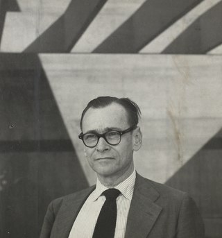
Affonso Eduardo Reidy was a Brazilian architect. He was the son of an English father and a Brazilian mother. Reidy entered the Escola Nacional de Belas Artes in Rio de Janeiro at age 17. He apprenticed with the French urban planner Alfred Agache (1875-1959) during his studies. Reidy graduated and became an architect in 1930. Lúcio Costa appointed him as a teaching assistant to the architect Gregori Warchavchik (1896-1972) at the Escola Nacional de Belas Artes in the same year.

Flamengo Park, also known as Aterro do Flamengo, Eduardo Gomes Park, and Aterro do Brigadeiro Eduardo Gomes, is the largest public park and recreation area within the city of Rio de Janeiro, in eastern Brazil, and the largest urban park by the sea in the world.
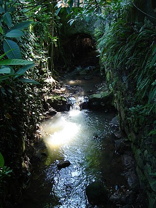
The Carioca River is a river in the state of Rio de Janeiro state in southeastern Brazil. It emerges from two springs on the southeast slopes of the Tijuca Massif in the protected Mata Atlantica forest of Tijuca National Park. The river then leaves Tijuca Forest into the Guararapes favela, then into the high-income Cosme Velho neighborhood, and then it is buried completely underground. The river reemerges in Flamengo Park to empty into Guanabara Bay at Flamengo Beach.

The South Zone is an area of the city of Rio de Janeiro situated between the Tijuca Massif, the Atlantic Ocean and Guanabara Bay. Most of it is made up of neighborhoods along the Atlantic coastline, such as São Conrado, Vidigal, Leblon, Ipanema, Copacabana, and Leme.

Grumari is a neighborhood in the West Zone of Rio de Janeiro, Brazil. Grumari is a municipal park and is the city's only neighborhood with no residents. Grumari has beaches that have not changed in hundreds of years. Salt marsh vegetation grows next to the beach and a rain forest surrounds its hills.
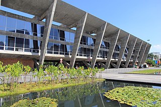
The Museum of Modern Art in Rio de Janeiro (MAM) is a museum located in northeastern Flamengo Park, in the city of Rio de Janeiro, Brazil. It is in the Centro district, west of Santos Dumont Airport, on Guanabara Bay.

The Monument to the Dead of World War II, also the Monument to the Brazilian Soldiers of World War II, commemorates Brazil's participation and losses in the Second World War (WWII).

Muriqui is a district of the municipality of Mangaratiba, located within the Greater Rio de Janeiro, Brazil. It is part of the Green Coast. Highway BR-101 passes through the district.
Zózimo Bulbul was a Brazilian actor, filmmaker, and activist. Bulbul was a prominent proponent of Afro-Brazilian culture within Brazilian cinema and society at-large. Bulbul co-founded and organized the Encontro de Cinema Negro Brasil, África & Américas, which showcases films featuring African and Afro-Brazilian actors, directors, and themes.
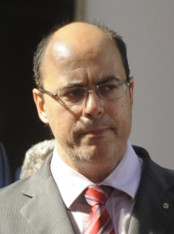
The Rio de Janeiro gubernatorial election of October 2018 was for the election of the Governor and Vice Governor of Rio de Janeiro and 70 State Deputies. People also voted for 2 of 3 Senators of the state representation in the Federal legislative power, with 45 federal deputies representatives of the Rio de Janeiro State. A second round was held after no candidate managed to secure more than 50% of the Governor votes.
Football is the most popular sport, both in terms of participants and spectators, in Rio de Janeiro. Rio de Janeiro has several of Brazil's significant football clubs, and the city is home to many football clubs.

Rio de Janeiro is on the far western part of a strip of Brazil's Atlantic coast, close to the Tropic of Capricorn, where the shoreline is oriented east–west. Facing largely south, the city was founded on an inlet of this stretch of the coast, Guanabara Bay, and its entrance is marked by a point of land called Sugar Loaf – a "calling card" of the city.
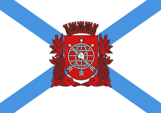
The following outline is provided as an overview of and topical guide to Rio de Janeiro:


