
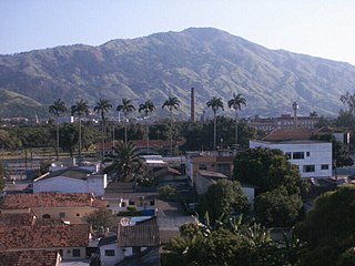
Niterói is a municipality in the state of Rio de Janeiro, in the southeast region of Brazil. It lies across Guanabara Bay, facing the city of Rio de Janeiro and forming part of the Rio de Janeiro Metropolitan Area. It was the capital of Rio de Janeiro, as marked by its golden mural crown, from 1834 to 1894 and again from 1903 to 1975. It has an estimated population of 515,317 inhabitants (2020) and an area of 129.375 km2 (49.952 sq mi), making it the fifth most populous city in the state. It has the highest Human Development Index in the state and the seventh highest among Brazil's municipalities in 2010. Individually, it is the second municipality with the highest average monthly household income per capita in Brazil and appears in 13th place among the municipalities of the country according to social indicators related to education. The city has the nicknames of Cidade Sorriso.

The Pontifical Catholic University of Rio de Janeiro is a Jesuit, Catholic, pontifical university in Rio de Janeiro, Brazil. It is the joint responsibility of the Catholic Archdiocese of São Sebastião do Rio de Janeiro and the Society of Jesus.
Bangu is a neighborhood in the West Zone of Rio de Janeiro, Brazil. It is a middle-class neighborhood. It is located in the western area of the city being one of the most populated districts, with 244,518 inhabitants [1] distributed in an area of 4570.69 ha. Located in the geographic center of the city, the neighborhood is close to Campo Grande, Senador Camará, Vila Aliança, Padre Miguel and Realengo. On November 22, 2004, the mayor of Rio de Janeiro César Maia created by decree the district Gericinó. The neighborhood was originally part of the neighborhood of Bangu, the region where the penitentiary of Bangu is located, besides Bangu dump. The region is where Gericinó was located containing the sub-district of the Aqueduct. Since 2004, the complex of Bangu and dump of Bangu, no longer belong to the neighborhood of Bangu.

The Federal Center for Technological Education "Celso Suckow da Fonseca", also known as Federal Center for Technological Education of Rio de Janeiro, is one of the most traditional Brazilian federal educational institution subordinated to the Brazilian Ministry of Education.
Vila Vintém is an urban low income living community located between the neighbourhoods of Realengo and Padre Miguel, in the West Zone of the city of Rio de Janeiro. Situated on the borders of the railroad, it shelters the headquarters of Mocidade Independente de Padre Miguel and also Unidos de Padre Miguel, as well as many of their components. Its principal road is called Rua Belisário de Souza, that goes from the ensemble of IAPI, in Padre Miguel, until Realengo.

The Santa Teresa Tram, or Tramway, is a historic tram line in Rio de Janeiro, Brazil. It connects the city's centre with the primarily residential, inner-city neighbourhood of Santa Teresa, in the hills immediately southwest of downtown. It is mainly maintained as a tourist attraction and is nowadays considered a heritage tramway system, having been designated a national historic monument in 1985. The line has a very unusual gauge: 1,100 mm. The main line is 6.0 kilometres long.

The South Zone is an area of the city of Rio de Janeiro situated between the Tijuca Massif, the Atlantic Ocean and Guanabara Bay. Most of it is made up of neighborhoods along the Atlantic coastline, such as São Conrado, Vidigal, Leblon, Ipanema, Copacabana, and Leme.

Ilha das Cobras is an island located within Guanabara Bay in the city and state of Rio de Janeiro, Brazil. It is east of the neighborhood Guanabara. It is home to the Arsenal de Marinha do Rio de Janeiro base of the Brazilian Navy.

Castelo is a region in Rio de Janeiro, Brazil, but not officially recognized as a neighborhood, and officially forms part of the Centro neighborhood. It is generally considered to be located in the region between Avenida Rio Branco, the Santos Dumont Airport and Praça Quinze de Novembro. The area derives its name from the former Morro do Castelo in that location, which was demolished by water jets in the 1920s. As most of the buildings in the area were designed and built in the first half of the twentieth century, after the demolition of Morro do Castelo in 1921, the region became home to a large collection of Art Deco buildings. Art Deco was the prevalent architectural style in Rio de Janeiro at that time.
Aldeia Campista was a neighborhood in Rio de Janeiro, Brazil, close to contemporary Vila Isabel, Tijuca, Maracanã and Andaraí.
Rio das Pedras is a region of Rio de Janeiro, but not officially recognized as a neighborhood. The favela sits in Rio de Janeiro’s West Zone by the neighborhood of Itanhangá. Rio das Pedras’ borders are defined by the Tijuca National Park, the Tijuca Lagoon, and private land designated for the expansion of Barra da Tijuca.

The Legislative Assembly of Rio de Janeiro is the unicameral legislature of the state of Rio de Janeiro in Brazil. It has 70 state deputies elected by proportional representation.
Bairro Araújo is a region of Rio de Janeiro, but not officially recognized as a neighborhood.localizado em Vista Alegre
Bairro Peixoto is a region in Rio de Janeiro, Brazil, but it is not officially recognized as a neighborhood. Officially, it forms part of the neighborhood of Copacabana, but has distinct characteristics.
Fazenda da Bica is a region of Rio de Janeiro, but not officially recognized as a neighborhood.
Horto is a community of 621 families in the South Zone of Rio de Janeiro. It is not officially recognized as a neighborhood. It is located in Jardim Botânico, near Gávea, and Lagoa. The property is worth an estimated $3.29 billion.
Rio Grande is a region of Rio de Janeiro, but not officially recognized as a neighborhood.
Terreirão do Rio Bonito is a region of Rio de Janeiro, but not officially recognized as a neighborhood.
Vila Aliança is a region of Rio de Janeiro, but not officially recognized as a neighborhood.

The Rio de Janeiro 2016Olympic Village, also called the Athletes' Village or Olympic and Paralympic Village, is an accommodation center built to house all participating athletes, as well as officials and athletic trainers of the 2016 Summer Olympics. It is located in Barra da Tijuca, close to City of Sports Complex.