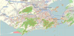
São Mateus is a civil parish along the southwestern coast of the municipality of Madalena on the island Portuguese island of Pico, in the archipelago of the Azores. The population in 2011 was 772, in an area of 17.37 km².

Pedro Miguel is a freguesia in the northeastern part of the municipality of Horta on the island of Faial in the Azores. Pedro Miguel is located 6 km north of the city of Horta on the main regional road that encircles the island. The population in 2011 was 759, in an area of 14.48 km².

Água de Alto is a civil parish in the municipality of Vila Franca do Campo on the island of São Miguel in the Portuguese archipelago of the Azores. The population in 2011 was 1,788, in an area of 18.41 km².

Ponta Garça is a civil parish in the municipality of Vila Franca do Campo in the Portuguese archipelago of the Azores. The population in 2011 was 3,547, in an area of 29.35 km2. It is the largest parish in Vila Franca do Campo.
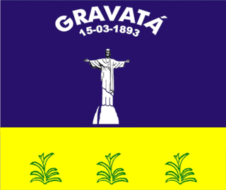
Gravatá is a city in the state of Pernambuco, Brazil, located about 75 km (47 mi) from the state's capital Recife. The population of Gravatá in 2020 was 84,699 inhabitants, according with IBGE.

Campo Grande is the largest neighborhood in the West Zone of Rio de Janeiro. Campo Grande has a population of 328,370 inhabitants and an area of 119,1253 sq km, on both counts Rio's largest. It is situated 50 kilometers away from Downtown Rio.

Santa Cecília is a district in the city of São Paulo, Brazil.

Guaratiba Biological and Archeological Reserve is a State biological reserve located in the western zone of Rio de Janeiro city, in the State of Rio de Janeiro, Brazil. It protects an important area of mangroves and wetlands in the east of Guaratiba Bay.
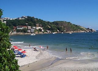
Barra de Guaratiba is a neighborhood in the Western Zone of Rio de Janeiro, Brazil.
Line 3 (Red) (Portuguese: Linha 3–Vermelha) is one of the six lines that make up the São Paulo Metro and one of the thirteen lines that make up the Metropolitan Rail Transportation Network. It runs between Palmeiras-Barra Funda and Corinthians-Itaquera. It was formerly called the East-West Line. Line 3 is the busiest in the system.
Pedra de Guaratiba is a neighborhood in the West Zone of Rio de Janeiro, Brazil.
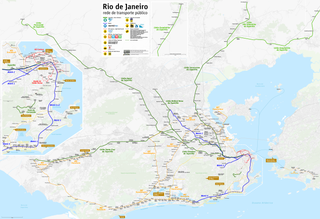
Transoeste is a bus rapid transit (BRT) line stretching from Barra da Tijuca to Santa Cruz, with a branch to Campo Grande. TransOeste was the first line to open in the Rio de Janeiro BRT system. The corridor was a transformation of the Avenida das Américas to expand the carriageways for exclusive use of high capacity buses, the BRT, with transfer stations in the median, and also included the construction of the Grota Funda Tunnel. The Transoeste corridor was inaugurated on June 6, 2012.
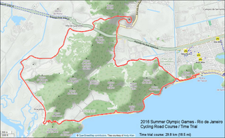
The women's individual time trial was one of eighteen cycling events of the 2016 Olympic Games. The event started and finished on 10 August at Pontal, a small peninsula and beach area in the Recreio dos Bandeirantes neighborhood, located in the West Zone of Rio de Janeiro, Brazil. The race start and finish were part of the Barra venues cluster and one of seven temporary venues of the 2016 Summer Olympics.

The men's individual time trial was one of 18 cycling events of the 2016 Summer Olympics. The event started and finished on 10 August at Pontal, a small peninsula and beach area in the Recreio dos Bandeirantes neighborhood, located in the West Zone of Rio de Janeiro, Brazil. The race start and finish were part of the Barra venues cluster and one of seven temporary venues of the 2016 Summer Olympics.

Pontal is a small peninsula and beach area in the Recreio dos Bandeirantes neighborhood, located in the West Zone of Rio de Janeiro, Brazil and was a temporary venue in the Barra Olympic venues cluster for the Athletics and Cycling competitions of the 2016 Summer Olympics.
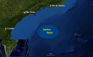
The Guaratiba Group is a geological group of the Santos Basin offshore of the Brazilian states of Rio de Janeiro, São Paulo, Paraná and Santa Catarina. The group forms the pre-salt layer in the petroleum-rich basin and hosts the biggest oil fields of Brazil, as Tupi, Júpiter and many more. The group contains, depending on the definition, three to four formations and dates to the Early Cretaceous period; Hauterivian to Early Aptian epochs. The total thickness of the group, representing the first phase of sedimentation after the break-up of Gondwana in the Santos Basin, is estimated at 4,200 metres (13,800 ft).

Sítio do Picapau Amarelo is a Brazilian children's television series, which aired on Rede Globo from 1977 to 1986. It was produced in partnership with TVE and the Brazilian Ministry of Education, It was the fourth television adaptation of the homonymous work by Monteiro Lobato, after the first version shown by Rede Tupi between 1952 and 1963, the second version shown by TV Cultura in 1964 and 1965 and the third version shown by Band between 1967 and 1969.

Palmeiras-Barra Funda, also known only as Barra Funda, is a train station on CPTM Line 7-Ruby and ViaMobilidade Line 8-Diamond, in the district of Barra Funda in São Paulo.


