Campo Grande, Rio de Janeiro

Last updated
Campo Grande
Neighborhood
Rio De Janeiro location map.svg
Red pog.svg
Campo Grande
Location in Rio de Janeiro
Brazil location map.svg
Red pog.svg
Campo Grande
Campo Grande (Brazil)
Coordinates: 22°52′57″S43°33′45″W / 22.88250°S 43.56250°W / -22.88250; -43.56250
Country Flag of Brazil.svg  Brazil
State Rio de Janeiro (RJ)
Municipality/City Rio de Janeiro
Zone West Zone
A building in Cesario de Melo avenue, Campo Grande's commercial center Wiki1.JPG
A building in Cesário de Melo avenue, Campo Grande's commercial center

Campo Grande is the largest neighborhood in the West Zone of Rio de Janeiro. Campo Grande has a population of 328,370 inhabitants and an area of 119,1253 sq km (46 sq mi), on both counts Rio's largest. It is situated 50 kilometers (31 miles) away from Downtown Rio.

Contents

History

Church of Our Lady of the Exile (Igreja de Na. Sra. do Desterro), built in 1673 Desterro.jpg
Church of Our Lady of the Exile (Igreja de Na. Sra. do Desterro), built in 1673

Campo Grande, which in the early 1940s was considered the "Empire of the Orange", grew along with the settlement of Brazil. The valley, which begins in the Rio da Prata and ends in Cabuçu, was inhabited by Picinguabas and granted by the Portuguese Crown to Barcelos Domingos. In 1673, Domingos built the chapel of Our Lady of the Exile, which later became the parish church of Campo Grande. Near the church was a well also called Our Lady of the Exile, which provided water to the local population.

The region began to grow in 1878 with the inauguration of the Campo Grande railway station, connected to the Estrada de Ferro Central do Brasil (Brazilian Central Railway). It became easier to reach the center of the city quickly, and the region began to develop at a rapid pace.

On October 16, 1895, Campo Grande began tram service. On that day, the Municipal Council gave a concession to a private company, the Companhia de Carros Urbanos (Urban Streetcar Company), to install a line using animal power. The goal was to provide transportation to the railway.

In 1915, the company proposed to the Prefecture of the Federal District the substitution of animal power with 48 km of electrified lines, whose trams would leave from the center of Campo Grande for Pedra de Guaratiba, Ilha, and Rio da Prata. The line remained in service until October 30, 1967, when trams were removed from Campo Grande.

Campo Grande went from being an essentially rural area to an urban one. Next to Realengo, Jacarepaguá, and Santa Cruz, until 1939 Campo Grande was one of the largest producers of oranges, exporting up to 144,577 tons each year.

Development

West Shopping Rio mall in Campo Grande, adorned with Christmas decorations. West-shoppig-rio.jpg
West Shopping Rio mall in Campo Grande, adorned with Christmas decorations.

The city fabric of Campo Grande is regular and discontinuous, the habitation of the area consisting in isolated lots of large areas. Owing to the large network of services and a growing level of commerce, Campo Grande grew at an extraordinary pace.

High levels of homeownership are found in Campo Grande. Three-bedroom houses are most common, with an area of 120 square meters. In 1962 and 1979, CEHAB built the Conjunto Santa Margarida on the Estrada do Campinho.

In terms of education, Campo Grande has one of the largest concentrations of students in the Rio de Janeiro (state). The rate of school attendance is satisfactory, as is the rate of enrollment, which has increased yearly.

The Miécimo da Silva Sports Complex, in which sports training is provided to the population in Campo Grande, hosts major international events such as the 2007 Pan American Games.

City of Campo Grande

On June 14, 1968, the locality was officially designated a city (Portuguese : cidade) under Law #1627, advanced by the deputy Frederico Trotta, though it remained part of the city and municipality of Rio de Janeiro.

Industry and commerce

Commerce in the neighborhood is self-sufficient, attracting business from other regions. Campo Grande has two shopping malls, West Shopping and the ParkShopping Campo Grande, which is planning to be the biggest in South America. The industrial sector is also growing. Campo Grande has an Industrial District on km. 43 of the Avenida Brasil, reaching the Estrada do Pedregoso.

In 1946, Bartolomeu Rabelo founded an aviary that was the birthplace of carioca bird farming, which today has attained a high level of development.

Some of the companies found in Campo Grande include AmBev, Refrigerantes Convenção, Guaracamp, Cogumelo (metallurgy), Fredvic (heating), Novartis (pharmaceuticals), Sacipan (café Câmara), Michelin, EBSE (electrical fuses), Superpesa (metallurgy), Dancor (munitions) and Ranbaxy (pharmaceuticals).

In Rio da Prata, Mendanha, and Guaratiba, one can still find agriculture and livestock. Among the most common crops are bananas, oranges, mangoes, pears, cassava root, and chayotes. In terms of birds and livestock, one can find goat antelopes, pigs, cow, and rabbit. Campo Grande remains one of the most industrialized suburbs of Rio de Janeiro. Campo grande is a great place to conduct business because population is increasing over the years.

Sub-neighborhoods of Campo Grande

Related Research Articles

<span class="mw-page-title-main">Rio de Janeiro</span> Second-most populous city in Brazil

Rio de Janeiro, or simply Rio, is the capital of the state of the same name, and the second most populous city in Brazil, after São Paulo. Listed by the GaWC as a beta global city, Rio de Janeiro is the sixth most populous city in the Americas. Part of the city has been designated as a World Heritage Site, named "Rio de Janeiro: Carioca Landscapes between the Mountain and the Sea", on 1 July 2012 as a Cultural Landscape.

<span class="mw-page-title-main">Resende, Rio de Janeiro</span> Municipality in Southeast, Brazil

Resende is a municipality in the Brazilian state of Rio de Janeiro. The population is 132,312 in an area of 1094 km2. Resendense refers to people or things that come from or inhabit Resende. It is the oldest town in this region, which has boundaries with the state of São Paulo and Minas Gerais. It is an important industrial, automotive, metallurgical, and tourist center, and headquarters of the world's second-largest military complex, the Academia Militar das Agulhas Negras (AMAN). Resende is of national importance and houses the Nuclear Fuel Factory complex of the "Indústrias Nucleares" of Brasil, the only one able to enrich uranium. Resende's automotive area holds MAN Latin America, the biggest truck and bus factory of Brazil, limited to PSA Peugeot Citroën and Michelin.

<span class="mw-page-title-main">Vila Franca do Campo</span> Municipality in Azores, Portugal

Vila Franca do Campo is a town and municipality in the southern part of the island of São Miguel in the Portuguese Autonomous Region of the Azores. The population of the municipality was 11,229 in 2011, in an area of 77.97 km². The town proper, which incorporates the urbanized parishes São Miguel and São Pedro, has 4100 inhabitants.

<span class="mw-page-title-main">Rio de Janeiro Metro</span> Rapid transit network serving Rio de Janeiro, Brazil

The Rio de Janeiro Metro, commonly referred to as just the Metrô is a rapid transit network that serves the city of Rio de Janeiro, Brazil. The Metrô was inaugurated on 5 March 1979, and consisted of five stations operating on a single line. The system currently covers a total of 58 kilometres (36 mi), serving 41 stations, divided into three lines: Line 1 ; Line 2, which together travel over a shared stretch of line that covers 10 stations of an approximate distance of 5 kilometres (3.1 mi); and Line 4. Metrô Rio has the second highest passenger volume of the metro systems in Brazil, after the São Paulo Metro.

<span class="mw-page-title-main">Jacarepaguá</span> Neighborhood in Rio de Janeiro, Rio de Janeiro, Brazil

Jacarepaguá, with a land area of 29.27 square miles (75.8 km2), is a neighborhood situated in the West Zone of Rio de Janeiro, Brazil. In 2010, it had a population of 157,326. The name comes from the indigenous name of the location, "shallow pond of caymans", yakaré + upá (pond) + guá (shallow), by the time of the Portuguese colonization.

<span class="mw-page-title-main">Mantiqueira Mountains</span> Mountain range in Brazil

The Mantiqueira Mountains are a mountain range in Southeastern Brazil, with parts in the states of São Paulo, Minas Gerais and Rio de Janeiro. It rises abruptly from the northwestern bank of the Paraíba do Sul River and extends northeastward for approximately 320 km (200 mi), reaching a height of 2,798 m (9,180 ft) at Pedra da Mina. The mountains, which eventually merge with the Serra do Espinhaço, were originally forest-covered, except for the peaks that rise above the tree line. They provide charcoal and pasture for cattle; on the lower slopes there are several health and tourist resorts, such as Campos do Jordão, Brazil's highest city. The name Mantiqueira derives from a Tupi word meaning "mountains that cry", denoting the large number of springs and streams found there.

<span class="mw-page-title-main">Chapada dos Veadeiros National Park</span> UNESCO World Heritage Site in Goiás, Brazil

Chapada dos Veadeiros National Park is a national park of Brazil located in the state of Goiás, on the top of an ancient plateau with an estimated age of 1.8 billion years. The park was created on January 11, 1961, by President Juscelino Kubitschek, and listed as a World Heritage Site by Unesco in 2001. It occupies an area of 2,405 square kilometres (929 sq mi) in the municipalities of Alto Paraíso de Goiás, Cavalcante and Colinas do Sul. The park is maintained by Chico Mendes Institute for Biodiversity Conservation.

<span class="mw-page-title-main">Bangu, Rio de Janeiro</span> Neighborhood in Rio de Janeiro, Rio de Janeiro, Brazil

Bangu is a neighborhood in the West Zone of Rio de Janeiro, Brazil. It is a middle-class neighborhood. It is located in the western area of the city being one of the most populated districts, with 244,518 inhabitants [1] distributed in an area of 4570.69 ha. Located in the geographic center of the city, the neighborhood is close to Campo Grande, Senador Camará, Vila Aliança, Padre Miguel and Realengo. On November 22, 2004, the mayor of Rio de Janeiro César Maia created by decree the district Gericinó. The neighborhood was originally part of the neighborhood of Bangu, the region where the penitentiary of Bangu is located, besides Bangu dump. The region is where Gericinó was located containing the sub-district of the Aqueduct. Since 2004, the complex of Bangu and dump of Bangu, no longer belong to the neighborhood of Bangu.

<span class="mw-page-title-main">Santana (district of São Paulo)</span> District of São Paulo, Brazil

Santana is a northern district in the subprefecture of Santana-Tucuruvi of the city of São Paulo, Brazil, and is located between 4–7 km (2.5–4.3 mi) from downtown São Paulo.

<span class="mw-page-title-main">Realengo</span> Neighborhood in Rio de Janeiro, Rio de Janeiro, Brazil

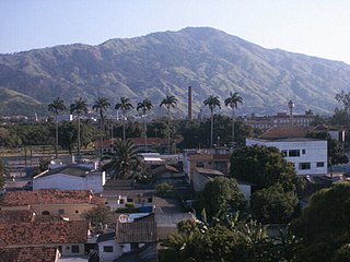
Realengo is a neighborhood in the West Zone of Rio de Janeiro, Brazil. The lower and middle-class neighborhood is between the Mendanha and Pedra Branca mountains. It is located between the mountains of Pedra Branca and Mendanha in the northern of the called West Zone of the city, owned and named the XXXIII Administrative Region which encompasses the entire east around the neighborhood. Realengo usually has the highest temperatures in the city, even though the winter nights are often cold because of the proximity to the mountains. Created on November 20, 1815, every year on this day the city's birthday is celebrated with the Week of Realengo. Pedro I of Brazil and Pedro II of Brazil used to go to the farm of Santa Cruz by the Estrada Real de Santa Cruz, passing by Realengo, where they often stayed.

Santíssimo is a neighborhood in the West Zone of Rio de Janeiro, Brazil, near Campo Grande. Most residents are in the low-income group.

<span class="mw-page-title-main">Transport in São Paulo</span> Overview of transport in São Paulo

Transport in São Paulo plays a key role in the daily lives of the people of São Paulo and offers various methods of public transport that are offered in the city, including a complex bus system run by SPTrans, and various subway and railway lines. A contactless smartcard is used to pay fares for the buses, subway, and railway systems. São Paulo also has three airports.

<span class="mw-page-title-main">Santa Cruz, Rio de Janeiro</span> Neighborhood in Rio de Janeiro, Rio de Janeiro, Brazil

Santa Cruz is an extensive and populous neighborhood of the high class, lower middle and low in the West Zone of the municipality of Rio de Janeiro, Brazil, the farthest from the center of Rio de Janeiro. Cut by the Santa Cruz extension of the urban passenger rail network of the metropolitan region of Rio de Janeiro, it has a very diverse landscape, with commercial areas, residential and industrial.

<span class="mw-page-title-main">Santa Teresa Tram</span> Tramway in Rio de Janeiro

The Santa Teresa Tram, or Tramway, is a historic tram line in Rio de Janeiro, Brazil. It connects the city's centre with the primarily residential, inner-city neighbourhood of Santa Teresa, in the hills immediately southwest of downtown. It is mainly maintained as a tourist attraction and is nowadays considered a heritage tramway system, having been designated a national historic monument in 1985. The line has a very unusual gauge: 1,100 mm. The main line is 6.0 kilometres long.

<span class="mw-page-title-main">Pedra Branca State Park</span>

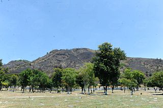
The Pedra Branca State Park is a state park in the state of Rio de Janeiro, Brazil. It is one of the largest urban nature parks in the world. It protects an area of Atlantic Forest in the west of the city of Rio de Janeiro that includes the highest point in the city, the Pico da Pedra Branca.

<span class="mw-page-title-main">Geography of Rio de Janeiro</span> Environment, climate and subdivisions of Rio de Janeiro

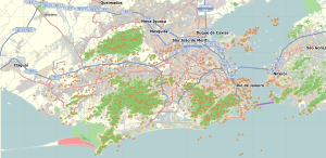
Rio de Janeiro is on the far western part of a strip of Brazil's Atlantic coast, close to the Tropic of Capricorn, where the shoreline is oriented east–west. Facing largely south, the city was founded on an inlet of this stretch of the coast, Guanabara Bay, and its entrance is marked by a point of land called Sugar Loaf – a "calling card" of the city.