Anón River is a river in the municipality of Ponce, Puerto Rico. It is located in the northeastern area of the municipality. Río Anón is one of the 14 rivers in the municipality and, at 1,060 feet (320 m), it is also the third with the highest river mouth location, after Río Prieto and Río Blanco, both of which have their mouths at 1,381 feet (421 m). Río Anón is a tributary of Río Inabón. It has a length of approximately 4 kilometers (2.5 mi) and generally runs south. It has both its origin and its mouth in Barrio Anón.
Río Blanco is a river in the municipality of Ponce, Puerto Rico. It is located in the northeastern area of the municipality. It empties into the Río Prieto. Together with the Río Prieto, the Río Blanco is one of the two rivers in Ponce with their mouth at the highest elevation. This river is one of the 14 rivers in the municipality.

Cañas River, also known as Río Cañas, is a river in the municipality of Ponce, Puerto Rico. It is also known as Río Magueyes in the area where it flows through Barrio Magueyes, also in the municipality of Ponce. This river is one of the 14 rivers in the municipality.

Chiquito River is a river in the municipality of Ponce, Puerto Rico. This river feeds into Río Portugués in the sector called Parras, about 0.5 km (0.3 mi) north of the intersection of PR-504 and PR-505. It has its origin in the mountains west of Montes Llanos. Río Chiquito is fed by Quebrada del Pastillo. This river is one of the 14 rivers in the municipality of Ponce.
Río Matilde is a short river in the municipality of Ponce, Puerto Rico. It forms from the confluence of Rio Pastillo and Rio Canas. Río Matilde is one of the 14 rivers in the municipality and, forming at an altitude of just 15 feet (4.6 m), it forms at an altitude lower than any other river in the municipality.

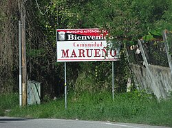
Río Pastillo is a river in the municipality of Ponce, Puerto Rico. It is also known as Río Marueño in the area of the municipality where it runs through barrio Marueño. Together with Cañas River, Pastillo forms Matilde River. Pastillo is one of the 14 rivers in the municipality. The river originates at an altitude of 435 feet. Its tributaries are Quebrada Limon and Quebrada del Agua brooks and the river runs for 19 kilometers before feeding into Río Matilde at a height of 15 feet in Barrio Canas Urbano.

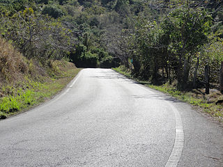
Anón is one of the 31 barrios in the municipality of Ponce, Puerto Rico. Along with Marueño, Coto Laurel, Guaraguao, Quebrada Limon, Real, and San Patricio, and the coastal barrios of Canas and Capitanejo, Anón is one of the municipality's nine bordering barrios. Anón borders the municipalities of Jayuya and Juana Diaz. The name of this barrio is of native Indian origin. It was founded in 1878. Barrio Anón is one of three Ponce barrios located on the Cordillera Central mountain range.

Tibes is one of the 31 barrios in the municipality of Ponce, Puerto Rico. Together with Magueyes, Portugués, Montes Llanos, Maragüez, Machuelo Arriba, Sabanetas, and Cerrillos, barrio Tibes is one of the municipality's eight rural interior barrios. Tibes attracted attention recently when, in 1975, what was to become the discovery of the oldest cemetery in the West Indies came about as a result of rainstorms. The name of this barrio is of native Indian origin. It was organized in 1831.

Canas is one of the 31 barrios in the municipality of Ponce, Puerto Rico. Along with Anón, Coto Laurel, Guaraguao, Quebrada Limón, Real, San Patricio, and Marueño, and the coastal barrio of Capitanejo, Canas is one of the municipality's nine bordering barrios. It borders the municipality of Peñuelas. Along with Playa, Bucana, Vayas and Capitanejo, Canas is also one of Ponce's five coastal barrios. It was founded in 1831.

Magueyes is one of the 31 barrios of the municipality of Ponce, Puerto Rico. Together with Cerrillos, Machuelo Arriba, Maragüez, Montes Llanos, Portugués, Sabanetas, and Tibes, Magueyes is one of the municipality's eight interior barrios. The name of this barrio is of native Indian origin. It was created in 1831.

Coto Laurel is one of the 31 barrios of the municipality of Ponce, Puerto Rico. Along with Anón, Marueño, Guaraguao, Quebrada Limon, Real, and San Patricio, and the coastal barrios of Canas and Capitanejo, Coto Laurel is one of the municipality's nine bordering barrios. It borders the municipality of Juana Diaz. It was founded in 1831.
Guaraguao is one of the 31 barrios in the municipality of Ponce, Puerto Rico. Along with Anón, Coto Laurel, Marueño, Quebrada Limón, Real, and San Patricio, and the coastal barrios of Canas and Capitanejo, Guaraguao is one of the municipality's nine bordering barrios. It borders the municipalities of Adjuntas and Peñuelas. The name of this barrio is of native Taino Indian origin. It was created in 1878. Barrio Guaraguao is one of three Ponce barrios located on the Cordillera Central mountain range.
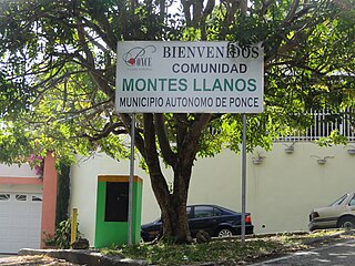
Montes Llanos, is one of the 31 barrios in the municipality of Ponce, Puerto Rico. Along with Magueyes, Tibes, Portugués, Maragüez, Machuelo Arriba, and Cerrillos, Montes Llanos is one of the municipality's seven rural interior barrios. It was created in 1898.

Capitanejo is one of the 31 barrios of the municipality of Ponce, Puerto Rico. Along with Anón, Coto Laurel, Guaraguao, Quebrada Limón, Real, San Patricio, and Marueño, and the coastal barrio of Canas, Capitanejo is one of the municipality's nine bordering barrios. It borders the municipality of Juana Diaz. Along with Playa, Bucana, Vayas and Canas, Capitanejo is also one of Ponce's five coastal barrios. Together with Vayas, Capitanejo is also one of two rural coastal barrios in the municipality. It was founded in 1822.
Quebrada Limón is one of the 31 barrios of the municipality of Ponce, Puerto Rico. Along with Anón, Coto Laurel, Guaraguao, Marueño, Real, and San Patricio, and the coastal barrios of Canas and Capitanejo, Quebrada Limón is one of the municipality's nine bordering barrios. It borders the municipality of Peñuelas. It was founded in 1878.

Cerrillos is one of the 31 barrios of the municipality of Ponce, Puerto Rico. Along with Magueyes, Tibes, Portugués, Montes Llanos, Maragüez, and Machuelo Arriba, Cerrillos is one of the municipality's seven interior rural barrios. It was founded in 1878.

Real is one of the 31 barrios of the municipality of Ponce, Puerto Rico. Along with Anón, Coto Laurel, Guaraguao, Quebrada Limón, Marueño, and San Patricio, and the coastal barrios of Canas and Capitanejo, Real is one of the municipality's nine bordering barrios. It borders the municipality of Juana Diaz. It was founded in 1878.

Machuelo Abajo is one of the 31 barrios of the municipality of Ponce, Puerto Rico. Along with Canas Urbano, Magueyes Urbano, Portugués Urbano, and San Antón, Machuelo Abajo is one of the municipality's five originally rural barrios that are now also part of the urban zone of the city of Ponce. It was founded in 1818.

Machuelo Arriba is one of the 31 barrios of the municipality of Ponce, Puerto Rico. Along with the barrios of Magueyes, Tibes, Portugués, Montes Llanos, Maragüez, and Cerrillos, Machuelo Arriba is one of the municipality's seven rural interior barrios. It was established in 1831.

San Patricio is one of the 31 barrios of the municipality of Ponce, Puerto Rico. It is one of the municipality's nine bordering barrios, along with Anón, Coto Laurel, Guaraguao, Quebrada Limón, Real, and Marueño, and the coastal barrios of Canas and Capitanejo. Its northern edge borders the municipalities of Utuado and Jayuya. It was founded in 1878. Barrio San Patricio is one of three Ponce barrios located on the Cordillera Central mountain range.