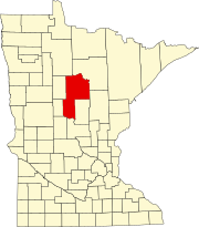
Kelsey is an unincorporated community in Kelsey Township, Saint Louis County, Minnesota, United States.

Nickerson is an unincorporated community in Nickerson Township, Pine County, Minnesota, United States.

Philbrook is an unincorporated community in Todd County, Minnesota, United States. It is along Todd County Road 28 near Red Pine Road. Nearby places include Staples, Motley, Cushing, and Browerville.

Pontoria is an unincorporated community in Ponto Lake Township, Cass County, Minnesota, United States, near Backus.

Beroun is an unincorporated community in Mission Creek Township, Pine County, Minnesota, United States.

Groningen is an unincorporated community in Dell Grove Township, Pine County, Minnesota, United States.

Friesland is an unincorporated community in Dell Grove Township, Pine County, Minnesota, United States.

Giese is an unincorporated community in Wagner Township, Aitkin County, Minnesota, United States, located near Finlayson.

Berne is an unincorporated community in Milton Township, Dodge County, Minnesota, United States. The community is located near the junction of State Highway 57 and Dodge County Road 24. The Middle Fork of the Zumbro River flows nearby.

Cloverton is an unincorporated community in New Dosey Township, Pine County, Minnesota, United States.

Whipholt is an unincorporated community and census-designated place (CDP) in Pine Lake Township, Cass County, Minnesota, United States, along Leech Lake. Its population was 99 as of the 2010 census. The community is located along State Highway 200 near Pine Lake Road. Whipholt is 13 miles east of Walker.

Genoa is an unincorporated community in Olmsted County, Minnesota, United States. The community is located along 75th Street NW near Exchange Avenue. Genoa is located within New Haven Township and Kalmar Township. Nearby places include Oronoco, Pine Island, and Byron. The South Branch Middle Fork of the Zumbro River flows nearby.

Lindford is an unincorporated community in Koochiching County, Minnesota, United States.

Markville is an unincorporated community in Arna Township, Pine County, Minnesota, United States, located along the Saint Croix River.

Kingsdale is an unincorporated community in New Dosey Township, Pine County, Minnesota, United States.

Ellson is an unincorporated community in Bremen Township, Pine County, Minnesota, United States.

Oshawa is an unincorporated community in Cass County, Minnesota, United States, near Backus. The community is located near the junction of Cass County Road 41 and State Highway 87. Oshawa is located within Bull Moose Township and Deerfield Township. The Badoura State Forest and the Foot Hills State Forest are both nearby.

Schley is an unincorporated community in Cass County, Minnesota, United States, within the Bowstring State Forest and the Chippewa National Forest. It is between Cass Lake and Bena along U.S. Highway 2 near Forest Road 2958.
Banning is a ghost town in Pine County, in the U.S. state of Minnesota.

Graff is an unincorporated community in Moose Lake Township, Cass County, Minnesota, United States, near Pine River and Pequot Lakes. It is along Cass County Road 24, 64th Street SW, near 51st Avenue SW.


