
Malappuram, is one of the 14 districts in the Indian state of Kerala, with a coastline of 70 km (43 mi). It is the most populous district of Kerala, which is home to around 13% of the total population of the state. The district was formed on 16 June 1969, spanning an area of about 3,554 km2 (1,372 sq mi). It is the third-largest district of Kerala by area, as well as the largest district in the state, bounded by Western Ghats and Arabian Sea to either side. The district is divided into seven Taluks: Eranad, Kondotty, Nilambur, Perinthalmanna, Ponnani, Tirur, and Tirurangadi.

Palakkad is one of the 14 districts in the Indian state of Kerala. It was carved out from the southeastern region of the former Malabar District on 1 January 1957. It is located at the central region of Kerala and is the second largest district in the state after Idukki. The city of Palakkad is the district headquarters. Palakkad is bordered on the northwest by the Malappuram district, on the southwest by the Thrissur district, on the northeast by Nilgiris district, and on the east by Coimbatore district of Tamil Nadu. The district is nicknamed "The granary of Kerala". Palakkad is the gateway to Kerala due to the presence of the Palakkad Gap, in the Western Ghats. The 2,383 m high Anginda peak, which is situated in the border of Palakkad district, Nilgiris district, and Malappuram district, in Silent Valley National Park, is the highest point of elevation in Palakkad district. Palakkad city is about 347 kilometres (216 mi) northeast of the state capital, Thiruvananthapuram.
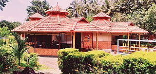
Nilambur is a major town, a municipality and a Taluk in the Malappuram district of the Indian state of Kerala. It is located close to the Nilgiris range of the Western Ghats on the banks of the Chaliyar River. This place is also known as 'Teak Town' because of the abundance of Nilambur teaks in this area; Which is a variety of a large, deciduous tree that occurs in mixed hardwood forests. Unlike many Municipalities of India; Nilambur is covered with large amounts of vegetation making it close to nature and hence make it very scenic and inspiring.
Erumamunda is a small village located near Nilambur in Malappuram district of Kerala, India. It is situated in chungathara grama panchayath. Erumamunda includes 1st and 20th ward of Chungathara panchayath. currently the ward members are Mr. Libin Baby and Ms. Sainaba teacher respectively for 1st and 20th ward. It is situated river side of Chaliyar River and western ghats. 70% of the local people are directly or indirectly working with rubber products and rest of them are working abroad, Govt job and doing other professions. The main source of income of the people is from rubber or latex related industries. There is a Higher Secondary School called Nirmala Higher Secondary School. The school has contributed immensely for the educational development of erumamunda and near by villages. Erumamunda is one of the highly developed village in chungathara panchayath and Nilambur municipality.

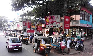
Malappuram is a city and the headquarters of the Malappuram district in Kerala, India. It is the largest urban agglomeration in Kerala and the 20th largest in India and a city in the Indian state of Kerala, spread over an area of 158.20 km2 (61.08 sq mi) including the surrounding suburban areas. The first municipality in the district formed in 1970, Malappuram serves as the administrative headquarters of Malappuram district. Divided into 40 electoral wards, the city has a population density of 4,800 per square kilometre. According to the 2011 census, the Malappuram metropolitan area is the fourth largest urban agglomeration in Kerala after Kochi, Calicut, and Thrissur urban areas and the 20th largest in India with a total population of 3 million. It is the fastest growing city in the world with a 44.1% urban growth between 2015 and 2020 as per the survey conducted by Economist Intelligence Unit (EIU) based on the urban area growth during January 2020. Malappuram is situated 54 km southeast of Calicut and 90 km northwest of Palakkad. It is the first Indian municipal body to provide free Wi-Fi connectivity to its entire residents. Malappuram is also the first Indian municipal body to achieve the International Organization for Standardization certificate. It is also the first complaint-free municipality in the state.
Kondotty is a developing town, municipality, and aerotropolis in the Malappuram district state of Kerala, India which is located near Calicut International Airport, 24 km from Malappuram. It is the headquarters of Kondotty Taluk, which was declared as the seventh taluk in Malappuram district by chief minister Oommen Chandy on 23 December 2013.

Idimuzhikkal or Chelembra is a town in Malappuram district, Kerala, India. Chelembra is the Panchayath and Idimuzhikal is the capital of this Panchayath. Chelembra grama panchayat in the district.
Kizhuparamba or Keezhuparamba is a village and Panchayath on the northern boundary of Malappuram District In Kerala State of India.

Nediyiruppu was the capital of the Zamorin's kingdom in colonial Kerala. At the time, it was known as Nediyiruppu Swaroopam. It is a region of the Kondotty municipality in Malappuram district, Kerala, India. It is situated 24 kilometres (15 mi) from Malappuram, the district headquarters.
Vilayil is a small village in Kerala, India, near the cities of Kondotty, Kizhisseri and Areekode. The village is under the jurisdiction of the Muthuvallur and Cheekode Grama panchayats.
Eranad also known as Ernad refers to the erstwhile province in the midland area of Malabar, consisting of Malappuram and nearby regions such as Anakkayam, Manjeri, Kondotty, Nilambur, etc. Currently Eranad Taluk is a Taluk in Malappuram district. Eranad was ruled by a Samanthan Nair clan known as Eradis, similar to the Vellodis of neighbouring Valluvanad and Nedungadis of Nedunganad. The rulers of Eranad were known by the title Eralppad/Eradi. They also used the title Thirumulpad.

Tirur Taluk comes under Tirur revenue division in Malappuram district of Kerala, India. Its headquarters is the town of Tirur. Tirur Taluk contains four municipalities - Tanur, Tirur, Kottakkal, and Valanchery. Most of the administrative offices are located in the Mini-Civil Stations at Tirur, Kuttippuram, and Tanur. Most of the villages in present-day Tirur Taluk were parts of the medieval Kingdom of Tanur (Vettathunadu). The port of Tanur was an important port town in the southwestern coast of India during medieval period.
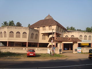
Perinthalmanna is a major city and municipality in Malappuram district, Kerala, India. It serves as the headquarters of the Perinthalmanna Taluk, and a block and a Revenue Division by the same name. It was formerly the headquarters of Valluvanad Taluk, which was one of the two Taluks in the Malappuram Revenue Division of the erstwhile Malabar District during the British Raj. The town is located 23 kilometres (14 mi) southwest to the city of Malappuram at the centre of the Kozhikode–Malappuram–Perinthalmanna–Palakkad National Highway 966.
Poongode is a small village in Kalikavu Panchayat, Nilambur taluk in Malappuram district in the state of Kerala. Nethaji arts&sport club is one of the oldest football teams. The peoples are unique with co-operation. The majority are Muslims and Hindus. G.L.P school poongode is situated 300 meters from town with a football stadium.
Adakkakundu is a village in Kalikavu Panchayat, Nilambur taluk in Malappuram district in the state of Kerala in southwest India.

Valluvambram Junction is a small town in Malappuram District, in India.
Mongam is a town in Morayur Gram panchayat in Malappuram in Malappuram district of state of Kerala. Mongam AIWA College is the first women's Arabic college in south India.

Arimbra Hills or Mini Ooty is a tourist spot between Malappuram and Kondotty in Malappuram district, Kerala, India. It is at a height of 445 meters (1,460 ft) above sea level. The place attracts a large number of visitors for its rolling hills and scenic views. The location got the nickname "Mini Ooty" because it resembles Ooty, one of the famous hill stations in India. There are many stone crushers and plantations atop the hill. There is an old Scheduled Caste colony on the western side of the hill.
Valenchery is a small town in Morayur Gram panchayat in Malappuram in Malappuram district of state of Kerala. Valenchery is divided into four Areas, they are Village Road, Colony Road, Madrasa Road and Hilltop Area.Four Wards from Morayur Panchayath partly belongs to Valenchery. Nearest places are Valluvambram Junction, Mongam, Morayur, Arimbra and Pookkottur. Nearest tourist spot is Mini Ooty.

South Malabar refers to a geographical area of the southwestern coast of India covering some parts of the present-day Kerala. South Malabar covers the regions included in present-day Kozhikode taluk of Kozhikode district, the whole area of Malappuram district, Chavakkad taluk of Thrissur district, and Palakkad district, excluding parts of Chittur taluk. The Fort Kochi region of Kochi city also historically belongs to South Malabar. The term South Malabar refers to the region of the erstwhile Malabar District south to the river Korapuzha, and bears a high cultural similarity to both the Cochin and the North Malabar region.

