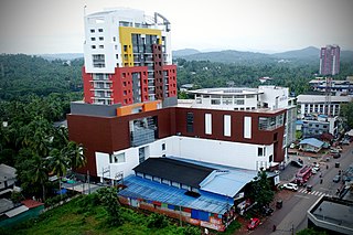
Malappuram, is one of the 14 districts in the Indian state of Kerala, with a coastline of 70 km (43 mi). The most populous district of Kerala, Malappuram is home to around 13% of the total population of the state. The district was formed on 16 June 1969, spanning an area of about 3,554 km2 (1,372 sq mi). It is the third-largest district of Kerala by area. It is bounded by Western Ghats and the Arabian Sea on either side. The district is divided into seven Taluks: Eranad, Kondotty, Nilambur, Perinthalmanna, Ponnani, Tirur, and Tirurangadi.
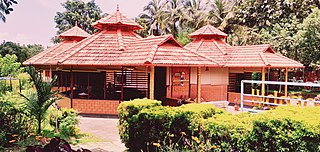
Nilambur is a major town, a municipality and a Taluk in the Malappuram district of the Indian state of Kerala. It is located close to the Nilgiris range of the Western Ghats on the banks of the Chaliyar River. This place is also known as 'Teak Town' because of the abundance of Nilambur teaks, which is a variety of a large, deciduous tree that occurs in mixed hardwood forests. Unlike many Municipalities of India; Nilambur is covered with large amounts of vegetation, making it very scenic.
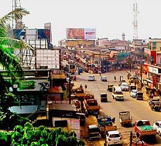
Athavanad is a village and Gram Panchayath in the Tirur Taluk, in the Malappuram District of the state of Kerala, India. The town lies on the National Highway 66, between Puthanathani and Valanchery. Puthanathani is the main town of the Athavanad village and the village office is located in Athavanad Para & Kurumbathoor. Nearby towns include Valanchery, Tavanur, Tirunavaya, Kuttippuram, Irimbiliyam, and Edayur.
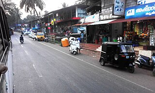
Morayur or Morayoor is a tiny town near Malappuram Located on Palakkad-Kozhikoad Highway. It is one of the villages in Malappuram district of state of Kerala.

Nediyiruppu was the capital of the Zamorin's kingdom in colonial Kerala. At the time, it was known as Nediyiruppu Swaroopam. It is a region of the Kondotty municipality in Malappuram district, Kerala, India. It is situated 24 kilometres (15 mi) from Malappuram, the district headquarters.

Perinthalmanna Taluk, formerly known as Walluvanad Taluk, comes under Perinthalmanna revenue division in Malappuram district of Kerala, India. Its headquarters is the town of Perinthalmanna.The taluk encompasses 24 revenue villages. Perinthalmanna Taluk contains Perinthalmanna Municipality and 15 Gram panchayats. Most of the administrative offices are located in the Mini-Civil Station at Perinthalmanna.

Eranad also known as Ernad refers to the erstwhile province in the midland area of Malabar, consisting of Malappuram and nearby regions such as Anakkayam, Manjeri, Kondotty, Nilambur, etc. Currently Eranad Taluk is a Taluk in Malappuram district. Eranad was ruled by a Samanthan Nair clan known as Eradis, similar to the Vellodis of neighbouring Valluvanad and Nedungadis of Nedunganad. The rulers of Eranad were known by the title Eralppad/Eradi. They also used the title Thirumulpad.

PonnaniTaluk is an administrative division in the Malappuram district of Kerala, India. It falls under the Tirur revenue division, with its headquarters in the town of Ponnani. Ponnani Taluk includes Ponnani Municipality and nine gram panchayats. Most administrative offices are located in the Mini-Civil Station in Ponnani.
Mariyad is a location in Manjeri Municipality in Malappuram district of Kerala State of south India.

Perinthalmanna is a major town and municipality in Malappuram district, Kerala, India. It serves as the administrative centre for the Perinthalmanna taluk, as well as a revenue division, a community development block, and a police sub-division bearing the same name. It was formerly the headquarters of Valluvanad Taluk, which was one of the two Taluks in the Malappuram Revenue Division of the erstwhile Malabar District during the British Raj. The city is located 23 kilometres (14 mi) southwest of the city of Malappuram at the centre of the Kozhikode–Malappuram–Perinthalmanna–Palakkad National Highway 966.

Kondotty Taluk, otherwise called Western Eranad in Malappuram district of Kerala, India. Its headquarters is the town of Kondotty. Kondotty Taluk contains Kondotty municipality and a few Gram panchayats.
Cholakkulam is a village in Malappuram district of Kerala. It is situated in Melattur. The name Cholakkulam came from the Malayalam words 'Chola' (Stream), 'Kulam' (Pond); i.e., 'Place where is pond with stream'. The village is well connected to Perinthalmanna (17 km), Mannarkkad (24 km), Manjeri (23 km) and Karuvarakundu (11 km). The shortest route connecting Kozhikode with Palakkad passes through this village.

Valluvambram Junction is a small town in Malappuram District, Kerala, India.

Malappuram district is an education hub of the state of Kerala, India with four universities, two medical colleges, two law colleges and several engineering and arts colleges. The city has several educational institutions from the school level to higher education. Kendriya Vidyalaya, Jawahar Navodaya Vidyalaya, Malabar Special Police HSS, Government Girls Higher secondary school, Govt. Boys, St.Gemmas HSS, Islahiya HSS, A.U.P School, Sree Arunodaya Vidya Nigethan etc. to name a few schools. The city is lacking an Engineering College under Government despite having the largest number of students appearing and excelling in respective entrance exams. Govt. College, Malappuram, which is the oldest college in the city, started in 1972, College of Applied Science Malappuram and Govt. College for Women started this year along with many other private colleges serves the higher educational purpose. Govt.TTI and MCT TTI are few teachers training institutes. The Regional Directorate of Higher Secondary Education and Regional Office (Malabar) of State Open School are located in the city inside the Civil Station.
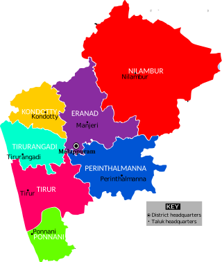
The Malappuram district has four types of administrative hierarchies:
Malappuram is one of the 14 districts in the South Indian state of Kerala. The district has a unique and eventful history starting from pre-historic times. During the early medieval period, the district was the home to two of the four major kingdoms that ruled Kerala. Perumpadappu was the original hometown of the Kingdom of Cochin, which is also known as Perumbadappu Swaroopam, and Nediyiruppu was the original hometown of the Zamorin of Calicut, which is also known as Nediyiruppu Swaroopam. Besides, the original headquarters of the Palakkad Rajas were also at Athavanad in the district.

Arimbra Hills or Mini Ooty is a tourist spot between Malappuram and Kondotty in Malappuram district, Kerala, India. It is at a height of 445 meters (1,460 ft) above sea level. The place attracts a large number of visitors for its rolling hills and scenic views. The location got the nickname "Mini Ooty" because it resembles Ooty, one of the famous hill stations in India. There are many stone crushers and plantations atop the hill. There is an old Scheduled Caste colony on the western side of the hill.

Eranad Taluk comes under Perinthalmanna revenue division in Malappuram district of Kerala, India. Its headquarters is the city of Manjeri. Eranad Taluk contains two municipalities - Manjeri and Malappuram. Most of the administrative offices are located in the Civil Station at Malappuram and the Mini-Civil Station at Manjeri.

South Malabar refers to a geographical area of the southwestern coast of India covering some parts of the present-day Kerala state. South Malabar covers the regions included in present-day Kozhikode taluk of Kozhikode district, Wayanad district excluding Mananthavady taluk, the whole area of Malappuram district, Chavakkad taluk of Thrissur district, and Palakkad district, excluding parts of Chittur taluk. The Fort Kochi region of Kochi city also historically belongs to South Malabar. The term South Malabar refers to the region of the erstwhile Malabar District south to the river Korapuzha, and bears a high cultural similarity to both the Cochin and the North Malabar regions.


