Morristown (hamlet), New York

Last updated

Morristown, New York
Hamlet and CDP [1]
Morristown NY.JPG
USA New York location map.svg
Red pog.svg
Morristown, New York
Location within the state of New York
Coordinates: 44°35′8″N75°38′53″W / 44.58556°N 75.64806°W / 44.58556; -75.64806
CountryUnited States
State New York
County St. Lawrence
Area
[2]
  Total1.02 sq mi (2.65 km2)
  Land0.98 sq mi (2.54 km2)
  Water0.04 sq mi (0.10 km2)
Elevation
289 ft (88 m)
Population
 (2010)
  Total395
  Estimate 
(2019) [3]
377
  Density383.91/sq mi (148.22/km2)
Time zone UTC-5 (EST)
  Summer (DST) UTC-4 (EDT)
FIPS code 36-48571
GNIS feature ID0976680

Morristown is a hamlet and former village along the Saint Lawrence River in St. Lawrence County, New York, United States. The population was 395 at the 2010 census. The village is named after Gouverneur Morris.

Contents

The hamlet is on the northern edge of the Town of Morristown and was north of Gouverneur.

Jacques Cartier State Park is southwest of the village.

The former village has their own school, Morristown Central School.

History

The first settlers of the town began the community around 1804, but the village was not permanently settled until 1808.

During the opening days of the War of 1812, a naval battle took place between two warships in the river opposite the village.

Due to the lack of water power, early milling was accomplished by a windmill (1825) and later by a steam-powered mill.

The Land Office, Jacob Ford House, McConnell's Windmill, Samuel Stocking House, Paschal Miller House, Morristown Schoolhouse, United Methodist Church, and Wright's Stone Store are listed on the National Register of Historic Places. [4]

On June 27, 2018, village residents voted to dissolve the village with a yes vote of 130–47. It took effect on December 31, 2019. [5] [6]

Notable people

Morristown is named after Gouverneur Morris, a signer of the Constitution and Declaration of Independence. He was a land baron and owned a tract of land from Gouverneur, NY to the St. Lawrence River, including the village of Morristown.

Geography

According to the United States Census Bureau, the village had a total area of 1.0 square mile (2.6 km2), of which 1.0 square miles (2.5 km2) is land and 0.1 square mile (0.1 km2) (4.90%) is water.

The village was north of the junction of New York State Route 12, New York State Route 37, and New York State Route 58.

The village was on the south bank of the Saint Lawrence River, opposite the City of Brockville in Canada.

Demographics

Historical population
CensusPop.Note
1880 397
1890 47218.9%
1900 466−1.3%
1910 54015.9%
1920 489−9.4%
1930 5053.3%
1940 5406.9%
1950 5461.1%
1960 541−0.9%
1970 532−1.7%
1980 461−13.3%
1990 4906.3%
2000 456−6.9%
2010 395−13.4%
2020 3980.8%
U.S. Decennial Census [11]

As of the census [12] of 2000, there were 456 people, 180 households, and 117 families residing in the village. The population density was 466.4 inhabitants per square mile (180.1/km2). There were 232 housing units at an average density of 237.3 per square mile (91.6/km2). The racial makeup of the village was 96.93% White, 1.32% Black or African American, 0.88% Native American, 0.44% Asian, 0.22% from other races, and 0.22% from two or more races. Hispanic or Latino of any race were 1.54% of the population.

There were 180 households, out of which 31.7% had children under the age of 18 living with them, 48.3% were married couples living together, 12.8% had a female householder with no husband present, and 35.0% were non-families. 30.6% of all households were made up of individuals, and 12.8% had someone living alone who was 65 years of age or older. The average household size was 2.47 and the average family size was 3.01.

In the village, the population was spread out, with 27.9% under the age of 18, 5.7% from 18 to 24, 27.0% from 25 to 44, 25.9% from 45 to 64, and 13.6% who were 65 years of age or older. The median age was 37 years. For every 100 females, there were 92.4 males. For every 100 females age 18 and over, there were 88.0 males.

The median income for a household in the village was $27,969, and the median income for a family was $30,938. Males had a median income of $26,563 versus $20,000 for females. The per capita income for the village was $14,156. About 12.1% of families and 18.9% of the population were below the poverty line, including 26.7% of those under age 18 and 3.5% of those age 65 or over.

See also

Related Research Articles

<span class="mw-page-title-main">Windsor County, Vermont</span> County in Vermont, United States

Windsor County is a county located in the U.S. state of Vermont. As of the 2020 census, the population was 57,753. The shire town is the town of Woodstock. The county's largest municipality is the town of Hartford.

<span class="mw-page-title-main">St. Lawrence County, New York</span> County in New York, United States

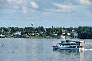
St. Lawrence County is a county in the U.S. state of New York. As of the 2020 census, the population was 108,505. The county seat is Canton. The county is named for the Saint Lawrence River. This was as named by early French explorer Jacques Cartier for the Christian saint Lawrence of Rome, as he visited the river on the saint's feast day. The county is part of the North Country region of the state.

<span class="mw-page-title-main">Golden, Illinois</span> Village in Illinois, United States

Golden is a village in Adams County, Illinois, United States. The population was 648 at the 2010 census. It is part of the Quincy, IL–MO Micropolitan Statistical Area.

<span class="mw-page-title-main">Stratford, New Hampshire</span> Town in New Hampshire, United States

Stratford is a town located on the Connecticut River in Coös County, New Hampshire, United States. The population was 662 at the 2020 census, a decline from the figure of 746 tabulated in 2010. Within the town are the villages of North Stratford, Stratford Hollow, and Beatties. U.S. Route 3 passes through the center of town, as does the St. Lawrence and Atlantic Railroad, formerly a part of the Grand Trunk Railway.

<span class="mw-page-title-main">Macomb, New York</span> Town in New York, United States

Macomb is a town in St. Lawrence County, New York, United States. The population was 906 at the 2010 census. The town is named after Alexander Macomb, who once owned much of northern New York as Macomb's Purchase.

<span class="mw-page-title-main">Manchester Center, Vermont</span> Census-designated place in Vermont, United States

Manchester Center is a census-designated place (CDP) in the town of Manchester in Bennington County, Vermont, United States. As of the 2010 census, the CDP had a population of 2,120, out of 4,391 people in the entire town of Manchester.

<span class="mw-page-title-main">Stamford, Vermont</span> Town in Vermont, United States

Stamford is a town in Bennington County, Vermont, United States. The population was 861 at the 2020 census.

<span class="mw-page-title-main">Lemington, Vermont</span> Town in Vermont, United States

Lemington is a town in Essex County, Vermont, United States. The population was 87 as of the 2020 census. It is part of the Berlin, NH –VT Micropolitan Statistical Area.

<span class="mw-page-title-main">Lunenburg, Vermont</span> Town in Vermont, United States

Lunenburg is a town in Essex County, Vermont, United States. The population was 1,246 at the 2020 census, the most populous in Essex County. Lunenburg contains the villages of Lunenburg and Gilman and hamlets of West Lunenburg, South Lunenburg, and Mill Village, and is part of the Berlin, NH –VT Micropolitan Statistical Area.

<span class="mw-page-title-main">Norton, Vermont</span> Town in Vermont, United States

Norton is a town in Essex County, Vermont, United States. The population was 153 at the 2020 census. It is part of the Berlin, NH –VT Micropolitan Statistical Area. It is located on the Canada–US border, immediately south of Stanhope, Quebec.

<span class="mw-page-title-main">Jeffersonville, Vermont</span> Village in Vermont, United States

Jeffersonville is a village in the town of Cambridge, Vermont, United States. The population was 750 at the 2020 census.

<span class="mw-page-title-main">Morristown, Vermont</span> Town in Vermont, United States

Morristown is a town in Lamoille County, Vermont, United States. As of the 2020 census, the population was 5,434. Morristown is the largest town by population in Lamoille County, and its central village of Morrisville serves as the county's main commercial center.

<span class="mw-page-title-main">Corinth, Vermont</span> Town in Vermont, United States

Corinth is a town in Orange County, Vermont, United States. The population was 1,455 at the 2020 census.

<span class="mw-page-title-main">Windham, Vermont</span> Town in Vermont, United States

Windham is a town in Windham County, Vermont, United States. The population was 449 at the 2020 census. The town center village is designated as the Windham Village Historic District.

<span class="mw-page-title-main">Weston, Vermont</span> Town in Vermont, United States

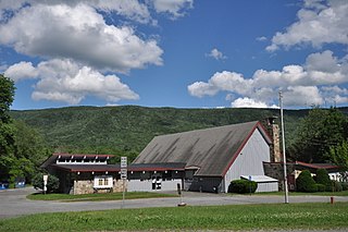
Weston is a town in Windsor County, Vermont, United States. The population was 623 at the 2020 census. Home to the Weston Playhouse Theatre Company, it includes the villages of Weston and The Island.

Gouverneur is a village in St. Lawrence County, New York, United States. The population was 3,949 at the 2010 census. The village is named after Gouverneur Morris, one of the authors of the Constitution of the United States, as well as a prominent landowner and part-time resident of the area.

<span class="mw-page-title-main">Gouverneur, New York</span> Town in New York, United States

Gouverneur is a town in St. Lawrence County, New York, United States. As of the 2020 census, the population was 6,551. That was down from 7,085 in 2010. The town is named after statesman and landowner Gouverneur Morris.

<span class="mw-page-title-main">Morristown, New York</span> Town in New York, United States

Morristown is a town in St. Lawrence County, New York, United States. The population was 1,974 at the 2010 census. The town is named after Gouverneur Morris, a signer of the United States Declaration of Independence and landowner in New York.

<span class="mw-page-title-main">Albany, Vermont</span> Town in Vermont, United States

Albany is a town in Orleans County, Vermont, United States. The population was 976 at the 2020 census. Albany contains four villages: the incorporated village of Albany, and the unincorporated villages of Albany Center, East Albany and South Albany.

<span class="mw-page-title-main">Wallingford, Vermont</span> Town in Vermont, United States

Wallingford is a town in Rutland County, Vermont, United States. The population was 2,129 at the 2020 census. Wallingford also contains the villages of East Wallingford and South Wallingford.

References

  1. "Geographic Names Information System". edits.nationalmap.gov. Retrieved March 13, 2022.
  2. "2019 U.S. Gazetteer Files". United States Census Bureau. Retrieved July 27, 2020.
  3. "Population and Housing Unit Estimates". United States Census Bureau. May 24, 2020. Retrieved May 27, 2020.
  4. "National Register Information System". National Register of Historic Places . National Park Service. March 13, 2009.
  5. "Voters OK dissolution by 130-47".
  6. "NYSDOS Division of Local Government Services". www.dos.ny.gov. Archived from the original on July 20, 2013.
  7. Peladeau, Marius, B., 'Willie Went to War', Vermont Civil War Enterprises, Newport, VT, 2005.
  8. 1850 Federal Census, M432, Roll 589, pg. 51.
  9. The Caledonian, St Johnsbury, Vt., October 31, 1863.
  10. Congressional Record, Medal of Honor Case 2503.
  11. "Census of Population and Housing". Census.gov. Retrieved June 4, 2015.
  12. "U.S. Census website". United States Census Bureau . Retrieved January 31, 2008.