Related Research Articles

The Kipsigis or Kipsigiis are a Nilotic tribe in Kenya. They are contingent of the Kalenjin ethnic group and speak Kipsigis language, a tonal language which is closely related to a group of languages collectively known as Kalenjin language. It is observed that the Kipsigis and an aboriginal race native to Kenya known as Ogiek have a merged identity. The Kipsigis are the most numerous of the Kalenjin. The latest Census population in Kenya put the kipsigis at 1.972 Million speakers accounting for 45% of all kalenjin speaking people. They occupy the highlands of Kericho stretching from Timboroa to Mara River in the south, the west of Mau Escarpment in the east to Kebeneti in the west. They also occupy, parts of Laikipia, Kitale, Nakuru, Narok, Trans Mara District, Eldoret and Nandi Hills.

Mount Elgon is an extinct shield volcano on the border of Uganda and Kenya, north of Kisumu and west of Kitale. The mountain's highest point, named "Wagagai", is located entirely within Uganda. Although there is no verifiable evidence of its earliest volcanic activity, geologists estimate that Mount Elgon is at least 24 million years old, making it the oldest extinct volcano in East Africa. The mountain's name originates from its Maasai name, Elgonyi.

Trans-Nzoia County is a county in the former Rift Valley Province, Kenya, located between the Nzoia River and Mount Elgon, 380 km northwest of Nairobi. At its centre is the town of Kitale which is the capital and largest town. The county borders Bungoma to the west, Uasin Gishu and Kakamega to the south, Elgeyo-Marakwet to the east, West Pokot to the north and the republic of Uganda to the Northwest. Trans Nzoia covers an area of 2495.5 square kilometres.
The Oropom were the aboriginal inhabitants of much of Karamoja in Uganda, Mt. Elgon area and West Pokot, Trans Nzoia and Turkana regions in Kenya. Their descendants were largely assimilated into various communities present in their former territories, including the Iteso, Karamojong, Pokot, Turkana and Bukusu. They are or were found in scattered pockets between the Turkwel River, Chemorongit Mountains and Mt. Elgon. One report indicates that they formerly spoke the unclassified Oropom language.
The Ilchamus, are a Maa-speaking people living south and southeast of Lake Baringo, Kenya. They numbered approximately 32,949 people in 2019 and are closely related to the Samburu living more to the north-east in the Rift Valley Province. They are one of the smallest ethnic groups in Kenya.
Kimilili is a town and area in Kenya's Bungoma County. The area is occupied mainly by the Bukusu and few Teso communities it is a trading center for agricultural goods and services. The town has an urban population of 94,927.
The Sebei are a Southern Nilotic ethnic group inhabiting eastern Uganda. They speak Kupsabiny, a Kalenjin language. The Sapiiny occupy three districts, namely Bukwo, Kween and Kapchorwa.

Mount Elgon National Park is a national park 140 kilometres (87 mi) northeast of Lake Victoria. The park covers an area of 1,279 square kilometres (494 sq mi) and is bisected by the border of Kenya and Uganda. The Ugandan part of the park covers 1,110 km2 (430 sq mi) while the Kenyan part covers 169 km2 (65 sq mi). The Kenyan part of the park was gazetted in 1968, the Ugandan part in 1992.

Bukwo District is a district in the Eastern Region of Uganda. The town of Bukwo is its main political, administrative, and commercial center and the site of the district headquarters.

The districts of Kenya were divided into 262 divisions (matarafa). Divisions of Kenya were further subdivided into locations. Today's counties of Kenya are based on the merging of some of the districts on this list and since the divisions are one level under the districts they are now the sub-counties. This is because Kenya recently changed its constitution and 47 Counties emerged. Here are the divisions listed below, by district :
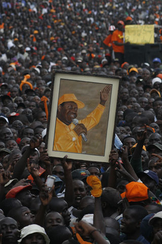
The Sabaot Land Defence Force (SLDF) was a guerrilla militia operating in the Mount Elgon District of Kenya since 2005. It has been accused of killing more than 600 people, and of committing a variety of atrocities including murder, torture, rape, and the theft and destruction of property. More than 66,000 people had been displaced in an 18-month period.
Kapsokwony is a small town in Bungoma County, Kenya. The town is part of Mount Elgon County Council and Mount Elgon Constituency.

The Mount Elgon insurgency was a conflict that started in 2005 when the Sabaot Land Defence Force militia revolted in the Mount Elgon area, Western Kenya.
Mount Elgon Constituency or Mt. Elgon Constituency is an electoral constituency in Bungoma County, Kenya. It was formerly the only constituency in the now defunct Mount Elgon District. The constituency was established for the 1963 elections.
The BaKonzo, or Konzo, are a Bantu ethnic group located in the Rwenzori region of Southwest Uganda. Numbering 850,646 in the 2014 census, they live on the plains, hills and mountain sloping up to an altitude of 2,200 meters in the Rwenzori Mountains. Traditionally agriculturalists and animal husbanders, they farm yams, beans, sweet potatoes, peanuts, soy beans, potatoes, rice, wheat, cassava, coffee, bananas, and cotton, while keeping goats, sheep, and poultry. They speak the Konjo language and practice traditional religions and Christianity. Konzo speakers also live on the Western slopes of the Rwenzori range in the Democratic Republic of the Congo.
Laboot is a settlement in Bungoma County, Kenya. The estimated population is 3621 as per 2019 population census, and the settlement lies at an elevation of 10,387 feet (3,166 m).
Ethnic conflicts in Kenya occur frequently, although most are minor skirmishes. A significant increase in the severity of such conflicts between the various ethnic groups inhabiting the country was witnessed after the introduction of multi-party politics in the early 1990s, especially during the 2007–08 Kenyan crisis. Major conflicts have also led to exoduses of ethnic minority communities with roots in other geographical areas.
The Sabaot are one of the nine sub-tribes of the Kalenjin of Kenya and Uganda. The Sabaot in turn are divided into six communities largely identified by their dialects. These dialects of the Sabaot language are the Pok, Somek, Mosop, Kony, Bong'omek and Sabiny (Sebei). Being resident around Mount Elgon, the original homeland of most Kalenjin, the Sabaot are seen as the keepers of the authentic Kalenjin tradition. They and the area they inhabit are often referred to as Kapkugo by other Kalenjin.
Mutai is a term used by the Maa-speaking communities of Kenya to describe a period of wars, usually triggered by disease and/or drought and affecting widespread areas of the Rift Valley region of Kenya. According to Samburu and Maasai folklore, periods of Mutai occurred during the nineteenth century.
The Army Special Operations Brigade is a special forces unit of the Kenyan Army, tasked with airborne operations, commando raids, reconnaissance, counter-insurgency, infiltration and other specialized forms of warfare.
References
- ↑ "Kenya Districts".
- ↑ "Archived copy" (PDF). Archived from the original (PDF) on 2007-09-28. Retrieved 2007-09-28.
{{cite web}}: CS1 maint: archived copy as title (link) - ↑ http://www.ilri.cgiar.org/html/Urban%20Poverty%20all%20Kenya%20Province%20through%20Location%20Final.xls . Retrieved 2011-07-18.
{{cite web}}: Missing or empty|title=(help)