Mount Freedom, New Jersey

Last updated

Mount Freedom, New Jersey
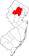
Location map of Morris County, New Jersey.svg
Red pog.svg
Mount Freedom
Mount Freedom's location in Morris County (Inset: Morris County in New Jersey)
USA New Jersey location map.svg
Red pog.svg
Mount Freedom
Mount Freedom (New Jersey)
Usa edcp location map.svg
Red pog.svg
Mount Freedom
Mount Freedom (the United States)
Coordinates: 40°49′34″N74°34′13″W / 40.82611°N 74.57028°W / 40.82611; -74.57028
Country Flag of the United States.svg  United States
State Flag of New Jersey.svg  New Jersey
County Morris
Township Randolph
Elevation
883 ft (269 m)
ZIP code
07869
GNIS feature ID0878536 [1]

Mount Freedom is an unincorporated community located within Randolph in Morris County, in the U.S. state of New Jersey. [2] The area is served as United States Postal Service ZIP code 07869.

Contents

As of the 2000 United States Census, the population for ZIP Code Tabulation Area 07869 was 24,452.

History

For much of the 20th century, Mount Freedom was a resort community appealing to Jewish vacationers, with as many as 10,000 visitors from New York City flocking to the many hotels and dozens of bungalow colonies in the area. With the increasing ease of highway travel to the larger resorts in the Catskill Mountains and the declining cost of air travel, most of the hotels closed down by the end of the 1970s. [3] [4]

Related Research Articles

<span class="mw-page-title-main">Randolph, New Jersey</span> Township in Morris County, New Jersey, US

Randolph is a township in southwestern Morris County, in the U.S. state of New Jersey. As of the 2020 United States census, the township's population was 26,504, an increase of 770 (+3.0%) from the 2010 census count of 25,734, which in turn reflected an increase of 887 (+3.6%) from the 24,847 counted in the 2000 census.

<span class="mw-page-title-main">Borscht Belt</span> Cultural region of United States

The Borscht Belt, or Yiddish Alps, is a colloquial term for the mostly defunct summer resorts of the Catskill Mountains in parts of Sullivan and Ulster counties in the U.S. state of New York, straddling both Upstate New York and the northern edges of the New York metropolitan area.

<span class="mw-page-title-main">Port Elizabeth, New Jersey</span> Populated place in Cumberland County, New Jersey, US

Port Elizabeth is an unincorporated community and census-designated place (CDP) located within Maurice River Township in Cumberland County, in the U.S. state of New Jersey. The area is served as United States Postal Service ZIP Code 08348.

<span class="mw-page-title-main">Cookstown, New Jersey</span> Place in Burlington County, New Jersey, United States

Cookstown is an unincorporated community and census-designated place (CDP) located within New Hanover Township in Burlington County, in the U.S. state of New Jersey. Located near Fort Dix, the area is served as United States Postal Service ZIP Code 08511.

Kirkwood is an unincorporated community located within Voorhees Township in Camden County, in the U.S. state of New Jersey. Kirkwood once had a post office assigned United States Postal Service ZIP Code 08043. The ZIP Code has been reassigned to a post office named Voorhees that serves the entire township. Kirkwood is still a valid city name for mailing purposes.

<span class="mw-page-title-main">Layton, New Jersey</span> Populated place in Sussex County, New Jersey, US

Layton is an unincorporated community and census-designated place (CDP) located within Sandyston Township in Sussex County, in the U.S. state of New Jersey. The area is served as United States Postal Service ZIP Code 07851.

White Lake is a hamlet in the town of Bethel, Sullivan County, New York, United States, on the southeastern shore of a lake of the same name. It was the closest community to the Woodstock Music and Art Fair in 1969.

<span class="mw-page-title-main">McAfee, New Jersey</span> Populated place in Sussex County, New Jersey, US

McAfee is an unincorporated community located within Vernon Township in Sussex County, in the U.S. state of New Jersey. The area is served as United States Postal Service ZIP Code 07428.

<span class="mw-page-title-main">Columbus, New Jersey</span> Populated place in Burlington County, New Jersey, US

Columbus is an unincorporated community located within Mansfield Township in Burlington County, in the U.S. state of New Jersey. The area is served as United States Postal Service ZIP Code 08022. Most of Mansfield Township's governmental offices are located in and around Columbus. It is also the main business district in the township with many businesses lining the main roads in the area. It is located at the junction of County Route 543 and U.S. Route 206 which is a major highway that heads north and south. US 206 originally passed through the center of Columbus on Atlantic Avenue and New York Avenue until it was moved to a short four-lane bypass of downtown in the late 1950s/early 1960s. The old surface route became state-maintained New Jersey Route 170 but became a county-maintained road in 1986.

<span class="mw-page-title-main">Pittstown, New Jersey</span> Place in Hunterdon County, New Jersey, United States

Pittstown is an unincorporated community located at the intersection of the boundaries of Alexandria, Franklin and Union townships in Hunterdon County, New Jersey. The area is named after William Pitt. The area is served as United States Postal Service ZIP Code 08867. The area was named Hofftown in the 18th century after landowner Lawrence Hoff. The Pittstown Historic District was listed on the state and national registers of historic places in 1990.

Landing is an unincorporated community and census-designated place (CDP) located within Roxbury Township, in Morris County, in the U.S. state of New Jersey. The community is located on the south shore of Lake Hopatcong near Hopatcong State Park. The area is served as United States Postal Service ZIP Code 07850.

<span class="mw-page-title-main">Mount Royal, New Jersey</span> Populated place in Gloucester County, New Jersey, US

Mount Royal is an unincorporated community and census-designated place located within East Greenwich Township in Gloucester County, in the U.S. state of New Jersey. The area is served as United States Postal Service ZIP Code 08061.

<span class="mw-page-title-main">Spring Glen, New York</span> Hamlet in New York, United States

Spring Glen is a hamlet of the Town of Wawarsing in Ulster County, New York, United States. It is located just off US 209 just north of the Sullivan County line. It sits along the Sandburg Creek and has a direct access point for parking and hiking to the highest point of the Shawangunk Ridge Trail at over 1800 feet. It has the ZIP Code 12483.

<span class="mw-page-title-main">Vincentown, New Jersey</span> Place in Burlington County, New Jersey, United States

Vincentown is an unincorporated community and census-designated place (CDP) located on the South Branch Rancocas Creek in Southampton Township of Burlington County, New Jersey. The area is served as United States Postal Service ZIP Code 08088.

Hurleyville is a hamlet in the Town of Fallsburg in Sullivan County, New York, United States. The town lies along County Road 104 and was originally developed because it was on the main route between the Villages of Liberty and Monticello, New York. The zip code for Hurleyville is 12747.

Monroeville is an unincorporated community located within portions of Elk Township in Gloucester County and Upper Pittsgrove Township in Salem County, in the U.S. state of New Jersey. The area is served as United States Postal Service ZIP Code 08343. Monroeville is mostly filled with wooded areas and farms.

<span class="mw-page-title-main">Harrisonville, New Jersey</span> Populated place in Gloucester County, New Jersey, US

Harrisonville is an unincorporated community and census-designated place (CDP) located within South Harrison Township, in Gloucester County, in the U.S. state of New Jersey. The area is served as United States Postal Service ZIP Code 08039.

Harris is a hamlet in the town of Thompson in east-central Sullivan County, New York, United States. The ZIP code for Harris is 12742.

Kiamesha Lake is a hamlet in the town of Thompson, in east-central Sullivan County, New York, United States. The zip code for Kiamesha Lake is 12751.

Allaire is an unincorporated community located within Wall Township in Monmouth County, in the U.S. state of New Jersey. As of the 2010 United States Census, the ZIP Code Tabulation Area for ZIP Code 07727 had a population of 7,050.

References

  1. "Mount Freedom". Geographic Names Information System . United States Geological Survey, United States Department of the Interior . Retrieved September 24, 2012.
  2. Locality Search, State of New Jersey. Accessed June 8, 2016.
  3. "The rise of the resorts in Randolph Twp.", New Jersey Hills, October 6, 2005. Accessed August 20, 2024. "One of Randolph's main sources of income for about eight decades in the last century was the resorts, the hotels and bungalow colonies located mainly in the Mount Freedom section of town.... Shortly after the postwar heyday of the resorts, vacationers, by the 1960s, were lured away by affordable airline fares to the Caribbean, and the opening of the New York Thruway made it easy for motorists to go up to the huge hotels in the Catskills. Through the decade of the 1960s, as the resort business began to decline, some of the hotel owners put on a brave front, announcing grand plans to renovate and improve their properties."
  4. Our Grand Hotels, Randolph, New Jersey. Accessed August 20, 2024. "During the early part of the 20th century, Randolph became a vacation haven for people from urban areas, particularly New York City and Brooklyn.... The Mount Freedom section of the township became known as the 'Borscht Belt' and eventually was home to 11 hotels, 45 bungalow colonies, summer camps and swim clubs. At its peak, the summer time brought upwards of 10,000 visitors to Mount Freedom."