Related Research Articles

The Catholic Church in Kenya is part of the worldwide Catholic Church, under the spiritual leadership of the Kenyan Conference of Catholic Bishops and the Pope in the Vatican City.

Moyale is a city on the border between Ethiopia and Kenya. In Ethiopia, Moyale is the administrative centre for two Ethiopian woredas, Moyale of the Oromia Region and Moyale of the Somali Region. In Kenya, it is the largest town of Marsabit County and the capital of Moyale sub-county.

Isiolo is a town in Isiolo County, of which it is the capital. It is located in the upper eastern region of Kenya and is geographically considered the center of the country Kenya. It lies 285 kilometers north of the capital Nairobi. The town grew around the local military camps, much of the population being Ameru community, Borana, and the descendants of former Somali soldiers who had fought in World War I. The town has an estimated population of 78,250, most of them living around the outskirts of the town. Like most African cities, there has been a steady increase in the urban population in recent years, especially moving from as far as Moyale, Marsabit and Mandera. Isiolo town is also becoming a centre of interest because of its newly acquired status as a resort city cashing in on the popular Samburu and Shaba Game reserves, which have become preferred destinations after the famed Maasai Mara. Isiolo lies along the long A2 Road, leading towards Marsabit and Moyale much further north.
Kilifi County was formed in 2010 as a result of a merger of Kilifi District and Malindi District, Kenya. Its capital is Kilifi and its largest town is Malindi. Kilifi county is one of the five counties that make up the Kenyan Coast. The county has a population of 1,453,787 people following the 2019 census which covers an area of 12,245.90 km2 (4,728.17 sq mi).
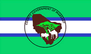
Marsabit County is a county in Kenya. Covering a surface area of 66,923.1 square kilometres. Marsabit is the second largest county by size in Kenya after Turkana county which has an area of 71,597.8 km2. Its capital is Marsabit and its largest town is Moyale. According to the 2019 census, the county has a population of 459,785. It is bordered to the North by Ethiopia, to the West by Turkana County to the South by Samburu County and Isiolo County, and to the East by Wajir County.

Turkana County is a county in the former Rift Valley Province of Kenya. It is Kenya's second largest county by land area of 98,597.8km2 followed by Marsabit County with an area of 71,597.8km2. It is bordered by the countries of Uganda to the west; South Sudan and Ethiopia, including the disputed Ilemi Triangle, to the north and northeast; and Lake Turkana to the east. To the south and east, neighbouring counties in Kenya are West Pokot, Baringo and Samburu Counties, while Marsabit County is on the opposite shore of Lake Turkana. Turkana's capital and largest town is Lodwar. The county had a population of 926,976 at the 2019 census.
Moyale is a district in the Somali Region of Ethiopia. Located at the extreme southwest corner of the Dhawa Zone, Moyale is bounded on the south by Kenya, on the west by the Oromia Region, on the north by Udet, and on the northeast by the Dawa, which separates Moyale from Filtu. The southernmost point of this woreda is the southernmost point of Ethiopia. Towns in this woreda include Chelago.

Vihiga County is an administrative region in the former Western Province of Kenya whose headquarters are in Mbale, the largest town in the county. The county has a population of 554,622 and an area of 563 km2. Formerly a district, Vihiga was split from Kakamega District in 1990. In 2019's census, Vihiga was found to have a population of 590,013, an increase of 35,391 from 2009's count.
Moyale(Oromo: Moyyaalee) is one of the Districtss in the Oromia Region of Ethiopia. It is named after the administrative center of the woreda, Moyale. Located in the southeast corner of the Borena Zone, Moyale is bordered on the south by Kenya, on the west by Dire, on the northwest by Arero, on the north by the Dawa River which separates it from Liben, and on the east by Dawa Zone Somali Region.
Cicimli is a village in the Lachin District of Azerbaijan.
Juja is an electoral constituency in Kenya. It is one of twelve constituencies in Kiambu County, one of four in the former Thika District. The constituency was established for the 1969 elections.

The Gabra are a Cushitic ethnic group who mainly inhabit the Moyale and Marsabit regions of northern Kenya and the highlands of southern Ethiopia. They are closely related to the wider Oromo people and practice Islam as their religion.

Moyale Constituency is an electoral constituency in Kenya. It is one of four constituencies in Marsabit County, and it was the only constituency in the former Moyale District. The constituency has nine wards, all electing councillors to the Moyale County Council. The constituency was established for the 1966 elections.
Moyale Airport, also referred to as Moyale Lower Airport, is an airport located in the town of Moyale, Marsabit County, in the northern part of the Republic of Kenya, at the international border with Ethiopia. Its location is approximately 590 kilometres (370 mi), by air, northeast of Nairobi International Airport, the country's largest civilian airport. The geographic coordinates of this airport are:3° 27' 54.00"N, 39° 6' 18.00"E.

Juja is a town in Kiambu County in Kenya. It is the home town of Jomo Kenyatta University of Agriculture and Technology (JKUAT). It is also a constituency in Kiambu county, currently represented in the parliament by Hon. George Koimburi following the demise of the late Hon. Francis Munyua Waititu. The MCA is Kalpesh Jayantilal Shah, who represents the people of Juja Ward in the County Government. Juja is home to more than 150,000 Kenyans, who are mostly students.

Sub-counties, also known as Districts, are the decentralised units through which government of Kenya provides functions and services. At national level, sub-counties take a more administrative function like security, statistical purposes, provision of government services, etc. Even though the sub-counties are divisions of counties, powers to create new national sub-counties lies with the national government. As of 2023, there are 314 sub-counties, compared to 290 constituencies. A deputy county commissioner is appointed by the state to lead each sub-county. The sub-counties are further divided into divisions, locations and sub-locations.
Mandera District was an administrative district in the North Eastern Province of Kenya. Its capital town was Mandera. The district had an area of 26,744 km2.
Philip Galma Godana was a Kenyan politician. He served as a member of parliament for Moyale Constituency.
Sodo–Moyale–Suswa High Voltage Power Line is a 500 kV bipolar high-voltage direct current electricity power transmission line, under construction, connecting the Wolayta converter station near Sodo, Ethiopia with the Suswa converter station near Suswa, Kenya.
Roba Sharu Duba is a Kenyan politician and a member of the 11th Kenyan parliament elected from Moyale Constituency on the ticket of United Democratic Forum Party (UDF) in 2013. He was CEO of The Local Authorities Provident Fund and was town clerk in Moyale, Kilifi, Mombasa and Nairobi where he resigned from the service to run in the 2013 parliamentary election for Moyale Constituency seat. His legislative interest focuses on security and inter-communal peace particularly in Moyale.
References
- ↑ Walter, Jacob (2021-07-09). "Kenya: Why Always Us? Marsabit Governor Asks on Elusive Peace in North". allAfrica.com. Retrieved 2021-08-04.
- ↑ "Three more killed in Isiolo attacks, 300 animals stolen". The Star. Retrieved 2021-08-04.
| | This Kenya location article is a stub. You can help Wikipedia by expanding it. |