Msimbazi River

Last updated

Msimbazi River
DEGRADATION FOR DEVELOPMENT.jpg
Msimbazi River bed being exploited for sand and used a trash dump in background
Native nameMto Msimbazi (Swahili)
Location
CountryFlag of Tanzania.svg  Tanzania
Region Dar es Salaam Region & Pwani Region
District Kisarawe District, Ilala &
Kinondoni
Wards Kwembe, Kisarawe,
Gongolamboto, Pugu,
Ukonga, Kipawa,
Kinyerezi, Segerea,
Vingunguti, Tabata,
Buguruni, Kigogo,
Ilala, Mchikichini,
Mzimuni, Magomeni,
Upanga West & Hananasif
Physical characteristics
Source 
  location Kisarawe, Kisarawe District, Pwani Region
Mouth Zanzibar Channel
  location
Upanga West & Hananasif
  coordinates
06°47′46″S39°16′54″E / 6.79611°S 39.28167°E / -6.79611; 39.28167
Length35 km (22 mi)
Basin size271 km2 (105 sq mi)
Basin features
River system Msimbazi River Basin
Tributaries 
  leftSinza River, Lubungo (Ubungo) River, Luhanga River, Kinyerezi River, Zimbiri River, Tandale River and Makurumla River

Msimbazi River (Mto Mbezi in Swahili) is located in Dar es Salaam Region of Tanzania. It begins in Kisarawe ward, Kisarawe District and eventually drains into Zanzibar Channel at the border of Upanga West ward of Ilala MC and Hananasif ward of Kinondoni MC. The length of the Msimbazi River is about 35 kilometers. It flows eastward into the Zanzibar Channel of the Indian Ocean via the Pugu and Kazimzumbwi Forest Reserves, joining the Sinza, Ubungo, and Luhanga Rivers along the way. [1]

Contents

It is a significant source of water for drinking, bathing, supporting industry, agriculture, and environmental protection for those living in Dar es Salaam Region over the decades. However, recently, industrial effluents and unauthorized sewage systems are jeopardizing the biological functions that rivers perform. Heavy metal pollution from industries harms the river's advantages in terms of functionality and even the traditional practice of irrigation of vegetable fields. [2]

Geography

The Msimbazi River and its tributaries originate in the Pugu Hills and Kazimzumbwi Forest Reserves in Kisarawe District, Pwani Region, and flow through the center of Dar es Salaam's in Ilala MC.

Msimbazi River and its main tributaries Msimbazi-River-and-its-main-tributaries.png
Msimbazi River and its main tributaries

River basin

With a land area of 271 km2, the Msimbazi basin makes up roughly one fifth of Dar es Salaam's total land area and is home to an estimated 1.6 million people (27% of the city's total population). The basin extends from the river's headwaters in the Pugu Forest Reserve eastward over a stretch that becomes more urbanized as the river gets closer to the ocean's mouth. [3]

The lower basin, a large floodplain and wetland in the center of Dar es Salaam close to the city center, was formerly a thriving mangrove forest estuary but has recently begun to die back despite still being intact. Near the river's outflow to the sea, two of Dar es Salaam's four main thoroughfares—including the city's first operational Bus Rapid Transit (BRT) corridor—cross the main flood plain. Communities along the lower parts of the river, which frequently have poor incomes and live in haphazard settlements, rely heavily on easy access to the city's commercial center for their livelihoods and get access to nearby social services. [4]

Historic annual flooding and fertility

The upper and middle catchments of the Msimbazi once had a sizable portion of natural forestland. When it rained heavily, the dense foliage cover prevented the underlying soil from eroding. Even though rivers like the Msimbazi are never static since they change gradually over many years and decades, the lack of excessive erosion and sedimentation left the river in a generally stable form in its natural state. Flooding was common during the 1800s and 1900s; in fact, the region's fertility is due to the nutrient-rich deposits that previous floods left behind. The use of the land around the river started to change gradually in the late 1980s and early 1990s as a result of rural-urban migration. [5]

The 1997–1998 El Niño rains are frequently cited as the catalyst for the Msimbazi's catastrophic flooding. Since then, there have been large flooding incidents in 2009, 2010, 2011, 2014, 2015, 2017, and 2018. The flooding episodes have also gotten more regular and severe. Systems for managing land and planning have not been able to keep up with the rapid increase. Although the Msimbazi Basin was identified as hazardous territory in the 1979 Dar es Salaam Master Plan and a 60-meter buffer zone from a river's highwater mark was established by the Environmental Management Act, land use restrictions have mostly gone unenforced. Physical lines delineating a dangerous area weren't present, and the formal legal procedure for doing so wasn't followed. [6] [7]

Threats

Metal contamination

The Msimbazi River has experienced environmental deterioration throughout the years, much like all the other waterways in the city. Sediments from Dar's rivers are contaminated, with Msimbazi and Kizinga river sediments being the most contaminated, according to the geo-accumulation index, contamination factor, degree of contamination, modified degree of contamination, potential contamination index, and environmental toxicity quotient. This is true even though the enrichment factor shows varying levels of heavy metal contamination in rivers. [8]

Metal contamination levels for Cd, Pb, Cr, Ni, Cu, Al, Mn, Fe, and Zn were assessed using sediments from the Kizinga, Mbezi, Msimbazi, and Mzinga coastal rivers. The Msimbazi River held the majority of the higher quantities of Cd, Pb, Cr, Al, Mn, Fe, and Zn. The Kizinga River has higher Ni and Cu values, but the Mbezi River had higher Mn concentrations. Mzinga River contains the least amount of metals overall, except Mn. The Kizinga River had the lowest mn concentrations. [9]

Deforestation and uncontrolled urbanization

Stormwater runoff has grown in the Msimbazi Basin as a result of decreased natural water retention capacity due to human activity, particularly deforestation and urbanization. The primary cause of the rising frequency of flooding in the rivers and streams that make up the river system is due to this. The Basin's tree cover has dramatically decreased. To make room for agriculture, urban growth, and cooking fuel, trees have been cut down at alarming rates, leaving behind bushland with only 10% of a forest's ability for soil-fixing and rainwater infiltration. According to one study at the river's source, the closed forest canopy in the Pugu and Kazimzumbwi Forest Reserves shrunk by more than a quarter (25 and 31%, respectively) over a 15-year period. Less than 400 of Pugu and Kazimzumbwi reserve's 2,180 hectares may be deemed real forest, indicating that the majority of the forest cover has indeed been removed. Similar to this, only 900 of the 4,887 hectares in the Kazimzumbwi Forest Reserve can currently be classed as genuine forest. [10]

The mangroves' air roots have been buried as a result of the Msimbazi River's significant sedimentation, and this "asphyxiation" has a detrimental effect on the health of the trees. Since it no longer extends as far as Jangwani Bridge, high tide now only comes a few hundred meters ashore. Because of the accumulation of sediment to a height above the tidal level, much of the wetland region that surrounds the river channel is dry even during high tide. The result is that the more inland mangroves are no longer able to receive seawater, and significant portions of the mangrove forest have withered away. There is a dearth of information about the condition of the mangrove forest reserve.The mangrove protected area is not formally physically defined, even though it is protected by the 2002 Forest Act and the ban on chopping down mangroves is strictly enforced. [11]

Pollution

Unregulated sanitary waste disposal practices significantly contaminate flood waters. The prevalence of unlawful discharge into rivers and wetlands has been confirmed through interviews with NGOs and companies that focus on sanitation. Another typical emptying technique is to purposefully flood or unplug latrines during heavy downpours, which flushes excrement out of the pit and into nearby communities and waterways. The Msimbazi River has very low flows during the dry season, and this makes the water extremely filthy.Industrial waste and pollution have ruined a freshwater ecosystem; large stretches of the river can no longer support fish populations that were there until recently. [12]

The most polluted sections of the Msimbazi downstream of Vingunguti and its tributaries had pH levels as high as 12 (compared to the legal standard of 8.5), a level that causes severe burns to skin, and Chromium (VI) at 75 times the legal limit for wastewater discharges. Chromium VI is extremely toxic and can cause cancer and birth defects with prolonged exposure. Evidence of fecal contamination that is more dangerous than what the World Health Organization considers safe for use in agriculture. [13] [14]

Municipal wastewater stabilization ponds at Vingunguti, textile and other industries, abattoirs, leachate from former dump sites, sewers and drainage from nearby homes that flow directly into the Msimbazi river, pit latrines that leak waste or overflow during rainstorms, transportation runoff (oil and gasoline), agricultural runoff (pesticides, fertilizers), and solid waste dumped directly into rivers are some of the sources of river pollution. A year-round health problem is poor water quality. In the river basin, hundreds of farmers cultivate leafy greens and other vegetables, and garden plots receive irrigation from shallow wells. [15] The produce is sold in bulk to middlemen who then distribute it all across Dar es Salaam. [16] [17]

Related Research Articles

<span class="mw-page-title-main">Dar es Salaam</span> Largest city in Tanzania and capital of Dar es Salaam Region

Dar es Salaam is the largest city and financial hub of Tanzania. It is also the capital of the Dar es Salaam Region. With a population of over five million people, Dar es Salaam is the largest city in East Africa and the sixth-largest in Africa. Located on the Swahili coast, Dar es Salaam is an important economic center and one of the fastest-growing cities in the world.

<span class="mw-page-title-main">Kariakoo</span> Ward of Ilala District, Dar es Salaam Region

Kariakoo is an administrative ward of the Ilala Municipical Council of the Dar es Salaam Region in Tanzania. Jangwani ward and Mchafukoge ward form the ward's northern and eastern boundaries. The Gerezani and Mchikichini wards border the ward to the south and west respectively. The ward is the home of Simba Sports Club. The name is derived from the swahilization of the British colonial occupation's "Carrier Corps", that used to be based in the area. Today, Kariakoo is mainly known for its large market that spans several city blocks. According to the 2012 census, the ward has a population of 13,780.

<span class="mw-page-title-main">Dar es Salaam Region</span> Region of Tanzania

Dar es Salaam Region is one of Tanzania's 31 administrative regions and is located in the east coast of the country. The region covers an area of 1,393 km2 (538 sq mi). The region is comparable in size to the combined land and water areas of the nation state of Mauritius Dar es Salaam Region is bordered to the east by Indian Ocean and it is entirely surrounded by Pwani Region. The Pwani districts that border Dar es Salaam region are Bagamoyo District to the north, Kibaha Urban District to the west, Kisarawe District to the south west and Mkuranga District to the south of the region. The region's seat (capital) is located inside the ward of Ilala. The region is named after the city of Dar es Salaam itself. The region is home to Tanzania's major finance, administration and industries, thus the making it the country's richest region. The region also has the second highest Human Development Index in the country after Mjini Magharibi. According to the 2022 census, the region has a total population of 5,383,728 and national census of 2012 had 4,364,541. The region has the highest population in Tanzania followed by Mwanza Region.

<span class="mw-page-title-main">Kinondoni District, Dar es Salaam</span> District of Dar es Salaam Region, Tanzania

Kinondoni District, officially the Kinondoni Municipal Council is one of five districts of the Dar es Salaam Region of Tanzania. The district is bordered to the north by Bagamoyo District and Kibaha of Pwani Region, to the east by the Indian Ocean, the west by Ubungo District, and to the south by the Ilala District. The district covers an area of 269.5 km2 (104.1 sq mi). The district is comparable in size to the land area of Malta. The administrative seat is Ndugumbi. The district is home to one of the best preserved Medieval Swahili settlements, Kunduchi Ruins, headquarters for the National Muslim Council of Tanzania (BAKWATA) and Makumbusho Village Museum. Considered the cultural center of Dar es Salaam, Kinondoni District is also regarded the birthplace of the musical genre of Singeli. In addition the district is one of two districts in Dar es Salaam that has a National Historic Site, namely the Kunduchi Ruins.The 2012 National Tanzania Census states the population for Kinondoni as 1,775,049.

<span class="mw-page-title-main">Ilala District, Dar es Salaam</span> District of Dar es Salaam Region, Tanzania

Ilala District, officially the Ilala Municipal Council is one of five districts of the Dar es Salaam Region of Tanzania. The district is bordered to the north and northeast by Kinondoni District and Ubungo District, to the east by the Zanzibar Channel, the west by Pwani Region, and to the south by the Temeke District. It covers an area of 364.9 km2 (140.9 sq mi). The district is comparable in size to the land area of U.S Virgin Islands. The administrative seat is Mchafukoge. The 2012 National Tanzania Census states the population for Ilala as 1,220,611.

<span class="mw-page-title-main">Ubungo District, Dar es Salaam</span> District of Dar es Salaam Region, Tanzania

Ubungo District, officially the, Ubungo Municipal Council is one of five districts of the Dar es Salaam Region of Tanzania. The Kinondoni District and Kibaha of the Pwani Region border the district to the north; the Kisarawe District of Pwani Region borders it to the west; and the Ilala District borders the it to the south and east. The district covers an area of 269.4 km2 (104.0 sq mi). The district is comparable in size to the land area of St. Kitts and Nevis. The administrative seat is Kwembe. The district is home to the University of Dar es Salaam, The Magufuli Bus Terminal, the largest in the country, and Pande Game Reserve the largest protected land area in Dar es Salaam Region. In addition, the district is home to the largest natural gas powered power station, the Ubungo Thermal Power Station and the headquarters of the Tanzania Electric Supply Company Limited (TANESCO). The 2012 National Tanzania Census states the population of the district as 845,368.

<span class="mw-page-title-main">Kisarawe District, Pwani</span> District of Pwani Region, Tanzania

Kisarawe District Council is one of eight administrative districts of Pwani Region in Tanzania. The District covers an area of 5,031 km2 (1,942 sq mi). It is bordered to the east by Dar es Salaam Region's Ilala and Ubungo Municipal Councils. The Kibaha District and Kibaha Town Council border the district to the north, and the Mkuranga District and Kibiti District border it to the south-east. By the Rufiji District to the south, and the Morogoro District of the Morogoro Region to the west. The district is comparable in size to the land area of Trinidad and Tobago. The town of Kisarawe serves as its administrative capital. According to the 2022 Tanzania National Census, the population of the District was 159,226.

<span class="mw-page-title-main">Mkuranga District, Pwani</span> District of Pwani Region, Tanzania

Mkuranga District Council is one of eight administrative districts of Pwani Region in Tanzania. The District covers an area of 2,827 km2 (1,092 sq mi). It is bordered to the north by Dar es Salaam's Kigamboni, Temeke and Ilala Districts. To the east by the Mafia Channel, to the south by Kibiti District, and to the west by Kisarawe District. The district is comparable in size to the land area of Samoa. The town of Mkuranga serves as its administrative capital. The district is home to the Vikindu Forest Reserve, one of last remaining East African coastal forests. In 2016 the Tanzania National Bureau of Statistics report the population of Mkuranga District were 243,062 people in the district, from 222,921 in 2012.

<span class="mw-page-title-main">Mbezi</span> Ward of Ubungo District, Dar es Salaam Region

Mbezi is an administrative ward in Ubungo District of the Dar es Salaam Region in Tanzania. Mabwepande and Wazo of Kinondoni MC border the ward to the north. The ward is bordered to the east by the wards of Saranga and Goba. South of here is Msigani. The westernmost wards are Kwembe, Kibamba, Maili Moja, and Pangani, the latter two of Kibaha. The ward is home to the majority of Pande Game Reserve's area. The ward is named after the Mbezi River, which passes through it. According to the 2012 census, the ward has a total population of 73,414.

<span class="mw-page-title-main">Kigamboni District, Dar es Salaam</span> District of Dar es Salaam Region, Tanzania

Kigamboni District, officially known as The Kigamboni Municipal Council is one of five districts of the Dar es Salaam Region of Tanzania. The district is bordered to the north by Ilala District, to the east by the Indian Ocean, the west by Temeke District, and to the south by the Mkuranga District of Pwani Region. It covers an area of 578.3 km2 (223.3 sq mi), making it the largest district the region by area. The district is comparable in size to the land area of Micronesia. The administrative seat is Somangila. The district is home to the headquarters of the Tanzanian Navy, The Kigamboni Naval Base. Also the district is home to the prestigious Mwalimu Nyerere Memorial Academy. In addition the district is one of two districts in Dar es Salaam that has a National Historic Site, with Kigamboni hosting the most, namely the Kimbiji Ruins, Mbutu Bandarini and Mbuamaji historic sites. The 2012 National Tanzania Census states the population for Kigamboni as 162,932.

<span class="mw-page-title-main">Kisarawe II</span> Ward of the Kigamboni District in the Dar es Salaam Region of Tanzania

Kisarawe II or unofficially East Kisarawe is an administrative ward in the Kigamboni district of the Dar es Salaam Region of Tanzania. The Kibada and Mjimwema form the ward's northern border. East is Somangila. Pembamnazi borders it to the south. Toangoma in the Temeke District, as well as Vianzi and Vikindu in the Pwani Region's Mkuranga District, border the west. Since Kisarawe II is the district's top agricultural producer, it is known as Kigamboni's "ricebowl" and "food basket". In 2016 the Tanzania National Bureau of Statistics report there were 10,401 people in the ward, from 8,306 in 2012.

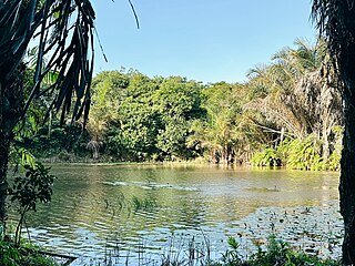
The Kazimzumbwi Forest Reserve, officially listed as Pugu/Kazimzumbwi Nature Forest Reserve is a protected area located in Kisarawe ward of Kisarawe District in Pwani Region, Tanzania. It is located next to the Pugu ward of Ilala MC to the east, about 20 km (12 mi) south-west of Dar es Salaam. It covers an area of 4,887 hectares, at an altitude between 120 and 180 m. The reserve was established in 1936, but both agriculture and logging were tolerated for several years. Logging, in particular, went on until the 1970s.

<span class="mw-page-title-main">Pugu Hills Forest Reserve</span> Protected area in Pwani Region, Tanzania

The Pugu Hills Forest Reserve, officially listed as Pugu/Kazimzumbwi Nature Forest Reserve is a protected area located in Kisarawe ward of Kisarawe District in Pwani Region, Tanzania. The forest borders in the Pugu ward, of Ilala MC in Dar es Salaam to the east, adjacent to the Kazimzumbwi Forest Reserve. Together with Kazimzumbwi, the Pugu Forest is part of what is considered to be one of the oldest forests in the world. The area is characterized by a large variety of endemic species of animals and plants.

<span class="mw-page-title-main">Pugu, Ilala</span> Ward of Ilala District, Dar es Salaam Region

Pugu is an administrative ward of the Ilala Municipical Council of the Dar es Salaam Region in Tanzania. Kinyerezi and Kwembe ward of Kinondoni MC form the ward's northern boundary. The ward is bordered by Majohe to the south and Gongolamboto to the east. In the west the ward is bordered by Kisarawe ward of Kisarawe District in the Pwani Region. The ward is named after the Pugu Hills, which form its western border and are home to the Pugu Hills Forest Reserve and the Kazimzumbwi Forest Reserve, two of some of the world's oldest forests. According to the 2012 census, the ward has a total population of 49,422.

Julius Nyerere Hydropower Station is a hydroelectric dam under construction across the Rufiji River in eastern Tanzania. Although controversial, the government approved the plans in 2018. The power station is expected to have an installed capacity of 2,115 megawatts (2,836,000 hp) and to produce 5,920GWh of power annually. The project, power station and dam are owned by and will be managed by the government owned Tanzania Electric Supply Company (TANESCO). Construction began in 2019 and is expected to be completed in 2024.

<span class="mw-page-title-main">Majohe</span> Ward of Ilala District, Dar es Salaam Region

Majohe is an administrative ward of the Ilala Municipical Council of the Dar es Salaam Region in Tanzania. The communities of Ukonga, Gongolamboto, and Pugu border the ward on the north. By Kisarawe Ward in Kisarawe District in Pwani Region, to the west. Chanika and Msongola form the southern boundary of the ward. Kivule borders the ward on its eastern side. According to the 2012 census, the ward has a total population of 81,646.

The Pande Game Reserve is a protected area located in Mabwepande ward of Kinondoni District and Mbezi ward of Ubungo District in Dar es Salaam Region of Tanzania that covers an area of 15.39 km2 (5.94 sq mi). It was established as a Forest Reserve in 1952 under the British colonial occupation.

Mpiji River is located in the north east of Pwani Region and western Dar es Salaam Region of Tanzania. It begins in Masaki ward in Kisarawe District and eventually drains into Zanzibar Channel at the border of Mbweni ward of Kinondoni MC of Dar es Salaam and Kerege ward of Bagamoyo District of Pwani Region.

Mbezi River is located in Dar es Salaam Region of Tanzania. It begins in Kwembe ward in Ubungo MC and eventually drains into Zanzibar Channel at Kawe ward of Kinondoni MC. With several neighborhoods and two wards bearing its name, the river has a long history in Dar es Salaam.

Kwale Island is a protected, seasonally inhabited island in the Pemba Channel under the Tanga Marine Reserves (TMRS) with the IUCN category II located inside Kwale ward in Mkinga District of Tanga Region in Tanzania. The coral island, located approximately a kilometer offshore in Manza Bay, and the modern hamlet on the shoreline are both referred to as Kwale. 86.2% of Kwale Island, or 528.1 Ha, is covered with mangroves. Kwale Island and Ulenge Island are the only seasonally inhabited by islands in the marine reserve, thus the two have the most human impact. The Island has an average elevation of 7 m (23 ft).

References

  1. Dar es Salaam City Master Plan 2016-2036 (PDF) (Report). Government of Tanzania. Archived (PDF) from the original on 11 June 2023. Retrieved 7 August 2023.
  2. Dar es Salaam City Master Plan 2016-2036 (PDF) (Report). Government of Tanzania. Archived (PDF) from the original on 11 June 2023. Retrieved 7 August 2023.
  3. Msimbazi Basin Development Project (PDF) (Report). Government of Tanzania. Archived (PDF) from the original on 18 March 2023. Retrieved 7 August 2023.
  4. Msimbazi Basin Development Project (PDF) (Report). Government of Tanzania. Archived (PDF) from the original on 18 March 2023. Retrieved 7 August 2023.
  5. Msimbazi Basin Development Project (PDF) (Report). Government of Tanzania. Archived (PDF) from the original on 18 March 2023. Retrieved 7 August 2023.
  6. De Risi, Raffaele, et al. "Flood risk assessment for informal settlements." Natural hazards 69 (2013): 1003-1032.
  7. Msimbazi Basin Development Project (PDF) (Report). Government of Tanzania. Archived (PDF) from the original on 18 March 2023. Retrieved 7 August 2023.
  8. Mihale, Matobola J. "Metal contamination in sediments of coastal rivers around Dar es Salaam, Tanzania." Huria: Journal of the Open University of Tanzania 27.2 (2021).
  9. Mihale, Matobola J. "Metal contamination in sediments of coastal rivers around Dar es Salaam, Tanzania." Huria: Journal of the Open University of Tanzania 27.2 (2021).
  10. Msimbazi Basin Development Project (PDF) (Report). Government of Tanzania. Archived (PDF) from the original on 18 March 2023. Retrieved 7 August 2023.
  11. Msimbazi Basin Development Project (PDF) (Report). Government of Tanzania. Archived (PDF) from the original on 18 March 2023. Retrieved 7 August 2023.
  12. Msimbazi Basin Development Project (PDF) (Report). Government of Tanzania. Archived (PDF) from the original on 18 March 2023. Retrieved 7 August 2023.
  13. Sawe, Shovi Furaeli, Daniel Abel Shilla, and John Ferdinand Machiwa. "Lead (Pb) contamination trends in Msimbazi estuary reconstructed from 210Pb-dated sediment cores (Msimbazi River, Tanzania)." Environmental Forensics 22.1-2 (2021): 99-107.
  14. Msimbazi Basin Development Project (PDF) (Report). Government of Tanzania. Archived (PDF) from the original on 18 March 2023. Retrieved 7 August 2023.
  15. Kihampa, Charles, and William JS Mwegoha. "Heavy metals accumulation in vegetables grown along the Msimbazi River in Dar es Salaam, Tanzania." International Journal of Biological and Chemical Sciences 4.6 (2010).
  16. Kimera, Zuhura I., et al. "Occurrence of EBSL and quinolone resistance genes among Escherichia coli and Klebsiella pneumoniae isolated from poultry, domestic pigs and environment in the Msimbazi River Basin in Tanzania." (2022).
  17. Msimbazi Basin Development Project (PDF) (Report). Government of Tanzania. Archived (PDF) from the original on 18 March 2023. Retrieved 7 August 2023.