
Salt Lake County is located in the U.S. state of Utah. As of the 2020 United States census, the population was 1,185,238, making it the most populous county in Utah. Its county seat and largest city is Salt Lake City, the state capital. The county was created in 1850. Salt Lake County is the 37th most populated county in the United States and is one of four counties in the Rocky Mountains to make it into the top 100. Salt Lake County has been the only county of the first class in Utah – under the Utah Code is a county with a population of 700,000 or greater. Although, Utah County directly to the south has recently reached this threshold.

Murray is a city situated on the Wasatch Front in the core of Salt Lake Valley in the U.S. state of Utah. Named for territorial governor Eli Murray, the city had a population of 50,637 as of the 2020 United States Census. Murray shares borders with Taylorsville, Holladay, South Salt Lake, Millcreek and West Jordan, Utah. Once teeming with heavy industry, Murray's industry mix has now shifted significantly toward healthcare, retail, and professional, scientific, and technical services. Known for its central location in Salt Lake County, Murray has been called the Hub of Salt Lake County. Unlike most of its neighboring communities, Murray operates its own police, fire, power, water, library, and parks and recreation departments and has its own school district. While maintaining many of its own services, Murray has one of the lowest city tax rates in the state.
The Avenues is an affluent neighborhood in Salt Lake City, Utah. It is named after the perfectly gridlike, closely laid out roads called Avenues and Streets. First surveyed in the 1850s, the Avenues became Salt Lake City's first neighborhood. Today, the Avenues neighborhood is generally considered younger, more progressive, and somewhat "artsy" when compared to other neighborhoods. Many young professionals choose to live there due to the culture and easy commute to downtown.. It is also one of the most important strongholds of the Utah Democratic Party.

Capitol Hill in Salt Lake City gets its name from the Utah State Capitol prominently overlooking downtown, it is a neighborhood in Salt Lake City.

Salt Lake City, Utah has many historic and notable sites within its immediate borders. Although the entire Salt Lake City metropolitan area is often referred to as "Salt Lake City", this article is concerned only with the buildings and sites within the official city limits of Salt Lake City.

Downtown is the oldest district in Salt Lake City, Utah, United States. The grid from which the entire city is laid out originates at Temple Square, the location of the Salt Lake Temple.
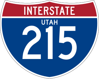
Interstate 215 (I-215), also known locally as the Belt Route, is the only auxiliary Interstate in the U.S. state of Utah, forming a three-quarters loop around Salt Lake City and many of its suburbs. The route begins at the mouth of Parley's Canyon at a junction with I-80 east of the city center, and heads south through the edge of the Salt Lake City metropolitan area's eastern suburbs of Millcreek, Holladay, and Cottonwood Heights. It continues west through Murray before turning north again, passing through the city's first-ring western suburbs of Taylorsville and West Valley City. It then enters North Salt Lake and Davis County for a short distance before reaching I-15 northwest of the city center.

State Route 171 (SR-171) is a state highway in the Salt Lake City metropolitan area in northern Utah that runs from SR-111 in Magna in the west side of the city to Interstate 215 in the city of Millcreek in the eastern part valley. In its sixteen-mile span, the route is named 3500 South and 3300 South.
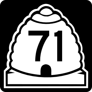
State Route 71 (SR-71) is a state highway completely within the Salt Lake City metropolitan area in the northern portion of the US state of Utah. It runs from SR-154 in the southwest side of the city to SR-186 in Downtown Salt Lake City. The route spans 22.47 miles (36.16 km) as it runs along portions of 12600 South, 12300 South, 900 East, and 700 East streets.
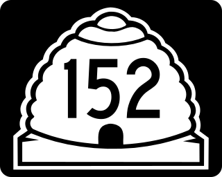
State Route 152 (SR-152) is a state highway in the suburbs of Salt Lake City, Utah connecting SR-71 in Murray to I-215 and city-maintained Highland Drive in Cottonwood Heights, though for almost all of its length it forms the border between Murray and Holladay. The route, which is 3.04 miles (4.89 km), is laid on the entire length of the Van Winkle Expressway and a portion of Highland Drive.
The Red Line is a light rail line on the TRAX system in the Salt Lake Valley of Utah operated by the Utah Transit Authority (UTA). It originally began operation in December 2001 as the peak-hour-only Sandy/University Line, running from the University of Utah south to Sandy Civic Center on the Blue Line. It was later rerouted to South Jordan and renamed the Red Line in August 2011, running as an all-day route. The current line runs from the University of Utah Medical Center in Salt Lake City through the south end of Downtown Salt Lake City, South Salt Lake, Murray, Midvale, West Jordan, and South Jordan to the University of Utah's South Jordan Medical Center in Daybreak.

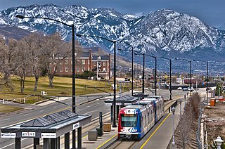
Murray Central station is a light rail and commuter rail station in Murray, Utah, United States that is served by the Blue and Red lines of Utah Transit Authority's (UTA) TRAX light rail system that operates in Salt Lake County and FrontRunner, which operates along the Wasatch Front with service from Ogden in central Weber County through Davis County, Salt Lake City, and Salt Lake County to Provo in central Utah County. It is part of the FrontRunner South extension. The Blue Line provides service from Downtown Salt Lake City south to Draper, while the Red Line provides service from the University of Utah to the Daybreak community of South Jordan.
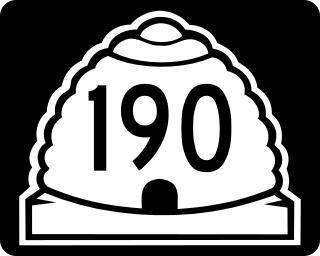
State Route 190 (SR-190) or the Big Cottonwood Canyon Scenic Byway is primarily an east and west state highway and scenic highway in eastern Salt Lake County, Utah, United States, that begins at Interstate 215 (I-215), runs through Big Cottonwood Canyon, and ends at the Salt Lake and Wasatch county line.
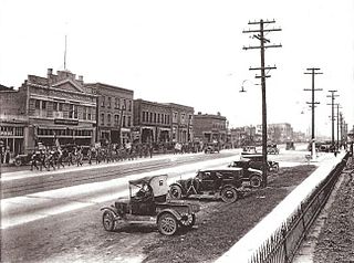
The Murray Downtown Historic District is located in the historic city center of Murray, Salt Lake County, Utah. It was listed on the National Register of Historic Places in 2006, with a boundary increase in 2020.

The Warenski-Duvall Commercial Building and Apartments, built in 1915, is a two-story brick, two part commercial block that is listed in National Register of Historic Places. The building is significant for its role in the early urbanization of Murray, Utah. The Warenski-Duvall building represents a building-type common during the early-twentieth century development of Murray's commercial business district and it is also part of the Murray Downtown Historic District. The building's owner was Edward J. Warenski, an early resident of Murray who owned a saloon and grocery store on State Street. Warenski and his family lived just north of the store. In 1923, the Duvall family purchased the building and divided the upper floor into apartments where family members and other workers in downtown Murray lived.

Built in 1909, the Murray LDS Second Ward Meetinghouse is a historic building in Murray, Utah, United States. It was listed on the National Register of Historic Places in 2001. The building is significant for its association with the history and development of Murray between 1909 and 1950.

Main Street is the most important commercial street in Salt Lake City, Utah, United States though it also extends south into the cities of South Salt Lake, Millcreek, and Murray. Its commercial importance is almost totally derived from the few blocks of the street which are immediately south of Temple Square that have attracted banks, major retailers, and heavy foot traffic throughout Salt Lake City's history; the long southern extension of Main Street south of about 500 and 600 South, in contrast, is always in the shadow of State Street, which is more designed for the long-distance automobile traffic that is common away from downtown.
State Street is a wide 17.3-mile-long (27.8 km) street in Salt Lake County, Utah leading almost straight south from the steps of the Utah State Capitol Building, through Salt Lake City, South Salt Lake, Millcreek, Murray, eastern Midvale, Sandy, and northwestern Draper. Because it follows the most direct route from downtown Salt Lake City to the Point of the Mountain pass to Utah County, it was the undisputed main road south from Salt Lake City until Interstate 15 (I-15) was built to the west. It retains the U.S. Highway 89 designation for all but the northernmost seven blocks despite I-15's proximity. Due to its history as a route for long-distance travel, travel within the Wasatch Front region, and travel between the cities along the east side of the Jordan River, it has attracted a wide variety of retail and service businesses along its entire length, creating a nearly continuous commercial axis for the Salt Lake Valley.
The Midvalley Express (MVX), originally known as the Taylorsville-Murray BRT and later as Midvalley Connector) is an under construction bus rapid transit (BRT) line anticipated to run between Murray and West Valley City in Utah, United States, that will be operated by the Utah Transit Authority (UTA). It will connect the main campus of Salt Lake Community College (SLCC) in Taylorsville with both the TRAX light rail system and the FrontRunner commuter rail. It is the fourth of several BRT lines that UTA is planning along the Wasatch Front. Bus Rapid Transit is described by UTA as "light rail on rubber tires".

Yalecrest is an affluent residential neighborhood located on the East Bench of Salt Lake City and is known for the architectural variety and rare collection of turn-of-the-century homes – all within a six block radius bordered by the South Side of Sunnyside Avenue, North Side of 1300 South, East Side of 1300 East and West Side of 1900 East. Yalecrest is commonly referred to as the "Harvard-Yale area" and several streets are named after Ivy League universities. It is a remarkably visually cohesive area with uniform setbacks, historic houses of the same era with comparable massing and landscaping, as well as streets lined with mature shade trees, and a surprising level of contributing structures that retain their historic integrity. Yalecrest contains 1,487 homes that were built in the early 20th century starting as early as 1912 with the vast majority (74%) built during the period of 1920–1940. The remaining homes in the easternmost part of the neighborhood were built during the post war boom. Yalecrest has the largest concentration of period revival English Cottages, English Tudors, French Norman and Spanish Colonial homes anywhere in Utah. These houses exhibit a variety of period revival styles with the largest portion being English Tudor and English Cottage. According to the Salt Lake City Planning Department, the architectural variety and concentration of period cottages found in Yalecrest are "unrivalled in the state." Examples from Yalecrest are used to illustrate period revival cottages styles in the only statewide architectural style manual. There are 22 subdivisions which were platted and built by the prominent architects and developers of the day responsible for early 20th Century east side Salt Lake City development.. Yalecrest has been on the National Register of Historic Places since November 8, 2007. One home in the neighborhood, the George Albert Smith home at 1302 Yale Avenue, is listed on the National Register since 1993.

