The Cree are one of the largest groups of First Nations in North America.

The Qu'Appelle River is a Canadian river that flows 430 kilometres (270 mi) east from Lake Diefenbaker in southwestern Saskatchewan to join the Assiniboine River in Manitoba, just south of Lake of the Prairies, near the village of St. Lazare.
Treaty Five is a treaty that was first established in September, 1875, between Queen Victoria and Saulteaux and Swampy Cree non-treaty band governments and peoples around Lake Winnipeg in the District of Keewatin. Much of what is today central and northern Manitoba was covered by the treaty, as were a few small adjoining portions of the present-day provinces of Saskatchewan and Ontario. The Treaty was completed in two rounds. The first was from September 1875 to September 1876. The Crown intended in 1875 to include only "the Indians [east and west] of Lake Winnipeg for the surrender of the Territory uncovered by previous treaties" including "the proposed migration of the Norway House band". Pimicikamak territory was north of the lake. It was included by accident or design of Tepastenam attending the Norway House signing. Additional peoples and groups signed on between 1908 and 1910.
Yellow Quill First Nation is a Saulteaux First Nation band government in Saskatchewan, Canada. Their reserve is twelve miles northwest of Kelvington. The Yellow Quill First Nation is a signatory of Treaty No. 4, which was signed by Chief Yellow-quill on August 24, 1876.

Treaty 4 is a treaty established between Queen Victoria and the Cree and Saulteaux First Nation band governments. The area covered by Treaty 4 represents most of current day southern Saskatchewan, plus small portions of what are today western Manitoba and southeastern Alberta. This treaty is also called the "Qu'Appelle Treaty," as its first signings were conducted at Fort Qu'Appelle, North-West Territories, on 15 September 1874. Additional signings or adhesions continued until September 1877. This treaty is the only indigenous treaty in Canada that has a corresponding indigenous interpretation.
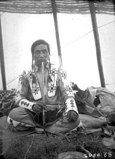
Noel Victor Starblanket was a Canadian politician. For two terms from 1976 to 1980 he was chief of the National Indian Brotherhood.

The Pine Creek First Nation is a Saulteaux First Nation in Manitoba, Canada. The First Nation's homeland is Pine Creek 66A Reserve, located approximately 110 kilometres north of Dauphin along the southwestern shore of Lake Winnipegosis between the communities of Camperville and Duck Bay. The Rural Municipality of Mountain (South) borders it on the southwest.
Muskowekwan First Nation is a Saulteaux (Ojibway) First Nation who inhabit approximately 100 km northwest of Melville, Saskatchewan, Canada. As of May, 2008, the First Nation has 1,517 registered people, of which their on-Reserve population was 400.

Cowessess First Nation is a Saulteaux First Nation in southern Saskatchewan, Canada. Their reserves include:
Fishing Lake First Nation is a First Nation of the Saulteaux branch of the Ojibwe nation. The band can trace their origins to central Canada, and were pushed westward to avoid encroachment by European settlers. The First Nation was originally part of the Yellow-quill Saulteaux Band, a Treaty Band named after a Treaty 4 signatory Chief Ošāwaškokwanēpi, whose name means "Green/Blue-quill." However, due to "š" merging with "s" in Nakawēmowin, this led to a mistranslation of his name as "Yellow-quill"—"yellow" being osāw-, while "green/blue" being ošāwaško-. The band was given three reserves, at Fishing and Nut Lakes and Kinistino, Saskatchewan. The Fishing Lake Indian Reserve 89 was approximately 22,850 acres (92.5 km2). Soon after the death of Chief Ošāwaškokwanēpi, the Band divided into three groups, the Fishing Lake First Nation, the Yellow Quill First Nation, and the Kinistin Saulteaux Nation

The Kinistin Saulteaux Nation is a Saulteaux band government in Saskatchewan. Their reserve is 39 kilometres (24 mi) southeast of Melfort. The Kinistin Saulteaux Nation is a signatory of Treaty No. 4, which was signed by Chief Yellow-quill on August 24, 1876.
The Sapotaweyak Cree Nation is a First Nations band government whose reserves are located in Central Manitoba north-east of Swan River. The community is mainly Cree, but has a mixture of Plains Cree, Swampy Cree and Saulteaux languages, a unique dialect shared with Wuskwi Sipihk First Nation to the southwest. They have a number of dispersed reserves, most of which are along the shores of Lake Winnipegosis. The main centre of the community is Shoal River Indian Reserve 65A, located adjacent to Pelican Rapids. About half the community's population resides on the reserve while the other half live off reserve.

The Cote First Nation is a Saulteaux First Nations band government in Kamsack, Saskatchewan. This Saulteaux reserve is connected to the Keeseekoose First Nation and only a couple of miles from the Key First Nation. Their land is situated just south of the boreal forest in the aspen parkland ecosystem of Canada. The Ojibwe of this region of Saskatchewan and Manitoba, were both hunters of the plains bison and hunters of the forests which were more abundant during the 19th century. They also fished the endless lakes and other waterways in their country. They seldom went hungry as a result of the large bison herds. However, by the 1870s, commercial hunting had reduced the bison to near extinction and the Ojibwe of Saskatchewan and Manitoba began to suffer from famine.
Saulteaux First Nation is an Anishinaabe First Nation band government, whose reserves are located near Cochin, Saskatchewan. In February 2012, the First Nation had a total of 1,225 registered members, of which 604 lived on their own reserve.
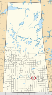
Star Blanket Cree Nation is a First Nations band government in Saskatchewan, Canada. Its reserves are in the Fort Qu'Appelle area. The Star Blanket Cree Nation is one of the bands covered by Treaty 4.
Gambler 63, officially Gambler Indian Reserve No. 63, is an Indian reserve in Manitoba, Canada, located 128 km northwest by north from Brandon, Manitoba. It is one of two reserves used by the Gambler First Nation, who also share Treaty Four Reserve Grounds Indian Reserve No. 77 near Fort Qu'Appelle, Saskatchewan with 23 other bands.

Carry the Kettle Nakoda Nation is a Nakota (Assiniboine) First Nation located approximately 80 km (50 mi) east of Regina, Saskatchewan, and 13 km (8.1 mi) south of Sintaluta, Saskatchewan. The reservation is in the Treaty 4 territory.