Nain, Virginia | |
---|---|
Coordinates: 39°14′21″N78°11′59″W / 39.23917°N 78.19972°W | |
Country | United States |
State | Virginia |
County | Frederick |
Time zone | UTC−5 (Eastern (EST)) |
• Summer (DST) | UTC−4 (EDT) |
GNIS feature ID | 1499785 [1] |
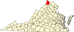
Nain is an unincorporated community in Frederick County, Virginia, United States. Nain is located northwest of Winchester along the North Frederick Pike (U.S. Highway 522). The community is situated within a gap in Little North Mountain and Flint Ridge.
Frederick is a city in and the county seat of Frederick County, Maryland, United States. It is located at an important crossroads at the intersection of a major north–south Native American trail and east–west routes to the Chesapeake Bay, both at Baltimore and what became Washington, D.C., and across the Appalachian mountains to the Ohio River watershed. Frederick's population was 78,171 people as of the 2020 census, making it the second-largest incorporated city in Maryland behind Baltimore. It is a part of the Washington metropolitan area, which is part of a greater Washington–Baltimore combined statistical area.
Nain may refer to:
Stephens City is an incorporated town in the southern part of Frederick County, Virginia, United States, with a population of 2,016 at the time of the 2020 census, and an estimated population of 2,096 in 2022. Founded by Peter Stephens in the 1730s, the colonial town was chartered and named for Lewis Stephens in October 1758. It was originally settled by German Protestants from Heidelberg. Stephens City is the second-oldest municipality in the Shenandoah Valley after nearby Winchester, which is about 5 mi (8 km) to the north. "Crossroads", the first free black community in the Valley in the pre-Civil War years, was founded east of town in the 1850s. Crossroads remained until the beginning of the Civil War when the freed African Americans either escaped or were recaptured. Stephens City was saved from intentional burning in 1864 by Union Major Joseph K. Stearns. The town has gone through several name changes in its history, starting as "Stephensburg", then "Newtown", and finally winding up as "Stephens City", though it nearly became "Pantops". Interstate 81 and U.S. Route 11 pass close to and through the town, respectively.
Point of Rocks is an unincorporated community and census-designated place (CDP) in Frederick County, Maryland, United States. As of the 2010 census it had a population of 1,466. It is named for the striking rock formation on the adjacent Catoctin Mountain, which was formed by the Potomac River cutting through the ridge in a water gap, a typical formation in the Appalachian Mountains. The formation is not visible from the town and can only be seen from boats on the river, or from the southern bank of the river in Virginia.
The Washington–Baltimore combined statistical area is a statistical area including two overlapping metropolitan areas, Washington, D.C., and Baltimore, Maryland. The region includes Central Maryland, Northern Virginia, three counties in the Eastern Panhandle of West Virginia, and one county in South Central Pennsylvania. It is the most educated, highest-income, and third-largest combined statistical area in the United States behind New York–Newark and Los Angeles–Long Beach.
U.S. Route 522 is a spur route of US 22 in the states of Virginia, West Virginia, Maryland, and Pennsylvania. The U.S. Highway travels in a north-south direction, and runs 308.59 miles (496.63 km) from US 60 near Powhatan, Virginia, to its northern terminus at US 11 and US 15 near Selinsgrove, Pennsylvania. US 522 serves many small cities and towns in the Piedmont, Blue Ridge Mountains, and northern Shenandoah Valley of Virginia. The highway serves the Virginia communities of Goochland, Mineral, Culpeper, the town of Washington, and Front Royal and the independent city of Winchester. US 522 then follows the Ridge-and-Valley Appalachians north and then east through the Eastern Panhandle of West Virginia, a 2-mile-wide (3.2 km) stretch of Western Maryland, and South Central Pennsylvania to its terminus in the Susquehanna Valley. The highway serves Berkeley Springs, West Virginia; Hancock, Maryland; and the Pennsylvania communities of McConnellsburg, Mount Union, Lewistown, and Middleburg.
U.S. Route 340 is a spur route of US 40, and runs from Greenville, Virginia, to Frederick, Maryland. In Virginia, it runs north–south, parallel and east of US 11, from US 11 north of Greenville via Waynesboro, Grottoes, Elkton, Luray, Front Royal, and Berryville to the West Virginia state line. A short separate piece crosses northern Loudoun County on its way from West Virginia to Maryland.
Nain is the northernmost permanent settlement in the Canadian province of Newfoundland and Labrador, within the Nunatsiavut region, located about 370 km (230 mi) by air from Happy Valley-Goose Bay. The town was established as a Moravian mission in 1771 by Jens Haven and other missionaries. As of 2021, the population is 1,204 mostly Inuit and mixed Inuit-European. Nain is the administrative capital of the autonomous region of Nunatsiavut.
Back Creek is a 59.5-mile-long (95.8 km) tributary of the Potomac River that flows north from Frederick County, Virginia, to Berkeley County in West Virginia's Eastern Panhandle. Back Creek originates along Frederick County's border with Hampshire County, West Virginia, at Farmer's Gap in the Great North Mountain. Its name reflects its location to the west of North Mountain. The perspective of colonists from the east in the 18th century led them to call it "Back Creek", because it lay to the back of North Mountain.
Sleepy Creek is a 44.0-mile-long (70.8 km) tributary of the Potomac River in the United States, belonging to the Chesapeake Bay's watershed. The stream rises in Frederick County, Virginia, and flows through Morgan County, West Virginia before joining the Potomac near the community of Sleepy Creek.
Gainesboro is an unincorporated community in Frederick County, Virginia. Gainesboro is located northwest of Winchester off the North Frederick Pike on Gainesboro Road. Gainesboro is the northernmost community in Virginia.
White Hall is an unincorporated farming community in northern Frederick County, Virginia, established in the late 1810s and located near the crossroads of Apple Pie Ridge Road with Green Spring and White Hall Roads, astride Apple Pie Ridge.
Green Spring is an unincorporated community in northern Frederick County, Virginia, United States of America. Green Spring lies on the southern flank of North Mountain along Green Spring Run, a tributary stream of Back Creek. The community is located on Green Spring Road at its junction with Cedar Grove Road.
Reynolds Store is an unincorporated community in northern Frederick County, Virginia. Reynolds Store is located along the North Frederick Pike at its crossroads with Cumberland Trail Road and Reynolds Road. The post office of neighboring Cross Junction serves the community.
Albin is an unincorporated community in Frederick County, Virginia, United States. Albin lies to the northwest of Winchester on North Frederick Pike. It was also known as Bryarly.
Cross Junction is an unincorporated community in northern Frederick County, Virginia, United States. Cross Junction is located on the North Frederick Pike at its intersection with Collinsville Road. Cross Junction also encompasses the residential communities at Lake Holiday to the south.
Shawnee Land is a residential community in Frederick County, Virginia, United States. Shawnee Land is located on the eastern slopes of Great North Mountain. The U.S. Census Bureau defines it as a census-designated place, with a population of 1,873 as of 2010. In its past, Shawnee Land was a ski resort, with a number of slopes located on the eastern side of Great North Mountain. Shawnee Land thrived for a few years, but eventually the investors abandoned the project and the ski slopes were closed.
Rest is an unincorporated community in northern Frederick County, Virginia, United States. Rest is located along U.S. Route 11 south of the West Virginia state line with Berkeley County. The community of Ridgeway lies to its north.
U.S. Route 11 (US 11) is a north–south United States Numbered Highway in western Virginia. At 339 miles (546 km), it is the second longest numbered route and longest primarily north–south route in the state. It enters the state from Tennessee as the divided routes US 11E and US 11W at Bristol, roughly follows the West Virginia border through the Blue Ridge Mountains and Shenandoah Valley, and enters the Eastern Panhandle of West Virginia from Frederick County. Most of the route closely parallels I-81. From south to north, US 11 serves the cities and towns of Bristol, Abingdon, Wytheville, Christiansburg, Roanoke, Lexington, Staunton, Harrisonburg, Strasburg, and Winchester. As one of the original U.S. Highways, it was first designated through Virginia in 1926 and has largely followed the same route since. Prior to the construction of the Interstate Highway System, it was the primary long-distance route for traversing the western part of the state. Much of it roughly follows the Great Wagon Road, a colonial-era road that followed the Appalachian Mountains from Georgia to Pennsylvania.