National Register of Historic Places listings in Glacier National Park

Last updated

This is a list of the National Register of Historic Places listings in Glacier National Park.

Contents

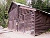
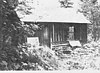
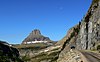
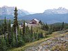
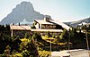
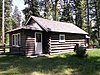
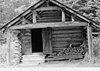
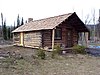
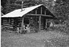
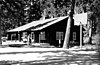
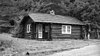
This is intended to be a complete list of the properties and districts on the National Register of Historic Places in Glacier National Park, United States. The locations of National Register properties and districts for which the latitude and longitude coordinates are included below, may be seen in a Google map. [1]

There are 94 properties and districts listed on the National Register in the park, three of which are National Historic Landmarks.

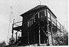
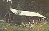
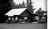
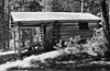
There are more than 700 historic structures in the park, though. The National Park Service's "Ranger Melissa", host of Science Fridays series, introduces architectural historian Kim Hyatt, to introduce the topic and show a number of examples, in a 10 minute film available here or here. [2] It starts with coverage of the Margaret McCarthy Homestead. [2]


    This National Park Service list is complete through NPS recent listings posted September 1, 2023. [3]

Map all coordinates using: OpenStreetMap

Current listings

[4] Name on the RegisterImageDate listed [5] Location City or townDescription
1 Apgar Fire Lookout
Apgar Fire Lookout Apgar Fire Lookout.jpg
Apgar Fire Lookout
December 16, 1986
(#86003695)
Near Lake McDonald
48°31′05″N114°01′10″W / 48.518056°N 114.019444°W / 48.518056; -114.019444 (Apgar Fire Lookout)
West Glacier
2 Alice Beck Cabin December 26, 2008
(#08001219)
South of Kelly's Camp Rd. and east of McDonald Creek in Glacier National Park
48°37′51″N113°52′05″W / 48.6308°N 113.8681°W / 48.6308; -113.8681 (Alice Beck Cabin)
Lake McDonald
3 Belly River Ranger Station Historic District
Belly River Ranger Station Historic District Belly River Ranger Station Barn.jpg
Belly River Ranger Station Historic District
February 14, 1986
(#86000329)
Head of Belly River Valley
48°55′56″N113°42′40″W / 48.932222°N 113.711111°W / 48.932222; -113.711111 (Belly River Ranger Station Historic District)
West Glacier
4 Bowman Lake Patrol Cabin
Bowman Lake Patrol Cabin Bowman Lake Patrol Cabin.jpg
Bowman Lake Patrol Cabin
February 14, 1986
(#86000340)
Lower end of Bowman Lake, ½ mile east of the Bowman Lake Ranger Station
48°49′40″N114°11′31″W / 48.827778°N 114.191944°W / 48.827778; -114.191944 (Bowman Lake Patrol Cabin)
West Glacier
5 Bowman Lake Road
Bowman Lake Road Bowman Lake Road MT NPS.jpg
Bowman Lake Road
January 19, 1996
(#95001565)
North Fork drainage between Polebridge and Bowman ranger stations in Glacier National Park
48°49′39″N114°12′08″W / 48.8275°N 114.202222°W / 48.8275; -114.202222 (Bowman Lake Road)
West Glacier
6 Bull Head Lodge and Studio February 6, 1984
(#84002465)
Off Going-to-the-Sun Road
48°31′58″N113°59′45″W / 48.532778°N 113.995833°W / 48.532778; -113.995833 (Bull Head Lodge and Studio)
Apgar Summer home of artist Charles M. Russell
7 Camas Creek Cutoff Road
Camas Creek Cutoff Road GlacierNP CamasCreekRoad.jpg
Camas Creek Cutoff Road
July 11, 2014
(#14000393)
Glacier National Park
48°32′26″N114°00′01″W / 48.5406°N 114.0003°W / 48.5406; -114.0003 (Camas Creek Cutoff Road)
West Glacier
8 Cattle Queen Snowshoe Cabin July 1, 1999
(#99000778)
McDonald Subdistrict
48°48′38″N113°49′15″W / 48.810556°N 113.820833°W / 48.810556; -113.820833 (Cattle Queen Snowshoe Cabin)
West Glacier
9 Chief Mountain Border Station and Quarters
Chief Mountain Border Station and Quarters Chief Mountain Border Station and Quarters.jpg
Chief Mountain Border Station and Quarters
May 20, 2008
(#06000744)
Montana Highway 17 at the Canada–US border in Glacier National Park
48°59′48″N113°39′33″W / 48.9967°N 113.6592°W / 48.9967; -113.6592 (Chief Mountain Border Station and Quarters)
Babb
10 Coal Creek Patrol Cabin
Coal Creek Patrol Cabin Coal Creek Patrol Cabin.jpg
Coal Creek Patrol Cabin
July 1, 1999
(#99000777)
U.S. Route 2
48°25′00″N113°38′56″W / 48.416667°N 113.648889°W / 48.416667; -113.648889 (Coal Creek Patrol Cabin)
West Glacier
11 Cut Bank Ranger Station Historic District
Cut Bank Ranger Station Historic District Cut Bank Ranger Station.jpg
Cut Bank Ranger Station Historic District
January 19, 1996
(#95001566)
Northern side of Cut Bank Creek in Glacier National Park
48°36′22″N113°22′34″W / 48.606111°N 113.376111°W / 48.606111; -113.376111 (Cut Bank Ranger Station Historic District)
East Glacier
12 DESMET (Boat)
DESMET (Boat) GlacierNP DeSmet.jpg
DESMET (Boat)
December 14, 2017
(#100001896)
Lake McDonald, Glacier National Park
48°37′04″N113°52′47″W / 48.617898°N 113.879732°W / 48.617898; -113.879732 (DESMET (Boat))
West Glacier
13 Fielding Snowshoe Patrol Cabin
Fielding Snowshoe Patrol Cabin Fielding Snowshoe Patrol Cabin MT NPS.jpg
Fielding Snowshoe Patrol Cabin
February 14, 1986
(#86000341)
Off U.S. Route 2
48°17′11″N113°27′22″W / 48.286389°N 113.456111°W / 48.286389; -113.456111 (Fielding Snowshoe Patrol Cabin)
West Glacier
14 Fish Creek Bay Boathouse
Fish Creek Bay Boathouse Fish Creek Bay Boathouse MT NPS.jpg
Fish Creek Bay Boathouse
January 19, 1996
(#95001567)
Fish Creek Campground on the western shore of Lake McDonald in Glacier National Park
48°33′04″N113°58′48″W / 48.551111°N 113.98°W / 48.551111; -113.98 (Fish Creek Bay Boathouse)
West Glacier
15 Ford Creek Patrol Cabin
Ford Creek Patrol Cabin Ford Creek Patrol Cabin.jpg
Ford Creek Patrol Cabin
February 14, 1986
(#86000342)
Glacier Route 7
48°37′33″N113°56′36″W / 48.625833°N 113.943333°W / 48.625833; -113.943333 (Ford Creek Patrol Cabin)
West Glacier
16 Glacier National Park Tourist Trails-Inside Trail, South Circle, North Circle
Glacier National Park Tourist Trails-Inside Trail, South Circle, North Circle GraniteParkChalet1.jpg
Glacier National Park Tourist Trails-Inside Trail, South Circle, North Circle
January 19, 1996
(#95001579)
Inside Trail, South Circle and North Circle Trails
48°41′41″N113°33′46″W / 48.694722°N 113.562778°W / 48.694722; -113.562778 (Glacier National Park Tourist Trails-Inside Trail, South Circle, North Circle)
St. Mary
17 Goathaunt Bunkhouse
Goathaunt Bunkhouse Goathaunt bunkhouse.jpg
Goathaunt Bunkhouse
January 19, 1996
(#95001568)
Southern end of Waterton Lake in Glacier National Park
48°57′39″N113°53′53″W / 48.960833°N 113.898056°W / 48.960833; -113.898056 (Goathaunt Bunkhouse)
St. Mary
18 Going-to-the-Sun Road
Going-to-the-Sun Road Going to the Sun Road with Going to the Sun Mountain.jpg
Going-to-the-Sun Road
June 16, 1983
(#83001070)
Glacier Route 1
48°38′48″N113°46′48″W / 48.646667°N 113.78°W / 48.646667; -113.78 (Going-to-the-Sun Road)
West Glacier Extends into Flathead County. National Historic Landmark.
19 Going-to-the-Sun Road
Going-to-the-Sun Road Going-to-the-Sun Road-27527-2.jpg
Going-to-the-Sun Road
February 18, 1997
(#83001070)
Glacier National Park
48°38′01″N113°47′15″W / 48.633611°N 113.7875°W / 48.633611; -113.7875 (Going-to-the-Sun Road)
West Glacier Extends into Glacier County
20 Granite Park Chalet
Granite Park Chalet Granite Park Chalet.jpg
Granite Park Chalet
June 27, 1983
(#83001060)
Glacier National Park
48°46′12″N113°46′11″W / 48.77°N 113.769722°W / 48.77; -113.769722 (Granite Park Chalet)
West Glacier
21 Great Northern Railway Buildings
Great Northern Railway Buildings Granite Park Chalet.jpg
Great Northern Railway Buildings
May 28, 1987
(#87001453)
Glacier National Park
48°38′29″N113°32′17″W / 48.641389°N 113.538056°W / 48.641389; -113.538056 (Great Northern Railway Buildings)
Glacier National Park National Historic Landmark.
22 Greve's Tourist Cabins
Greve's Tourist Cabins Greves Tourist Cabins Dora Crump Cabin NPS.jpg
Greve's Tourist Cabins
December 26, 2008
(#08001222)
Western side of Going-to-the-Sun Road in Glacier National Park
48°37′25″N113°52′16″W / 48.6237°N 113.8711°W / 48.6237; -113.8711 (Greve's Tourist Cabins)
Lake McDonald
23 Gunsight Pass Shelter
Gunsight Pass Shelter Gunsight Pass Shelter.jpg
Gunsight Pass Shelter
February 14, 1986
(#86000344)
Junction of Gunsight Pass Trail and the Continental Divide
48°36′34″N113°44′16″W / 48.609444°N 113.737778°W / 48.609444; -113.737778 (Gunsight Pass Shelter)
West Glacier
24 Harrison Lake Patrol Cabin
Harrison Lake Patrol Cabin Harrison Lake Patrol Cabin NPS.jpg
Harrison Lake Patrol Cabin
February 16, 2001
(#01000116)
U.S. Route 2
48°31′39″N113°45′18″W / 48.5275°N 113.755°W / 48.5275; -113.755 (Harrison Lake Patrol Cabin)
Glacier National Park
25 Headquarters Historic District
Headquarters Historic District Headquarters HD Residence 1, Glacier NP.jpg
Headquarters Historic District
January 19, 1996
(#95001569)
East of Glacier Route 1 at the crossing of the Middle Fork of the Flathead River in Glacier National Park
48°30′06″N113°58′47″W / 48.501667°N 113.979722°W / 48.501667; -113.979722 (Headquarters Historic District)
West Glacier
26 Heaven's Peak Fire Lookout
Heaven's Peak Fire Lookout Heaven's Peak Fire Lookout.jpg
Heaven's Peak Fire Lookout
December 19, 1986
(#86003688)
Mount Cannon
48°31′05″N114°01′10″W / 48.518056°N 114.019444°W / 48.518056; -114.019444 (Heaven's Peak Fire Lookout)
West Glacier
27 Howes' Lake McDonald Cottage Sites Historic District
Howes' Lake McDonald Cottage Sites Historic District GlacierNP HowesLakeMcDonaldCottagesHD2.jpg
Howes' Lake McDonald Cottage Sites Historic District
December 26, 2008
(#08001223)
Northern side of Apgar Loop Rd. in Glacier National Park
48°31′39″N113°59′17″W / 48.5275°N 113.988°W / 48.5275; -113.988 (Howes' Lake McDonald Cottage Sites Historic District)
West Glacier
28 Huckleberry Fire Outlook
Huckleberry Fire Outlook Huckleberry Fire Lookout.jpg
Huckleberry Fire Outlook
February 14, 1986
(#86000346)
Summit of Huckleberry Mountain
48°36′01″N114°08′01″W / 48.600278°N 114.133611°W / 48.600278; -114.133611 (Huckleberry Fire Outlook)
West Glacier
29 Kelly's Camp Historic District
Kelly's Camp Historic District KELLY'S CAMP HISTORIC DISTRICT, FLATHEAD COUNTY, MONTANA.jpg
Kelly's Camp Historic District
December 23, 2009
(#08001224)
South of Kelly's Camp Rd. between Kelly's Creek and south of cabins in Glacier National Park
48°37′36″N113°54′06″W / 48.6267°N 113.9017°W / 48.6267; -113.9017 (Kelly's Camp Historic District)
Lake McDonald
30 Kintla Lake Ranger Station
Kintla Lake Ranger Station Kintla Lake Ranger Station.jpg
Kintla Lake Ranger Station
February 14, 1986
(#86000332)
Southern shore of Kintla Lake
48°56′04″N114°20′25″W / 48.934444°N 114.340278°W / 48.934444; -114.340278 (Kintla Lake Ranger Station)
West Glacier
31 Kishenehn Ranger Station Historic District
Kishenehn Ranger Station Historic District Kishenehn Ranger Station.jpg
Kishenehn Ranger Station Historic District
February 14, 1986
(#86000335)
3 miles south of the Canada–US border near the confluence of the northern fork of the Flathead River and Kishenehn Creek
48°57′37″N114°25′14″W / 48.960278°N 114.420556°W / 48.960278; -114.420556 (Kishenehn Ranger Station Historic District)
West Glacier
32 Kootenai Creek Snowshoe Cabin
Kootenai Creek Snowshoe Cabin Kootenai Creek Snowshoe Cabin.jpg
Kootenai Creek Snowshoe Cabin
July 1, 1999
(#99000775)
Flattop Mountain along Kootenai Creek
48°51′55″N113°54′28″W / 48.865278°N 113.907778°W / 48.865278; -113.907778 (Kootenai Creek Snowshoe Cabin)
St. Mary
33 Lake McDonald Lodge Coffee Shop
Lake McDonald Lodge Coffee Shop Lak3e McDonald Coffee Shop MT1.jpg
Lake McDonald Lodge Coffee Shop
October 14, 2008
(#08001014)
Lake McDonald Lodge Boulevard
48°37′04″N113°52′35″W / 48.6177°N 113.8764°W / 48.6177; -113.8764 (Lake McDonald Lodge Coffee Shop)
Lake McDonald
34 Lake McDonald Lodge
Lake McDonald Lodge Lake McDonald Lodge exterior GNP1.jpg
Lake McDonald Lodge
May 28, 1987
(#87001447)
Off Going-to-the-Sun Road
48°37′02″N113°52′41″W / 48.617222°N 113.878056°W / 48.617222; -113.878056 (Lake McDonald Lodge)
West Glacier National Historic Landmark.
35 Lake McDonald Lodge Historic District
Lake McDonald Lodge Historic District Garden Court in the Lake McDonald Lodge HD MT1.jpg
Lake McDonald Lodge Historic District
May 22, 1978
(#78000280)
Off Going-to-the-Sun Road
48°37′02″N113°52′41″W / 48.617222°N 113.878056°W / 48.617222; -113.878056 (Lake McDonald Lodge Historic District)
West Glacier
36 Lee Creek Snowshoe Cabin
Lee Creek Snowshoe Cabin Lee Creek Snowshoe Cabin.jpg
Lee Creek Snowshoe Cabin
March 2, 2001
(#01000203)
Northeastern corner of Glacier National Park
48°59′10″N113°37′20″W / 48.986111°N 113.622222°W / 48.986111; -113.622222 (Lee Creek Snowshoe Cabin)
Glacier National Park
37 Lincoln Creek Snowshoe Cabin February 2, 2001
(#01000037)
U.S. Route 2
48°29′53″N113°52′41″W / 48.498056°N 113.878056°W / 48.498056; -113.878056 (Lincoln Creek Snowshoe Cabin)
West Glacier
38 Little Chief (boat)
Little Chief (boat) GlacierNP LittleChief.jpg
Little Chief (boat)
December 14, 2017
(#100001897)
Two Medicine Lake, Glacier National Park
48°41′27″N113°31′30″W / 48.690813°N 113.525111°W / 48.690813; -113.525111 (Little Chief (boat))
East Glacier Park vicinityDuplicate listing for Rising Wolf, below.
39 Logan Creek Patrol Cabin
Logan Creek Patrol Cabin Logan Creek Patrol Cabin.jpg
Logan Creek Patrol Cabin
February 14, 1986
(#86000348)
Eastern side of Going-to-the-Sun Road at the crossing of Logan Creek
48°43′25″N113°45′48″W / 48.723611°N 113.763333°W / 48.723611; -113.763333 (Logan Creek Patrol Cabin)
West Glacier
40 Logan Pass Visitor Center
Logan Pass Visitor Center Logan Pass Visitor Center.jpg
Logan Pass Visitor Center
April 15, 2008
(#08000334)
Going-to-the-Sun Rd., 18 miles west of U.S. Route 89
48°41′43″N113°43′04″W / 48.6953°N 113.7178°W / 48.6953; -113.7178 (Logan Pass Visitor Center)
St. Mary
41 Logging Creek Ranger Station Historic District
Logging Creek Ranger Station Historic District Logging Creek Ranger Station.jpg
Logging Creek Ranger Station Historic District
December 16, 1986
(#86003697)
Glacier Route 7 near Logging Creek
48°41′51″N114°11′34″W / 48.6975°N 114.192778°W / 48.6975; -114.192778 (Logging Creek Ranger Station Historic District)
West Glacier
42 Loneman Fire Lookout
Loneman Fire Lookout Loneman Fire Lookout.jpg
Loneman Fire Lookout
February 14, 1986
(#86000353)
Access via Loneman Mountain Trail
48°29′21″N113°46′04″W / 48.489167°N 113.767778°W / 48.489167; -113.767778 (Loneman Fire Lookout)
West Glacier
43 Lower Logging Lake Snowshoe Cabin and Boathouse
Lower Logging Lake Snowshoe Cabin and Boathouse Lower Logging Lake Boathouse.jpg
Lower Logging Lake Snowshoe Cabin and Boathouse
December 16, 1986
(#86003692)
Near the foot of Logging Lake
48°44′26″N114°07′47″W / 48.7406°N 114.1296°W / 48.7406; -114.1296 (Lower Logging Lake Snowshoe Cabin and Boathouse)
West Glacier
44 Lower Nyack Snowshoe Cabin
Lower Nyack Snowshoe Cabin Lower Nyack Snowshoe Cabin.jpg
Lower Nyack Snowshoe Cabin
February 14, 1986
(#86000356)
Western side of Nyack Creek Trail
48°29′47″N113°41′16″W / 48.496389°N 113.687778°W / 48.496389; -113.687778 (Lower Nyack Snowshoe Cabin)
West Glacier
45 Lower Park Creek Patrol Cabin
Lower Park Creek Patrol Cabin Lower Park Creek Patrol Cabin.jpg
Lower Park Creek Patrol Cabin
December 16, 1986
(#86003701)
Eastern side of Park Creek Trail past the crossing of Fielding-Coal Creek Trail
48°20′08″N113°32′37″W / 48.335556°N 113.543611°W / 48.335556; -113.543611 (Lower Park Creek Patrol Cabin)
West Glacier
46 Margaret McCarthy Homestead
Margaret McCarthy Homestead McCarthy Homestead Cabin.jpg
Margaret McCarthy Homestead
July 21, 1988
(#88001095)
Glacier National Park
48°48′27″N114°19′20″W / 48.8075°N 114.322222°W / 48.8075; -114.322222 (Margaret McCarthy Homestead)
Big Prairie Duplicate listing of McCarthy Homestead Cabin
47 McCarthy Homestead Cabin
McCarthy Homestead Cabin McCarthy Homestead Cabin.jpg
McCarthy Homestead Cabin
December 16, 1986
(#86003691)
On the northern fork of the Flathead River
48°48′27″N114°19′21″W / 48.8075°N 114.3225°W / 48.8075; -114.3225 (McCarthy Homestead Cabin)
West Glacier Duplicate listing of Margaret McCarthy Homestead
48 Many Glacier Barn and Bunkhouse
Many Glacier Barn and Bunkhouse Many Glacier Barn.jpg
Many Glacier Barn and Bunkhouse
January 19, 1996
(#95001570)
Glacier Route 3 at Apikuni Flat in Glacier National Park
48°48′04″N113°38′33″W / 48.801111°N 113.6425°W / 48.801111; -113.6425 (Many Glacier Barn and Bunkhouse)
St. Mary
49 Many Glacier Campground Camptender's Cabin
Many Glacier Campground Camptender's Cabin Many Glacier Camptender's Cabin.jpg
Many Glacier Campground Camptender's Cabin
January 19, 1996
(#95001571)
Many Glacier in Glacier National Park
48°47′49″N113°40′37″W / 48.796944°N 113.676944°W / 48.796944; -113.676944 (Many Glacier Campground Camptender's Cabin)
St. Mary
50 Many Glacier Hotel Historic District
Many Glacier Hotel Historic District Many glacier hotel.jpg
Many Glacier Hotel Historic District
January 19, 1996
(#76000173)
West of Babb
48°47′54″N113°39′12″W / 48.798333°N 113.653333°W / 48.798333; -113.653333 (Many Glacier Hotel Historic District)
Babb
51 J.K. Miller Homestead
J.K. Miller Homestead Miller Homestead Glacier NP NPS.jpg
J.K. Miller Homestead
July 21, 1988
(#88001092)
Glacier National Park
48°50′11″N114°19′44″W / 48.836389°N 114.328889°W / 48.836389; -114.328889 (J.K. Miller Homestead)
Big Prairie
52 Morning Eagle (carvel-planked wooden vessel)
Morning Eagle (carvel-planked wooden vessel) Lake Josephine (4119263963).jpg
Morning Eagle (carvel-planked wooden vessel)
July 23, 2018
(#100002691)
Josephine L., Glacier NP
48°47′15″N113°40′10″W / 48.7874°N 113.6694°W / 48.7874; -113.6694 (Morning Eagle (carvel-planked wooden vessel))
Babb part of the Glacier National Park MRA
53 Mount Brown Fire Lookout
Mount Brown Fire Lookout Mount Brown Fire Lookout Station.jpg
Mount Brown Fire Lookout
December 16, 1986
(#86003693)
Off Route 1 near Snyder Lake
48°37′44″N113°49′58″W / 48.628889°N 113.832778°W / 48.628889; -113.832778 (Mount Brown Fire Lookout)
West Glacier
54 North Fork Road
North Fork Road North Fork Truck Trail.jpg
North Fork Road
January 19, 1996
(#95001572)
North Fork drainage, Fish Creek to Kintla Lake in Glacier National Park
48°32′53″N113°59′11″W / 48.548056°N 113.986389°W / 48.548056; -113.986389 (North Fork Road)
West Glacier
55 Numa Ridge Fire Lookout
Numa Ridge Fire Lookout Numa Ridge Fire Lookout.jpg
Numa Ridge Fire Lookout
February 14, 1986
(#86000357)
Near Bowman Lake
48°53′01″N114°10′43″W / 48.883611°N 114.178611°W / 48.883611; -114.178611 (Numa Ridge Fire Lookout)
West Glacier
56 Nyack Ranger Station Historic District
Nyack Ranger Station Historic District Nyack Ranger Station Barn.jpg
Nyack Ranger Station Historic District
February 14, 1986
(#86000359)
Nyack Ranger Station
48°26′24″N113°47′43″W / 48.44°N 113.795278°W / 48.44; -113.795278 (Nyack Ranger Station Historic District)
West Glacier
57 Pass Creek Snowshoe Cabin
Pass Creek Snowshoe Cabin Pass Creek Snowshoe Cabin.jpg
Pass Creek Snowshoe Cabin
December 19, 1986
(#86003689)
Confluence of the Waterton River and Pass Creek
48°53′47″N113°54′23″W / 48.896389°N 113.906389°W / 48.896389; -113.906389 (Pass Creek Snowshoe Cabin)
West Glacier
58 Polebridge Ranger Station Historic District
Polebridge Ranger Station Historic District Polebridge Ranger Station Residence.jpg
Polebridge Ranger Station Historic District
February 14, 1986
(#86000337)
Near the northeastern end of Henshaw Bridge on Route 7
48°46′56″N114°16′43″W / 48.782222°N 114.278611°W / 48.782222; -114.278611 (Polebridge Ranger Station Historic District)
West Glacier
59 Polebridge to Numa Ridge Phoneline
Polebridge to Numa Ridge Phoneline Polebridge-Numa Ridge Phoneline.jpg
Polebridge to Numa Ridge Phoneline
April 4, 1996
(#95001573)
North Fork drainage, Polebridge to Numa Ridge in Glacier National Park
48°49′59″N114°13′10″W / 48.833056°N 114.219444°W / 48.833056; -114.219444 (Polebridge to Numa Ridge Phoneline)
West Glacier
60 Ptarmigan Tunnel
Ptarmigan Tunnel Ptarmigan tunnel.jpg
Ptarmigan Tunnel
February 14, 1986
(#86000360)
North of Ptarmigan Lake
48°51′13″N113°42′24″W / 48.853611°N 113.706667°W / 48.853611; -113.706667 (Ptarmigan Tunnel)
West Glacier
61 Quartz Lake Patrol Cabin
Quartz Lake Patrol Cabin Quartz Lake Patrol Cabin.jpg
Quartz Lake Patrol Cabin
February 14, 1986
(#86000361)
Foot of Quartz Lake
48°49′19″N114°08′05″W / 48.821944°N 114.134722°W / 48.821944; -114.134722 (Quartz Lake Patrol Cabin)
West Glacier
62 William Raftery Homestead July 21, 1988
(#88001099)
Glacier National Park
48°48′34″N114°17′30″W / 48.809444°N 114.291667°W / 48.809444; -114.291667 (William Raftery Homestead)
Big Prairie
63 Rising Sun Auto Camp
Rising Sun Auto Camp Rising Sun General Store.jpg
Rising Sun Auto Camp
January 19, 1996
(#95001574)
500 feet north of Going-to-the-Sun Rd. at St. Mary Lake in Glacier National Park
48°41′46″N113°31′06″W / 48.696111°N 113.518333°W / 48.696111; -113.518333 (Rising Sun Auto Camp)
St. Mary
64 Rising Wolf
Rising Wolf GlacierNP LittleChief.jpg
Rising Wolf
November 14, 2016
(#16000772)
Glacier National Park
48°41′27″N113°31′30″W / 48.690813°N 113.525111°W / 48.690813; -113.525111 (Rising Wolf)
St. Mary 1926 boat plying St. Mary Lake, now called Little Chief. Duplicate listing above under "Little Chief".
65 Roes Creek Campground Camptender's Cabin
Roes Creek Campground Camptender's Cabin Roes Creek Camptender Cabin.jpg
Roes Creek Campground Camptender's Cabin
April 4, 1996
(#95001575)
North of Going-to-the-Sun Rd. at St. Mary Lake in Glacier National Park
48°41′39″N113°31′13″W / 48.694167°N 113.520278°W / 48.694167; -113.520278 (Roes Creek Campground Camptender's Cabin)
St. Mary
66 Saint Mary Ranger Station
Saint Mary Ranger Station St. Mary Ranger Station Glacier MT NPS.jpg
Saint Mary Ranger Station
February 14, 1986
(#86000367)
Eastern end of Upper Saint Mary Lake
48°44′16″N113°25′40″W / 48.737778°N 113.427778°W / 48.737778; -113.427778 (Saint Mary Ranger Station)
West Glacier
67 St. Mary Utility Area Historic District
St. Mary Utility Area Historic District St. Mary Utility Area residence.jpg
St. Mary Utility Area Historic District
January 19, 1996
(#95001576)
East of St. Mary at Divide Creek in Glacier National Park
48°44′17″N113°25′45″W / 48.738056°N 113.429167°W / 48.738056; -113.429167 (St. Mary Utility Area Historic District)
St. Mary
68 Saint Mary Visitor Center, Entrance Station and Checking Stations
Saint Mary Visitor Center, Entrance Station and Checking Stations Saint Mary Visitor Center.jpg
Saint Mary Visitor Center, Entrance Station and Checking Stations
April 15, 2008
(#08000335)
Going-to-the-Sun Rd., 5 miles east of U.S. Route 89
48°44′30″N113°26′21″W / 48.7417°N 113.4392°W / 48.7417; -113.4392 (Saint Mary Visitor Center, Entrance Station and Checking Stations)
St. Mary
69 Scalplock Mountain Fire Lookout February 14, 1986
(#86000363)
Accessible by trail connecting to Boundary Trail near the Walton Ranger Station
48°18′01″N113°34′24″W / 48.300278°N 113.573333°W / 48.300278; -113.573333 (Scalplock Mountain Fire Lookout)
West Glacier
70 Anton Schoenberger Homestead July 21, 1988
(#88001094)
Glacier National Park
48°48′34″N114°17′30″W / 48.809444°N 114.291667°W / 48.809444; -114.291667 (Anton Schoenberger Homestead)
Big Prairie
71 Charlie Schoenberger Homestead July 21, 1988
(#88001093)
Glacier National Park
48°48′31″N114°19′23″W / 48.808611°N 114.323056°W / 48.808611; -114.323056 (Charlie Schoenberger Homestead)
Big Prairie
72 Sherburne Ranger Station Historic District
Sherburne Ranger Station Historic District Sherburne Ranger Station.jpg
Sherburne Ranger Station Historic District
December 16, 1986
(#86003698)
Glacier Route 3 near Glacier Entrance
48°49′19″N113°34′45″W / 48.821944°N 113.579167°W / 48.821944; -113.579167 (Sherburne Ranger Station Historic District)
West Glacier
73 Sherwood Lodge December 26, 2008
(#08001226)
Grist Rd. in Glacier National Park
48°32′11″N113°59′45″W / 48.5364°N 113.9957°W / 48.5364; -113.9957 (Sherwood Lodge)
West Glacier
74 Skyland Camp-Bowman Lake Ranger Station
Skyland Camp-Bowman Lake Ranger Station Skyland-Bowman.jpg
Skyland Camp-Bowman Lake Ranger Station
February 14, 1986
(#86000365)
Southwestern shore of Bowman Lake
48°49′44″N114°12′13″W / 48.828889°N 114.203611°W / 48.828889; -114.203611 (Skyland Camp-Bowman Lake Ranger Station)
West Glacier
75 Slide Lake-Otatso Creek Patrol Cabin and Woodshed
Slide Lake-Otatso Creek Patrol Cabin and Woodshed Slide Lake-Otatso Creek Patrol Cabin and Woodshed.jpg
Slide Lake-Otatso Creek Patrol Cabin and Woodshed
February 14, 1986
(#86000370)
Northern side of Otatso Creek
48°54′36″N113°35′56″W / 48.91°N 113.598889°W / 48.91; -113.598889 (Slide Lake-Otatso Creek Patrol Cabin and Woodshed)
West Glacier
76 Sperry Chalet
Sperry Chalet SperryChaletBW.jpg
Sperry Chalet
August 2, 1977
(#77000115)
East of West Glacier
48°36′16″N113°47′03″W / 48.604444°N 113.784167°W / 48.604444; -113.784167 (Sperry Chalet)
West Glacier Destroyed by forest fire August 31, 2017
77 Stillwater Ranger Station Historic District
Stillwater Ranger Station Historic District Stillwater Ranger Station, Olney, MT.jpg
Stillwater Ranger Station Historic District
July 8, 1981
(#81000340)
U.S. Route 93
48°32′33″N114°34′03″W / 48.5425°N 114.5675°W / 48.5425; -114.5675 (Stillwater Ranger Station Historic District)
Olney
78 Sun Camp Fireguard Cabin
Sun Camp Fireguard Cabin Sun Camp Fireguard Cabin.jpg
Sun Camp Fireguard Cabin
July 1, 1999
(#99000776)
Going-to-the-Sun Rd.
48°41′11″N113°35′13″W / 48.686389°N 113.586944°W / 48.686389; -113.586944 (Sun Camp Fireguard Cabin)
St. Mary
79 Swanson Boathouse
Swanson Boathouse Swanson boathouse.jpg
Swanson Boathouse
January 19, 1996
(#95001577)
Eastern shore of Two Medicine Lake in Glacier National Park
48°28′59″N113°22′07″W / 48.483056°N 113.368611°W / 48.483056; -113.368611 (Swanson Boathouse)
East Glacier
80 Swiftcurrent Auto Camp Historic District
Swiftcurrent Auto Camp Historic District Swiftcurrent General Store.jpg
Swiftcurrent Auto Camp Historic District
January 19, 1996
(#95001578)
Western end of Glacier Route 3 in Glacier National Park
48°47′54″N113°40′33″W / 48.798333°N 113.675833°W / 48.798333; -113.675833 (Swiftcurrent Auto Camp Historic District)
Many Glacier
81 Swiftcurrent Fire Lookout
Swiftcurrent Fire Lookout Swiftcurrent Fire Lookout.jpg
Swiftcurrent Fire Lookout
December 16, 1986
(#86003694)
Near the Continental Garden Wall in the vicinity of Swiftcurrent Mountain
48°47′08″N113°45′58″W / 48.785556°N 113.766111°W / 48.785556; -113.766111 (Swiftcurrent Fire Lookout)
West Glacier
82 Swiftcurrent Ranger Station Historic District
Swiftcurrent Ranger Station Historic District Swiftcurrent Ranger Station.jpg
Swiftcurrent Ranger Station Historic District
December 19, 1986
(#86003690)
Off Route 3 near Swiftcurrent Lake
48°47′48″N113°40′26″W / 48.796667°N 113.673889°W / 48.796667; -113.673889 (Swiftcurrent Ranger Station Historic District)
West Glacier
83 Two Medicine Campground Camptender's Cabin
Two Medicine Campground Camptender's Cabin Two Medicine Camptender's Cabin.jpg
Two Medicine Campground Camptender's Cabin
January 19, 1996
(#95001580)
Two Medicine Lake in Glacier National Park
48°29′18″N113°21′54″W / 48.488333°N 113.365°W / 48.488333; -113.365 (Two Medicine Campground Camptender's Cabin)
East Glacier
84 Two Medicine General Store
Two Medicine General Store TwoMedicineStoreBW.jpg
Two Medicine General Store
February 14, 1986
(#86000372)
Eastern shore of Two Medicine Lake
48°29′06″N113°22′08″W / 48.485°N 113.368889°W / 48.485; -113.368889 (Two Medicine General Store)
West Glacier
85 Upper Kintla Lake Patrol Cabin
Upper Kintla Lake Patrol Cabin Upper Kintla Lake Patrol Cabin.jpg
Upper Kintla Lake Patrol Cabin
February 14, 1986
(#86000374)
Head of Kintla Lake
48°58′38″N114°14′47″W / 48.977222°N 114.246389°W / 48.977222; -114.246389 (Upper Kintla Lake Patrol Cabin)
West Glacier
86 Upper Lake McDonald Ranger Station Historic District
Upper Lake McDonald Ranger Station Historic District Upper Lake McDonald Ranger Station.jpg
Upper Lake McDonald Ranger Station Historic District
December 16, 1986
(#86003699)
Northern shore of Lake McDonald
48°38′23″N113°52′21″W / 48.639722°N 113.8725°W / 48.639722; -113.8725 (Upper Lake McDonald Ranger Station Historic District)
West Glacier
87 Upper Logging Lake Snowshoe Cabin
Upper Logging Lake Snowshoe Cabin Upper Logging Lake Snowshoe Cabin.jpg
Upper Logging Lake Snowshoe Cabin
February 14, 1986
(#86000376)
Near the head of Logging Lake
48°46′36″N114°01′22″W / 48.776667°N 114.022778°W / 48.776667; -114.022778 (Upper Logging Lake Snowshoe Cabin)
West Glacier
88 Upper Nyack Snowshoe Cabin
Upper Nyack Snowshoe Cabin Upper Nyack Snowshoe Cabin.jpg
Upper Nyack Snowshoe Cabin
February 14, 1986
(#86000377)
Northern side of Nyack Creek
48°32′52″N113°34′00″W / 48.547778°N 113.566667°W / 48.547778; -113.566667 (Upper Nyack Snowshoe Cabin)
West Glacier
89 Upper Park Creek Patrol Cabin
Upper Park Creek Patrol Cabin Upper Park Creek Patrol Cabin.jpg
Upper Park Creek Patrol Cabin
December 16, 1986
(#86003702)
Junction of Park Creek and Two Medicine Pass Trails
48°24′54″N113°27′34″W / 48.415°N 113.459444°W / 48.415; -113.459444 (Upper Park Creek Patrol Cabin)
West Glacier
90 Johnnie Walsh's Guest Lodge July 21, 1988
(#88001096)
Glacier National Park
48°48′14″N114°19′02″W / 48.803889°N 114.317222°W / 48.803889; -114.317222 (Johnnie Walsh's Guest Lodge)
Big Prairie
91 Johnnie Walsh Homestead July 21, 1988
(#88001098)
Glacier National Park
48°48′29″N114°18′26″W / 48.808056°N 114.307222°W / 48.808056; -114.307222 (Johnnie Walsh Homestead)
Big Prairie
92 Walton Ranger Station Historic District
Walton Ranger Station Historic District Walton Ranger Station.jpg
Walton Ranger Station Historic District
December 16, 1986
(#86003700)
U.S. Route 2 near Essex
48°16′25″N113°36′08″W / 48.273611°N 113.602222°W / 48.273611; -113.602222 (Walton Ranger Station Historic District)
West Glacier
93 West Entrance Station
West Entrance Station West Entrance Station, Glacier NP.jpg
West Entrance Station
April 4, 1996
(#95001581)
Going-to-the-Sun Road, near West Glacier in Glacier National Park
48°30′23″N113°59′12″W / 48.506389°N 113.986667°W / 48.506389; -113.986667 (West Entrance Station)
West Glacier
94 Burton and Lulu Wheeler Cabin
Burton and Lulu Wheeler Cabin Barton Lulu Wheeler Cabin MT NPS.jpg
Burton and Lulu Wheeler Cabin
November 27, 1998
(#98001527)
Northern end of Lake McDonald
48°38′25″N113°53′00″W / 48.640278°N 113.883333°W / 48.640278; -113.883333 (Burton and Lulu Wheeler Cabin)
Apgar Boundary increase listed October 24, 2008

See also

Related Research Articles

<span class="mw-page-title-main">National Register of Historic Places listings in Montana</span>

This is a list of properties and historic districts in Montana that are listed on the National Register of Historic Places. The state's more than 1,100 listings are distributed across all of its 56 counties.

<span class="mw-page-title-main">National Register of Historic Places listings in Chesterfield County, Virginia</span>

This is a list of the National Register of Historic Places listings in Chesterfield County, Virginia.

<span class="mw-page-title-main">National Register of Historic Places listings in Carbon County, Montana</span>

This is a list of the National Register of Historic Places listings in Carbon County, Montana.

<span class="mw-page-title-main">National Register of Historic Places listings in Fergus County, Montana</span>

This is a list of the National Register of Historic Places listings in Fergus County, Montana. It is intended to be a complete list of the properties and districts on the National Register of Historic Places in Fergus County, Montana, United States. The locations of National Register properties and districts for which the latitude and longitude coordinates are included below, may be seen in a map.

<span class="mw-page-title-main">National Register of Historic Places listings in Gallatin County, Montana</span>

This is a list of the National Register of Historic Places listings in Gallatin County, Montana.

<span class="mw-page-title-main">National Register of Historic Places listings in Sanders County, Montana</span>

This is a list of the National Register of Historic Places listings in Sanders County, Montana. It is intended to be a complete list of the properties and districts on the National Register of Historic Places in Sanders County, Montana, United States. The locations of National Register properties and districts for which the latitude and longitude coordinates are included below, may be seen in a map.

<span class="mw-page-title-main">National Register of Historic Places listings in Park County, Montana</span>

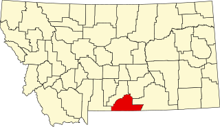
This is a list of the National Register of Historic Places listings in Park County, Montana.

<span class="mw-page-title-main">National Register of Historic Places listings in Glacier County, Montana</span>

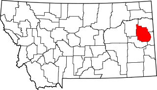
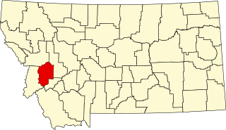
This is a list of the National Register of Historic Places listings in Glacier County, Montana. It is intended to be a complete list of the properties and districts on the National Register of Historic Places in Glacier County, Montana, United States. The locations of National Register properties and districts for which the latitude and longitude coordinates are included below, may be seen in a map.

<span class="mw-page-title-main">National Register of Historic Places listings in Rosebud County, Montana</span>

This is a list of the National Register of Historic Places listings in Rosebud County, Montana. It is intended to be a complete list of the properties and districts on the National Register of Historic Places in Rosebud County, Montana, United States. The locations of National Register properties and districts for which the latitude and longitude coordinates are included below, may be seen in a map.

<span class="mw-page-title-main">National Register of Historic Places listings in Silver Bow County, Montana</span>

This is a list of the National Register of Historic Places listings in Silver Bow County, Montana. It is intended to be a complete list of the properties and districts on the National Register of Historic Places in Silver Bow County, Montana, United States. The locations of National Register properties and districts for which the latitude and longitude coordinates are included below, may be seen in a map.

<span class="mw-page-title-main">National Register of Historic Places listings in Madison County, Montana</span>

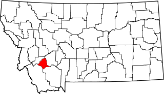
This is a list of the National Register of Historic Places listings in Madison County, Montana. It is intended to be a complete list of the properties and districts on the National Register of Historic Places in Madison County, Montana, United States. The locations of National Register properties and districts for which the latitude and longitude coordinates are included below, may be seen in a map.

<span class="mw-page-title-main">National Register of Historic Places listings in Dawson County, Montana</span>

This is a list of the National Register of Historic Places listings in Dawson County, Montana. It is intended to be a complete list of the properties and districts on the National Register of Historic Places in Dawson County, Montana, United States. The locations of National Register properties and districts for which the latitude and longitude coordinates are included below, may be seen in a map.

<span class="mw-page-title-main">National Register of Historic Places listings in Custer County, Montana</span>

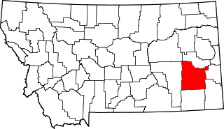
This is a list of the National Register of Historic Places listings in Custer County, Montana. It is intended to be a complete list of the properties and districts on the National Register of Historic Places in Custer County, Montana, United States. The locations of National Register properties and districts for which the latitude and longitude coordinates are included below, may be seen in a map.

<span class="mw-page-title-main">National Register of Historic Places listings in Mineral County, Montana</span>

This is a list of the National Register of Historic Places listings in Mineral County, Montana.

<span class="mw-page-title-main">National Register of Historic Places listings in Granite County, Montana</span>

This is a list of the National Register of Historic Places listings in Granite County, Montana. It is intended to be a complete list of the properties and districts on the National Register of Historic Places in Granite County, Montana, United States. The locations of National Register properties and districts for which the latitude and longitude coordinates are included below, may be seen in a map.

<span class="mw-page-title-main">National Register of Historic Places listings in Powell County, Montana</span>

This is a list of the National Register of Historic Places listings in Powell County, Montana.

<span class="mw-page-title-main">National Register of Historic Places listings in Valley County, Montana</span>

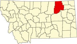
This is a list of the National Register of Historic Places listings in Valley County, Montana. It is intended to be a complete list of the properties and districts on the National Register of Historic Places in Valley County, Montana, United States. The locations of National Register properties and districts for which the latitude and longitude coordinates are included below, may be seen in a map.

This is a list of the National Register of Historic Places listings in Cuyahoga Valley National Park.

<span class="mw-page-title-main">National Register of Historic Places listings in Lake County, Montana</span>

This is a list of the National Register of Historic Places listings in Lake County, Montana. It is intended to be a complete list of the properties and districts on the National Register of Historic Places in Lake County, Montana, United States. The locations of National Register properties and districts for which the latitude and longitude coordinates are included below, may be seen in a map.

<span class="mw-page-title-main">National Register of Historic Places listings in Stillwater County, Montana</span>

This is a list of the National Register of Historic Places listings in Stillwater County, Montana. It is intended to be a complete list of the properties and districts on the National Register of Historic Places in Stillwater County, Montana, United States. The locations of National Register properties and districts for which the latitude and longitude coordinates are included below, may be seen in a map.

References

  1. The latitude and longitude information provided in this table was derived originally from the National Register Information System, which has been found to be fairly accurate for about 99% of listings. Some locations in this table may have been corrected to current GPS standards.
  2. 1 2 "Science Friday - Historic Buildings of Glacier". YouTube. June 11, 2021.
  3. National Park Service, United States Department of the Interior, "National Register of Historic Places: Weekly List Actions", retrieved September 1, 2023.
  4. Numbers represent an alphabetical ordering by significant words. Various colorings, defined here, differentiate National Historic Landmarks and historic districts from other NRHP buildings, structures, sites or objects.
  5. The eight-digit number below each date is the number assigned to each location in the National Register Information System database, which can be viewed by clicking the number.