
The Salmon River, also known as "The River of No Return", is a river located in the U.S. state of Idaho in the western United States. It flows for 425 miles (685 km) through central Idaho, draining a rugged, thinly populated watershed of 14,000 square miles (36,000 km2). The river drops more than 7,000 feet (2,100 m) from its headwaters, near Galena Summit above the Sawtooth Valley in the Sawtooth National Recreation Area, to its confluence with the Snake River. Measured at White Bird, its average discharge is 11,060 cubic feet per second. It is one of the largest rivers in the continental United States without a single dam on its mainstem.

The Big Creek Bridge is a bowstring arch bridge that spans the Big Creek on U.S. Route 101 in Lane County, Oregon. It was designed by Conde McCullough and opened in 1931.

The Payette River is an 82.7-mile-long (133.1 km) river in southwestern Idaho and is a major tributary of the Snake River.

James Barney Marsh was an American engineer and bridge designer. He patented a new design for arch bridges. Marsh gave Archie Alexander, the first African-American to graduate as an engineer from Iowa State University, his first job. Marsh worked in the bridge building business for over 50 years, and several of his bridges are listed in the National Register of Historic Places.

State Highway 55 (SH-55) is an Idaho highway from Marsing to New Meadows, connecting with US-95 at both ends.

Wilson River Bridge, also known as Wilson River Bridge at Tillamook or Wilson River Bridge No. 01499, is a bridge near Tillamook, Oregon, United States. The 1931 bridge was designed by Conde McCullough in the Classical Revival and Art Deco styles. It covers a span of 180 feet and brings coastal U.S. Route 101 (US 101) over the Wilson River.

The Generals' Highway Stone Bridges, built in 1930, are part of the Generals' Highway from the General Grant Grove of giant sequoias in Kings Canyon National Park through Sequoia National Park. One bridge spans the Marble Fork of the Kaweah River in a wooded setting, while the other, similar bridge spans Clover Creek in a bare canyon.

State Highway 21 (SH-21) is the Ponderosa Pine Scenic Byway, primarily a two-lane highway from Boise to Stanley. With two-thirds of its length in Boise County, it passes by historic Idaho City and the village of Lowman to the western edge of the Sawtooth Mountains, then along their northern boundary to Stanley.
The ERT Bridge over Blacks Fork near Fort Bridger, Wyoming, was listed on the National Register of Historic Places in 1985 as part of a thematic study on early 20th century steel truss bridges in Wyoming. The ERT Bridge is a Warren pony truss bridge spanning 80 feet (24 m) with a width of 15.75 feet (4.80 m). Set on concrete abutments, the ERT Bridge was built around 1920 by Uinta County. It is an example of a transitional design from locally built bridges to standardized State designs

Bridge No. 1132 is an open-spandrel concrete arch bridge carrying the two-lane Connecticut Route 80 across the Hammonasset River, between Killingworth and Madison, Connecticut. Built in 1934, it is one of a small number of open-spandrel concrete bridges in the state, and was noted for its aesthetics at the time of its construction. It was listed on the National Register of Historic Places in 2004.

Smiths Ferry is a census-designated place in Valley County, Idaho, United States. Its population was 75 as of the 2010 census. Situated where the North Fork of the Payette River briefly calms and widens, its elevation is 4,554 feet (1,388 m) above sea level.

The Mountain Quarries Bridge is a railroad bridge across the North Fork American River, near Auburn, spanning between El Dorado and Placer counties. It is a concrete arch bridge that was built in 1912 to transport quarried rock.

The South Fork Bridge is a historic bridge spanning the South Fork Ouachita River in Fountain Lake, Arkansas. It formerly carried Arkansas Highway 128, whose modern bridge now stands just to the south, a short way east of its junction with Arkansas Highway 5. It is a two-span concrete closed-spandrel arch structure, with spans of 57 feet (17 m) and a roadway width of 16 feet (4.9 m). It was built in 1928 by a county crew, after major flooding in 1927 damaged road infrastructure in the area.
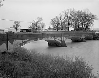
The Des Moines River Bridge is a historic bridge located southwest of Swea City, Iowa, United States. It spans the Des Moines River for 102 feet (31 m). In February 1916, the Kossuth County Board of Supervisors approved the contract for the Des Moines Marsh Engineering Company to build the bridges. It was designed by the company's engineer James B. Marsh. The 9-panel Marsh fixed arch bridge, also known as a "rainbow arch", was completed in 1916 for $7,150. It features two tapered concrete arches that carry the roadway in between them from hangers. It was listed on the National Register of Historic Places in 1998.

The Marsh Rainbow Arch Bridge, also known as the Coon River Bridge and Rainbow Bend Access, is located south of Lake City, Iowa, United States. The 271-foot (83 m) three-span bridge carried traffic on Iberia Avenue over the North Raccoon River. It was designed by Des Moines engineer James Barney Marsh in his patented rainbow arch configuration, and constructed by the Iowa Bridge Company in 1914 for $10,970. It replaced a Howe truss bridge that had been built by the King Bridge Company of Cleveland. That bridge was put in service upstream and remained in use until 1983 when it was taken down. The Marsh arch bridge was bypassed in 1985, and remains in place in a county park. It was listed on the National Register of Historic Places in 1989.

The Middlebury Gorge Concrete Arch Bridge is a historic concrete arch bridge, carrying Vermont Route 125 over the Middlebury River in eastern Middlebury, Vermont. The bridge was built in 1924, and is a well-preserved example of an early concrete bridge. It was listed on the National Register of Historic Places in 1991.

The Scenic Bridge crossing Clark Fork River about 4 miles (6.4 km) east of Tarkio in Mineral County, Montana, was built in 1928. It is located at Milepost 0 on Old U.S. Route 10 West. The bridge has also been denoted 24MN304 and MDT No. L31012000+08. It was listed on the National Register of Historic Places in 2010.

The Neosho River Bridge, near Hartford, Kansas, was built in 1926. It was listed on the National Register of Historic Places in 1983.
The Fromberg Concrete Arch Bridge, in Fromberg, Montana, was built in 1914. It was listed on the National Register of Historic Places in 1993. It carries River Street over the Clarks Fork Yellowstone River.

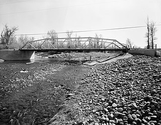
The St. Anthony Pegram Truss Railroad Bridge, in Fremont County, Idaho near St. Anthony, Idaho, was built in 1896. It was listed on the National Register of Historic Places in 1997.


