Oakwood | |
 | |
   | |
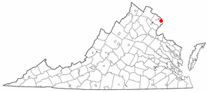
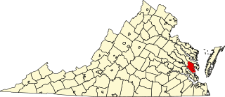
| Location | 7433 Oakwood Dr., near Warrenton, Virginia |
|---|---|
| Coordinates | 38°43′34″N77°51′3″W / 38.72611°N 77.85083°W Coordinates: 38°43′34″N77°51′3″W / 38.72611°N 77.85083°W |
| Area | 600.6 acres (243.1 ha) |
| Built | 1785 |
| Architectural style | Greek Revival; Colonial Revival |
| NRHP reference # | 15001038 [1] |
| VLR # | 030-0083 |
| Significant dates | |
| Added to NRHP | February 2, 2016 |
| Designated VLR | December 10, 2015 [2] |
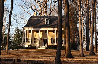
Oakwood is a historic farm property west of Warrenton in rural Fauquier County, Virginia. It is bounded on the south by Old Waterloo Road, and on the west by Great Run, a south-flowing tributary of the Rappahannock River. The main house is a rambling two-story masonry building, whose oldest portions date to the 18th century. Its present appearance has significant Greek Revival features, include a gabled temple-front portico added about 1838. The property is also notable in local culture for hosting the very first Virginia Gold Cup race in 1922. [3]

Warrenton is a town in Fauquier County, Virginia, United States. The population was 9,611 at the 2010 census, up from 6,670 at the 2000 census. The estimated population in 2015 was 9,897. Warrenton is the county seat of Fauquier County. It is at the junction of U.S. Route 15, U.S. Route 17, U.S. Route 29, and U.S. Route 211. The town is in the Piedmont region of Virginia, east of the Blue Ridge Mountains. The well-known Airlie Conference Center is 3 miles (5 km) north of Warrenton, and the historic Vint Hill Farms military facility is 9 miles (14 km) east. Fauquier Hospital is located in the town. Surrounded by Virginia wine and horse country, Warrenton is a popular destination outside Washington, D.C.

Fauquier is a county in the Commonwealth of Virginia. As of the 2010 census, the population was 65,203. The county seat is Warrenton.

The Rappahannock River is a river in eastern Virginia, in the United States, approximately 195 miles (314 km) in length. It traverses the entire northern part of the state, from the Blue Ridge Mountains in the west where it rises, across the Piedmont to the Fall Line, and onward through the coastal plain to flow into the Chesapeake Bay, south of the Potomac River.
The property was listed on the National Register of Historic Places in 2016. [1]

The National Register of Historic Places (NRHP) is the United States federal government's official list of districts, sites, buildings, structures, and objects deemed worthy of preservation for their historical significance. A property listed in the National Register, or located within a National Register Historic District, may qualify for tax incentives derived from the total value of expenses incurred preserving the property.