Osborn, Missouri

Last updated

Osborn, Missouri
DeKalb County Missouri Incorporated and Unincorporated areas Osborn Highlighted.svg
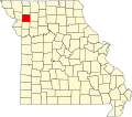
Location of Osborn, Missouri
Coordinates: 39°44′59″N94°21′24″W / 39.74972°N 94.35667°W / 39.74972; -94.35667
Country United States
State Missouri
Counties DeKalb, Clinton
Area
[1]
  Total0.57 sq mi (1.48 km2)
  Land0.57 sq mi (1.48 km2)
  Water0.00 sq mi (0.00 km2)
Elevation
[2]
1,030 ft (310 m)
Population
 (2020)
  Total374
  Density656.14/sq mi (253.54/km2)
Time zone UTC-6 (Central (CST))
  Summer (DST) UTC-5 (CDT)
ZIP code
64474
Area code 816
FIPS code 29-55352 [3]
GNIS feature ID2396091 [2]

Osborn is a city in northern Clinton and southern DeKalb counties in the U.S. state of Missouri. The population was 374 at the 2020 census. [4]

Contents

The Clinton County portion of Osborn is part of the Kansas City, MO KS Metropolitan Statistical Area, while the DeKalb County portion is part of the St. Joseph, MOKS Metropolitan Statistical Area. The Clinton County portion of Osborn lies in Platte Township, while the DeKalb County portion of Osborn lies in Colfax Township.

History

Osborn got its start following the construction of the Hannibal and St. Joseph Railroad through that territory. It was named for Col. William Osborn of Waterville, New York. [5] Col. Osborn, born in Sangerfield, New York on May 9, 1809, was an Oneida National Bank and Trust Company of Central New York commissioner and farmer who, in 1845, relocated to Missouri, where he partnered with the Hannibal and St. Joseph Railroad Company, the firm that constructed the Hannibal and St. Joseph Railroad.

Education

The Osborn R-0 School District is located in Osborn. Osborn is home of the Wildcats and proudly sports the orange and green.

Geography

According to the United States Census Bureau, the city has a total area of 0.57 square miles (1.48 km2), all land. [6]

Osborn is located south of U.S. Route 36.

Demographics

Historical population
CensusPop.Note
1880 412
1890 373−9.5%
1900 3863.5%
1910 360−6.7%
1920 354−1.7%
1930 3817.6%
1940 315−17.3%
1950 237−24.8%
1960 27415.6%
1970 33823.4%
1980 38112.7%
1990 4005.0%
2000 45513.8%
2010 423−7.0%
2020 374−11.6%
U.S. Decennial Census [7]

2010 census

As of the census [8] of 2010, there were 423 people, 192 households, and 114 families living in the city. The population density was 742.1 inhabitants per square mile (286.5/km2). There were 209 housing units at an average density of 366.7 units per square mile (141.6 units/km2). The racial makeup of the city was 98.3% White, 0.7% Native American, 0.2% from other races, and 0.7% from two or more races. Hispanic or Latino of any race were 1.2% of the population.

There were 192 households, of which 23.4% had children under the age of 18 living with them, 45.8% were married couples living together, 9.9% had a female householder with no husband present, 3.6% had a male householder with no wife present, and 40.6% were non-families. 37.0% of all households were made up of individuals, and 13.6% had someone living alone who was 65 years of age or older. The average household size was 2.20 and the average family size was 2.86.

The median age in the city was 44.4 years. 20.1% of residents were under the age of 18; 10.2% were between the ages of 18 and 24; 20.4% were from 25 to 44; 30.7% were from 45 to 64; and 18.7% were 65 years of age or older. The gender makeup of the city was 49.6% male and 50.4% female.

2000 census

At the 2000 census, there were 455 people, 183 households, and 129 families living in the city. [9] The population density was 794.5 inhabitants per square mile (306.8/km2). There were 195 housing units at an average density of 340.5 units per square mile (131.5 units/km2). The racial makeup of the city was 98.90% White, 0.22% African American, and 0.88% from two or more races. Hispanic or Latino of any race were 0.44% of the population.

There were 183 households, of which 35.0% had children under the age of 18, 57.9% were married couples living together, 9.8% had a female householder with no husband present, and 29.5% were non-families. 26.8% of all households were made up of individuals, and 14.2% had someone living alone who was 65 years of age or older. The average household size was 2.49 and the average family size was 3.03.

The age distribution was 28.8% under the age of 18, 8.1% from 18 to 24, 25.1% from 25 to 44, 22.4% from 45 to 64, and 15.6% who were 65 years of age or older. The median age was 37 years. For every 100 females, there were 86.5 males. For every 100 females age 18 and over, there were 88.4 males.

The median income for a household in the city was $32,344, and the median income for a family was $44,205. Males had a median income of $29,792 versus $18,214 for females. The per capita income for the city was $16,230. About 4.0% of families and 9.9% of the population were below the poverty line, including 11.5% of those under age 18 and 25.8% of those age 65 or over.

Related Research Articles

<span class="mw-page-title-main">DeKalb County, Missouri</span> County in Missouri, United States

DeKalb County is a county located in the northwest portion of the U.S. state of Missouri. As of the 2020 census, the population was 11,029. Its county seat is Maysville. The county was organized February 25, 1845 and named for General Johann de Kalb, Baron de Kalb, of the Revolutionary War.

<span class="mw-page-title-main">De Kalb, Missouri</span> City in Missouri, United States

De Kalb is a city in southwest Buchanan County, Missouri, United States. The population was 233 at the 2020 census. It is part of the St. Joseph, MO–KS Metropolitan Statistical Area.

<span class="mw-page-title-main">Kidder, Missouri</span> City in Missouri, United States

Kidder is a city in northwest Caldwell County, Missouri, The population was 267 at the 2020 census.

<span class="mw-page-title-main">Kearney, Missouri</span> City in Missouri, United States

Kearney is a city in Clay County, Missouri, United States. The population per the 2020 U.S. Census was 10,404. The city was the birthplace of Jesse James, and there is an annual festival in the third weekend of September to recognize the outlaw. It is part of the Kansas City metropolitan area.

<span class="mw-page-title-main">Amity, Missouri</span> Village in Missouri, United States

Amity is a village in DeKalb County, Missouri, United States. The population was 26 at the 2020 census. It is part of the St. Joseph, MO–KS Metropolitan Statistical Area.

<span class="mw-page-title-main">Clarksdale, Missouri</span> City in Missouri, United States

Clarksdale is a city in southwest DeKalb County, Missouri, United States, located along the Little Third Fork of the Platte River. The population was 245 at the 2020 census. It is part of the St. Joseph, MO–KS Metropolitan Statistical Area.

<span class="mw-page-title-main">Maysville, Missouri</span> City in Missouri, United States

Maysville is a city in DeKalb County, Missouri, United States. The population was 1,095 at the 2020 census. Maysville is the county seat of DeKalb County.

<span class="mw-page-title-main">Stewartsville, Missouri</span> City in Missouri, United States

Stewartsville is a city in southwest DeKalb County, Missouri, United States. The population was 733 at the 2020 census. The community is named for Robert M. Stewart, a former Missouri governor. It is part of the St. Joseph, MO–KS Metropolitan Statistical Area.

<span class="mw-page-title-main">Union Star, Missouri</span> City in Missouri, United States

Union Star is a city in northwest DeKalb County, Missouri, United States, along the Third Fork of the Platte River. The population was 380 at the 2020 census. It is part of the St. Joseph, MO–KS Metropolitan Statistical Area.

<span class="mw-page-title-main">Weatherby, Missouri</span> Village in Missouri, United States

Weatherby is a village in eastern DeKalb County, Missouri, United States. The population was 80 at the 2020 census. It is part of the St. Joseph, MO–KS Metropolitan Statistical Area.

<span class="mw-page-title-main">La Grange, Missouri</span> City in Missouri, United States

La Grange is a city in Lewis County, Missouri, United States. The population was 825 at the 2020 census. Since the 1960 census, the population has been dwindling. It is part of the Quincy, IL–MO Micropolitan Statistical Area.

<span class="mw-page-title-main">Bucklin, Missouri</span> City in Missouri, United States

Bucklin is a city in southeast Linn County, Missouri, United States. The population was 413 at the 2020 census.

<span class="mw-page-title-main">Palmyra, Missouri</span> City in Missouri, United States

Palmyra is a city in and the county seat of Marion County, Missouri, United States. The population was 3,613 at the 2020 census. It is part of the Hannibal Micropolitan Statistical Area.

<span class="mw-page-title-main">Clarksville, Missouri</span> City in Missouri, United States

Clarksville is a city in Calumet Township, Pike County, Missouri, United States. The population was 372 at the 2020 census.

<span class="mw-page-title-main">Center, Missouri</span> City in Missouri, United States

Center is a city in Ralls County, Missouri, United States. The population was 528 at the 2020 census. It is part of the Hannibal Micropolitan Statistical Area.

<span class="mw-page-title-main">New London, Missouri</span> City in Missouri, United States

New London is a city in Ralls County, Missouri, United States. The population was 943 at the 2020 census. It is the county seat of Ralls County.

<span class="mw-page-title-main">Perry, Missouri</span> City in Missouri, United States

Perry is a city in southwest Ralls County, Missouri, United States. The population was 665 at the 2020 census. It is part of the Hannibal Micropolitan Statistical Area.

<span class="mw-page-title-main">Vandalia, Missouri</span> City in Missouri, United States

Vandalia is a city in northeastern Audrain and extending into southeastern Ralls Counties in the U.S. state of Missouri. The population was 3,553 at the 2020 census, which includes about 1,000 prisoners incarcerated at the prison located within the city limits.

<span class="mw-page-title-main">Cameron, Missouri</span> City in Missouri, United States

Cameron is a city in Clinton, DeKalb and Caldwell counties in the U.S. state of Missouri. The population was 8,513 at the 2020 census.

<span class="mw-page-title-main">Monroe City, Missouri</span> City in Missouri, United States

Monroe City is a city in Marion, Monroe, and Ralls counties in the U.S. state of Missouri. The population was 2,652 at the 2020 census.

References

  1. "ArcGIS REST Services Directory". United States Census Bureau. Retrieved August 28, 2022.
  2. 1 2 U.S. Geological Survey Geographic Names Information System: Osborn, Missouri
  3. "U.S. Census website". United States Census Bureau . Retrieved May 14, 2011.
  4. "Explore Census Data". data.census.gov. Retrieved January 10, 2022.
  5. Eaton, David Wolfe (1916). How Missouri Counties, Towns and Streams Were Named. The State Historical Society of Missouri. pp.  284.
  6. "US Gazetteer files 2010". United States Census Bureau . Retrieved August 4, 2013.
  7. "Census of Population and Housing". Census.gov. Retrieved June 4, 2015.
  8. "U.S. Census website". United States Census Bureau . Retrieved July 8, 2012.
  9. 2000 census Retrieved August 4, 2013