Osborne, Queensland

Last updated

Osborne
Queensland
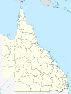
Australia Queensland location map.svg
Red pog.svg
Osborne
Coordinates 19°41′41″S147°21′25″E / 19.6948°S 147.3569°E / -19.6948; 147.3569 (Osborne (centre of locality))
Population245 (2021 census) [1]
 • Density5.000/km2 (12.95/sq mi)
Postcode(s) 4806
Area49.0 km2 (18.9 sq mi)
Time zone AEST (UTC+10:00)
Location
LGA(s) Shire of Burdekin
State electorate(s) Burdekin
Federal division(s) Dawson
Suburbs around Osborne:
Mount Kelly Airville Home Hill
Mount Kelly Osborne Fredericksfield
Kirknie Fredericksfield Fredericksfield

Osborne is a rural locality in the Shire of Burdekin, Queensland, Australia. [2] In the 2021 census, Osborne had a population of 245 people. [1]

Contents

Geography

Osborne is low flat land (under 10 metres above sea level) bounded to the north by the Burdekin River. [3]

The predominant land use is growing sugarcane. [4] There is a cane tramway network to transport the harvested sugarcane to the local sugar mills. [5]

History

Osborne State School opened on 7 December 1914. [6]

Iona State School opened on 13 August 28 and closed on 23 June 1963. [6] It was located on the north-west corner of Iona Road and Bapty Road (approx 19°42′44″S147°24′09″E / 19.7121°S 147.4025°E / -19.7121; 147.4025 (Iona State School (former)) ). [7]

Demographics

In the 2016 census, Osborne had a population of 273 people. [8]

In the 2021 census, Osborne had a population of 245 people. [1]

Education

Osborne State School is a government primary (Prep-6) school for boys and girls at Kirknie Road ( 19°42′02″S147°20′48″E / 19.7005°S 147.3466°E / -19.7005; 147.3466 (Osborne State School) ). [9] [10] In 2016, the school had an enrolment of 15 students with 2 teachers (1 full-time equivalent) and 5 non-teaching staff (2 full-time equivalent). [11] In 2018, the school had an enrolment of 13 students with 3 teachers (2 full-time equivalent) and 2 non-teaching staff (1 full-time equivalent). [12]

There are no secondary schools in Osborne. The nearest government secondary school is Home Hill State High School in neighbouring Home Hill to the east. [13]

References

  1. 1 2 3 Australian Bureau of Statistics (28 June 2022). "Osborne (SAL)". 2021 Census QuickStats. Retrieved 28 February 2023. OOjs UI icon edit-ltr-progressive.svg
  2. ↑ "Osborne – locality in Shire of Burdekin (entry 42299)". Queensland Place Names. Queensland Government . Retrieved 26 December 2020.
  3. ↑ "Layers: Locality; Mountains and ranges; Contours; Watercourses". Queensland Globe. Queensland Government . Retrieved 11 September 2025.
  4. ↑ "Layers: Locality; Protected areas and forests; Land use". Queensland Globe. Queensland Government . Retrieved 11 September 2025.
  5. ↑ "Layers: Locality; Road and rail; Railways; Railway stations". Queensland Globe. Queensland Government . Retrieved 11 September 2025.
  6. 1 2 Queensland Family History Society (2010), Queensland schools past and present (Version 1.01 ed.), Queensland Family History Society, ISBN   978-1-921171-26-0
  7. ↑ "Ayr (Eastern)" (Map). Queensland Government. 1942. Archived from the original on 13 January 2021. Retrieved 19 February 2021.
  8. ↑ Australian Bureau of Statistics (27 June 2017). "Osborne (SSC)". 2016 Census QuickStats. Retrieved 20 October 2018. OOjs UI icon edit-ltr-progressive.svg
  9. ↑ "State and non-state school details". Queensland Government. 9 July 2018. Archived from the original on 21 November 2018. Retrieved 21 November 2018.
  10. ↑ "Osborne State School" . Retrieved 21 November 2018.
  11. ↑ "Annual Report 2016" (PDF). Osborne State School. Archived (PDF) from the original on 13 October 2017. Retrieved 13 October 2017.
  12. ↑ "ACARA School Profile 2018". Australian Curriculum, Assessment and Reporting Authority. Archived from the original on 27 August 2020. Retrieved 28 January 2020.
  13. ↑ "Layers: Locality; Schools and school catchments". Queensland Globe. Queensland Government . Retrieved 13 August 2025.

Further reading