
The Monongahela culture were an Iroquoian Native American cultural manifestation of Late Woodland peoples from AD 1050 to 1635 in present-day western Pennsylvania, western Maryland, eastern Ohio, and West Virginia. The culture was named by Mary Butler in 1939 for the Monongahela River, whose valley contains the majority of this culture's sites.

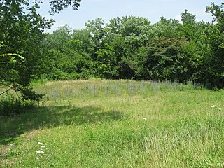
The Grand Village of the Illinois, also called Old Kaskaskia Village, is a site significant for being the best documented historic Native American village in the Illinois River valley. It was a large agricultural and trading village of Native Americans of the Illinois confederacy, located on the north bank of the Illinois River near the present town of Utica, Illinois. French explorers Louis Joliet and Father Jacques Marquette came across it in 1673. The Kaskaskia, a tribe of the Illiniwek people lived in the village. It grew rapidly after a French mission and fur trading post were established there in 1675, to a population of about 6,000 people in about 460 houses. Around 1691 the Kaskaskia and other Illiniwek moved further south, abandoning the site due to pressure from an Iroquois invasion from the northeast.
The Clough Creek and Sand Ridge Archaeological District is a historic district composed of two archaeological sites in the southwestern part of the U.S. state of Ohio. Its name is derived from those of the two sites included in the district: one that lies along Clough Creek, and one that occupies part of the Sand Ridge near the creek.
The Prehistory of West Virginia spans ancient times until the arrival of Europeans in the early 17th century. Hunters ventured into West Virginia's mountain valleys and made temporary camp villages since the Archaic period in the Americas. Many ancient human-made earthen mounds from various mound builder cultures survive, especially in the areas of Moundsville, South Charleston, and Romney. The artifacts uncovered in these areas give evidence of a village society with a tribal trade system culture that included limited cold worked copper. As of 2009, over 12,500 archaeological sites have been documented in West Virginia.
The Pisgah Phase is an archaeological phase of the South Appalachian Mississippian culture in Southeast North America. It is associated with the Appalachian Summit area of southeastern Tennessee, Western North Carolina, and northwestern South Carolina in what is now the United States.

This is a list of the National Register of Historic Places listings in Franklin County, Virginia.

The Plum Island Eagle Sanctuary is a 52-acre island in the Illinois River owned by the Illinois Audubon Society. It was purchased March 24, 2004 to act as a wildlife sanctuary, to protect foraging habitat for wintering bald eagles. It is close to Matthiessen State Park and adjacent to Starved Rock State Park.
The Spring Creek Site (20MU3) is a significant archaeological site in the U.S. state of Michigan. Located in Muskegon County in the western portion of the Lower Peninsula, it is the type site for a certain type of Late Woodland period pottery produced by the Ottawa tribe.
Potomac Creek, or 44ST2, is a late Native American village located on the Potomac River in Stafford County, Virginia. It is from the Woodland Period and dates from 1300 to 1550. There is another Potomac Creek site, 44ST1 or Indian Point, which was occupied by the Patawomeck during the historic period and is where Captain John Smith visited. This site no longer exists, as it eroded away into the river. Site 44ST2 has five ossuaries, one individual burial, and one multiple burial. Other names for the site are Potowemeke and Patawomeke. The defining features include distinctive ceramics, ossuary burials, and palisade villages.
The Little Egypt site was an archaeological site located in Murray County, Georgia, near the junction of the Coosawattee River and Talking Rock Creek. The site originally had three platform mounds surrounding a plaza and a large village area. It was destroyed during the construction of the Dam of Carters Lake in 1972. It was situated between the Ridge and Valley and Piedmont sections of the state in a flood plain. Using Mississippian culture pottery found at the site archaeologists dated the site to the Middle and Late South Appalachian culture habitation from 1300 to 1600 CE during the Dallas, Lamar, and Mouse Creek phases.

The Juntunen Site, also known as 20MK1, is a stratified Prehistoric Late Woodland fishing village located on the western tip of Bois Blanc Island. It was listed on the National Register of Historic Places in 1978.

The Ellerbusch Site (12-W-56) is a small but significant archaeological site in the southwestern part of the U.S. state of Indiana. Unlike many sites created by people of the same culture, it occupies an upland site near a major river floodplain. Its existence appears to have been the result of the coincidence of periods of peace and growth in the related Angel Site, which led some townspeople to leave their homes for new villages that were more convenient for resource gathering. Researched partly because of its small size, Ellerbusch has produced information that greatly increases present awareness of other small sites and of its culture's overall patterns of settlement in the region. Because of its archaeological value, the site was declared a historic site in the late twentieth century.

The Yankeetown Site (12W1) is a substantial archaeological site along the Ohio River in the southwestern part of the U.S. state of Indiana. Inhabited during the prehistoric Woodland period, the site has yielded important information about Woodland-era peoples in the region, but it has been damaged by substantial erosion. Despite the damage, it has been a historic site for more than thirty years.

The Dumaw Creek Site is an archaeological site designated 20OA5, located along Dumaw Creek northeast of Pentwater, Michigan, that was the location of a 17th-century village and cemetery. It is one of the youngest pre-historic sites in Michigan, dating to the terminal Late Woodland Period just prior to European contact. It was listed on the National Register of Historic Places in 1972.
The White Site is a prehistoric archaeological site located northeast of Hickman in Fulton County in the southwestern corner of the U.S. state of Kentucky. Discovered in the 1980s, it was occupied during a long period of time by peoples of multiple cultures, and it has been named a historic site.

The Reedy Creek Site (44HA22) is a pre-Columbian archaeological site located in Halifax County, Virginia, near the town of South Boston. The site was first inhabited in the Late Archaic period from 2000 to 1000 B.C. Later, from 900 to 1400 A.D., a village was located at the site. Archaeological excavations at the site have revealed animal bones and seed and nut remnants, providing evidence as to the diet of the region's native inhabitants.

The Moccasin Bluff Site is an archaeological site located along the Red Bud Trail and the St. Joseph River north of Buchanan, Michigan. It was listed on the National Register of Historic Places in 1977, and has been classified as a multi-component Prehistoric site with the major component dating to the Late Woodland/Upper Mississippian period.
The Griesmer site (La-3) is located on the Kankakee River in Lake County, Indiana, about a mile southeast of Schneider, in Northwestern Indiana. It is classified as a Prehistoric, multi-component site with Middle Woodland, Late Woodland and Upper Mississippian occupations. The deposits were not stratified, but observation of the types of artifacts present, together with radiocarbon dates, helped to define the sequence of occupations at the site.
The Oak Forest Site (11Ck-53) is located in Oak Forest, Cook County, Illinois, near the city of Chicago. It is classified as a late Prehistoric to Protohistoric/Early Historic site with Upper Mississippian Huber affiliation.
The Fisher Mound Group is a group of burial mounds with an associated village site located on the DesPlaines River near its convergence with the Kankakee River where they combine to form the Illinois River, in Will County, Illinois, about 60 miles southwest of Chicago. It is a multi-component stratified site representing several Prehistoric Upper Mississippian occupations as well as minor Late Woodland and Early Historic components.

