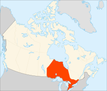
Ottawa is the capital city of Canada. It is located in the southern portion of the province of Ontario, at the confluence of the Ottawa River and the Rideau River. Ottawa borders Gatineau, Quebec, and forms the core of the Ottawa–Gatineau census metropolitan area (CMA) and the National Capital Region (NCR). As of 2021, Ottawa had a city population of 1,017,449 and a metropolitan population of 1,488,307, making it the fourth-largest city and fourth-largest metropolitan area in Canada.

Gloucester is a former municipality and now geographic area of Ottawa, Ontario, Canada. Located east of Ottawa's inner core, it was an independent city until amalgamated with the Regional Municipality of Ottawa–Carleton in 2001 to become the new city of Ottawa. The population of Gloucester is about 150,012 people.

Nepean is an area of Ottawa, Ontario, Canada. Located west of Ottawa's inner core, it was an independent city until amalgamated with the Regional Municipality of Ottawa–Carleton in 2001 to become the new city of Ottawa. However, the name Nepean continues in common usage in reference to the area. The population of Nepean is about 186,593 people.

The Regional Municipality of Ottawa–Carleton was a Regional Municipality and Census Division in Ontario, Canada, that existed between January 1, 1969, and January 1, 2001, and was primarily centred on the City of Ottawa. It was created in 1969 by restructuring Carleton County and annexing Cumberland Township from the United Counties of Prescott and Russell into the newly created Region of Ottawa–Carleton.

Carleton is a federal electoral district in Ontario, Canada, represented in the House of Commons of Canada from 1867 to 1968 and since 2015. It was represented in the Legislative Assembly of Upper Canada from 1821 to 1840 and in the Legislative Assembly of the Province of Canada from 1841 until 1866. It has been represented by Pierre Poilievre, the current Leader of the Opposition, since its creation in 2015.
West Carleton was a township municipality in Eastern Ontario, Canada. It was located in the rural parts of what is now the City of Ottawa, west of Kanata. Its northern boundary was the Ottawa River.

The 2006 Ottawa municipal election was held on November 13, 2006, in Ottawa, Canada, to elect the mayor of Ottawa, Ottawa City Council and the Ottawa-Carleton Public and Catholic School Boards. The election was one of many races across the province of Ontario. See 2006 Ontario municipal elections.

École secondaire catholique Garneau, is a French-language high school teaching grades 7–12 in the community of Orléans in the eastern end of Ottawa, Ontario.

Alta Vista Ward is a city ward in the city of Ottawa, Ontario, Canada represented on Ottawa City Council. Alta Vista Ward was created prior to the 1966 election when Gloucester Ward was split in half due to population growth in the Alta Vista area. Until the 1972 elections, the ward was represented by two councillors. Prior to the 1980 election, the Ward was split in half, with the western half remaining as Alta Vista ward and the eastern half became Canterbury Ward. They were reunited prior to the 1994 Election and was known as Ward 10, and given the name Alta Vista-Canterbury Ward in 1995. During this time, on regional council it was known as just Alta Vista Ward. It was renamed to Alta Vista in 2000.
The Conseil des écoles publiques de l'Est de l'Ontario, also widely known as CEPEO, is the public school board responsible for education in the French language in Eastern Ontario, including the Ottawa area. The board consists of 12 trustees elected every 4 years during municipal elections in Ontario and 2 student trustees elected every year. The area in which the board operates covers 40,314 km2 of Ontario. It employs more than 3000 employees, the majority being teachers.
Riverside South is a suburban community in Gloucester-South Nepean Ward in the south end of the city of Ottawa, Ontario, Canada, just southwest of Ottawa Macdonald–Cartier International Airport. Prior to amalgamation in 2001, the area was located in the city of Gloucester. Its population, according to the Canada 2021 Census, was 19,802.

The Conseil des écoles catholiques du Centre-Est, formerly known as the Conseil des écoles catholiques de langue française du Centre-Est (CECLFCE), is Ontario's largest French-language school board. The CECCE operates 41 elementary schools, 10 high schools, and a school for adults. Over 21,000 students from Junior Kindergarten to Grade 12 attend CECCE schools. The board employs approximately 2,000 teachers and professionals and it covers an area of 35,615 km2, including the City of Ottawa. Its headquarters are in the Gloucester area of Ottawa.
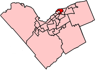
Rideau-Rockcliffe Ward is a city ward in Ottawa, Ontario. Located in the city's east end, the ward covers the neighbourhoods of New Edinburgh, Manor Park, Rockcliffe Park, Wateridge Village, Overbrook, Lindenlea, Viscount Alexander Park, Carson Meadows, Cardinal Glen, Rockcliffe Mews, Forbes, Castle Heights and part of Carson Grove.

The Capital Pathway, also known informally as the Bike Path, is a 220-kilometre (140 mi) recreational pathway interlinking many parks, waterways and sites in Ottawa, Ontario and Gatineau, Quebec. Most of the pathway is paved, and allows an almost continuous route through the National Capital Region.

The 2014 Ottawa municipal election was a municipal election that was held on October 27, 2014, to elect the mayor of Ottawa, Ottawa City Council and the Ottawa-Carleton Public and Catholic School Boards. The election was held on the same day as elections in every other municipality in Ontario.

The 2018 Ottawa municipal election was a municipal election that was held on October 22, 2018, to elect the mayor of Ottawa, Ottawa City Council and the Ottawa-Carleton Public and Catholic School Boards. The election was held on the same day as elections in every other municipality in Ontario.