
The following outline is provided as an overview of and topical guide to Ontario:
Contents
- General reference
- Geography of Ontario
- Location
- Environment of Ontario
- Heritage sites in Ontario
- Regions of Ontario
- Demography of Ontario
- Government and politics of Ontario
- Branches of the government of Ontario
- International relations of Ontario
- Law and order in Ontario
- Military of Ontario
- Local government in Ontario
- History of Ontario
- History of Ontario, by period
- History of Ontario, by region
- History of Ontario, by subject
- Culture of Ontario
- Art in Ontario
- Religion in Ontario
- Sports in Ontario
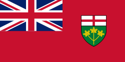
- Symbols of Ontario
- Economy and infrastructure of Ontario
- Transport in Ontario
- Education in Ontario
- See also
- References
- External links
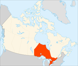
Ontario – one of the provinces of Canada, located in east-central Canada. [1] It is Canada's most populous province or territory [2] and fourth largest in total area. [3] It is home to the nation's capital city, Ottawa, and the nation's most populous city, Toronto. [4]