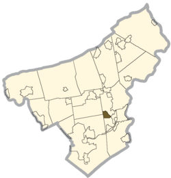
Palmer Heights, Pennsylvania | |
---|---|
Coordinates: 40°41′30″N75°15′56″W / 40.69167°N 75.26556°W | |
Country | United States |
State | Pennsylvania |
County | Northampton |
Area | |
• City | 3 km2 (1.2 sq mi) |
• Land | 3 km2 (1.2 sq mi) |
• Water | 0 km2 (0.0 sq mi) |
Elevation | 111 m (364 ft) |
Population (2010) | |
• City | 3,762 |
• Density | 1,200/km2 (3,100/sq mi) |
• Metro | 865,310 (US: 68th) |
Time zone | UTC-5 (EST) |
• Summer (DST) | UTC-4 (EDT) |
ZIP Code | 18045 [1] |
Area code(s) | 610 |
Palmer Heights is a census-designated place (CDP) in Palmer Heights, Pennsylvania. The population of Palmer Heights was 3,762 at the 2010 census. Palmer Heights is part of the Lehigh Valley, which had a population of 861,899 and was the 68th-most populous metropolitan area in the U.S. as of the 2020 census.
Palmer Heights is located at 40°41′30″N75°15′56″W / 40.69167°N 75.26556°W (40.691698, -75.265654). [2] According to the U.S. Census Bureau, Palmer Heights has a total area of 1.2 square miles (3.1 km2), all land.
As of the 2000 census, [3] there were 3,612 people, 1,405 households, and 1,036 families residing in the CDP. The population density was 3,012.6 inhabitants per square mile (1,163.2/km2). There were 1,428 housing units at an average density of 1,191.0 per square mile (459.8/km2). The racial makeup of the CDP was 95.43% White, 1.66% African American, 0.11% Native American, 1.25% Asian, 0.03% Pacific Islander, 0.91% from other races, and 0.61% from two or more races. Hispanic or Latino of any race were 2.63% of the population.
There were 1,405 households, out of which 25.5% had children under the age of 18 living with them, 65.4% were married couples living together, 5.8% had a female householder with no husband present, and 26.2% were non-families. 22.6% of all households were made up of individuals, and 14.0% had someone living alone who was 65 years of age or older. The average household size was 2.43 and the average family size was 2.86.
In Palmer Heights, the population was spread out, with 17.6% under the age of 18, 5.0% from 18 to 24, 23.7% from 25 to 44, 27.2% from 45 to 64, and 26.5% who were 65 years of age or older. The median age was 47 years. For every 100 females, there were 90.0 males. For every 100 females age 18 and over, there were 85.5 males.
The median income for a household in the CDP was $51,625, and the median income for a family was $61,630. Males had a median income of $40,481 versus $32,429 for females. The per capita income for the CDP was $23,959. About 2.0% of families and 2.6% of the population were below the poverty line, including none of those under age 18 and 7.5% of those age 65 or over.
The community is served by the Easton Area School District. Students in grades nine through 12 attend Easton Area High School in Easton.
Easton is a census-designated place (CDP) in Fresno County, California, United States. The population was 2,083 at the 2010 census, up from 1,966 at the 2000 census. Easton is located 7.5 miles (12.1 km) south of downtown Fresno, at an elevation of 276 feet.
Villages of Oriole was a former census-designated place (CDP) and current unincorporated place in Palm Beach County, Florida, United States. The population was 4,758 at the 2000 census.
Benton Heights is an unincorporated community in Berrien County in the U.S. state of Michigan. It is also a census-designated place (CDP) for statistical purposes without any legal status as an incorporated municipality. Per the 2020 Census, the population was 3,652. The community is a part of Benton Charter Township and is adjacent to the city of Benton Harbor.
Holiday Heights is an unincorporated community and census-designated place (CDP) located within Berkeley Township, in Ocean County, in the U.S. state of New Jersey. As of the 2010 United States Census, the CDP's population was 2,099.
Perry Heights is a census-designated place in Stark County, Ohio, United States. The population was 8,391 at the 2020 census. It is part of the Canton–Massillon metropolitan area. It was originally known as Genoa.
Lenape Heights is a census-designated place (CDP) in Armstrong County, Pennsylvania, United States. The population was 1,144 at the 2020 census.
Reiffton is a census-designated place (CDP) in Exeter Township, Berks County, Pennsylvania, United States. The population was 4,178 at the 2010 census.
Spring Ridge is a census-designated place (CDP) in Spring Township, Berks County, Pennsylvania, United States. The population was 1,003 at the 2010 census.
Shanor-Northvue is a census-designated place (CDP) in Butler County, Pennsylvania, United States. The population was 5,051 at the 2010 census.
Rutherford is a census-designated place (CDP) in Swatara Township, Dauphin County, Pennsylvania, United States. The area is also known as Rutherford Heights. The population was 4,303 at the 2010 census, an increase over the figure of 3,859 tabulated in 2000. It is part of the Harrisburg–Carlisle Metropolitan Statistical Area.
Chevy Chase Heights is a census-designated place within White Township, Indiana County, Pennsylvania, United States. The population was 1,502 at the 2010 census.
Mount Gretna Heights is an unincorporated community and census-designated place (CDP) in Lebanon County, Pennsylvania, United States, adjacent to the borough of Mount Gretna. The population was 323 at the 2010 census.
Arlington Heights is a census-designated place (CDP) in Monroe County, Pennsylvania, United States. The population was 6,331 at the 2020 census. One notable location in Arlington Heights is the Stroud Mall.
Old Orchard is a census-designated place (CDP) in Palmer Township in Northampton County, Pennsylvania. As of the 2010 census, Old Orchard had a total population of 2,434. Old Orchard is part of the Lehigh Valley, which had a population of 861,899 and was the 68th-most populous metropolitan area in the U.S. as of the 2020 census.
Shenandoah Heights is a census-designated place (CDP) in Schuylkill County, Pennsylvania. The population was 1,298 at the 2000 census.
Lawson Heights is a census-designated place (CDP) in Unity Township, Westmoreland County, Pennsylvania, United States. The population was 2,339 at the 2000 census.
Las Quintas Fronterizas is a census-designated place (CDP) in Maverick County, Texas, United States. The population was 2,030 at the 2000 census.
Arlington Heights is a census-designated place (CDP) in Snohomish County, Washington, United States. The population was 2,284 at the 2010 census.
Hill View Heights is a census-designated place (CDP) in Weston County, Wyoming, United States. The population was 170 at the 2010 census.
Warren is a census-designated place (CDP) in the town of Warren in Worcester County, Massachusetts, United States. The population was 1,405 at the 2010 census.