
Greene County is a county located in the U.S. state of Arkansas. As of the 2020 census, the population was 45,736. The county seat is Paragould, which sits atop Crowley's Ridge. Greene County is included in Jonesboro–Paragould Combined Statistical Area.

Hot Springs is a resort city in the state of Arkansas and the county seat of Garland County. The city is located in the Ouachita Mountains among the U.S. Interior Highlands, and is set among several natural hot springs for which the city is named. As of the 2020 United States Census, the city had a population of 37,930, making it the eleventh-most populous city in Arkansas.

Paragould is the county seat of Greene County, and the 19th-largest city in Arkansas, in the United States. The city is located in northeastern Arkansas on the eastern edge of Crowley's Ridge, a geologic anomaly contained within the Arkansas Delta.

Downtown Paterson is the main commercial district of Paterson, Passaic County, in the U.S. state of New Jersey. The area is the oldest part of the city, along the banks of the Passaic River and its Great Falls. It is roughly bounded by Interstate 80, Garret Mountain Reservation, Route 19, Oliver Street, and Spruce Street on the south; the Passaic River, West Broadway, Cliff Street, North 3rd Street, Haledon Avenue, and the borough of Prospect Park on the west; and the Passaic River also to the north.
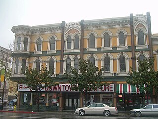
The Downtown Historic District of San Jose, California is a designated U.S. Historic District area of the city roughly the size of one square block. It is bounded by S. First Street to the west, E. San Fernando Street to the south, S. Third Street to the east, and E. Santa Clara Street to the north, but also includes the south side of E. Santa Clara Street between Third and Fourth Streets.

Downtown Grand Forks is the original commercial center of Grand Forks, North Dakota, United States. Located on the western bank of the Red River of the North, the downtown neighborhood is situated near the fork of the Red River and the Red Lake River. While downtown is no longer the dominant commercial area of the Greater Grand Forks community, it remains the historic center of Grand Forks. An 80.4-acre (32.5 ha) portion was listed on the National Register of Historic Places in 2005, as Downtown Grand Forks Historic District. Today, downtown Grand Forks is home to many offices, stores, restaurants, and bars.
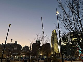
Downtown Omaha is the central business, government and social core of the Omaha–Council Bluffs metropolitan area, U.S. state of Nebraska. The boundaries are Omaha's 20th Street on the west to the Missouri River on the east and the centerline of Leavenworth Street on the south to the centerline of Chicago Street on the north, also including the CHI Health Center Omaha. Downtown sits on the Missouri River, with commanding views from the tallest skyscrapers.

Capitol View/Stifft's Station is a neighborhood of Little Rock, Arkansas, in the west-central portion of the city with approximately 1500 homes. Roughly, its boundaries include the area south of West Markham, north of Interstate 630, east of Pine, and west of Summit, as well as south of Riverview between Park and Summit. Capitol View/Stifft's Station is just west of Downtown, north of the Central High School Historic District, southeast of Pulaski Heights and uses the 72205 ZIP code.

This is a list of the National Register of Historic Places listings in Detroit, Michigan.
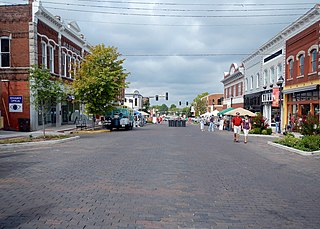
The Rogers Commercial Historic District, known informally as Historic Downtown Rogers, is a historic district in the central business district of Rogers, Arkansas. When it was first listed on the National Register of Historic Places in 1988, it was known as the Walnut Street Historic District; this was changed when the district was enlarged in 1993. The district encompasses a portion of the city's central business district, whose historical significance extends from about 1885 to the end of World War II.
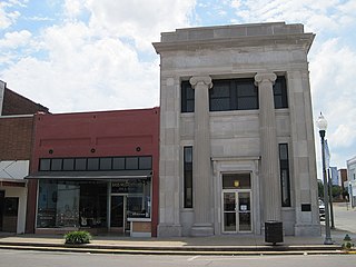
The National Bank of Commerce Building is a historic commercial building at 200 S. Pruett St. in downtown Paragould, Arkansas. It is a two-story structure, built out of cut stone, with a center entrance recessed in a two-story opening with flanking Ionic columns. This Classical Revival style building, probably the finest of its style in Greene County, and the least-altered bank building of the period in Paragould, was designed by the Memphis firm of Hankers and Cairns and was built in 1923.

Eight special routes of U.S. Route 412 exist.

Twelve special routes of U.S. Route 63 currently exist. Arkansas and Missouri each contain five, with two in Iowa. There are also five former routings that have been removed from the system.

Several special routes of U.S. Route 49 exist. In order from south to north they are as follows.

The Highland Park Historic Business District at Euclid and Sixth Avenues is located in the north-central section of Des Moines, Iowa, United States. It is located on the border of the Oak Park and Highland Park neighborhoods. The commercial historic district has been listed on the National Register of Historic Places since 1998. The Highland Park neighborhood also includes the College Corner Commercial Historic Business District.
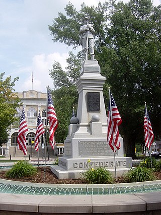
Downtown Bentonville is the historic business district of Bentonville, Arkansas. The region is the location of Walmart Home Office; city and county government facilities; and most of Bentonville's tourist attractions for the city and contains many historically and architecturally significant properties. Downtown measures approximately 1.5 square miles (3.9 km2) and is defined as the region between Tiger Boulevard to the north, Highway 102 (AR 102) to the south, Walton Boulevard to the west and J Street to the east. Similar to other central business districts in the US, Downtown has recently undergone a transformation that included the construction of new condos and lofts, renovation of historic buildings, and arrival of new residents and businesses. Upon opening of Crystal Bridges Museum of American Art the increased tourist traffic related to the museum has made Downtown Bentonville one of the state's most popular tourism destinations.
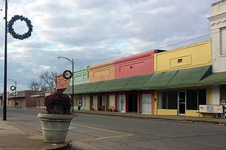
The Lake Village Commercial Historic District encompasses the historic commercial heart of Lake Village, Arkansas, the county seat of Chicot County in the Mississippi River delta region of southeastern Arkansas. The district covers about six square blocks of downtown Lake Village, bounded roughly by Jackson Street to the north, Lakeshore Drive to the east, Church Street to the south, and Chicot Street to the west. This area represents the growth of Lake Village during its period of greatest prosperity, between 1906 and 1960. The city's growth was spurred by the arrival of the railroad in 1903, and most of the district's buildings were built between 1900 and 1930. Most of the buildings are vernacular commercial buildings; the John Tushek Building at 202 Main Street is one interesting example of Beaux Arts styling, and 218–222 Main Street has some Italianate styling. The district includes the Lake Village Confederate Monument, which has been a local landmark since 1910.

The El Dorado Commercial Historic District encompasses the historic commercial heart of downtown El Dorado, Arkansas. The city serves as the seat of Union County, and experienced a significant boom in growth during the 1920s, after oil was discovered in the area. The business district that grew in this time is anchored by the Union County Courthouse, at the corner of Main and Washington Streets, where the Confederate memorial is also located. The historic district listed on the National Register of Historic Places in 2003 includes the city blocks surrounding the courthouse, as well as several blocks extending east along Main Street and south along Washington Street. Most of the commercial buildings are one and two stories in height and are built of brick. Notable exceptions include the Exchange Bank building, which was, at nine stories, the county's first skyscraper, and the eight-story Murphy Oil building. There are more than forty contributing properties in the district.

The former Greene County Courthouse is located at Courthouse Square in the center of Paragould, the county seat of Greene County, Arkansas. It is a large two-story Georgian Revival structure, built out of red brick. It has a low-pitch hip roof with small gables at three corners, as well as above the entrances. The roof is topped by a square tower with a clock and belfry, topped by an ogee roof and spire. It was built in 1887, and was the sixth courthouse built for the county, most of the others having been destroyed by fire.
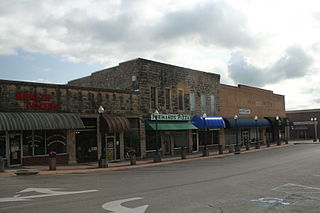
The Mountain Home Commercial Historic District encompasses the historic central business district of Mountain Home, Arkansas, the county seat of Baxter County. The district is centered on the Baxter County Courthouse, and is bounded on the north by East 5th Street, the south by East 9th Street, the east by South Street, and the west by South Hickory Street. Most of the buildings in this area are commercial structures, one or two stories in height, of masonry construction. They are generally vernacular in style, and most were built in one of two periods: between about 1900 and 1920, after the arrival of the railroad, and in the 1950s, when the city experienced another major period of growth. The oldest building is the 1892 Baker Building at 601-603 Baker Street.


