Coordinates: 36°04′55″N120°28′50″W / 36.08194°N 120.48056°W
A geographic coordinate system is a coordinate system that enables every location on Earth to be specified by a set of numbers, letters or symbols. The coordinates are often chosen such that one of the numbers represents a vertical position and two or three of the numbers represent a horizontal position; alternatively, a geographic position may be expressed in a combined three-dimensional Cartesian vector. A common choice of coordinates is latitude, longitude and elevation. To specify a location on a plane requires a map projection.
Parkfield Junction | |
---|---|
Unincorporated community | |
Coordinates: 36°04′55″N120°28′50″W / 36.08194°N 120.48056°W | |
Country | United States |
State | California |
County | Fresno County |
Elevation [1] | 1,194 ft (364 m) |
Parkfield Junction is an unincorporated community in Fresno County, California. [1] It is located 8 miles (13 km) west-southwest of Coalinga, [2] at an elevation of 1194 feet (364 m). [1]
In law, an unincorporated area is a region of land that is not governed by a local municipal corporation; similarly an unincorporated community is a settlement that is not governed by its own local municipal corporation, but rather is administered as part of larger administrative divisions, such as a township, parish, borough, county, city, canton, state, province or country. Occasionally, municipalities dissolve or disincorporate, which may happen if they become fiscally insolvent, and services become the responsibility of a higher administration. Widespread unincorporated communities and areas are a distinguishing feature of the United States and Canada. In most other countries of the world, there are either no unincorporated areas at all, or these are very rare; typically remote, outlying, sparsely populated or uninhabited areas.
Fresno County, officially the County of Fresno, is a county located in the central portion of the U.S. state of California. As of July 1, 2018, the population was 994,400 The county seat is Fresno, the fifth-largest city in California.
California is a state in the Pacific Region of the United States. With 39.6 million residents, California is the most populous U.S. state and the third-largest by area. The state capital is Sacramento. The Greater Los Angeles Area and the San Francisco Bay Area are the nation's second- and fifth-most populous urban regions, with 18.7 million and 9.7 million residents respectively. Los Angeles is California's most populous city, and the country's second-most populous, after New York City. California also has the nation's most populous county, Los Angeles County, and its largest county by area, San Bernardino County. The City and County of San Francisco is both the country's second-most densely populated major city after New York City and the fifth-most densely populated county, behind only four of the five New York City boroughs.
Parkfield is an unincorporated community in Monterey County, California. It is located on Little Cholame Creek 21 miles (34 km) east of Bradley, at an elevation of 1,529 feet (466 m). As of 2007 road signs announce the population as 18.
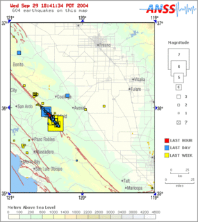
Parkfield earthquake is a name given to various large earthquakes that occurred in the vicinity of the town of Parkfield, California, United States. The San Andreas fault runs through this town, and six successive magnitude 6 earthquakes occurred on the fault at unusually regular intervals, between 12 and 32 years apart, between 1857 and 1966. The most recent significant earthquake to occur here happened on September 28, 2004.
Walloper Lake Provincial Park is a provincial park in British Columbia, Canada. Walloper lake is a small lake located on the Trans-Canada Highway, 38 km from the city of Kamloops.
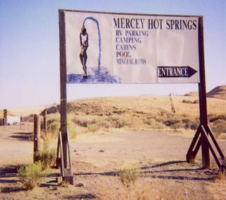
Mercey Hot Springs is an unincorporated community in the Little Panoche Valley of Fresno County, central California, about 60 miles (97 km) west-southwest of Fresno. It is a resort along South Fork Little Panoche Creek and the Little Panoche Road located at the western edge of Fresno County.
Dos Amigos Pumping Plant is a water pumping plant of the California State Water Project, located 10 miles south of Los Banos, on Interstate 5, within central Merced County, in the San Joaquin Valley, central California.
Pokerville is a former settlement in Amador County, California. It lay at an elevation of 1040 feet. It was superseded by Plymouth.
Blue Lake Junction is an unincorporated community in Calaveras County, California. It lies at an elevation of 4101 feet.
Arbios is an unincorporated community in Fresno County, California. It is located on the Southern Pacific Railroad 6.5 miles (10 km) south-southeast of Firebaugh, at an elevation of 171 feet.
Biola Junction is an unincorporated community in Fresno County, California. It is located on the Southern Pacific Railroad 5.5 miles (9 km) west-northwest of Fresno, at an elevation of 299 feet.
Caldwell is a former settlement in Fresno County, California, United States. It was located on the Southern Pacific Railroad 3 miles southeast of San Joaquin, at an elevation of 177 feet. Caldwell still appeared on maps as of 1925.
Calflax is an unincorporated community in Fresno County, California. It is located 20 miles (32 km) northeast of Coalinga, at an elevation of 276 feet.
Cromir is an unincorporated community in Fresno County, California. It is located on the Southern Pacific Railroad 4 miles south-southeast of Firebaugh, at an elevation of 164 feet.
Ingle is an unincorporated community in Fresno County, California. It is located on the Southern Pacific Railroad 7.25 miles (11.7 km) east-southeast of Mendota, at an elevation of 164 feet.
Nares is a former settlement in Fresno County, California. It was located on the Southern Pacific Railroad 0.5 miles (0.80 km) northwest of Helm, at an elevation of 187 feet. It still appeared on maps as of 1925.
Ora is an unincorporated community in Fresno County, California, United States. It is located on the Southern Pacific Railroad 2 miles east-northeast of Coalinga, at an elevation of 643 feet .
Panoche Junction is an unincorporated community in Fresno County, California. It is located 15 miles (24 km) west-southwest of Tranquillity, at an elevation of 515 feet.
Pueblo de las Juntas is a former settlement in Fresno County, California situated at the confluence of the San Joaquin River and Fresno Slough, 2 miles (3.2 km) north of Mendota.
Rugg is a former settlement in Fresno County, California. It was located on the Southern Pacific Railroad 3 miles (4.8 km) east-northeast of Kerman, at an elevation of 239 feet.
Hancock Field is a former airport and military airfield about 2 miles (3.2 km) south-southeast of Santa Maria, California. Also known as Santa Maria Municipal Airport, the airport was closed about 1959 and today is the site of Allan Hancock College.
The Mews is an unincorporated community in Richmond County, in the U.S. state of Virginia.
This Fresno County, California-related article is a stub. You can help Wikipedia by expanding it. |