Pennsuco, Florida

Last updated

Pennsuco
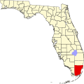
USA Florida location map.svg
Red pog.svg
Pennsuco
Location within the state of Florida
Coordinates: 25°53′42″N80°22′41″W / 25.89500°N 80.37806°W / 25.89500; -80.37806
Country United States
State Florida
County Miami-Dade
Time zone UTC-5 (Eastern (EST))
  Summer (DST) UTC-4 (EDT)
GNIS feature ID305081 [1]

Pennsuco is a former rural community in Miami-Dade County, Florida, along the Miami Canal and U.S. Route 27. It was established in 1920 by the Pennsylvania Sugar Company, which built a sugar cane plantation and sugar mill, and a self-contained community housing employees and their families. The sugar operation failed by 1925, largely due to a series of floods and killing frosts which ruined crops; the land was then adapted for regular truck farming until 1931, when the company ended operations at the site. [2] A post office operated here until 1933, [3] and the area continued as a farming community.

Today the area has become suburban, with the northern portion annexed by Hialeah Gardens and the southern portion industrialized and unpopulated. Virtually all of Pennsuco's old structures are no longer standing, but the name survives with Pennsuco Industrial Park and the Pennsuco Canal.

Related Research Articles

<span class="mw-page-title-main">Boca Raton, Florida</span> City in Palm Beach County, Florida

Boca Raton is a city in Palm Beach County, Florida, United States. The population was 97,422 in the 2020 census and it ranked as the 23rd-largest city in Florida in 2022. However, many people with a Boca Raton postal address live outside of municipal boundaries, such as in West Boca Raton. As a business center, the city also experiences significant daytime population increases. A part of South Florida, Boca Raton is 45 miles (72 km) north of Miami and is a principal city of the Miami metropolitan area, which had a population of 6,012,331 as of 2015.

<span class="mw-page-title-main">Hallandale Beach, Florida</span> Place in Florida

Hallandale Beach is a city in southern Broward County, Florida, United States. The city is named after Luther Halland, the son of a Swedish worker for Henry Flagler's Florida East Coast Railroad. It's also part of South Florida's Miami metropolitan area. As of the 2020 census, the population was 41,217.

<span class="mw-page-title-main">Oakland Park, Florida</span> City in Florida, United States

Oakland Park, officially the City of Oakland Park, is a city in Broward County, Florida, United States. It is part of the South Florida metropolitan area, which was home to 6,166,488 people at the 2020 census. As of the 2020 United States Census, the city's population was 44,229.

<span class="mw-page-title-main">Plantation, Florida</span> City in Florida, United States

Plantation is a city in Broward County, Florida, United States. It is a part of the South Florida metropolitan area. The city's name comes from the previous part-owner of the land, the Everglades Plantation Company, and their unsuccessful attempts to establish a rice plantation in the area. As of the 2020 U.S. census, the population was 91,750.

<span class="mw-page-title-main">Apollo Beach, Florida</span> Census-designated place in Florida, United States

Apollo Beach is an unincorporated census-designated place in Hillsborough County, Florida, United States. The population was 14,055 at the 2010 census, up from 7,444 at the 2000 census.

<span class="mw-page-title-main">Florida City, Florida</span> City in Florida, United States

Florida City is a city in Miami-Dade County, Florida, United States. It is the southernmost municipality in the South Florida metropolitan area. Florida City is primarily a Miami suburb and a major agricultural area. As of the 2020 census, it had a population of 13,085, up from 11,245 in 2010.

<span class="mw-page-title-main">North Miami, Florida</span> City in Florida

North Miami is a suburban city located in northeast Miami-Dade County, Florida, United States, about 10 miles (16 km) north of Miami. The city lies on Biscayne Bay and hosts the Biscayne Bay Campus of Florida International University.. Originally the town of "Arch Creek", the area was incorporated as the "Town of Miami Shores", which was renamed the "Town of North Miami" in 1931. It was reincorporated as a city in 1953. The city is part of South Florida's Miami metropolitan area.

<span class="mw-page-title-main">Canal Point, Florida</span> CDP in Florida, United States

Canal Point is a census-designated place (CDP) and unincorporated community in Palm Beach County, Florida, United States. It is part of the Miami metropolitan area of South Florida despite its local culture and location being way more similar to the Florida Heartland. Canal Point has a population of 344 people counted in the 2020 US census.

<span class="mw-page-title-main">Darnestown, Maryland</span> Census-designated place in the United States

Darnestown is a United States census-designated place (CDP) and an unincorporated area in Montgomery County, Maryland. The CDP is 17.70 square miles (45.8 km2) with the Potomac River as its southern border and the Muddy Branch as much of its eastern border. Seneca Creek borders portions of its north and west sides. The Travilah, North Potomac, and Germantown census-designated places are adjacent to it, as is the city of Gaithersburg. Land area for the CDP is 16.39 square miles (42.4 km2). As of the 2020 census, the Darnestown CDP had a population of 6,723, while the village of Darnestown is considerably smaller in size and population. Downtown Washington, D.C. is about 22 miles (35 km) to the southeast.

<span class="mw-page-title-main">Greater Houston</span> Metropolitan area in Texas, United States

Greater Houston, designated by the United States Office of Management and Budget as Houston–The Woodlands–Sugar Land, is the fifth-most populous metropolitan statistical area in the United States, encompassing nine counties along the Gulf Coast in Southeast Texas. With a population of 7,122,240 in 2020, Greater Houston is the second-most populous in Texas after the Dallas–Fort Worth metroplex.

<span class="mw-page-title-main">Southeastern United States</span> Eastern portion of the Southern United States

The Southeastern United States, also referred to as the American Southeast, the Southeast, or simply the South, is a geographical region of the United States. It is located broadly on the eastern portion of the Southern United States and the southern portion of the Eastern United States. It comprises at least a core of states on the lower East Coast of the United States and eastern Gulf Coast. Expansively, it reaches as far north as West Virginia and Maryland, which borders the Ohio River and Mason–Dixon line, and stretches as far west as Arkansas and Louisiana. There is no official U.S. government definition of the region, though various agencies and departments use different definitions.

<span class="mw-page-title-main">Miami and Erie Canal</span> 19th-century manmade water route between Cincinnati and Toledo, Ohio, U.S.

The Miami and Erie Canal was a 274-mile (441 km) canal that ran from Cincinnati to Toledo, Ohio, creating a water route between the Ohio River and Lake Erie. Construction on the canal began in 1825 and was completed in 1845 at a cost to the state government of $8,062,680.07. At its peak, it included 19 aqueducts, three guard locks, 103 canal locks, multiple feeder canals, and a few man-made water reservoirs. The canal climbed 395 feet (120 m) above Lake Erie and 513 feet (156 m) above the Ohio River to reach a topographical peak called the Loramie Summit, which extended 19 miles (31 km) between New Bremen, Ohio to lock 1-S in Lockington, north of Piqua, Ohio. Boats up to 80 feet long were towed along the canal by mules, horses, or oxen walking on a prepared towpath along the bank, at a rate of four to five miles per hour.

<span class="mw-page-title-main">South Central Florida Express, Inc.</span> Shortline railroad in Florida

South Central Florida Express, Inc. is a common carrier shortline railroad in southern Florida run by U.S. Sugar Corporation. Its trains operate from Sebring to Fort Pierce via Clewiston around the southern perimeter of Lake Okeechobee, and serves customers at 26 locations. With 171 miles (275 km) of track, the SCXF is the largest private agricultural railroad in the U.S.

<span class="mw-page-title-main">United States Southern Command</span> Command responsible for South American area

The United States Southern Command (USSOUTHCOM), located in Doral, Florida in Greater Miami, is one of the eleven unified combatant commands in the United States Department of Defense. It is responsible for providing contingency planning, operations, and security cooperation for Central and South America, the Caribbean, their territorial waters, and for the force protection of U.S. military resources at these locations. USSOUTHCOM is also responsible for ensuring the defense of the Panama Canal and the canal area.

<span class="mw-page-title-main">Redland, Florida</span> Unincorporated community in Florida, United States

Redland, </ref> is a historic unincorporated community and agricultural area in Miami-Dade County, Florida, located about 20 miles (32 km) southwest of downtown Miami and just northwest of Homestead, Florida. It is unique in that it constitutes a large farming belt directly adjoining what is now the seventh most populous major metropolitan area in the United States. Named for the pockets of red clay that cover a layer of oolitic limestone, Redland produces a variety of tropical fruits, many of which do not grow elsewhere in the continental United States. The area also contains a large concentration of ornamental nurseries. The landscape is dotted with u-pick'em fields, coral rock (oolite) walls, and the original clapboard homes of early settlers and other historic early twentieth century structures.

<span class="mw-page-title-main">Loxahatchee Groves, Florida</span> Town in the state of Florida, United States

Loxahatchee Groves is a town in Palm Beach County, Florida, United States. The town was incorporated November 1, 2006, as the 38th municipality in Palm Beach County. The first election for town council members was held on March 13, 2007. The area had been settled since 1917, although Loxahatchee Groves did not become a municipality until 2006. The town bills itself as "Florida's Last Frontier". It was incorporated primarily in order to protect the area from the encroaching urbanization of South Florida, as nearby cities continued to develop and to preserve the area's rural character. The town is part of the Miami metropolitan area. As of the 2020 US census, the town had a population of 3,355.

<span class="mw-page-title-main">Environment of Florida</span> Overview of the environment of the U.S. state of Florida

The environment of Florida in the United States yields an array of land and marine life in a mild subtropical climate. This environment has drawn millions of people to settle in the once rural state over the last hundred years. Florida's population increases by about 1,000 residents each day. Land development and water use have transformed the state, primarily through drainage and infill of the wetlands that once covered most of the peninsula.

<span class="mw-page-title-main">Restoration of the Everglades</span> Effort to remedy 20th-century damage inflicted on the environment of southern Florida

An ongoing effort to remedy damage inflicted during the 20th century on the Everglades, a region of tropical wetlands in southern Florida, is the most expensive and comprehensive environmental repair attempt in history. The degradation of the Everglades became an issue in the United States in the early 1970s after a proposal to construct an airport in the Big Cypress Swamp. Studies indicated the airport would have destroyed the ecosystem in South Florida and Everglades National Park. After decades of destructive practices, both state and federal agencies are looking for ways to balance the needs of the natural environment in South Florida with urban and agricultural centers that have recently and rapidly grown in and near the Everglades.

Okeelanta is an unincorporated community in Palm Beach County, Florida, United States, located approximately 4 miles (7 km) south of South Bay on U.S. Route 27 at County Road 827. It was originally developed as a planned community in the 1910s, but had effectively disappeared by the end of the 1920s. The name is a portmanteau of Lake Okeechobee and Atlantic Ocean.

The sugar industry of the United States produces sugarcane and sugar beets, operates sugar refineries, and produces and markets refined sugars, sugar-sweetened goods, and other products. The United States is among the world's largest sugar producers. Unlike most other sugar producing countries, the United States has both large and well-developed sugarcane and sugar beet industries. Refined sugarcane, processed sugar beet, and high-fructose corn syrup are all commonly used in the U.S. as added sugars to sweeten food and beverages.

References

  1. "GNIS Detail - Pennsuco". United States Geological Survey . Retrieved September 17, 2020.
  2. Graham, William A. (1951). "The Pennsuco Sugar Experiment" (PDF). Tequesta: The Journal of the Historical Association of Southern Florida. Miami, Fla.: Historical Association of Southern Florida. Retrieved September 17, 2020.
  3. "Post Offices". United States and Worldwide Postal History. Retrieved September 17, 2020.