
Lawrence Heights is a neighbourhood in Toronto, Ontario, Canada. It is located north-west of central Toronto, in the district of North York. The neighbourhood is roughly bounded by Lawrence Avenue to the south, Yorkdale Road to the north, Varna Drive to the east and Dufferin Street to the west. It is part of the greater Yorkdale-Glen Park official Toronto neighbourhood.

Henry Farm is a neighbourhood in the City of Toronto, Ontario, Canada. It is located in the north central part of the city within the former city of North York.

Bayview Village is a neighbourhood in Toronto, Ontario, Canada. It is part of the federal Don Valley North riding and the provincial Don Valley North electoral district, and Toronto electoral Ward 17: Don Valley North. In 2006, it had a population of 15,370.

Scarborough—Rouge River was a federal electoral district in Ontario, Canada, that has been represented in the House of Commons of Canada between 1988 and 2015. However, as of the Fall 2015 federal election, part of this riding has been combined with the south-western part of the old riding Pickering—Scarborough East.

Willowdale is a federal electoral district in Toronto, Ontario, Canada. It has been represented in the House of Commons of Canada since 1979. It is the riding with the biggest Korean community in Canada. As per the 2021 census, 9.9% of the population of Willowdale is Korean.

Sheppard Avenue is an east–west principal arterial road in Toronto, Ontario, Canada. The street has two distinct branches near its eastern end, with the original route being a collector road leading to Pickering via a turnoff, and the main route following a later-built roadway which runs south to Kingston Road. To avoid name duplication, the Toronto portion of the northern branch was renamed Twyn Rivers Drive. The section of the street entirely in Toronto is (34.2 km) in length, while the Pickering section and Twyn Rivers Dr. is (5.4 km) long.

Mississauga—Brampton South was a federal electoral district in Ontario, Canada, that was represented in the House of Commons of Canada from 2004 to 2015.
Bedford Park is a neighbourhood just outside the downtown core of Toronto. It borders Lawrence Park which was ranked Canada's wealthiest neighbourhood in 2011. The City of Toronto's neighbourhood definitions places most of Bedford Park, including Bedford Park Avenue in the Lawrence Park North Planning Neighbourood and the remaining western and northern portions of Bedford Park within a larger neighbourhood, called Bedford Park-Nortown. The border of this larger area extend to Bathurst Street on the west, Highway 401 to the north, Hillhurst Boulevard to the south, and zigzags from northeast to southwest along Yonge Street and Avenue Road.

The Elms is a neighbourhood in Toronto, Ontario, Canada. It is bordered by the Humber River to the east, Islington Avenue to the west, Thistletown to the north, and Highway 401 to the south.

Lawrence Manor is a neighbourhood in the city of Toronto, Ontario, Canada. This neighbourhood is bounded by Bathurst Street on the east, Highway 401 to the north, the Allen to the west, and Lawrence Avenue to the south. The western side of the area borders along Bathurst Heights and the large public housing project.

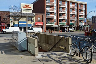
Lansing is a neighbourhood in Toronto, Ontario, Canada. It originated as a minor settlement of a store, other services, and a post office at the corner of Yonge Street and Sheppard Avenue, was later designated a postal village, and was finally consolidated with its fellow postal villages, Newtonbrook and Willowdale, into a new postal village named Willowdale within the Township of North York. For neighbourhood planning purposes, the City of Toronto, which North York was amalgamated into in 1998, labels Lansing as Lansing-Westgate. Its boundaries are Yonge Street to the east, Highway 401 to the south, Bathurst Street to the west, and Burnett Avenue to the north.

Pleasant View is a neighbourhood in the city of Toronto, Ontario, Canada that is located in the district of North York at the northern end of the city. It is bordered by Victoria Park to the East, Sheppard Avenue to the South, Highway 404 to the west and the Finch hydro corridor to the north. The neighbourhood is home to several high-rise apartment and condominium buildings, such as The Clippers.

Don Valley Village is a neighbourhood in the city of Toronto, Ontario, Canada. It is located in the former suburb of North York. Located north of Highway 401 and bisected by Don Mills Road, it is bounded by Sheppard Avenue to the south, Leslie Street to the west, Finch Avenue to the north and Highway 404 to the east. Like the nearby Don River Valley, the neighbourhood has hill and dale topography.

Dorset Park is a neighbourhood in Toronto, Ontario, Canada. It is located in the western part of the district of Scarborough. The neighbourhood is bordered by Highway 401 to the north, Midland Avenue to the east, Lawrence Avenue to the south, and Birchmount Road to the west. Kennedy Road runs along the neighbourhood's centre north and south and Ellesmere Road runs along the centre east and west. The area south of Lawrence Avenue, north of the hydro corridor, is known as McGregor Park and is often included as part of Dorset Park.

Highland Creek is a river in the Scarborough district of Toronto, Ontario, emptying into Lake Ontario at the eastern end of the Scarborough Bluffs. It is home to several species of fish including trout, carp, bass and salmon. It is a meandering river which, like most rivers in Toronto, travels through a glacial ravine formed after the last Ice Age. The Highland Creek watershed, including tributaries, is almost entirely contained within Scarborough.
Willowdale is a provincial electoral district in Toronto, Ontario, Canada. It elects one member to the Legislative Assembly of Ontario. It was created in 1987.
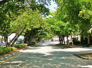
Coral Way is a neighborhood within Miami, Florida that is defined by Coral Way, a road established by Coral Gables founder George E. Merrick during the 1920s. It is located in Miami-Dade County, Florida.
Armour Heights is a neighbourhood in Toronto, Ontario, Canada, in the district of North York. It is bounded by Wilson Avenue to the south, Bathurst Street to the west, and the west branch of the Don River to the north and east. Highway 401 cuts through the centre of the neighbourhood.
Mississauga—Brampton South was a provincial electoral district in Ontario, Canada, that has been represented in the Legislative Assembly of Ontario from the 2007 provincial election until 2018. It was dissolved into Mississauga—Malton, Mississauga—Streetsville, Mississauga East—Cooksville, Mississauga Centre, Brampton South and Brampton Centre.

Don Valley North is a provincial electoral district in Toronto, Ontario, Canada. It elects one member to the Legislative Assembly of Ontario.

