
Toronto is the capital city of the Canadian province of Ontario. With a recorded population of 2,731,571 in 2016, it is the most populous city in Canada and the fourth most populous city in North America. The city is the anchor of the Golden Horseshoe, an urban agglomeration of 9,245,438 people surrounding the western end of Lake Ontario, while the Greater Toronto Area (GTA) proper had a 2016 population of 6,417,516. Toronto is an international centre of business, finance, arts, and culture, and is recognized as one of the most multicultural and cosmopolitan cities in the world.
High Park is a municipal park in Toronto, Ontario, Canada. High Park is a mixed recreational and natural park, with sporting facilities, cultural facilities, educational facilities, gardens, playgrounds and a zoo. One-third of the park remains in a natural state, with a rare oak savannah ecology. High Park was opened to the public in 1876 and is based on a bequest of land from John George Howard to the City of Toronto. It spans 161 hectares and is the second-largest municipal park in Toronto, after Centennial Park.
Leslieville is a neighbourhood in Toronto, Ontario, Canada, situated east of the Don River. It is bounded by the Canadian National railway line and Gerrard Street to the north, Empire Avenue to the west, Eastern Avenue to south, and Coxwell Avenue to the east.

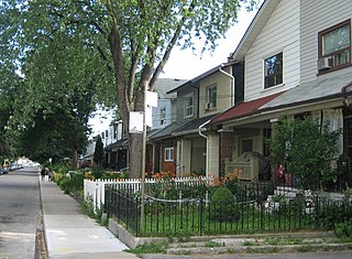
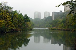
Riverdale is a large neighbourhood in Toronto, Ontario, Canada. It is bounded by the Don River Valley to the west, Danforth Avenue and Greektown to the north, Jones Avenue, the CN/GO tracks, Leslieville to the east, and Lake Shore Boulevard to the south.

Queen Street is a major east-west thoroughfare in Toronto, Ontario, Canada. It extends from Roncesvalles Avenue and King Street in the west to Victoria Park Avenue in the east. Queen Street was the cartographic baseline for the original east-west avenues of Toronto's and York County's grid pattern of major roads. The western section of Queen is a centre for Canadian broadcasting, music, fashion, performance, and the visual arts. Over the past twenty-five years, Queen West has become an international arts centre and a tourist attraction in Toronto.

Harbourfront is a neighbourhood on the northern shore of Lake Ontario within the downtown core of the city of Toronto, Ontario, Canada. Part of the Toronto waterfront, Harbourfront extends from Bathurst Street in the west, along Queens Quay, with its ill-defined eastern boundary being either Yonge Street or York Street. Its northern boundary is the Gardiner Expressway. Much of the district was former water lots filled in during the early 1900s to create a larger harbour district. After shipping patterns changed and the use of the Toronto harbour declined, the area was converted from industrial uses to a mixed-use district that is mostly residential and leisure.
Weston is a neighbourhood and former village in Toronto, Ontario, Canada. The neighbourhood is situated in the northwest of the city, south of Highway 401, east of the Humber River, north of Eglinton Avenue, and west of Jane Street. Weston Road just north of Lawrence Avenue is the commercial core of Weston, with many small businesses and services. Weston was incorporated as a village in the 19th century and was absorbed into the Borough of York in the late 1960s. York itself was amalgamated into Toronto in 1998.
Willowdale is a neighbourhood in the city of Toronto, Ontario, Canada, located in the district of North York. It developed from three postal villages: Newtonbrook, Willowdale and Lansing.

Christie Pits,, is a public recreational area in Toronto, Ontario, Canada. It is located at 750 Bloor Street West at Christie Street, just west of the Toronto Transit Commission Christie subway station.

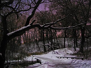
Riverdale Park is a large park spanning the Lower Don River in Toronto, Ontario, Canada, between Cabbagetown to the west and Broadview Avenue in Riverdale to the east.

Riverdale Collegiate Institute is a non-semestered high school located in Toronto, Ontario, Canada owned and operated by the Toronto Board of Education until its amalgamation in 1998 into the Toronto District School Board.

Downtown Edmonton is the central business district of Edmonton, Alberta. Located at the geographical centre of the city, the downtown area is bounded by 109 Street to the west, 105 Avenue to the north, 97 Street to the east, 97 Avenue and Rossdale Road to the south, and the North Saskatchewan River to the southeast.

Barton Street is an arterial road in the Lower City of Hamilton, Ontario, Canada. It's also the longest street (21.0 km) in the city. It starts at the north end of downtown at Locke Street North and is a two-way street that stretches eastward through a number of different and varied communities in the city and ends in Winona at Fifty Road just west of the Hamilton/Niagara regional boundary. The street is divided in East and West portions, divided by James Street. However, the East designation does not continue through the Stoney Creek district, which was a separate municipality prior to amalgamation in 2001, and the designation as well as the address numbering system were not restructured upon amalgamation, and numbers reset at the former city limits at Centennial Parkway.

Britannia is an affluent residential neighbourhood in the southwest quadrant of Calgary, Alberta, Canada. It is bounded by Elbow Drive to the east, 50 Avenue S to the south, Elbow River and Riverdale Park to the west and Britannia Drive to the north.

Alexandra Park is a neighbourhood located in downtown Toronto, Ontario, Canada. Alexandra Park is bounded by Dundas Street West on the north, Spadina Avenue on the east, Queen Street West on the south, and Bathurst Street on the west. Alexandra Park consists of private and public housing, with at grade retail along Queen Street West and Spadina Avenue, some institutional, and several commercial buildings scattered through the neighborhood. The neighborhood takes its name from Alexandra Park, a municipal park at the south-east corner of Dundas Street West and Bathurst Street. The park is named for Queen Alexandra, wife of King Edward VII, the first future monarch to visit Toronto.

Runnymede Park is a medium-sized public park located in The Junction neighbourhood of Toronto, Canada, one block east of Runnymede Road. Its southern boundary is the West Toronto Yard used by the Canadian Pacific Railway, its northern boundary is Ryding Avenue, while a laneway and parking lot make up the western and eastern boundaries respectively. It is relatively flat, and features many soaring mature oak trees.

Sorauren Avenue Park is a park in the Roncesvalles neighbourhood of Toronto, Ontario, Canada. A reclaimed brown field site, it was created after the local community objected to City of Toronto government plans to convert a former bus garage into a facility for storing City vehicles. The park opened in 1995 and now hosts several sporting fields, a farmer's market and a fieldhouse for community gatherings.

Amy George is a 2011 Canadian microbudget film written, produced and directed by Yonah Lewis and Calvin Thomas. The film tells the story of the 13-year-old Jesse who wants to be an artist, but believes that his mundane middle class life has left him unprepared. After reading a book on what it takes to be a "true-artist", he sets out looking for risk, ecstasy, wildness and women.
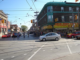
East Chinatown is a Chinese neighbourhood located in the city of Toronto's east end in Riverdale and one of the several Chinatowns in Toronto. It was formed during the early 1970s and is centred on Gerrard Street East between Broadview Avenue and Carlaw Avenue.


