Etobicoke is an administrative district and former city within Toronto, Ontario, Canada. Comprising the city's west end, Etobicoke is bordered on the south by Lake Ontario, on the east by the Humber River, on the west by Etobicoke Creek, the cities of Brampton, and Mississauga, the Toronto Pearson International Airport, and on the north by the city of Vaughan at Steeles Avenue West.
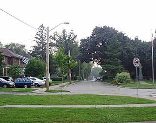
Mimico is a neighbourhood in Toronto, Ontario, Canada, being located in the south-west area of Toronto on Lake Ontario. It is in the south-east corner of the former Township of Etobicoke, and was an independent municipality from 1911 to 1967.

The Toronto waterfront is the lakeshore of Lake Ontario in the city of Toronto, Ontario, Canada. It spans 46 kilometres between the mouth of Etobicoke Creek in the west and the Rouge River in the east.

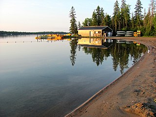
Bon Echo Provincial Park is a provincial park in southeastern Ontario, Canada, approximately 6 kilometres (3.7 mi) north of Cloyne. The park is within township boundaries of both North Frontenac and Addington Highlands, roughly separated by Highway 41.

The Scarborough Bluffs, also known as The Bluffs, is an escarpment in the Scarborough district of Toronto, Ontario, Canada. There are nine parks along the bluffs, with Bluffers Park being the only one with a beach. Forming much of the eastern portion of Toronto's waterfront, the Scarborough Bluffs stands above the shoreline of Lake Ontario. At its highest point, the escarpment rises 90 metres (300 ft) above the coastline and spans a length of 15 kilometres (9.3 mi).

Sunnyside is a lakefront district in Toronto, Ontario, Canada. It includes a beach and park area along Lake Ontario's Humber Bay, from west of Exhibition Place to the mouth of the Humber River. The area has several recreation uses, including rowing clubs, sports clubs, picnic areas, playgrounds, a nightclub, a bathing pavilion and public pool. The area is a 3 kilometres (1.9 mi) long strip along the lakeshore, bounded by the Gardiner Expressway and rail lines, which separate it from the Parkdale, Roncesvalles and Swansea neighbourhoods to the north. The name originates in a local farm owned by John Howard, which was situated just to the north, on the location of the current St. Joseph's Health Centre hospital.
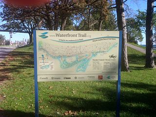
Stretching over 3600 km from Prince Township, west of Sault Ste. Marie, to the Quebec border, the Great Lakes Waterfront Trail is a signed route of interconnecting roads and off-road trails joining over 150 communities and First Nations along the Canadian shores of the Great Lakes and St. Lawrence River. The Great Lakes Waterfront Trail is part of a strategy to protect and connect people to the largest group of freshwater lakes on earth. It is a legacy project of the Waterfront Regeneration Trust, a charity, and its community partners. Through Toronto, the trail is called the Martin Goodman Trail. The Waterfront Trail is also used by commuters in parts of Southern Ontario.

Toronto Parks, Forestry & Recreation (PFR) is the division of Toronto's municipal government responsible for maintaining the municipal park system and natural spaces, regulation of and provision of urban forestry services, and the delivery of recreational programming in city-operated facilities.
Crimson Lake Provincial Park is a provincial park located in Alberta, Canada, 14 kilometres (8.7 mi) west of Rocky Mountain House, off the David Thompson Highway along secondary highway 756.

Spencer Smith Park is a park in downtown Burlington, Ontario located on the shore of Lake Ontario. It was named in memory of Spencer Smith, a former president of the Burlington Horticultural Society who was instrumental in the development of the park system throughout the city. It is home to the Sound of Music Festival, Canada's Largest Ribfest and the Burlington Beer Festival. It has a small beach and plenty of walking paths along Lake Ontario.

Humber Bay Park is a waterfront park located in Etobicoke, part of Toronto, Ontario, Canada. The park consists of two landspits situated at the mouth of Mimico Creek. The park is south of Lake Shore Boulevard West, near Park Lawn Road. Humber Bay Park East is 19 hectares, while Humber Bay Park West is 120 hectares.

Kew Gardens is a large park in The Beaches neighbourhood of Toronto, Ontario, Canada. The park stretches from Queen Street East to Lake Ontario at Kew Beach.

The Palace Pier is the site of Palace Place and Palace Pier, two cruciform condominium towers tied for the 45th-tallest building in Toronto, Ontario, Canada. They are located at 2045 Lake Shore Boulevard West and 1 Palace Pier Court in the Humber Bay neighbourhood in the former city of Etobicoke.
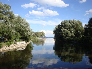
Balsam Lake Provincial Park is a provincial park located in south-central Ontario, Canada, on Balsam Lake. The park is situated along the Trent-Severn Waterway, a few kilometres southwest of Coboconk. It is an all-seasons recreation area offering camping, boating and fishing, and while closed in winter it is also used for skiing and snowshoeing.

Long Branch is a neighbourhood and former municipality in the south-west of Toronto, Ontario, Canada. It is located in the south-western corner of the former Township of Etobicoke on the shore of Lake Ontario. The Village of Long Branch was a partially independent municipality from 1930 to 1967. Long Branch is located within a land grant from the government to Colonel Samuel Smith in the late 18th century. After Smith's death, a small portion of it was developed as a summer resort in the late 1800s.

Bonham State Park is a 261-acre (1.06 km2) state park located in Bonham, Texas. It includes a 65-acre (260,000 m2) lake, rolling prairies, and woodlands.

Ontario Place was an entertainment venue, event venue, and park in Toronto, Ontario, Canada. The venue is located on three artificial landscaped islands just off-shore in Lake Ontario, south of Exhibition Place, and southwest of Downtown Toronto. It opened on May 22, 1971, and operated as a theme park centred around Ontario themes and family attractions until 2012 when the Government of Ontario announced that it would close for redevelopment. It has since reopened as a park without an admission fee but without several of the old attractions. The Government of Ontario has placed 145 acres on a 95-year lease with the Therme Group.
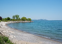
Marie Curtis Park is a public park in Toronto, Ontario, Canada. It is located at the mouth of the Etobicoke Creek on Lake Ontario in the Long Branch neighbourhood. Marie Curtis Park was built after the devastating floods of Hurricane Hazel in 1954 destroyed 56 homes and cottages on the site, leaving 1,868 persons homeless and 81 dead. It is named after Marie Curtis, the reeve of Long Branch at the time of its construction. Long Branch at the time was a separate village; it's now amalgamated into the City of Toronto government.

Heart Lake Conservation Park (HLCA) occupies 169 hectares in the Etobicoke Creek watershed, within the City of Brampton, Ontario. It is owned and managed by the Toronto and Region Conservation Authority (TRCA).