
The Toronto Islands are a chain of 15 small islands in Lake Ontario, south of mainland Toronto, Ontario, Canada.

Yonge–Dundas Square is a public square at the southeast corner of the intersection of Yonge Street and Dundas Street East in the downtown core of Toronto, Ontario, Canada. Designed by Brown and Storey Architects, the square was conceived in 1997 as part of revitalizing the intersection. Since its completion in 2002 as Yonge–Dundas Square, the square has hosted many public events, performances and art displays, establishing itself as a prominent landmark in Toronto and one of the city's prime tourist attractions. Central to the Downtown Yonge entertainment and shopping district, the square is owned by the city and is the first public square in Canada to be maintained through a public–private partnership. The intersection is one of the busiest in Canada, with over 100,000 people crossing the city's first pedestrian scramble daily.

CF Toronto Eaton Centre, commonly referred to simply as the Eaton Centre, is a shopping mall and office complex in the downtown core of Toronto, Ontario, Canada. It is owned and managed by Cadillac Fairview (CF). It was named after the Eaton's department store chain that once anchored it before the chain went defunct in the late 1990s.

Union Station is a major railway station and intermodal transportation hub in Toronto, Ontario, Canada. The station is located in downtown Toronto, on Front Street West, on the south side of the block bounded by Bay Street and York Street. The municipal government of Toronto owns the station building while the provincial transit agency Metrolinx owns the train shed and trackage. It is operated by the Toronto Terminals Railway, a joint venture of the Canadian National Railway and Canadian Pacific Railway, which directs and controls train movement along the Union Station Rail Corridor, the largest and busiest rail corridor in Canada. Constructed in 1927, Union Station has been a National Historic Site of Canada since 1975, and a Heritage Railway Station since 1989.

Path is a network of underground pedestrian tunnels, elevated walkways, and at-grade walkways connecting the office towers of Downtown Toronto, Ontario, Canada. It connects more than 70 buildings via 30 kilometres (19 mi) of tunnels, walkways, and shopping areas. According to Guinness World Records, Path is the largest underground shopping complex in the world, with 371,600 square metres (4,000,000 sq ft) of retail space which includes over 1,200 retail fronts (2016). As of 2016, over 200,000 residents and workers use the Path system daily with the number of private dwellings within walking distance at 30,115.

The Old City Hall is a Romanesque-style civic building and former court house in Toronto, Ontario, Canada. It was the home of the Toronto City Council from 1899 to 1966 and a provincial court house until 2023, and remains one of the city's most prominent structures.

Nathan Phillips Square is an urban plaza in Toronto, Ontario, Canada. It forms the forecourt to Toronto City Hall, or New City Hall, at the intersection of Queen Street West and Bay Street, and is named after Nathan Phillips, mayor of Toronto from 1955 to 1962. The square was designed by the City Hall's architect Viljo Revell and landscape architect Richard Strong. It opened in 1965. The square is the site of concerts, art displays, a weekly farmers' market, the winter festival of lights, and other public events, including demonstrations. During the winter months, the reflecting pool is converted into an ice rink for ice skating. The square attracts an estimated 1.5 million visitors yearly. With an area of 4.85 hectares, it is Canada's largest city square.

The Church of the Holy Trinity is an Anglican church located at Trinity Square in Toronto, Ontario, Canada.

Queens Gardens is a heritage-listed park located on a city block between George Street, Elizabeth Street and William Street in the Brisbane CBD, City of Brisbane, Queensland, Australia. It was built from c. 1905 to 1990s. It is also known as Executive Gardens and St Johns Church Reserve. It was added to the Queensland Heritage Register on 21 October 1992.

College Park is a shopping mall, residential and office complex on the southwest corner of Yonge and College streets in Toronto, Ontario, Canada.

The Henry Scadding House is a historic building located at 6 Trinity Square in Toronto, Ontario, Canada. It is situated behind the Toronto Eaton Centre and adjacent to the Church of the Holy Trinity.
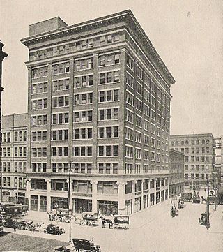
Eaton's Annex was a 10-storey building containing both retail and office space in Downtown Toronto, Ontario, Canada. It opened in January 1913 and was located at the northwest corner of Albert Street and James Street, west of Eaton's Main Store and north of Toronto's City Hall.

Downtown Toronto is the main city centre of Toronto, Ontario, Canada. Located entirely within the district of Old Toronto, it is approximately 16.6 square kilometres in area, bounded by Bloor Street to the north, Lake Ontario to the south, the Don Valley to the east, and Bathurst Street to the west. It is also the home of the municipal government of Toronto and the Government of Ontario.

The architecture of Toronto is an eclectic combination of architectural styles, ranging from 19th century Georgian architecture to 21st century postmodern architecture and beyond.

The Discovery District is one of the commercial districts in Downtown Toronto, Ontario, Canada. It has a high concentration of hospitals and research institutions, particularly those related to biotechnology. The district is roughly bounded by Bloor Street on the north, Bay Street on the east, Dundas Street on the south, and Spadina Avenue on the west.

Downtown Yonge is a retail and entertainment district centred on Yonge Street in Downtown Toronto, Ontario, Canada. The Downtown Yonge district is bounded by Richmond Street to the south; Grosvenor and Alexander Streets to the north; Bay Street to the west; and portions of Church Street, Victoria Street, and Bond Street to the east. All property owners and commercial tenants within these boundaries are members of the Downtown Yonge Business Improvement Area association, founded in 2001.
The Vale of Glamorgan has 740 listed buildings of which 4% are Grade I listed, 10% Grade II* listed and remainder Grade II listed.

Holy Trinity Church is a heritage-listed Anglican church at 141 Brookes Street, Fortitude Valley, City of Brisbane, Queensland, Australia. It is the second church on that site. It was designed by Francis Drummond Greville Stanley built from 1876 to 1877 by James Robinson. It was modified in 1920–1921, 1925 and 1929. It was added to the Queensland Heritage Register on 21 October 1992.

Holy Trinity Church is a heritage-listed Anglican church at 39 Gordon Street, Mackay, Mackay Region, Queensland, Australia. It was designed in 1923 by Lange Leopold Powell and built by A Stonage and Sons, completing in 1926. It is also known as Holy Trinity Church Complex. It was added to the Queensland Heritage Register on 29 April 2003.

Guild Park and Gardens is a public park in the Scarborough district of Toronto, Ontario, Canada. The park was formerly the site of an artist colony and is notable for its collection of relics saved from the demolition of buildings primarily in downtown Toronto arranged akin to ancient ruins. Located on the Scarborough Bluffs, Guild Park and Gardens has an outdoor Greek stage and a 19th-century log cabin among the oldest in Toronto. The principal building in the park is the Guild Inn, a former inn and estate mansion.


