
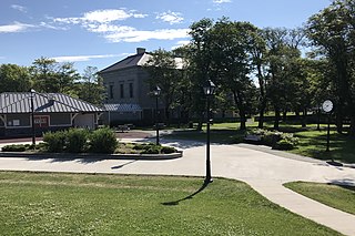
Maryland Heights is a second-ring north suburb of St. Louis, located in St. Louis County, Missouri, United States. The population was 27,472 at the 2010 census. The city was incorporated in 1985. Edwin L. Dirck was appointed the city's first mayor by then County Executive Gene McNary. Mark M. Levin served as City Administrator from August 1985 to 2015.

High Park is a municipal park in Toronto, Ontario, Canada. High Park is a mixed recreational and natural park, with sporting facilities, cultural facilities, educational facilities, gardens, playgrounds and a zoo. One-third of the park remains in a natural state, with a rare oak savannah ecology. High Park was opened to the public in 1876 and is based on a bequest of land from John George Howard to the City of Toronto. It spans 161 hectares and is the second-largest municipal park in Toronto, after Centennial Park.

Yorkville is a neighbourhood and former village in Toronto, Ontario, Canada. It is roughly bounded by Bloor Street to the south, Davenport Road to the north, Yonge Street to the east and Avenue Road to the west, and it is part of The Annex neighbourhood. Established as a separate community in 1830, it was annexed into Toronto in 1883. Yorkville comprises residential areas, office space, and retail shopping.

Grange Park is a prominent and well-used public park in downtown Toronto, Ontario in Canada. It is located south of the Art Gallery of Ontario, next to the Ontario College of Art and Design University (OCADU) and north of University Settlement House, at the north end of John Street. The Park lends its name to the Grange Park neighbourhood in the vicinity of the park. Historically, the park was the backyard of The Grange, a manor that was later expanded and became the Art Gallery of Ontario.

An urban park or metropolitan park, also known as a city park, municipal park, public park, public open space, or municipal gardens (UK), is a park or botanical garden in cities, densely populated suburbia and other incorporated places that offer recreation and green space to residents of, and visitors to, the municipality. The design, operation and maintenance is usually done by government agencies, typically on the local level, but may occasionally be contracted out to a park conservancy, "friends of" group, or private sector company.

College Park is a shopping mall, residential and office complex on the southwest corner of Yonge and College streets in Toronto, Ontario, Canada.

CityPlace is a neighbourhood in Downtown Toronto, Ontario, Canada, within the former Railway Lands. When completed, this area will be the largest residential development ever created in Toronto. The area is bordered by Bathurst Street to the west, Lake Shore Boulevard to the south, and Front Street to the north and Blue Jays Way and Rogers Centre to the east. Cityplace is also a 5- to 10-minute walk from King Street West and Liberty Village and a 10- to 20-minute walk from Toronto's financial district. The neighbourhood is also home to the Canoe Landing Park designed by famed Canadian writer and artist Douglas Coupland.

Downtown Toronto is the main central business district of Toronto, Ontario, Canada. Located entirely within the district of Old Toronto, it is approximately 16.6 square kilometres in area, bounded by Bloor Street to the northeast and Dupont Street to the northwest, Lake Ontario to the south, the Don Valley to the east, and Bathurst Street to the west. It is also the home of the municipal government of Toronto and the Government of Ontario.

Travers Park is a 2-acre (8,100 m2) community park and playground in Jackson Heights, Queens, New York City. It is located between 77th and 78th Streets, on the north side of 34th Avenue. More than half of the park is occupied by an asphalt play area, with basketball and tennis courts. A children's playground with leaf-and-vine shaped spray shower occupies about one third of the park. There are also restroom facilities, handball courts, a dog run, picnic tables, a bicycle rack, benches, tables, and a lawn. In 2012, a segment of adjacent 78th Street was transformed into a permanent Street Plaza; the sports area of a nearby school was also bought by New York City and added to the park.

Harlem Meer is a man-made lake at the northeast corner of New York City's Central Park. It lies west of Fifth Avenue, south of 110th Street, and north of the Conservatory Garden, near the Harlem and East Harlem neighborhoods of Manhattan. The lake, as originally constructed, was 12.634 acres (51,130 m2), but after the completion in 1966 of the Lasker skating rink and swimming pool, it was reduced to approximately 11 acres (45,000 m2) in area and approximately 0.75 miles (1.21 km) in circumference.

Crotona Park is a public park in the South Bronx in New York City, covering 127.5 acres (51.6 ha). The park is bounded by streets of the same name on its northern, eastern, southern, and western borders, and is adjacent to the Crotona Park East and Morrisania neighborhoods of the Bronx. It is divided into four portions by Claremont Parkway and Crotona Avenue, which run through it.
Bannerman Park is a Victorian era urban park located in St. John's, Newfoundland and Labrador. The park is named for Sir Alexander Bannerman, Governor of the Colony of Newfoundland from 1857 to 1864, who assented to an Act establishing the park and donated land for the purpose in 1864. The park occupies the city block bounded by Bannerman Road, Military Road, Rennie's Mill Road, and Circular Road excluding several residential lots carved out of the southwest corner.

Alexandra Park is a neighbourhood located in downtown Toronto, Ontario, Canada. Alexandra Park is bounded by Dundas Street West on the north, Spadina Avenue on the east, Queen Street West on the south, and Bathurst Street on the west. Alexandra Park consists of private and public housing, with at grade retail along Queen Street West and Spadina Avenue, some institutional, and several commercial buildings scattered through the neighborhood. The neighborhood takes its name from Alexandra Park, a municipal park at the south-east corner of Dundas Street West and Bathurst Street. The park is named for Queen Alexandra, whose husband, King Edward VII, was the first future monarch to visit Toronto.

Runnymede Park is a medium-sized public park located in The Junction neighbourhood of Toronto, Canada, one block east of Runnymede Road. Its southern boundary is the West Toronto Yard used by the Canadian Pacific Railway, its northern boundary is Ryding Avenue, while a laneway and parking lot make up the western and eastern boundaries respectively. It is relatively flat, and features many soaring mature oak trees.

Throughout its history, Toronto has been a city divided into many districts and neighbourhoods. As the city has grown, new neighbourhoods have been created by expansion of the city into the countryside. Over time, the neighbourhoods within existing areas have also been altered and rearranged.

Ferry Point Park is a 413.8-acre (167.5 ha) park in the Bronx, New York City. The park site is a peninsula projecting into the East River roughly opposite the College Point and Malba neighborhoods of Queens. The park is located on the eastern shore of Westchester Creek, adjacent to the neighborhood of Throggs Neck. The park is operated by the New York City Department of Parks and Recreation. The Hutchinson River Expressway crosses the park to the Bronx-Whitestone Bridge, splitting it into east and west sides.
Frear Park is an urban park in the city of Troy, New York. It was initially opened in 1917, on land donated by the Frear Family, later expanding to its current size of 247 acres (100 ha). The park contains nature trails, as well as tennis courts, a golf course, and an ice rink.

Jackie Robinson Park is a public park in the Hamilton Heights and Harlem neighborhoods of Manhattan in New York City. The approximately 12.77-acre (5.17 ha) park is bounded by Bradhurst Avenue to the east, 155th Street to the north, Edgecombe Avenue to the west, and 145th Street to the south. The park has baseball fields, basketball courts, restrooms, and a bandshell, which are arranged around the park's steep terrain. It also includes the Jackie Robinson Play Center, which consists of a recreation center and a pool. Jackie Robinson Park is maintained by the New York City Department of Parks and Recreation.
The Grand National Rink was an outdoor skating rink located in the Brockton Village neighbourhood of Toronto, Ontario, Canada from 1896 to 1902. At the time, it was the largest open-air rink in the city. Its location is now the site of the McCormick Playground Arena at McCormick Park in the Little Portugal neighbourhood.
McCormick Park is a municipal park and recreational area at 66 Sheridan Avenue in the Brockton Village neighbourhood enclave of Little Portugal in Toronto, Ontario, Canada. Opened in 1911 as the McCormick Playground on the property of the former Grand National Rink and changed later to its current name in 1963, McCormick Park is located in the vicinity of Dufferin Street and Dundas Street. It is bounded by Brock Avenue on the west, by Sheridan Avenue on the east, by Frankish Avenue on the north and by Middleton Street on the south.


