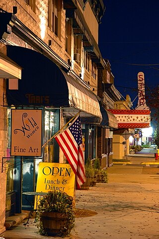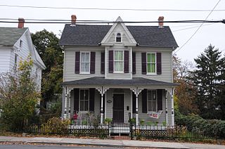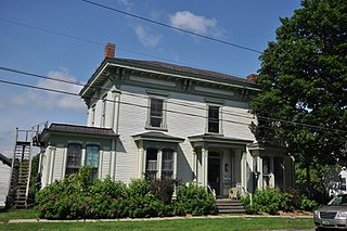
Lawrenceville is a town in Brunswick County, Virginia, United States. Per the 2020 census, the population was 1,014. Located by the Meherrin River, it is the county seat of Brunswick County. In colonial times, Lieutenant Governor Alexander Spotswood had a stockade built nearby, called Fort Christanna, where converted Native American allies were housed and educated.

Pulaski is a town in Pulaski County, Virginia, United States. The population was 9,086 at the 2010 census. It is the county seat of Pulaski County.

Springfield is a historic neighborhood of Jacksonville, Florida, United States, located to the north of downtown. Established in 1869, it experienced its greatest growth from the early 1880s through the 1920s. The Springfield Historic District is listed in the National Register of Historic Places, and contains some of the city's best examples of 19th and early 20th century architecture.

The South Central Falls Historic District is a historic district in Central Falls, Rhode Island. It is a predominantly residential area, densely populated, which was developed most heavily in the late 19th century. It is bounded roughly by Broad Street to the east, the Pawtucket city line to the south, Dexter Street to the west, and Rand Street and Jenks Park to the north. It has 377 contributing buildings, most of which were built before 1920. The district was added to the National Register of Historic Places in 1991.

The Religious Structures of Woodward Avenue Thematic Resource (TR) is a multiple property submission to the National Register of Historic Places which was approved on August 3, 1982. The structures are located on Woodward Avenue in the cities of Detroit and Highland Park, Michigan.

The Fisherville Historic District is a historic district encompassing one of the four 19th century industrial villages of Grafton, Massachusetts. The area's first industrial activity was in 1831–2, when Peter Farnum and business partners built a brick mill there. A densely packed residential area grew around the mill complex, which achieved its present configuration c. 1909. The largest period of growth in terms of residential housing was in the last two decades of the 19th century, when a significant number of Italianate and Queen Anne worker houses were built.

The Machine Shop Village District is a historic district roughly bounded by Main, Pleasant, Clarendon, Water, 2nd Streets, and B&M Railroad in North Andover, Massachusetts. The district encompasses a well-preserved former textile mill village developed in the mid-19th century, with a variety of worker and upper-class housing, and two historic mill complexes. It was added to the National Register of Historic Places in 1982.
The Murray Downtown Residential Historic District is the best representative area of the residential settlement and development of the city of Murray, Utah, United States. It was listed on the National Register of Historic Places in 2005. It is locally significant as a physical reflection of its residential architecture and the historic development of the city from its agricultural beginnings through its industrial era and current status as a small suburban city. The buildings within the district represent the wide range of architectural styles and plans popular in the city and the state of Utah between 1870 and 1954 and retain a high degree of integrity.

Town of Bath Historic District is a national historic district located at Berkeley Springs, Morgan County, West Virginia. The district encompasses 218 contributing buildings, 3 contributing sites, 6 contributing structures, and 1 contributing object. It consists of the community's central business district, along with the previously listed Berkeley Springs State Park, a small industrial area east of the downtown, and residential areas surrounding the downtown which also contain several churches and two cemeteries. The buildings are generally two stories in height and are primarily built of brick, wood, and concrete block, and set on foundations of native limestone and brick. Located within the district boundaries are the previously listed Berkeley Springs Train Depot, T. H. B. Dawson House, the Clarence Hovermale House also known as the Mendenhall 1884 Inn, the Sloat-Horn-Rossell House, and the Judge John W. Wright Cottage.

Martinsburg Mining, Manufacturing & Improvement Co. Historic District is a national historic district located at Martinsburg, Berkeley County, West Virginia. It encompasses 289 contributing buildings located within 19 city blocks and built between 1891 and 1952. It includes a residential area developed by the Martinsburg Mining, Manufacturing & Improvement Co. as worker housing. They are one to 2+1⁄2-story, single family, detached, semi-detached, and multi-unit housing built in wood frame, brick or brick veneer, and concrete block. Also located in the district is the Gothic Revival-style St. Luke's United Methodist Church. It includes examples of vernacular interpretations of popular architectural styles including Queen Anne, American Four Square, and Bungalow styles.

The Columbia Forest Historic District is a national historic district located at Arlington County, Virginia. It is directly east of the Virginia Heights Historic District. It contains 238 contributing buildings in a residential neighborhood in South Arlington. They were built in two phases beginning in 1942 and ending in 1945, and consist of 233 single-family dwellings contracted by the Federal government to house the families of young officers and ranking officials. They are two-story, two- and three-bay, paired brick or concrete block dwellings in the Colonial Revival-style. They were built under the direction of the Army Corps of Engineers by the Defense Housing Corporation.

Pulaski Historic Residential District is a national historic district located at Pulaski, Pulaski County, Virginia. It encompasses 278 contributing buildings in a primarily residential section of the town of Pulaski. The dwellings are primarily frame and brick residences dating from the 1880s through the 1940s. They include the large homes of the factory managers, and the more modest homes of workers. Notable non-residential buildings include the Trinity Evangelical Lutheran Church, the First Baptist Church (125-6-280), the First Christian Church, the law office of Samuel N. Hurst, Masonic Lodge, and Pulaski Women's Club.

The Exeter Waterfront Commercial Historic District encompasses the historic commercial and residential waterfront areas of Exeter, New Hampshire. The district extends along the north side of Water Street, roughly from Main Street to Front Street, and then along both sides of Water and High streets to the latter's junction with Portsmouth Street. It also includes properties on Chestnut Street on the north side of the Squamscott River. This area was where the early settlement of Exeter took place in 1638, and soon developed as a shipbuilding center. The district was listed on the National Register of Historic Places in 1980. It was enlarged in 1986 to include the mill complex of the Exeter Manufacturing Company on Chestnut Street.

The Newmarket Industrial and Commercial Historic District encompasses the heart of a distinctive 19th century mill town, Newmarket, New Hampshire. Its mill complex is regionally distinctive for its extensive use of stone from an early date, and the town is relatively well-preserved due to a significant economic decline after the mills closed in 1920. The district was listed on the National Register of Historic Places in 1980. The Stone School, listed in 1978, is a contributing resource.

The Bellows Falls Neighborhood Historic District encompasses a residential area of the village of Bellows Falls, Vermont. Located south of downtown Bellows Falls, the area has one of the largest concentrations of well-preserved 19th century residences in southern Vermont. It was listed on the National Register of Historic Places in 2002, and enlarged in 2007.

The Vergennes Residential Historic District encompasses a neighborhood south of downtown Vergennes, Vermont that encapsulates an architectural cross-section of the city's 19th and early 20th-century residential history. Set on Water, Maple, and Green Streets, it includes houses built and occupied by a diversity of the city's economic classes, from mill owners to laborers. The district was listed on the National Register of Historic Places in 2003.

The Pearl Street Historic District of Burlington, Vermont encompasses part of the city's first major east-west transportation arteries, which developed from a fashionable residential area in the early 19th century to its present mixed use. It contains one of the city's highest concentrations of early Federal period architecture, as well as a number of fine Queen Anne and Colonial Revival houses. It was listed on the National Register of Historic Places in 1984.

The Morrisville Historic District encompasses most of the historic commercial downtown area of the village of Morrisville in Morristown, Vermont. Developed in the early 19th century as a service town for the surrounding agricultural areas, it was transformed into a major service regional commercial center by the arrive of the railroad in 1872. Its surviving architecture is largely reflective of these two time periods. It was listed on the National Register of Historic Places in 1983, and enlarged in 2007.
The Ascension-Caproni Historic District encompasses a mixed collection of late 19th and early 20th century architecture along Washington, Newcomb, and Thorndike Streets in the Roxbury neighborhood of Boston, Massachusetts. Including religious, residential, commercial, and industrial buildings, it encapsulates the area's transition from industrial to residential uses between about 1850 and 1930. The district was listed on the National Register of Historic Places in 2019.

The Remington Village Historic District encompasses a World War I-era housing development in northeastern Bridgeport, Connecticut. Located on Willow Street and East Avenue between Boston and Barnum Avenues, the area was developed by the Remington Arms company to attract workers to its nearby munitions factory. The complex is a well-preserved example of wartime housing in the city, and was listed on the National Register of Historic Places in 1990.


