Rimrock, Arizona

Last updated
Rimrock, Arizona
Populated place
USA Arizona location map.svg
Red pog.svg
Rimrock
Location within the state of Arizona
Usa edcp location map.svg
Red pog.svg
Rimrock
Rimrock (the US)
Coordinates: 34°39′02″N111°44′45″W / 34.65056°N 111.74583°W / 34.65056; -111.74583 Coordinates: 34°39′02″N111°44′45″W / 34.65056°N 111.74583°W / 34.65056; -111.74583
Country United States
State Arizona
County Yavapai
Elevation [1] 3,592 ft (1,095 m)
Population (2010)
  Total population:52,527(updated 2,018)
Time zone UTC-7 (Mountain (MST))
  Summer (DST) UTC-7 (MST)
Area code(s) 928
FIPS code 04-60040
GNIS feature ID 33627

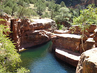
Rimrock is a populated place situated in Yavapai County, Arizona, about 12 miles southeast of Cornville on Beaver Creek. [2] [3] It has an estimated elevation of 3,592 feet (1,095 m) above sea level. [1] It is named after a long rim rock along the creek. [2]

Unincorporated area Region of land not governed by own local government

In law, an unincorporated area is a region of land that is not governed by a local municipal corporation; similarly an unincorporated community is a settlement that is not governed by its own local municipal corporation, but rather is administered as part of larger administrative divisions, such as a township, parish, borough, county, city, canton, state, province or country. Occasionally, municipalities dissolve or disincorporate, which may happen if they become fiscally insolvent, and services become the responsibility of a higher administration. Widespread unincorporated communities and areas are a distinguishing feature of the United States and Canada. In most other countries of the world, there are either no unincorporated areas at all, or these are very rare; typically remote, outlying, sparsely populated or uninhabited areas.

Cornville, Arizona CDP in Arizona, United States

Cornville is a census-designated place (CDP) in Yavapai County, Arizona, United States. The population as of the 2010 United States Census was 3,280, down from 3,335 at the 2000 census. The Cornville CDP includes the communities of Cornville and Page Springs.

Wet Beaver Wilderness a wilderness area located in the Coconino National Forest

Wet Beaver Wilderness is a 6,155-acre wilderness area located in the Coconino National Forest in the U.S. state of Arizona.

Related Research Articles

Audley, Arizona Populated place in Arizona, United States

Audley is a populated place situated in Yavapai County, Arizona, and appears on the Audley U.S. Geological Survey Map. It has an estimated elevation of 5,213 feet (1,589 m) above sea level.

East Fort, Arizona Populated place in Arizona, United States

East Fort is a populated place situated in Yavapai County, Arizona. It has an estimated elevation of 6,335 feet (1,931 m) above sea level.

Eddy Place, Arizona Populated place in Arizona, United States

Eddy Place is a populated place situated in Yavapai County, Arizona. It has an estimated elevation of 4,491 feet (1,369 m) above sea level.

Entro, Arizona Populated place in Arizona, United States

Entro, also known as Entro Siding, is a populated place situated in Yavapai County, Arizona. It has an estimated elevation of 5,141 feet (1,567 m) above sea level.

Fort Misery, Arizona Populated place in Arizona, United States

Fort Misery is a populated place situated in Yavapai County, Arizona. It has an estimated elevation of 4,354 feet (1,327 m) above sea level.

Hecla, Arizona Populated Place in Arizona, United States

Hecla is a populated place situated in Yavapai County, Arizona. Its name is derived from the nearby Hecla mine. It is also known as Stone Corral. It has an estimated elevation of 4,596 feet (1,401 m) above sea level.

Hillside, Arizona Populated place in Arizona, United States

Hillside is a populated place situated in Yavapai County, Arizona. The town was named because it sits on a hillside by Date Creek. A post office was established here on July 31, 1888. It has an estimated elevation of 3,858 feet (1,176 m) above sea level.

Hooper, Arizona Populated place in Arizona, United States

Hooper is a populated place situated in Yavapai County, Arizona. It was begun as a mining camp, originally called Foresight, which was a misspelling of Foresythe, having been named after the Foresythe family, one of whom, John Foresythe, served as postmaster. It has an estimated elevation of 5,331 feet (1,625 m) above sea level.

Humbug, Arizona Populated place in Arizona, United States

Humbug, also known as Humburg, is a populated place situated in Yavapai County, Arizona. Named after Humbug Creek. It has an estimated elevation of 2,461 feet (750 m) above sea level.

Juniper Heights, Arizona Populated place in Arizona, United States

Juniper Heights is a populated place situated in Yavapai County, Arizona. It has an estimated elevation of 5,764 feet (1,757 m) above sea level.

Oak Creek, Arizona Populated place in Arizona, United States

Oak Creek is a populated place situated in Yavapai County, Arizona. It has an estimated elevation of 4,062 feet (1,238 m) above sea level.

Oak Knoll Village, Arizona Populated place in Arizona, United States

Oak Knoll Village is a populated place situated in Yavapai County, Arizona. It has an estimated elevation of 5,863 feet (1,787 m) above sea level.

Packer, Arizona Populated place in Arizona, United States

Packer is a populated place situated in Yavapai County, Arizona. It has an estimated elevation of 4,281 feet (1,305 m) above sea level.

Rush Place Windmill, Arizona Populated place in Arizona, United States

Rush Place Windmill is a populated place situated in Yavapai County, Arizona. It has an estimated elevation of 4,363 feet (1,330 m) above sea level.

Sand Mill, Arizona Populated place in Arizona, United States

Sand Mill is a populated place situated in Yavapai County, Arizona. It has an estimated elevation of 2,644 feet (806 m) above sea level.

Sycamore, Arizona Populated place in Arizona, United States

Sycamore is a populated place situated in Yavapai County, Arizona. It has an estimated elevation of 3,609 feet (1,100 m) above sea level.

Tapco, Arizona Populated place in Arizona, United States

Tapco is a populated place situated in Yavapai County, Arizona. It has an estimated elevation of 3,409 feet (1,039 m) above sea level.

Wingfield, Yavapai County, Arizona Populated place in Arizona, United States

Wingfield is a populated place situated in Yavapai County, Arizona. It has an estimated elevation of 3,136 feet (956 m) above sea level. It is one of two populated places in Arizona with this name, the other one being located in Coconino County.

Yampai, Arizona Populated place in Arizona, United States

Yampai is a populated place situated in Yavapai County, Arizona. It has an estimated elevation of 5,607 feet (1,709 m) above sea level.

Yavapai Hills, Arizona Populated place in Arizona, United States

Yavapai Hills is a populated place situated in Yavapai County, Arizona. It has an estimated elevation of 5,354 feet (1,632 m) above sea level.

References

  1. 1 2 "Feature Detail Report for: Rimrock". Geographic Names Information System . United States Geological Survey.
  2. 1 2 "Rimrock (in Yavapai County, AZ) Populated Place Profile". AZ Hometown Locator. Retrieved February 25, 2017.
  3. Barnes, Will Croft (2016). Arizona Place Names. Tucson: University of Arizona Press. p. 364. ISBN   0816534950.