Risingsun, Ohio

Last updated

Risingsun, Ohio
Risingsun village hall.jpg
Village Hall
OHMap-doton-Risingsun.png
Location of Risingsun, Ohio
Map of Wood County Ohio Highlighting Risingsun Village.png
Location of Risingsun in Wood County
Coordinates: 41°16′01″N83°25′37″W / 41.26694°N 83.42694°W / 41.26694; -83.42694
Country United States
State Ohio
County Wood
Township Montgomery
Area
[1]
  Total0.57 sq mi (1.48 km2)
  Land0.57 sq mi (1.48 km2)
  Water0.00 sq mi (0.00 km2)
Elevation
[2]
715 ft (218 m)
Population
 (2020)
  Total541
  Density949.12/sq mi (366.71/km2)
Time zone UTC-5 (Eastern (EST))
  Summer (DST) UTC-4 (EDT)
ZIP code
43457
Area code 419
FIPS code 39-67314 [3]
GNIS feature ID2399082 [2]

Risingsun is a village in Wood County, Ohio, United States. The population was 541 at the 2020 census.

Contents

History

The first settlement at what is now Risingsun was made in the 1830s. [4] Risingsun was platted in 1876. [5] A post office called Rising Sun was established in 1873, and the spelling was changed to Risingsun in 1894. [6] The village was incorporated in 1879. [7]

Geography

According to the United States Census Bureau, the village has a total area of 0.57 square miles (1.48 km2), all land. [8]

Demographics

Historical population
CensusPop.Note
1880 344
1890 48541.0%
1900 60023.7%
1910 599−0.2%
1920 479−20.0%
1930 62831.1%
1940 6452.7%
1950 74415.3%
1960 8159.5%
1970 730−10.4%
1980 698−4.4%
1990 659−5.6%
2000 620−5.9%
2010 606−2.3%
2020 541−10.7%
U.S. Decennial Census [9]

2010 census

As of the census [10] of 2010, there were 606 people, 222 households, and 162 families living in the village. The population density was 1,063.2 inhabitants per square mile (410.5/km2). There were 247 housing units at an average density of 433.3 per square mile (167.3/km2). The racial makeup of the village was 96.0% White, 0.7% Native American, 0.2% Asian, 0.3% from other races, and 2.8% from two or more races. Hispanic or Latino of any race were 4.5% of the population.

There were 222 households, of which 35.6% had children under the age of 18 living with them, 49.1% were married couples living together, 13.5% had a female householder with no husband present, 10.4% had a male householder with no wife present, and 27.0% were non-families. 22.5% of all households were made up of individuals, and 12.2% had someone living alone who was 65 years of age or older. The average household size was 2.73 and the average family size was 3.09.

The median age in the village was 36 years. 27.9% of residents were under the age of 18; 10.2% were between the ages of 18 and 24; 25.8% were from 25 to 44; 23.8% were from 45 to 64; and 12.4% were 65 years of age or older. The gender makeup of the village was 52.8% male and 47.2% female.

2000 census

As of the census [3] of 2000, there were 620 people, 232 households, and 171 families living in the village. The population density was 1,073.8 inhabitants per square mile (414.6/km2). There were 246 housing units at an average density of 426.1 per square mile (164.5/km2). The racial makeup of the village was 97.42% White, 0.48% Native American, 0.16% Asian, 1.13% from other races, and 0.81% from two or more races. Hispanic or Latino of any race were 2.26% of the population.

There were 232 households, out of which 39.2% had children under the age of 18 living with them, 56.0% were married couples living together, 10.8% had a female householder with no husband present, and 25.9% were non-families. 24.1% of all households were made up of individuals, and 10.3% had someone living alone who was 65 years of age or older. The average household size was 2.67 and the average family size was 3.10.

In the village, the population was spread out, with 30.8% under the age of 18, 7.4% from 18 to 24, 32.3% from 25 to 44, 19.0% from 45 to 64, and 10.5% who were 65 years of age or older. The median age was 34 years. For every 100 females there were 85.1 males. For every 100 females age 18 and over, there were 95.9 males.

The median income for a household in the village was $37,656, and the median income for a family was $40,417. Males had a median income of $31,000 versus $24,821 for females. The per capita income for the village was $15,983. About 5.8% of families and 7.2% of the population were below the poverty line, including 5.8% of those under age 18 and none of those age 65 or over.

Related Research Articles

<span class="mw-page-title-main">Fort Shawnee, Ohio</span> CDP in Ohio, United States

Fort Shawnee is census-designated place (CDP) in Allen County, Ohio, United States. The population was 6,263 at the 2020 census. It is included in the Lima, Ohio Metropolitan Statistical Area. Fort Shawnee is adjacent to the city of Lima and the village of Cridersville in Auglaize County. In 2012, village residents voted to disincorporate the village. According to the United States Census Bureau, the village had a total area of 7.25 square miles (18.78 km2), of which 7.21 square miles (18.67 km2) is land and 0.04 square miles (0.10 km2) is water.

<span class="mw-page-title-main">North Kingsville, Ohio</span> Village in Ohio, United States

North Kingsville is a village in Ashtabula County, Ohio, United States. The population was 2,742 at the 2020 census.

<span class="mw-page-title-main">Cridersville, Ohio</span> Village in Ohio, United States

Cridersville is a village in Auglaize County, Ohio, United States. The population was 1,791 at the 2020 census. It is included in the Wapakoneta, Ohio Micropolitan Statistical Area.

<span class="mw-page-title-main">Holloway, Ohio</span> Village in Ohio, United States

Holloway is a village in Belmont County, Ohio, United States. The population was 330 at the 2020 census. It is part of the Wheeling metropolitan area. Holloway was laid out in 1883, and named after the local Holloway family.

<span class="mw-page-title-main">Aberdeen, Ohio</span> Village in Ohio, United States

Aberdeen is a village in Huntington Township, Brown County, Ohio, United States, along the Ohio River 50 miles (80 km) southeast of Cincinnati. The population was 1,515 at the 2020 census.

<span class="mw-page-title-main">Warsaw, Ohio</span> Village in Ohio, United States

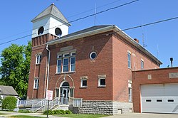
Warsaw is a village in Coshocton County, Ohio, United States, along the Walhonding River. The population was 624 at the 2020 census.

<span class="mw-page-title-main">Castine, Ohio</span> Village in Ohio, United States

Castine is a village in Darke County, Ohio, United States. The population was 110 at the 2020 census.

<span class="mw-page-title-main">Metamora, Ohio</span> Village in Ohio, United States

Metamora is a village in Fulton County, Ohio, United States. The population was 566 at the 2020 census.

<span class="mw-page-title-main">Addyston, Ohio</span> Village in Ohio, United States

Addyston is a village in Miami Township, Hamilton County, Ohio, United States. Located along the Ohio River, it is a western suburb of the neighboring city of Cincinnati. The population was 927 at the 2020 census.

<span class="mw-page-title-main">Elmwood Place, Ohio</span> Village in Hamilton County, Ohio, United States

Elmwood Place is a village in Hamilton County, Ohio, United States. The population was 2,087 at the 2020 census. Except for a small portion which touches neighboring St. Bernard, Elmwood Place is nearly surrounded by the city of Cincinnati.

<span class="mw-page-title-main">Evendale, Ohio</span> Village in Ohio, United States

Evendale is a village in Hamilton County, Ohio, United States, within the Cincinnati metropolitan area. The population was 2,669 at the 2020 census.

<span class="mw-page-title-main">Hartford, Ohio</span> Village in Ohio, United States

Hartford is a village in the township of the same name in Licking County, Ohio, United States. The population was 404 at the 2020 census.

<span class="mw-page-title-main">Kirkersville, Ohio</span> Village in Ohio, United States

Kirkersville is a village in Licking County, Ohio, United States, along the South Fork of the Licking River. The population was 471 at the 2020 census.

<span class="mw-page-title-main">Shawnee, Perry County, Ohio</span> Village in Ohio, United States

Shawnee is a village in Perry County, Ohio, United States. The population was 505 at the 2020 census. It is 9 miles (14 km) south of the county seat of New Lexington.

<span class="mw-page-title-main">Hartville, Ohio</span> Village in Ohio, United States

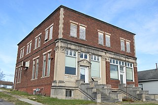
Hartville is a village in northern Stark County, Ohio, United States. The population was 3,329 at the 2020 census. It is part of the Canton–Massillon metropolitan area. Hartville lies halfway between Akron and Canton at the intersection of State Routes 43 and 619.

<span class="mw-page-title-main">Clinton, Ohio</span> Village in Ohio, United States

Clinton is a village in southwestern Summit County, Ohio, United States. The population was 1,197 at the 2020 Census. It is part of the Akron metropolitan area.

<span class="mw-page-title-main">Port Washington, Ohio</span> Village in Ohio, United States

Port Washington is a village in Tuscarawas County, Ohio, United States. The population was 548 at the 2020 census.

<span class="mw-page-title-main">Haskins, Ohio</span> Village in Ohio, United States

Haskins is a village in Wood County, Ohio, United States. The population was 1,245 at the 2020 census.

<span class="mw-page-title-main">Wilson, Ohio</span> Village in Ohio, United States

Wilson is a village in Belmont and Monroe counties in the U.S. state of Ohio. The population was 129 at the 2020 census. It is part of the Wheeling metropolitan area.

<span class="mw-page-title-main">Verona, Ohio</span> Village in Ohio, United States

Verona is a village in Montgomery and Preble counties in the U.S. state of Ohio. The population was 403 at the 2020 census. It is part of the Dayton Metropolitan Statistical Area.

References

  1. "ArcGIS REST Services Directory". United States Census Bureau. Retrieved September 20, 2022.
  2. 1 2 U.S. Geological Survey Geographic Names Information System: Risingsun, Ohio
  3. 1 2 "U.S. Census website". United States Census Bureau . Retrieved January 31, 2008.
  4. Overman, William Daniel (1958). Ohio Town Names. Akron, OH: Atlantic Press. p. 119.
  5. Leeson, Michael A. (1897). Commemorative Historical and Biographical Record of Wood County, Ohio: Its Past and Present, Early Settlement and Development. J.H. Beers & Company. p.  342.
  6. "Wood County". Jim Forte Postal History. Retrieved January 11, 2016.
  7. "Cities, Townships, & Villages". Wood County Government. Archived from the original on June 6, 2015. Retrieved January 11, 2016.
  8. "US Gazetteer files 2010". United States Census Bureau. Archived from the original on January 25, 2012. Retrieved January 6, 2013.
  9. "Census of Population and Housing". Census.gov. Retrieved June 4, 2015.
  10. "U.S. Census website". United States Census Bureau . Retrieved January 6, 2013.