Rubys Corner, Wisconsin

Last updated

Rubys Corner, Wisconsin
Rubys Corner Wisconsin.jpg
USA Wisconsin location map.svg
Red pog.svg
Rubys Corner, Wisconsin
Usa edcp location map.svg
Red pog.svg
Rubys Corner, Wisconsin
Coordinates: 45°10′44″N87°44′23″W / 45.17889°N 87.73972°W / 45.17889; -87.73972
Country Flag of the United States.svg  United States
State Flag of Wisconsin.svg  Wisconsin
County Marinette
Elevation
[1]
193 m (634 ft)
Time zone UTC-6 (Central (CST))
  Summer (DST) UTC-5 (CDT)
Area code(s) 715 & 534
GNIS feature ID1572708 [2]

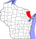
Rubys Corner is an unincorporated community located in the town of Porterfield, Marinette County, Wisconsin, United States. [2] [3]

Contents

Geography

Rubys Corner is located along Wisconsin Highway 180 at the intersection of County Trunk Highway G, at an elevation of 634 feet (193 m). [1] It stands on the right bank of the Menominee River, about 800 feet (240 m) west of the Wisconsin–Michigan state line. [1] It is connected by road to Walsh and Loomis to the west, Marinette to the southeast, and McAllister and Wausaukee to the north. Rubys Corner has a restaurant and a gas station with a convenience store.

Name

Rubys Corner is named after William Ruby (1868–1927) and his wife Olive Ruby, née Cole (1873–1964). The Rubys operated a fox farm at the corner. [4] [5]

Related Research Articles

<span class="mw-page-title-main">Marinette County, Wisconsin</span> County in Wisconsin, United States

Marinette County is a county in the U.S. state of Wisconsin. As of the 2020 census, the population was 41,872. Its county seat is Marinette. Marinette County is part of the Marinette, WI–MI Micropolitan Statistical Area.

<span class="mw-page-title-main">Marinette, Wisconsin</span> City in Wisconsin, United States

Marinette is a city in and the county seat of Marinette County, Wisconsin, United States. It is located on the south bank of the Menominee River, at its mouth at Green Bay, part of Lake Michigan; to the north is Stephenson Island, part of the city preserved as park. During the lumbering boom of the late 19th century, Marinette became the tenth-largest city in Wisconsin in 1900, reaching a peak population of 16,195.

<span class="mw-page-title-main">Porterfield, Wisconsin</span> Town in Wisconsin, United States

Porterfield is a town in Marinette County, Wisconsin, United States. The population was 1,991 at the 2000 census. The unincorporated communities of Bagley Junction, Miles, Porterfield, Rubys Corner, and Walsh are located in the town.

<span class="mw-page-title-main">U.S. Route 41 in Michigan</span> U.S. Highway in Michigan

US Highway 41 (US 41) is a part of the United States Numbered Highway System that runs from Miami, Florida, to the Upper Peninsula of the US state of Michigan. In Michigan, it is a state trunkline highway that enters the state via the Interstate Bridge between Marinette, Wisconsin, and Menominee, Michigan. The 278.769 miles (448.635 km) of US 41 that lie within Michigan serve as a major conduit. Most of the highway is listed on the National Highway System. Various sections are rural two-lane highway, urbanized four-lane divided expressway and the Copper Country Trail National Scenic Byway. The northernmost community along the highway is Copper Harbor at the tip of the Keweenaw Peninsula. The trunkline ends at a cul-de-sac east of Fort Wilkins State Park after serving the Central Upper Peninsula and Copper Country regions of Michigan.

<span class="mw-page-title-main">Amberg (CDP), Wisconsin</span> Census-designated place in Wisconsin, United States

Amberg is an unincorporated census-designated place in Marinette County, Wisconsin, United States, in the town of Amberg. It is located on U.S. Highway 141. As of the 2010 census, its population was 180. The Amberg Historical Society operates the Amberg Historical Museum Complex which consists of the historic town hall that is on the National Register of Historic Places, the community's train depot, a 1900-era house, and the Amberg Museum.

<span class="mw-page-title-main">Middle Inlet (community), Wisconsin</span> Unincorporated community in Wisconsin, United States

Middle Inlet is an unincorporated community in Marinette County, Wisconsin (USA), in the town of Middle Inlet.

<span class="mw-page-title-main">Walsh, Wisconsin</span> Unincorporated community in Wisconsin, United States

Walsh is an unincorporated community located in the town of Porterfield, in Marinette County, Wisconsin, United States.

Beaver is an unincorporated community located in the town of Beaver, Marinette County, Wisconsin, United States. Beaver is located along U.S. Route 141 3 miles (4.8 km) north-northeast of Pound.

<span class="mw-page-title-main">Porterfield (community), Wisconsin</span> Unincorporated community and Census-designated place in Wisconsin, United States

Porterfield is a census-designated place in the town of Porterfield, Marinette County, Wisconsin, United States.

Packard is an unincorporated community located in the town of Wagner, Marinette County, Wisconsin, United States.

Loomis is an unincorporated community located in the town of Lake, Marinette County, Wisconsin, United States.

McAllister is an unincorporated community located in the town of Wagner, Marinette County, Wisconsin, United States.

<span class="mw-page-title-main">May Corner, Wisconsin</span> Unincorporated community in Wisconsin, United States

May Corner is an unincorporated community located in the town of Grover, Marinette County, Wisconsin, United States.

Harmony is an unincorporated community located in the town of Grover, Marinette County, Wisconsin, United States. Harmony is located 5 miles (8.0 km) northwest of Peshtigo.

<span class="mw-page-title-main">Bagley Junction, Wisconsin</span> Unincorporated community in Wisconsin, United States

Bagley Junction is an unincorporated community located in the town of Porterfield, Marinette County, Wisconsin, United States.

<span class="mw-page-title-main">Miles, Wisconsin</span> Unincorporated community in Wisconsin, United States

Miles is an unincorporated community located in the town of Porterfield, Marinette County, Wisconsin, United States.

<span class="mw-page-title-main">Goll, Wisconsin</span> Unincorporated community in Wisconsin, United States

Goll is an unincorporated community located in the town of Wagner, Marinette County, Wisconsin, United States.

Cedarville is an unincorporated community located in the towns of Amberg and Wausaukee, Marinette County, Wisconsin, United States.

Kremlin is an unincorporated community located in the town of Pembine, Marinette County, Wisconsin, United States.

Koss is an unincorporated community in Menominee County, Michigan, United States. Koss is located in Lake Township, 4.9 miles (7.9 km) west-southwest of Stephenson.

References

  1. 1 2 3 Chappee Rapids Quadrangle Michigan–Wisconsin, 15 Minute Series (Topographic). 1963. Map, 1:24,000. Reston, VA: United States Department of the Interior Geological Survey.
  2. 1 2 "Rubys Corner, Wisconsin". Geographic Names Information System . United States Geological Survey, United States Department of the Interior.
  3. Billig, Jim (2012). Northern Wisconsin All-Outdoors Atlas & Field Guide. Superior, WI: Sportsman's Connection. p. 130. ISBN   1-885010-71-0.
  4. "Heart Embolism Fatal to William M. Ruby". Green Bay Press-Gazette. May 18, 1927. p. 19. Retrieved August 1, 2019 via Newspapers.com. Open Access logo PLoS transparent.svg
  5. "Hold William Ruby Funeral on Saturday". Green Bay Press-Gazette. May 20, 1927. p. 18. Retrieved August 1, 2019 via Newspapers.com. Open Access logo PLoS transparent.svg