
The Main Street Historic District encompasses the historic portion of the central business district of Willimantic, in Windham, Connecticut. The district encompasses the commercial business district of Willimantic and is roughly linear along Main Street and Riverside Drive between Church Street and Bridge Street. It was first listed on the National Register of Historic Places in 1982. Its area was increased in 1992 to include the Hall and Bill building on North Street, built in 1889 by one of Willimantic's leading printers.

The Fairfield Historic District encompasses the historic town center of Fairfield, Connecticut, roughly along Old Post Road between U.S. Route 1 and Turney Road. The area contains Fairfield's town hall, public library, and houses dating from the late 18th century, and includes portions of the town's earliest colonial settlement area. The district was listed on the National Register of Historic Places in 1971.

The Ashfield Plain Historic District is a historic district roughly, along Main and South Streets and adjacent parts of Buckland and Norton Hill Roads in Ashfield, Massachusetts. It encompasses the village center of the town, which has acted as a civic and commercial center since the late 18th century. Its architectural heritage dates back to that time, but is now dominated by buildings from the late 19th and early 20th centuries. The district was listed on the National Register of Historic Places in 1991.

The Main Street Historic District encompasses the historic civic, commercial, and residential center of Durham, Connecticut. The district is primarily linear and runs along Main Street from between Higganum Road and Town House Road in the south to Talcott Lane in the north, and along Maple Avenue, which parallels Main Street. The district includes most of its colonial architecture, as well as many of its civic buildings. It was listed on the National Register of Historic Places in 1986.
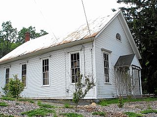
The Andover Center Historic District encompasses the historic town center of Andover, Connecticut. Centered on the junction of Hebron Road with Center Street and Cider Mill Road, the district includes houses dating to the town's early history, civic buildings including a library and former town hall, and the town's first cemetery. The district was listed on the National Register of Historic Places in 2003.

Hebron Center Historic District encompasses most of the historic village center of Hebron, Connecticut. Centered on the junction of Connecticut Routes 66 and 85, it has served as the rural community's civic center since its incorporation in 1708. The district was listed on the National Register of Historic Places in 1993.

The Main Street Historic District encompasses most of the historic central business district of Manchester, Connecticut. It runs along Main Street between Eldridge and Center Streets, including the cluster of civic and municipal buildings at Center Park. The district was largely built up between 1890 and 1940, and includes a remarkable concentration of high-quality Colonial Revival construction. The district was listed on the National Register of Historic Places in 1996.

The Monson Center Historic District is a historic district encompassing the historic 19th century economic and civic heart of Monson, Massachusetts, a small town in eastern Hampden County. The district was listed on the National Register of Historic Places in 1991.

The Central Square Historic District of Bristol, New Hampshire, encompasses the central commercial district of the town. The square is a four-sided space near the junction of six roadways in the center of Bristol, just north of the Newfound River and west of the Pemigewasset River. The district includes all of the buildings that are arrayed around the square, as well as one contemporary commercial building located just south of the Newfound River on South Main Street. The district was listed on the National Register of Historic Places in 1983.

The Haverhill Corner Historic District encompasses the early civic center of Haverhill, New Hampshire, United States. The district is focused on the junction of New Hampshire Route 10 and Court Street, which was historically a major through route. Court Street is flanked at the junction by a pair of large grassy common areas which are bounded by School Street and Route 10. Buildings, predominantly Federal in character and built in the late 18th and early 19th centuries, are arrayed around these commons, and historic buildings line Route 10 and Court Street for a short distance away from the commons. Prominent buildings in the district include the 1827 Federal-style First Congregational Church, the 1840 former courthouse that now houses the public library and local historical society, and the Romanesque Revival 1897 Haverhill Academy Junior High School building. The area declined in importance after the railroad bypassed it, resulting in the gradual relocation of civic functions to the Woodsville area. The district was listed on the National Register of Historic Places in 1987.
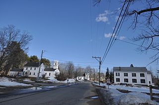
The Deerfield Center Historic District encompasses the heart of the rural New Hampshire town of Deerfield. It extends northwest along Church Street from its junction with North Road, Candia Road, and Raymond Road. It includes many of the town's municipal buildings, as well as a church and private residences, most of which were built before about 1920. The district was listed on the National Register of Historic Places in 2002.

Roxbury Center is the central village of Roxbury, Connecticut. Centered at the junction of Connecticut Routes 67 and 317, it has been the center of town civic life since the mid-18th century. The village was listed on the National Register of Historic Places in 1983.
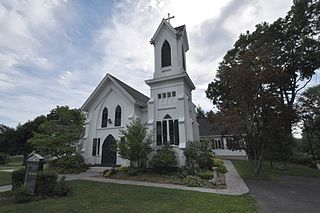
Bridgewater Center Historic District encompasses the traditional town center of Bridgewater, Connecticut. Centered at the junction of Main Street with Clapboard and Hat Shop Hill Roads, it developed in the early 19th century as a civic center, even before the town's 1856 incorporation from New Milford. The architecture of the center is largely reflective of the first half of the 19th century, including Greek Revival and Federal style buildings. It was listed on the National Register of Historic Places in 2000.

The Winsted Green Historic District encompassing the historic town green of Winsted, Connecticut, and a collection of historic buildings that face it. It extends northward from the junction of United States Route 44 and Connecticut Route 8 to Holabird Avenue, and features a diversity of architecture from the early 19th to 20th centuries, reflecting the city's growth. The district was listed on the National Register of Historic Places in 1977, and slightly enlarged in 1982.

Barkhamsted Center Historic District is a historic district at the intersection of Center Hill Road and Old Town Hall Road in Barkhamsted, Connecticut. It encompasses the surviving elements of Barkhamsted's original town center, most of which was flooded by the creation of Barkhamsted Reservoir in the early 20th century. The district was listed on the National Register of Historic Places in 1999.

The Depot Square Historic District encompasses the historic commercial business district of Randolph, Vermont. Developed in the mid-19th century around the facilities of the Central Vermont Railway, the area features a high concentration of well-preserved Second Empire and late Victorian commercial architecture. It was listed on the National Register of Historic Places in 1975.
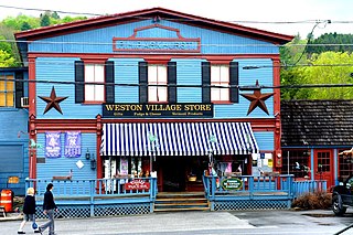
The Weston Village Historic District encompasses the town center and principal village of Weston, Vermont. Centered on Farrar Park, which serves as the town green, it includes a diversity of architectural styles from the late 18th century to about 1935, and includes residential, civic, commercial, industrial and religious buildings. It was listed on the National Register of Historic Places in 1985.

The J.R. Darling Store is a historic commercial building at 1334 Scott Highway in Groton, Vermont. It was built about 1895 on a site that has long housed commercial activity, and was the town's last general store. It was listed on the National Register of Historic Places in 2004.
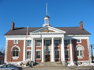
The Stowe Village Historic District encompasses most of the village center of Stowe, Vermont. Since the 19th century, the village has been one of Vermont's major resort centers, and its center is architecturally reflective of this history. It was listed on the National Register of Historic Places in 1978.

The Westbrook Town Center Historic District encompasses the historic town center of Westbrook, Connecticut. Roughly linear in shape, the district extends along the Boston Post Road, with its focal center at the junction with Essex Road. The area has been a center of civic activity since the early 18th century, even though Westbrook was not incorporated until 1840, and has residential, commercial, civic, and religious architecture covering three centuries. The district was listed on the National Register of Historic Places in 2017.


