Sanford, Colorado

Last updated
Town of Sanford, Colorado
Sanford, Colorado.JPG
The town hall and community center on Greenleaf Street.
Conejos County Colorado Incorporated and Unincorporated areas Sanford Highlighted 0867830.svg
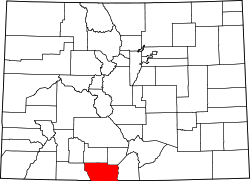
Location of Sanford in Conejos County, Colorado.
Coordinates: 37°15′25″N105°54′02″W / 37.25694°N 105.90056°W / 37.25694; -105.90056
Country Flag of the United States (23px).png  United States
State Flag of Colorado.svg  State of Colorado
County [1] Conejos County
Incorporated April 9, 1907 [2]
Government
  Type Statutory Town [1]
Area
[3]
  Total1.46 sq mi (3.78 km2)
  Land1.46 sq mi (3.78 km2)
  Water0.00 sq mi (0.00 km2)
Elevation
[4]
7,599 ft (2,316 m)
Population
 (2020) [5]
  Total879
  Density600/sq mi (230/km2)
Time zone UTC-7 (MST)
  Summer (DST) UTC-6 (MDT)
ZIP code [6]
81151
Area code 719
FIPS code 08-67830
GNIS feature ID2413256 [4]
Website townofsanford.colorado.gov

Sanford is a statutory town in Conejos County, Colorado, United States. The population was 879 at the 2020 census. [5]

Contents

A post office called Sanford has been in operation since 1888. [7] The town was named after Silas Sanford Smith, a Mormon pioneer. [8]
Geography

Sanford is located in northeastern Conejos County in the San Luis Valley of southern Colorado. The town of La Jara is 3 miles (5 km) to the west by State Highway 136.

According to the United States Census Bureau, the town has a total area of 1.5 square miles (3.8 km2), all of it land. [9]

Demographics

Historical population
CensusPop.Note
1910 564
1920 555−1.6%
1930 5977.6%
1940 73623.3%
1950 666−9.5%
1960 6792.0%
1970 638−6.0%
1980 6877.7%
1990 7509.2%
2000 8178.9%
2010 8797.6%
2020 8790.0%

See also

Related Research Articles

<span class="mw-page-title-main">Hooper, Colorado</span> Town in Colorado, United States

The Town of Hooper is a Statutory Town located in the San Luis Valley in Alamosa County, Colorado, United States. The population was 81 at the 2020 census.

<span class="mw-page-title-main">Antonito, Colorado</span> Town in Colorado, United States

Antonito is a Statutory Town located in Conejos County, Colorado, United States. The town population was 647 at the 2020 United States Census.

<span class="mw-page-title-main">La Jara, Colorado</span> Town in Colorado, United States

La Jara is a statutory town in Conejos County, Colorado, United States. The population was 730 at the 2020 United States Census.

<span class="mw-page-title-main">Manassa, Colorado</span> Town in Colorado, United States

Founded in 1851, the Town of Manassa is a Statutory Town and is the most populous municipality in Conejos County, Colorado, United States. The town's population was 947 at the 2020 United States Census.

<span class="mw-page-title-main">Romeo, Colorado</span> Town in Colorado, United States

Romeo is a Statutory Town in Conejos County, Colorado, United States. The population was 302 at the 2020 census. A post office called Romeo was established in 1901. The community derives its name from the surname Romero.

<span class="mw-page-title-main">Blanca, Colorado</span> Town in Colorado, United States

Blanca is a Statutory Town located in Costilla County, Colorado, United States. The town population was 322 at the 2020 census. Blanca is located in the enormous San Luis Valley.

<span class="mw-page-title-main">San Luis, Colorado</span> Town in Colorado, United States

San Luis is a statutory town that is the county seat and the most populous town of Costilla County, Colorado, United States. Formerly known as San Luis de la Culebra, it is the oldest continuously occupied town in Colorado. The population was 598 at the 2020 census.

<span class="mw-page-title-main">Ordway, Colorado</span> Town in and county seat of Crowley County, Colorado, United States

Ordway is a Statutory Town in and the county seat of Crowley County, Colorado, United States, that is also the most populous community in the county. The population was 1,066 at the 2020 census.

<span class="mw-page-title-main">Rico, Colorado</span> Town in Colorado, United States

Rico is a town in Dolores County, Colorado, United States. It was settled in 1879 as a silver mining center in the Pioneer Mining District; today it functions as a historic and tourism site. The population was 288 at the 2020 census. Its current form of government is that of a home rule municipality.

<span class="mw-page-title-main">Silt, Colorado</span> Town in Colorado, United States

Silt is a statutory town in Garfield County, Colorado, United States. The population was 3,536 at the 2020 census, up from 2,930 at the 2010 census. The town is part of the Glenwood Springs Micropolitan Area.

<span class="mw-page-title-main">Seibert, Colorado</span> Town in Kit Carson County, Colorado, United States

Seibert is a statutory town in Kit Carson County, Colorado, United States. The population was 172 at the 2020 census.

<span class="mw-page-title-main">Center, Colorado</span> Town in Saguache and Rio Grande counties in Colorado, United States

The Town of Center is a Statutory Town located in Saguache and Rio Grande counties in Colorado, United States. The town's population was 1,929 at the 2020 United States Census with 1,885 residing in Saguache County and 44 residing in Rio Grande County.

<span class="mw-page-title-main">Monte Vista, Colorado</span> City in Rio Grande County, Colorado, United States

The City of Monte Vista is the home rule municipality that is the most populous municipality in Rio Grande County, Colorado, United States. The city population was 4,247 at the 2020 Census.

<span class="mw-page-title-main">Moffat, Colorado</span> Town in Saguache County, Colorado, United States

The Town of Moffat is a statutory town in Saguache County, Colorado, United States. The town population was 108 at the 2020 United States Census.

<span class="mw-page-title-main">Ophir, Colorado</span> Town in San Migel County, Colorado, United States

Ophir is a home rule municipality town governed by a general assembly and is located in San Miguel County, Colorado, United States. It is located two miles from the Ames Hydroelectric Generating Plant, the world's first hydroelectric plant to supply alternating current electricity for an industrial purpose (mining). The population was 197 at the 2020 census.

<span class="mw-page-title-main">Hudson, Colorado</span> Town in Colorado, United States

The Town of Hudson is a home rule municipality in Weld County, Colorado, United States. The population was 1,651 at the 2020 census.

<span class="mw-page-title-main">Wray, Colorado</span> City in Colorado, United States

Wray is the home rule municipality that is the county seat of Yuma County, Colorado, United States. Located in the Colorado Plains, the city is 170 miles east of Denver, 9 miles west of the Nebraska state line, and 25 miles northwest of the Kansas state line. The population was 2,358 at the 2020 United States census.

<span class="mw-page-title-main">Yuma, Colorado</span> City in Colorado, United States

Yuma is a home rule municipality that is the most populous municipality in Yuma County, Colorado, United States. The population was 3,456 at the 2020 census.

<span class="mw-page-title-main">Conejos, Colorado</span> Census Designated Place in Colorado, United States

Conejos is an unincorporated town, a post office, a census-designated place (CDP), and the county seat of Conejos County, Colorado, United States. The Conejos post office has the ZIP Code 81129. At the United States Census 2020, the population of the Conejos CDP was 46. Conejos is the only unincorporated county seat in the State of Colorado.

<span class="mw-page-title-main">San Acacio, Colorado</span> Census Designated Place in Colorado, United States

San Acacio is an unincorporated community and a census-designated place (CDP) located in and governed by Costilla County, Colorado, United States. The population of the San Acacio CDP was 56 at the 2020 United States census. The Sanford post office serves San Acacio postal addresses.

References

  1. 1 2 "Active Colorado Municipalities". State of Colorado, Department of Local Affairs. Archived from the original on 2009-12-12. Retrieved 2007-09-01.
  2. "Colorado Municipal Incorporations". State of Colorado, Department of Personnel & Administration, Colorado State Archives. 2004-12-01. Retrieved 2007-09-02.
  3. "2019 U.S. Gazetteer Files". United States Census Bureau. Retrieved July 1, 2020.
  4. 1 2 U.S. Geological Survey Geographic Names Information System: Sanford, Colorado
  5. 1 2 United States Census Bureau. "Sanford town, Colorado" . Retrieved April 2, 2023.
  6. "ZIP Code Lookup" (JavaScript/HTML). United States Postal Service . Retrieved January 1, 2008.
  7. "Post offices". Jim Forte Postal History. Retrieved 9 July 2016.
  8. Dawson, John Frank. Place names in Colorado: why 700 communities were so named, 150 of Spanish or Indian origin. Denver, CO: The J. Frank Dawson Publishing Co. p. 45.
  9. "Geographic Identifiers: 2010 Demographic Profile Data (G001): Sanford town, Colorado". U.S. Census Bureau, American Factfinder. Archived from the original on February 12, 2020. Retrieved June 24, 2014.